Wednesday, January 26, 2011

Honolulu Mauka and Ka'iwa Ridge

January 26, 2011- Honolulu Mauka / Ruins / Ka'iwa Ridg
This week was a total loss as far as the Ko'olau Summit Trail goes.  My hiking partner needed a break from the less traveled trails we'd been doing so we scaled it back... way back and it was a good thing we did.  

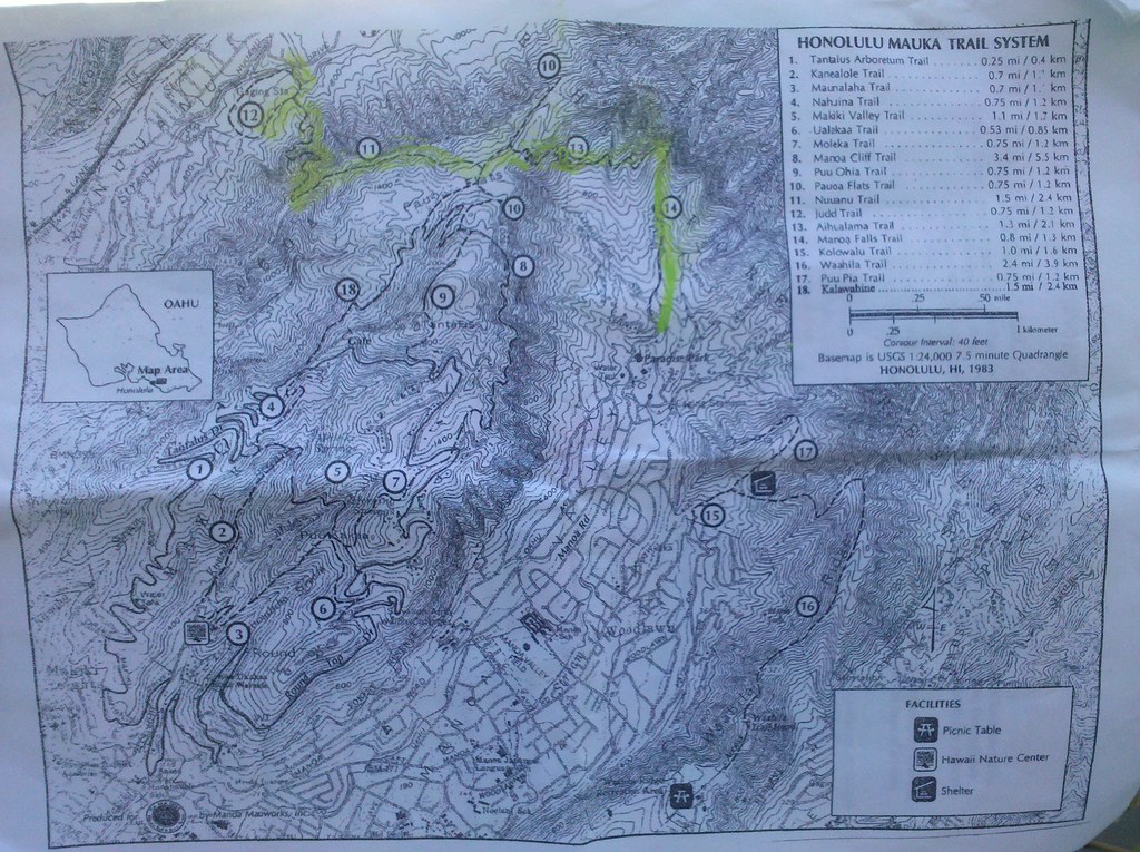
I figured we could combine a couple small trails behind Honolulu into something worth doing and then add a couple short trails in the area afterwards.  We met at our usual Zippy's on Vineyard St at 0600.  Interestingly enough I met a guy in the parking lot with a very interesting sob story about how he was mugged and his car had been towed while he was at the hospital.  Supposedly he was short 16 bucks and change from bailing it out.  I figured he just was short for his next fix of whatever it was he was on but when he lifted his hat and showed me some pretty gnarly cuts and bruises on his head I figured at the very least I could part with a couple bucks simply because the guy was obviously down on his luck and had been beat up pretty good.  Our hastily formulated plan at Zippys was to combine a couple short trails that are part of the Honolulu Mauka Trail System.  We'd take the Manoa Falls Trail, connect with the Aihualama Trail to the Pauhoa Flats Trail to the Nuuanu Trail and arrive back at what would hopefully still be my car with windows intact via the Judd Trail.  Yes, the picture of the map is printed from Na Ala Hele and because this is the Not So Great Hiking Blog that's not even highlighter- that's chalk from my son's room.  Don't want to raise anyone's expectations!

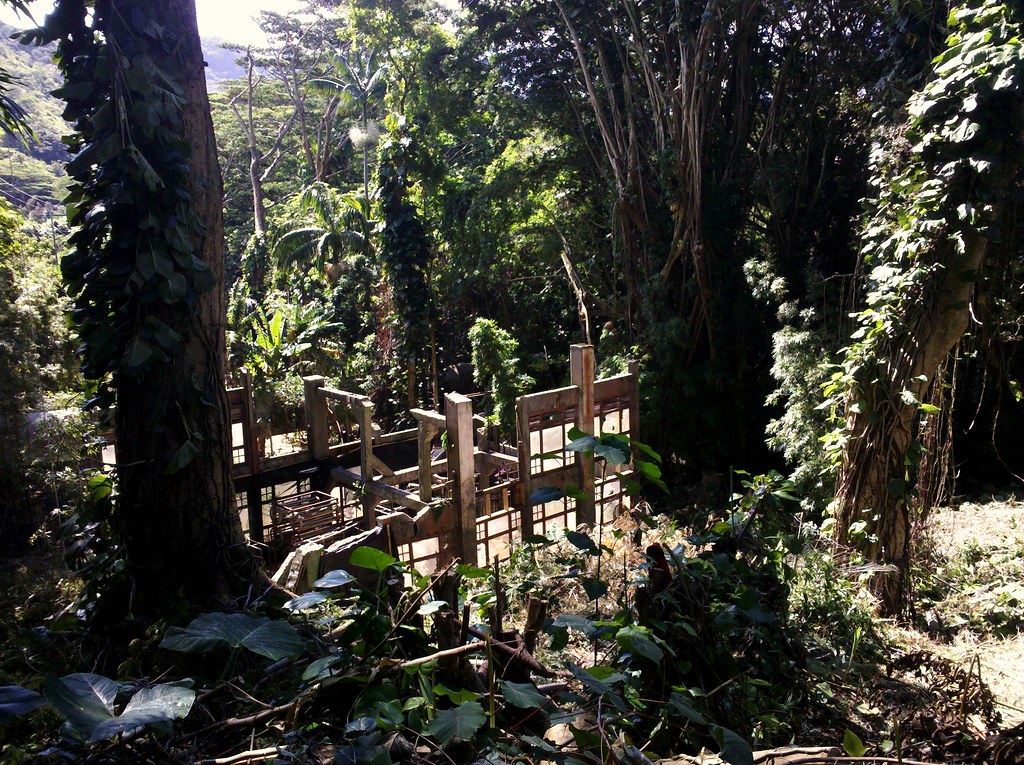
We headed to Old Pali Road and with a quick prayer for the safety of my car we left for Manoa Valley.  Nobody was at the parking lot of the old Paradise Park to collect the five bucks I'd just given the guy at Zippys anyway so I left a note on the car saying we'd be happy to pay when we came back later.  I wandered over and took a couple hurried shots of the Orchid Station from the ABC Series LOST and then geared up.  We started up Manoa Falls Trail just after 7 a.m.


Manoa Falls Trail


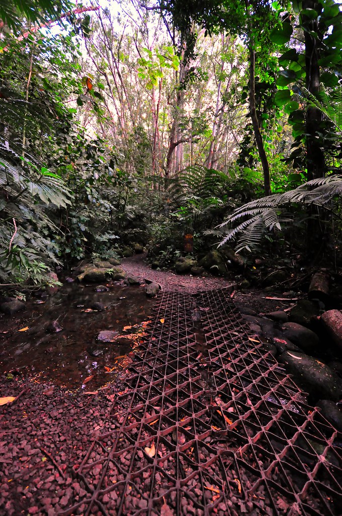
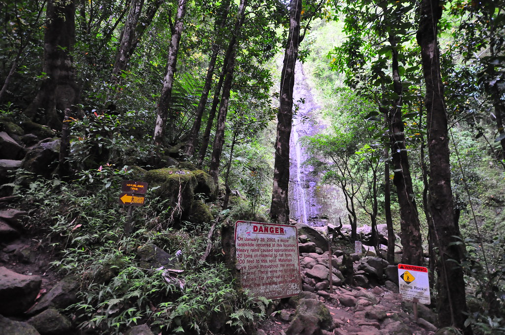
Manoa Falls Trail is all but paved.  Tour groups do this trail.  It's barely more than a walk in a park on what is a very manicured and very well maintained trail.  The first third is full of erosion control steps and gravel making for a very trouble free jungle trail.  Towards the middle there are elevated boardwalk sections that can get a little slippery when muddy or wet.  Towards the falls itself the trial gets a little more rocky, muddy, and rooty but it's just enough to give the hundreds of tourists that visit here a day an authentic Hawaiian hiking experience.  It's a pretty trail but the plants are almost all introduced species if not by Europeans then by the Polynesians that arrived before.  We were early enough that we arrived to the falls well before the crowds did.  In fact we were the only ones there.  They've got so many signs at the falls warning about rock falls that it kind of spoils the mood.  If that doesn't do it the steel poles and cable around the pool at the base will!  Oh well, if you look past it all and the fact we haven't got much rain lately the waterfall is still pretty so I snapped a couple shots of the anemic waterfall and we started down the Aihualama Trail.


Aihualama Trail to Pauhoa Trail

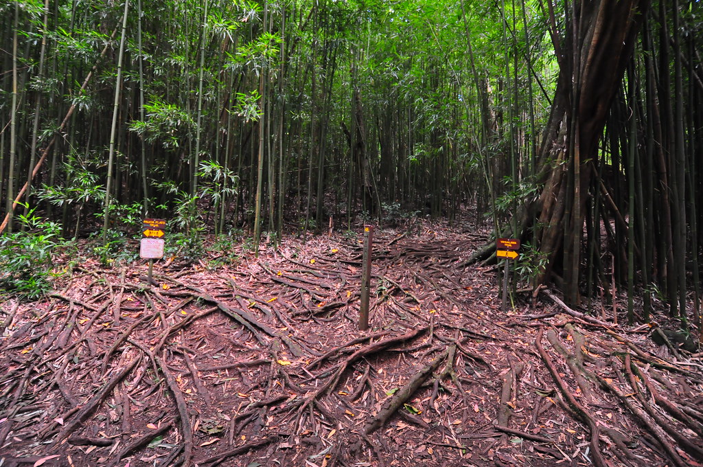
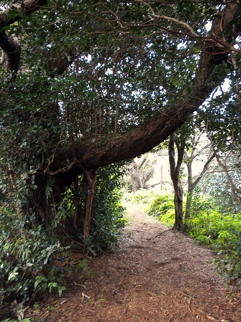
Taking a right just before falls we started up what I'd consider nothing more than a connector trail to get somewhere else.  We passed a couple large stands of bamboo, some fiddlewood groves, more bamboo, some switchbacks, gained some elevation and we'd gone 1.3 miles.  Every once in a while I'd catch a glimpse of what might have been a great view of town but the vegetation blocked them.  We crossed paths with a couple pig hunters and their dogs who hadn't had any luck so far a little ways in and that's about it for that section.

Pauhoa Trail to Nuuanu Trail
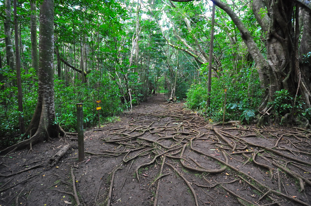
Familiar territory because we took this trail a couple weeks back when we did the Konahuanui summits.  It's a wide open expansive trail with extensive roots.  We were only one it for a couple minutes before we reached my favorite section of the trip, the Nuuanu Trail.


Nuuanu Trail to Judd Trail

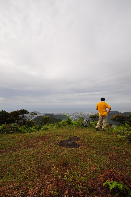
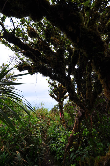
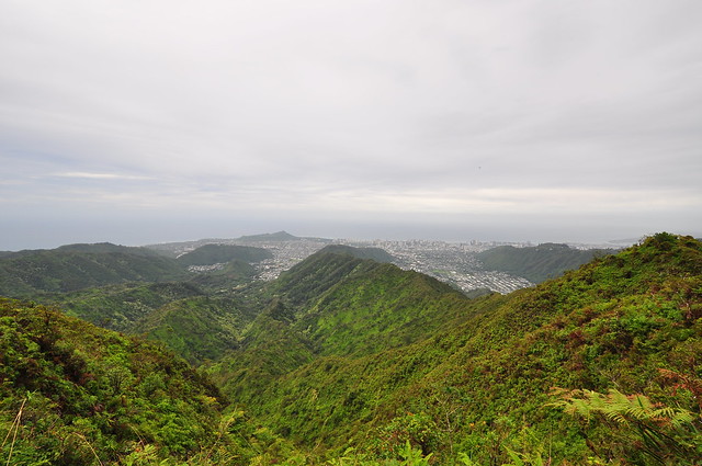
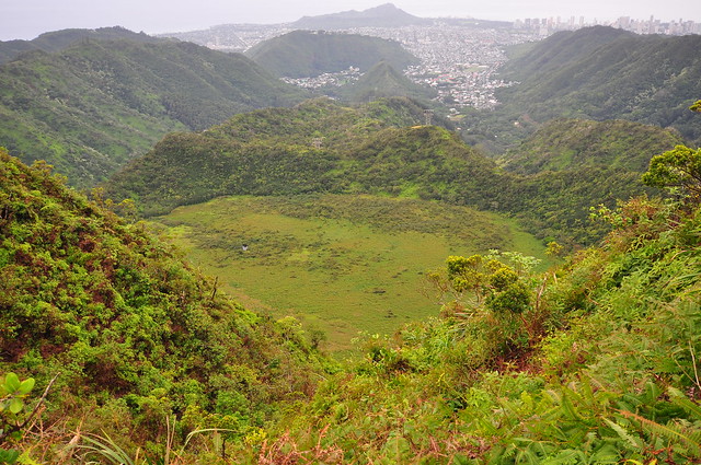
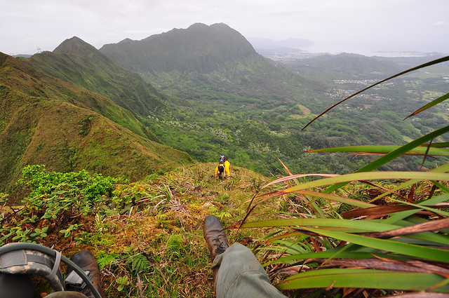
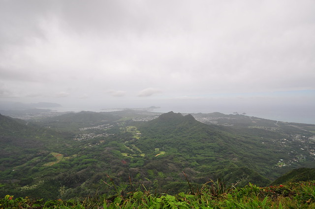
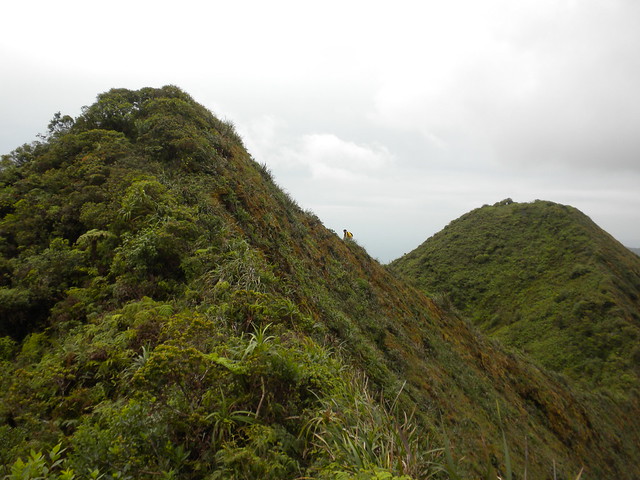
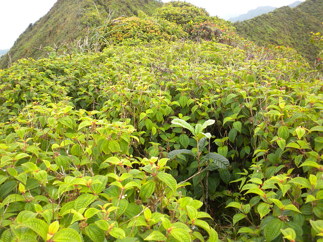
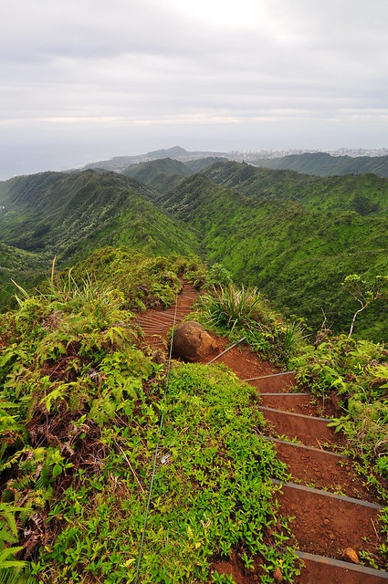
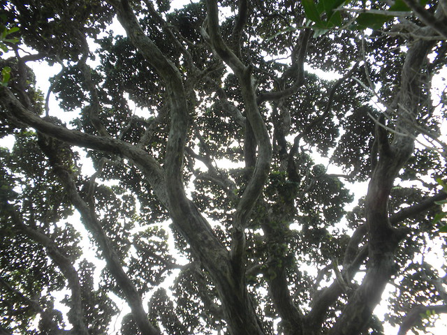
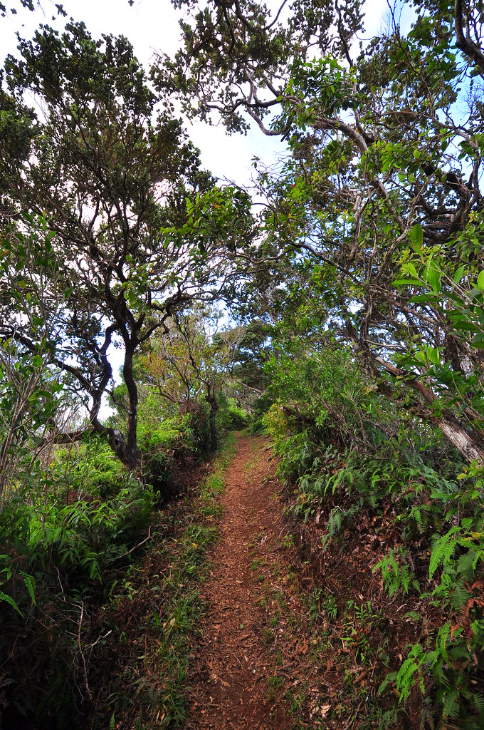
The Nuuanu Trail had some pretty nice sections with some really nice Ohia trees and a couple good views of Punchbowl and Downtown.  It takes you from behind Tantalus over to the ridge behind Pacific Heights.  Once you get over to the ridge the trail magically becomes a Hawaiian forest with uluhe ferns, ohia trees, ect.  We were treated to several great views of the downtown before we reached a bench with a nice grassy area and a short section with even bigger and better ohia.

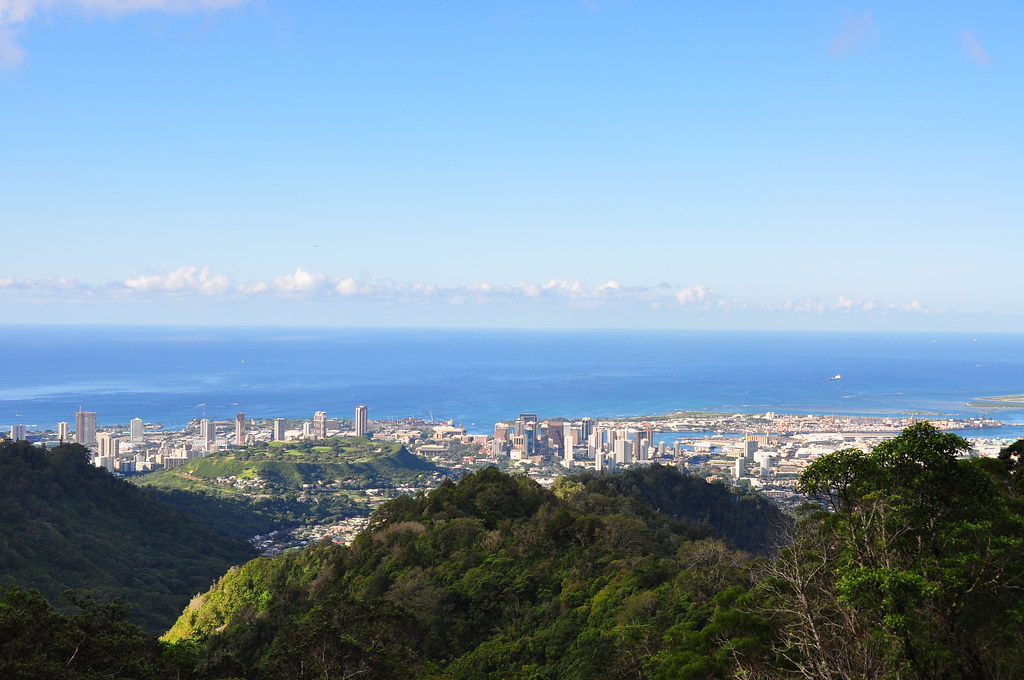
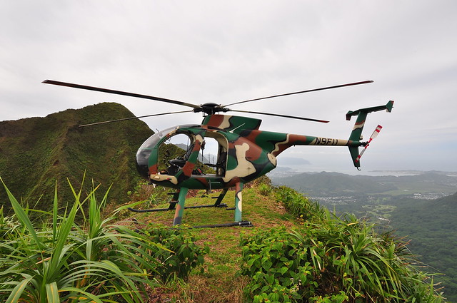
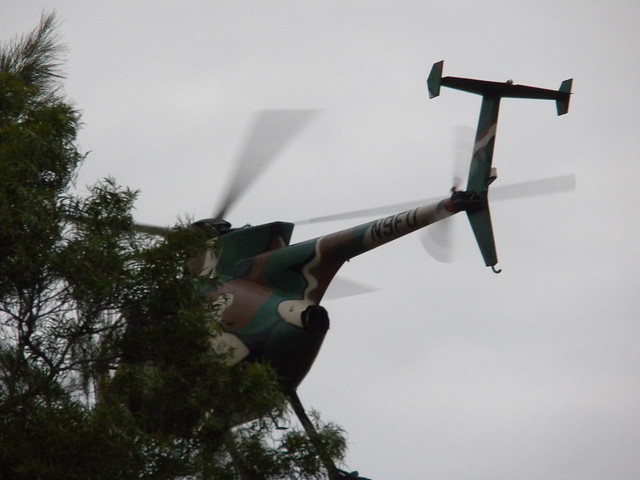
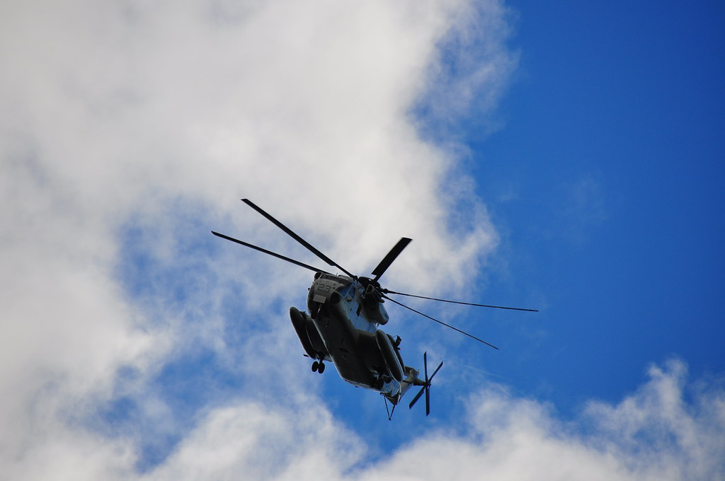
As we started down a Marine CH-53 helicopter flew down Nuuanu Valley and circled above us.  I grabbed a couple shots as it flew overhead.  Too quickly this section ended and we descended down into Nuuanu Valley through a series of switch backs.  I had to laugh when we came across the first of three rope sections.  The rope was about three feet long.  Further down the trail a downed tree truck had been notched nicely to make it easy to go over.

The last portion of the trail takes you through a Norfolk Pine stand.  These stately growing trees are often used as Christmas trees here (I buy one every year) and someone had taken the time to decorate a small one along the trail.  I took a couple pictures of that a a whole bunch of the pine forest.  Eventually we left the pines and entered the bamboo again near the Nuuanu Stream.  We paralelled the stream for a short time than crossed over and made our way upstream to the small pool and falls called Jackass Ginger.  This neat little spot is about 40 feet from Old Pali Road.  I took some pictures of the falls and we exited the trail to the road.  To my relief the car had all it's glass intact and was still there!


Kaniakapupu Ruins Trail (the singing of the land shells)

Back at the car we drove a short ways up to the Board of Water Supply's building and parked again.  The here we walked up the road and took a side trail to the ruins of King Kamehameha III's summer home.  These ruins are not on any tour bus route and I suspect that a lot of people who live here don't know anything about them and are only about 5 minutes from the road.  We walked along a pipe on one side ,which I'm guessing has to do with the water system, and a ditch on the other.

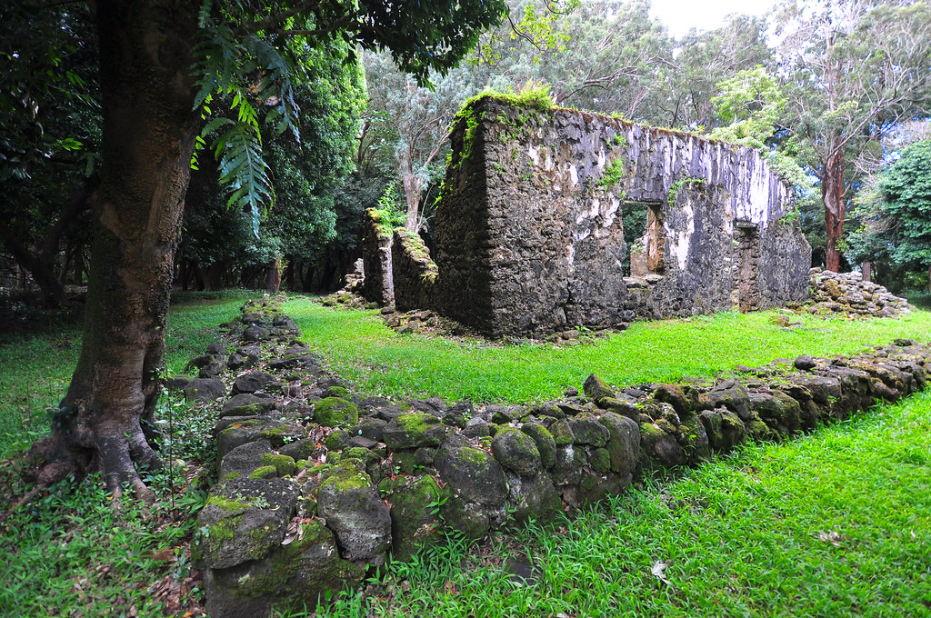
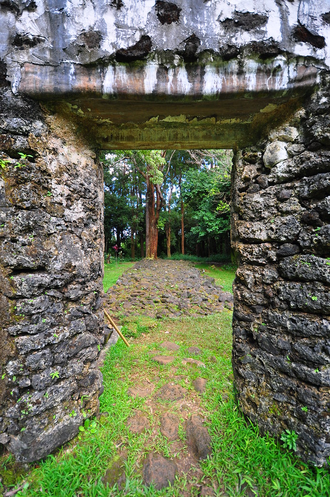
Not long after leaving the road we made a left turn and 50 yards or so later arrived at Kaniakapupu.  A fresh lei, and some other offerings were laid out below the plaque identifying the site.  We stayed for a short time taking a few pictures trying to imagine what this place looked like when the King of Hawaii was it's owner.  Here's a nice site with info if you want to read more about it.  I had planned to do the Pali Puka again afterwards but my hiking partner was in tough shape from last week's trail.  His knee was acting up and he was limping pretty bad so we called it a day.  It's a darn good thing we didn't go up to the Ko'olau Summit because if we had his knee would have been a big problem.  Hopefully he'll be back in action next week and the weather will cooperate because I'm itching to get back on the KST and finish the two remaining chunks.  Mokapu to Kuliouou and Konahuanui to Awa'awaloa will have to wait.


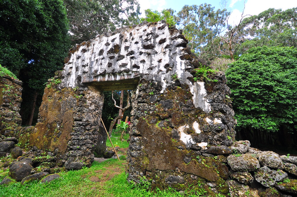
He was done for the day but after a lunch at Don Ho's at Aloha Tower I headed back to Kailua and when the kids came home it was time for the final trail of the day- Ka'iwa Ridge- again!  
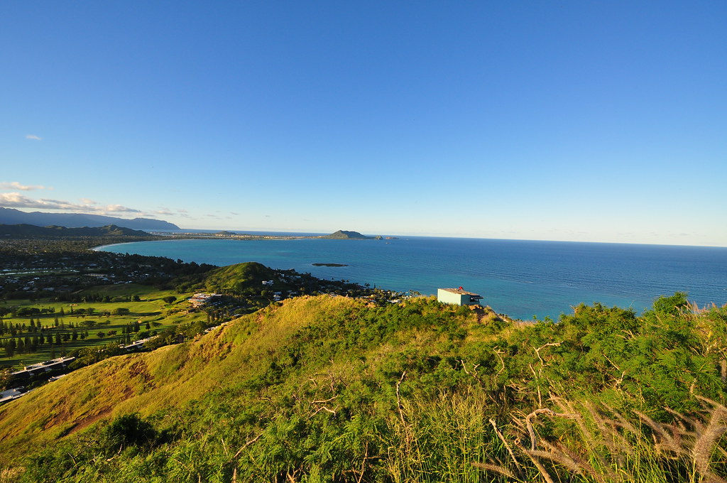
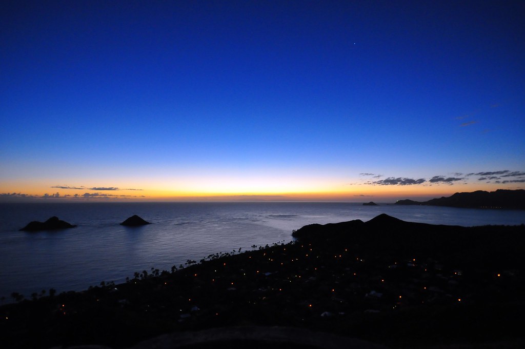
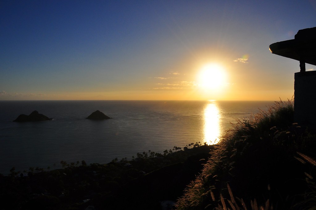
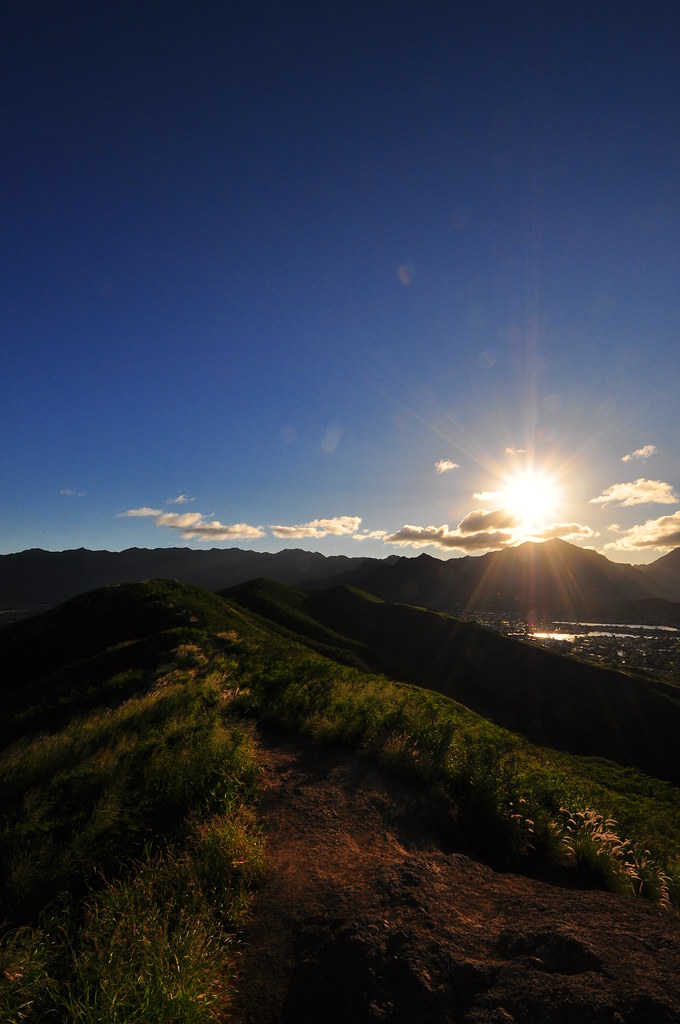
Ka'iwa Ridge Trail

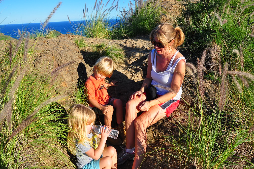
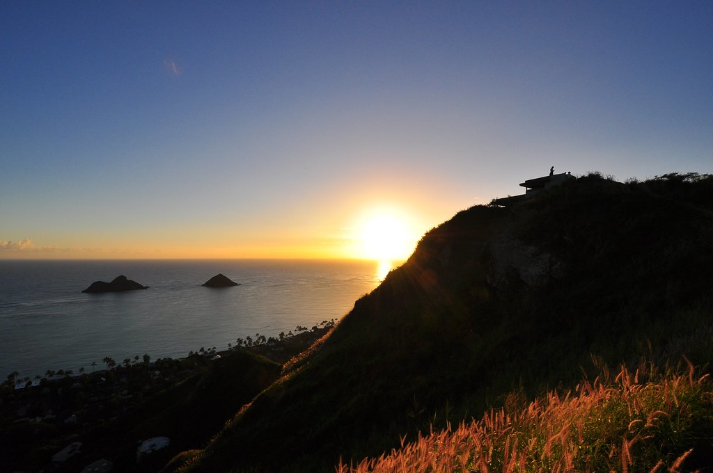
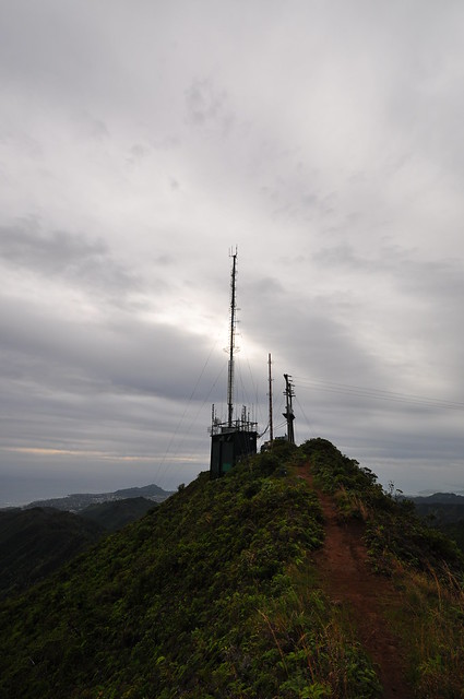
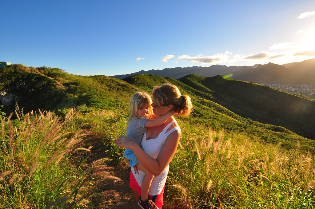
After the kids got out of school we loaded up and headed to Lanikai.  The weather was AWESOME.  The visibility was so good you could see Moloka'i, Lana'i, and Maui.  As an added bonus we had beautiful golden afternoon sunlight.  The kids slipped and slide up the hillside as their nervous mother anxiously watched.  Passing the initial climb we were treated to our first ocean views.  Whales!  We watched a group of whales playing just beyond the Mokuluas and I kicked myself for not bringing my 400mm lens.  I never have it when I need it!  We continued up with the kids doing a great job up past "Stay-Puft" rock.  Higher and higher we climbed with Mrs. XJ getting more an more nervous as the trial got steeper and the drop-offs on the windward side bigger.  Passing the first bunker she regrouped and we continued to the second set of bunkers.  I took Keona down into one of them and explained that, "This is where the men looked with big binoculars for ships for the big guns to shoot but they never came".  Questions, questions, and his curiosity was satisfied.  The visibility was so great and the landscape highlighted so beautifuly with that golden sun. Totally amazing!  We hung out enjoying a perfect Kailua afternoon atop the old fire control station and finally headed back down when the kids got restless.  Nohealani was carried for a while by my wife then passed to me.  A couple small slips by Keona and Mrs. XJ but we returned to the car safely.  A perfect ending to a great day!

The Honolulu Mauka pictures can be found here, the Kaniakapupu Ruins here, and these Ka'iwa Ridge shots here.  Other trails  I've done are can be viewed in my Trails Collection at Flickr. 

Aloha and mahalo for reading!


Tuesday, January 25, 2011

Ka'iwa Ridge Sunrise

January 25, 2011 Ka'iwa Ridge Sunrise

Dawn breaking over Wailea Point
It's a story longer than I wish to tell but instead of hiking across the Ko'olaus as planned, I'm having lunch with some relatives from out of town.  I woke up to an almost perfect day in Kailua.  Clear skies, no wind, and cool temperatures.  At just before 6am I jumped into my truck with my Nikon and headed to Ka'iwa Ridge behind Lanikai.  This trail and I go way, way back to my childhood when I lived on the road the trail starts from.  Later we moved to Blue Stone, the condo complex at the foot of the ridge.  I can still remember walking along this ridge with my dad all those years ago as a little kid.  I used to gaze in wonder at the runways of Bellows AFS as we looked down on them from the trail.  Funny the things you remember from so long ago!  In high school I climbed this ridge almost every Friday night to... well... nevermind what I was doing.  Let's just say I've been up this ridge hundreds and hundreds of times.  

Amazingly, I was the first one up the trail this morning.  I knew that because I was the lucky one who got to remove all the spider webs that had been built overnight.  It was still dark when I passed "Stay-Puft Rock" so I didn't pause, just kept climbing up to the first and then the second "bunkers" or "pill boxes" as they are called.  Part of network of coastal artillery, Fire-control station "Podmore" was built in 1942 to direct fire from the 3 and 5 inch guns of former Battery Wailea.  Each held optical range finding equipment to target the artillery in the event of a Japanese landing during WWII.

I arrived well before sunrise and took off one of my slippers to serve as a mount for my camera.  Thoughts of the scorpions that live here were not far from my mind.  In forth grade I got stung by one up at the second bunker on my birthday and I set an unbroken world speed record down the mountain thinking I was going to die.  I snapped a couple pics of the sky lightening up as the sun continued it's steady rise below the horizon.  A short time later the first voices floated up from below and soon the first of about a dozen people appeared.  I talked for a while with a guy from California who was renting a place in Lanikai who had just come from a pretty extensive tour of Normandy Beach and the Pacific.  He was happy that I knew what the emplacements were for and he told me about all the fortifications and battle sites he'd been visiting on his trip.  Turns out he was a private pilot too so we had a lot to talk about waiting for the sun to rise.

Soon enough the sun made it's grandiose rise over Moloka'i and officially bought in the new day.  I grabbed more than a couple shots and lingered as the tourists and a couple locals left.  I considered heading down the trail towards Enchanted Lakes but decided I'd better get home and take care of the chores that I usually do on Wednesday so I could hit a trail. 

Sun rising over Moloka'i
 As an added bonus I got to do a little climbing because about half way down I dropped a lens cap over the edge of the ridge. They're about twenty bucks (learned that a couple weeks ago when I lost one near Hawaii Loa on the KST) so I put down my camera and my other lens to scramble about 10 feet down the steep ridge to look for it.  I found it!  On the way up I surprised the heck out of a guy coming down who thought I fell off the ridge.

Uneventfully I returned to my truck and headed home.  Three hours later I have yet to start any of my chores!

More pictures of this trail and others I've done are can be viewed  Flickr.  Aloha and mahalo for reading. 

Wednesday, January 19, 2011

KSRT: Mount Olympus to Wiliwilinui

January 18, 2011 KSRT: Mt. Olympus - Wiliwilinui Ridge


Wa'ahila Ridge to Awa'awaloa

The morning began at the Vineyard St. Zippy's just after 6am.  We headed straight to the Wiliwiwlinui trail head to drop a car off.  Bob, the Waialae Iki subdivision security guard, and I are on a first name basis by now.  I'm not sure he believes I'm not actually hiking but tending to a pakalolo patch or casing the expensive houses all day.  Car one dropped, we head to Wa'ahilia Ridge State Recreation Area via Google Navigation (hey, I'm from the windward side...).  We departed  up the Wa'ahilia Ridge Trail just after 7am.

Small rock climb section
 Initially this trail starts out as dirt road sized trail through some large Norfolk Pines and soon shrinks to a Strawberry Guava choked pathway.  The first downhill leg starts at a grove of Ironwood trees and turns into a dry, rocky ridge trail with tons introduced forest species like Fiddlewood, Christmas Berry, and others.  This trail has received so much traffic over the years that the roots and rocks are worn smooth and almost have a sheen to them.  The ups and downs include some very small climbs and descents over small rock ledges but every one of them seems to have a bypass if you don't feel inclined to use your hands.  Someone found the time to carve 1963 or maybe '68 into a boulder at one of them.  Graffiti that will last for the ages.  Eventually we reached a fork in the trail with the customary signage begging us not to go further up the ridge but to take the left fork.  According to Na Ala Hele, " This trail ends at an intersection with Kolowalu Trail. Do not go up to the summit beyond the Kolowalu/Wa`ahila junction - it is a Restricted Watershed Area. You may continue down Kolowalu Trail, which descends steeply down into the back of Manoa Valley"

Signage disregarded, we continue up the ridge trail.  The series of climbs and descents continue until we reached the first clearing.  We stopped for a few minutes and enjoyed the views of downtown.

Continuing up the trail there were some large, by O'ahu standards, Ohia trees.  One of them had a huge limb across the trail that was bigger than the trunks of most Ohia on the island.  I pondered how the forests had changed since the arrival of first the Polynesians and then by the arrival of the Europeans.  I have yet to see any old growth 'ohia or koa forest left on O'ahu like still remain on the  other islands.   A few more ups and downs and we arrived at the second rest stop where we soaked in more of the awesome views of Manoa below.  Not really much different than the view of the first other than town being smaller we departed after remaining just long enough to snap a couple more shots and catch our breath.

First "Rest Stop" view of Manoa Valley and Honolulu

Third "Rest Stop"
The section between the second and third rest stops felt different.  The cool mountain air, quiet, smells, and the now native forest combined reminding me of the Big Island and Kilauea.  Along the way we got our first glimpses of Ka'au Crater.  Another steep climb took me out of my daydreams and we arrived at the third and final rest area.  Not to sound spoiled but the view of Manoa and downtown was getting pretty redundant.  Aside from noticing that someone had built a camp fire here not to long ago and some pig droppings we didn't stay long.  The final push to the top of Mt. Olympus looked like it was going to be fun!
It won't win any awards but here's my shot of the 'Apapane

We set off on last section to the top and the view of Ka'au Crater was complete.   As we made our way up what was increasingly becoming a steeper and steeper trail we spotted a pair of red birds flitting from tree to tree.  'Apapane!  While estimates done in 1991 guestimated 20,000-50,000 remaining they aren't something you see every day.  I quickly grabbed at my Nikon point and shoot and zoomed all the way in to try and catch a shot.  What I got were 3 pretty terrible pictures.  One blur, the one here where you can see a red thing in a green thing, and the last was a total fail- blurry and no 'Apapane.   

Last segment to Summit
Summit cloud forest
Spirits renewed with the sighting, we continued on an increasingly difficult trail.  As the peak loomed up ahead it became obvious there was a fairly decent climbing section.  Near the top there was a welcomed rope section which eased the climb Huffing and puffing we pushed through a summit area that included a really cool cloud forest filled with moss coated trees and arrived at summit of Awa'awaloa AKA Mount Olympus.  I grabbed a shot of the view from the summit with my Droid phone and posted it with a caption "Mt. Olympus... call me Zeus" then powered off my phone in case I needed it later if we got into trouble.

Leeward View from Mt. Olympus / Awa'awaloa Summit

Ko'olau Ridge, power line section and, Ka'au Crater from Awa'awaloa
  
Awa'awaloa - Palikea

Working carefully down Awa'awaloa
After we had scoped out the view for a few minutes I checked the trail ahead.  It got right down to business.  We had a steep descent with a big drop right away.  We'd then traverse the Ko'olau ridge line to the power lines above Ka'au Cater then make the climb to Palikea.   I scooted ahead on my butt down the steep decline absorbing the view of the valley far, far below and near the bottom I spotted two lobelia hypoleuca near a loulu palm.  I snapped pictures of them as my partner worked his way down.   There was a 8 foot section that required some real attention putting you on the narrow ridge high above Maunawili. 


Here I made another discovery.  A pink ribbon placed there by a group of pretty advanced hikers a little over a week before.  They had climbed up to the ridge from Maunawili below.  I'd read about it just a few days before on Hawaiian Forest.  I guess when you run out of regular hikes to do you have to start making your own!  I spied the trail below from the Maunawili Demonstration Trail to the base of the Ko'olaus and marveled at the climb up the ridge that they had made.   Too advanced for a not so good hiker like me!

Continuing onwards we headed past the twin power lines behind Ka'au Crater.  I was hoping for a really great shot of it from the ridge but the vegetation didn't cooperate so we kept moving.  I didn't look very hard anyway because I plan on coming back for the Ka'au Crater Loop Trail anyway.  The best I could do was this one.
Ka'au Crater
The easy walk below the power lines quickly faded as we made our way up to the top of the first peak.  It was long, steep, and the mud was the consistency of fudge.  Slipping and sliding we reached the top and paused to talk with two guys that had just made the climb up from Palolo Valley to Palikea Summit. 

Palikea- Lanipo

We set off towards Pu'u Lanipo along the windblown ridge which for the most part was pretty easy.  As we approached Lanipo it looked bigger and bigger.  Fun, fun!  I arrived at a really cool little windswept microvalley at the base of the peak and marveled at the cliff edge below and the really neat miniature hapu'u ferns dwarfed by the wind that must howl through here on a regular day.  Thankfully, this day it was calm so at least we wouldn't be hammered by gusts of wind as we scaled our way up.

 It took a minute to figure out exactly how to proceed at this point.  There really wasn't a defined trail anymore.  There was a dry waterfall that looked like it would work but the side facing the cliff looked like it had been used before so it's the path we took. 

Lanipo- We may have cheated the ridge but we still had to climb the summit.

I won't lie, I took all kinds of breaks going up this section.  I paused to examine a mountain naupaka, the view, and any other excuse to stop.  I wasn't particularly concerned sliding off the mountain to my death, it was a pretty reasonable climb and there were a lot of plants to grab if you slipped and the face was covered in grass providing good ground stability.  The views were fantastic as we made our way up what turned out to be a trouble free climb.  It looked bad from below but it was just tiring, not frightening.


 Eventually we topped Pu'u Lanipo and were rewarded with a 5 star view of Kailua even under the overcast and voggy skies.  All the reward of the view without tortuous Lanipo trail!
Lanipo windward view


Lanipo-Wiliwilinui 

I enjoyed this section of ups and downs


Clidemia forest
The next section was a series of peaks with some steep drops and areas of heavy and light vegetation.  All morning we'd heard helicopters working in the distance and dropping workers and equipment off near Wiliwilinui.  I wondered what they were up to and if they'd still be there when we arrived.  I was shocked to see entire areas filled with clidemia, a super invasive and seemingly ever-present plant along the trails here.  This particular section of the trail seemed drier than the others and I wondered if that was part of the reason for the huge stands of this noxious pest.  We crossed about four relatively small peaks before the  massive descent down to the saddle to Wiliwilinui.  

As the chopper worked dropping off men and moving equipment we figured out what they were doing... replacing the lines to the radio station.  I wondered if this was going to be problematic and decided if they gave us any trouble about passing through their work area then they could give us a ride on their whirly bird because there was now way I was turning back this close to the last segment.  My attention turned to the descent from this peak down to the saddle that would take us to Wiliwilinui ridge.  Believe me, the helicopter ride sounded pretty good as I looked below.

The decent down was fairly serious at first then went to crazy.  I took the easy way and slid down feet first and let my butt serve as a brake.  I accidentally dislodged a piece of dirt held together by plant roots and watched it bound down the decline towards the abyss.  It was a sobering sight.  Meanwhile the helicopter landed at a small clearing on the trail ahead.  At the last segment there is about a eight to ten foot segment that requires extreme care.  
This part actually scared me a little.  I paused at the end to snap this shot

The final and mentalist descent of the day
The drop is hundreds of feet straight down on the windward side and leeward side is choked with plants along a small outcropping the another drop too steep to risk either.  I used the 'uki plants as hand holds and felt below for the small foot wide ledge below.  A slip here was sure to be fatal.  I waited for my hiking partner to catch up and we set off towards the power lines where we ran into one of the workers.  We chatted with him for a few moments and continued towards the helicopter along the saddle.  Maybe I was getting tired but I thought the tail number was hilarious.  My imaginary conversation with the chopper was, "Hey, can we get a ride?" and the response, "Nine, F, U".  

Leaving the chopper behind we made the final climb to the terminus of the Wiliwilinui Trail pausing for a moment as we passed the continuation of the KSRT and remembering last week's adventure from here to Kuliouou Ridge.
Wiliwilinui terminus looking west down the KSRT

I should mention that this part of the trail is usually pleasant.  Today it was filled with shouting from the power line workers, their radios, and the backup generators of the radio station.  Soon after, the chopper fired back up to work on the transmission lines again.
Chopper pulling transmission wire.
Start of the final leg down Wiliwilinui Ridge
Downward we went past the station exchanging greetings with the guy who I'm guessing was there to monitor the generators and power situation.  The rest of the trail down was uneventful and it got quieter.  We passed the beginning of the Wiliwilinui Trail and continued down the dirt road towards Waialae Iki and the promise of a a shower and something to eat soon.
My knees hurt just looking at this.

Last shot of the day.
 Near the bottom there were a bunch of work trucks and some boom trucks parked along the dirt road north of the water tower belonging to the contractor doing the line work above.  As if on cue, just as we were about to finish the trail along came the helicopter overhead which did a quick circle a hundred feet above us before landing near the water tank.  My streak of helicopter landings every time I'm atop Wiliwilinui is unblemished and seems to be intensifying!  Hopefully this doesn't mean I'll be riding in Air 1, the fire department's rescue helicopter soon.  Trail completed, we hopped into my car and headed back to Wa'ahilia Ridge State Recreation Area where we were glad to see the other car sitting safely and unharmed.  Although shorter than last week's KSRT adventure this segment was a little more challenging.  There were a couple serious parts where falls would have been disastrous and extreme care was required.  Of course, your mileage may vary because I'm a not-so-great hiker and others have flown through this and other trails I've done.  I've read where someone did  Judd Trail to Konahuanui and the Ko'olau Summit Ridge Trail all the way to Mokapu in a day.  I like to take my time anyway because there is so much to see.  I'm shooting video too on the trail, which I haven't gotten around to editing yet, and I'm always seeing stuff I didn't notice on while I was hiking.  Those are just a few of my many, many excuses anyway! 

A shot on the climb up Lanipo
Ama'u Fern near Lanipo
My usual disclaimer:

I would NOT recommend this trail to anyone who's unfamiliar with the ridges along the route and doesn't have some fairly advanced hiking experience.  There is a whole lot of potential for some really bad things to happen and getting stuck on any section of this trail at night would be extremely dangerous.  


More pictures of this trail and others I've done are can be viewed  Flickr.  Aloha and thanks for reading.

Seldom seen view on O'ahu of a large 'ohia tree canopy.