Friday, March 23, 2012

Poamoho Fail and Kionaole Road Family Hike

February 20, 2012

This was supposed to be a fantastic day where we'd hike the Poamoho Trail to the Ko'olau Summit Trail then head to Pauao Ridge and back to finish that segment then return to Poamoho and exit via Papali Ridge to complete the KST from Pupukea to Waikane.  I'd secured a coveted permit on a federal holiday since both II and I don't get weekends off.  The matter of transportation was solved when my Mom offered to bring her sister and they'd go to the Poamoho Summit then back and drive out.  Everything was set for success!

Mauka Girl snoozes while I get my gear together for our adventure.
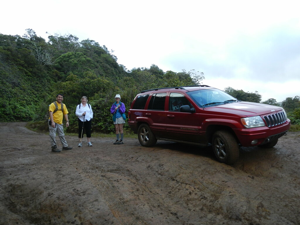
However, when 20th rolled around the weather looked less than perfect.  I anxiously checked the weather station at the trail installed and maintained by hiking legend Cory Yap of Aloha from 808 and the nearby Wheeler Army Airfield (HHI) forecast the night before and several times during the night hoping that things would improve.  Determined to take advantage of this opportunity, we piled into the Jeep at about 0600 and headed to Helemano.  The dark clouds and drizzling rains were discouraging but we made our way up the muddy road that leads into the Ewa Forest Reserve.  There's no way we'd have been able to make it up the road without four wheel drive in the mud but the the Jeep Grand Cherokee's Quadra Drive and Vari-Lok differential systems made the drive effortless.  (Take that "grocery getter" jokes!)  Since my mom's sister who was visiting from out of town would be driving out I gave her the wheel so she could  get used to the Jeep and the road.  Finally we arrived at the end of the road and the start of my favorite trail on O'ahu.

Da Crew
Now I should point out that the Jeep looks pretty fancy with it's chrome wheels and chrome tow hooks but it's 10 years old now and being the third car it's got a few "issues".  One of which is the rear tire that had a slow leak in it.  I eyed it suspiciously before we set out not wanting to leave my poor mother and her sister stranded on a dirt road in O'ahu's back country.  I was feeling about 99% sure about it making it down the road safely after inspecting it.


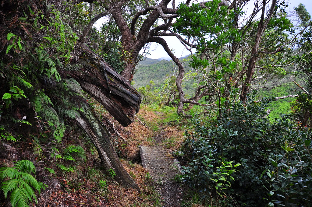
With some reservations, we started up the trail and almost immediately found ourselves surrounded by native forest.


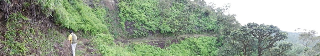
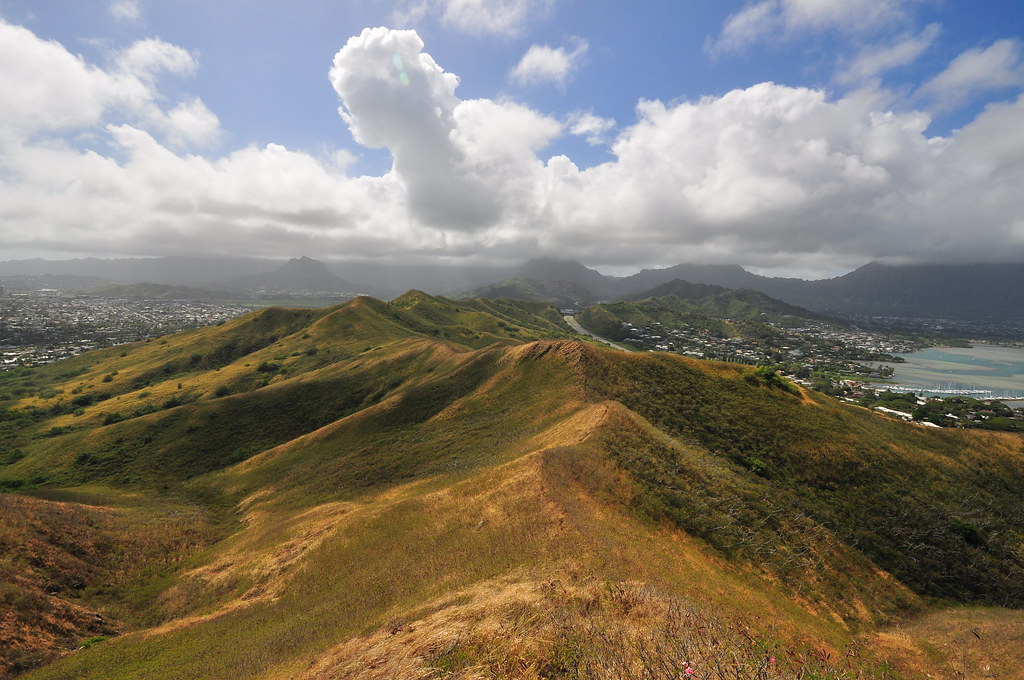
As we made our way through the initial segments that contour effortlessly up towards the summit the sun seemed to peak out under some of the clouds luring us further.


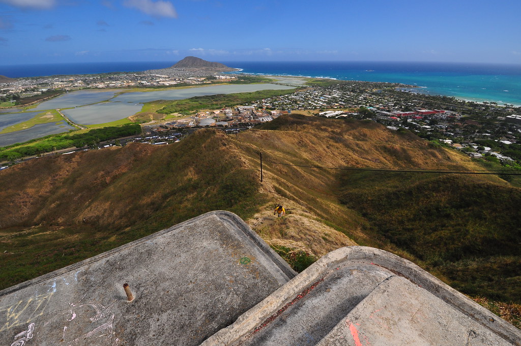
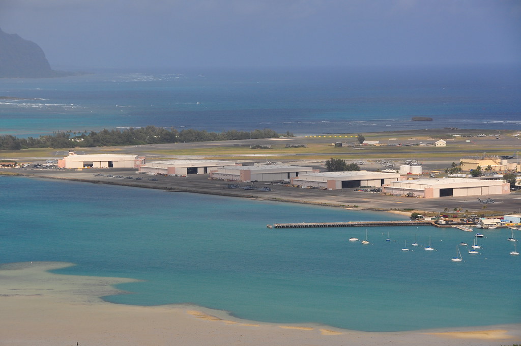
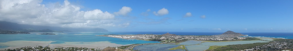
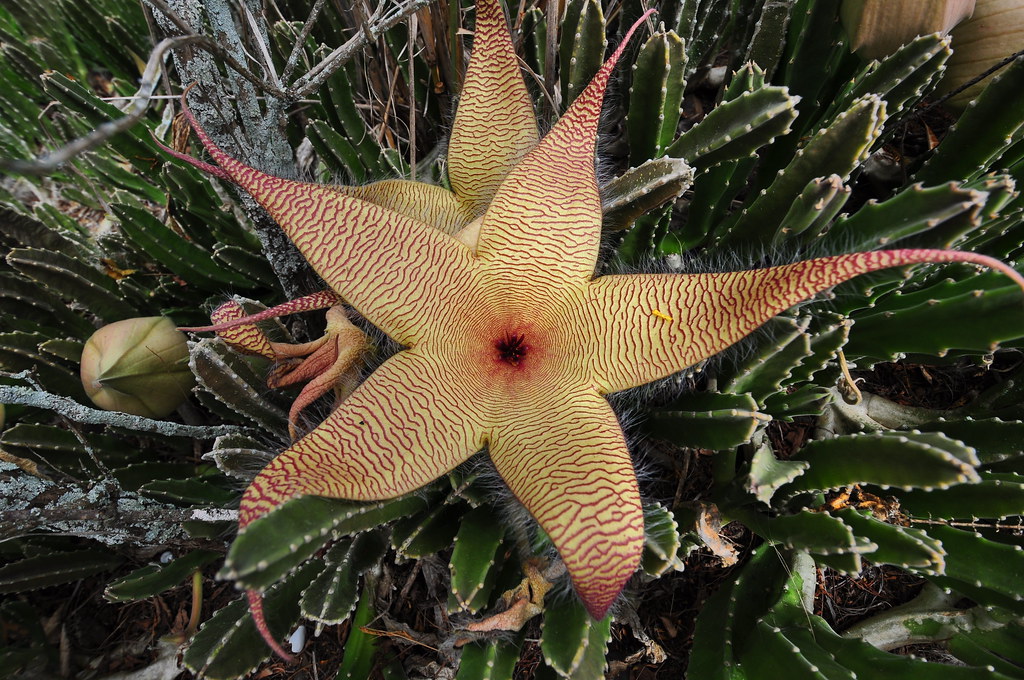
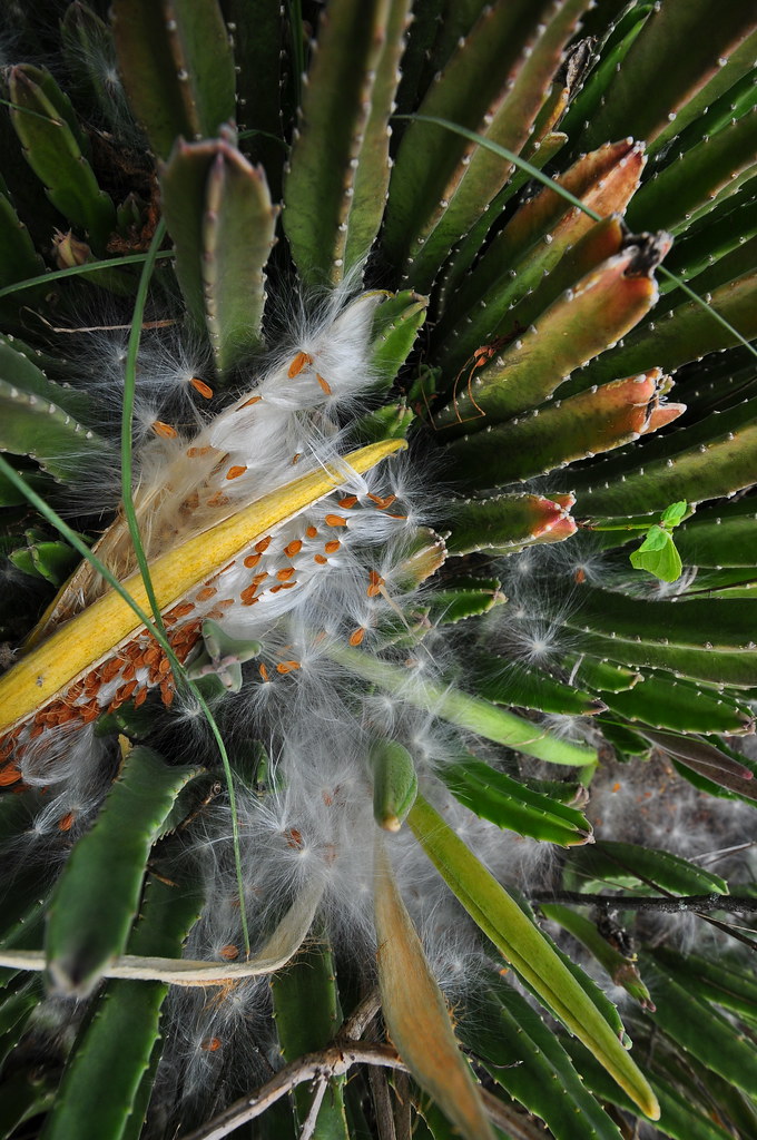
II and I were released to push ahead leaving my mom and aunt free to cruise behind.  I'm pretty sure heaven looks a lot like Poamoho Trail.  A nice graded trail lined with ohia and other natives that leads to a wild adventurous trail through the most beautiful scenery on O'ahu beyond.


II were making great time on the smooth trail but coming around a corner I got a voice mail from my Mom's phone.  It was already about 10 minutes old and I struggled to find a place to catch a signal so I could retrieve it.  Concerned it was a medical problem considering my mom's recent aneurism, I dropped my pack and left II to run back to find them.  Sure enough there had been a minor injury that meant my mom and aunt would be returning to the Jeep. They generously volunteered to sit in the car and wait for us to get to the summit and let them know if we were continuing out Papali, but we pulled the plug on the whole operation.  I hate to bring work into it but all of the training both II and I have had in risk management had both of us concerned.  In aviation, a chain of events, often called the error chain, refers to the concept that many contributing factors typically lead to an accident, rather than one single event. The number of small problems we were facing already had the potential to multiply into a bad situation.  It seemed like were were just pushing too hard with the weather, the leaky tire, the bad road conditions, and the minor injury.  It was becoming more and more risky to proceed.   Not to mention that I'm not going to leave my Mom and Aunt sitting in my Jeep waiting for us!

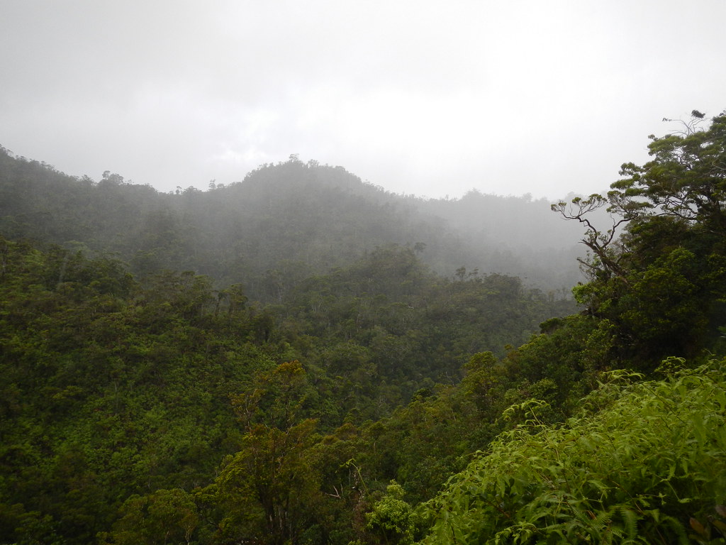
As we headed back to the Jeep a rain shower seemed to confirm the weather wasn't going to get any better.


Arriving back where we'd parked, the water flowed like a small stream down the road making for the nastiest mud ever.  Not nasty like the beautiful gooey dark mud that I loved to take my old Chevy Blazer through, but staining, clinging, red dirt mud that is nightmarish to get off your car and God help you if this stuff gets on any fabric that's not dark colored!

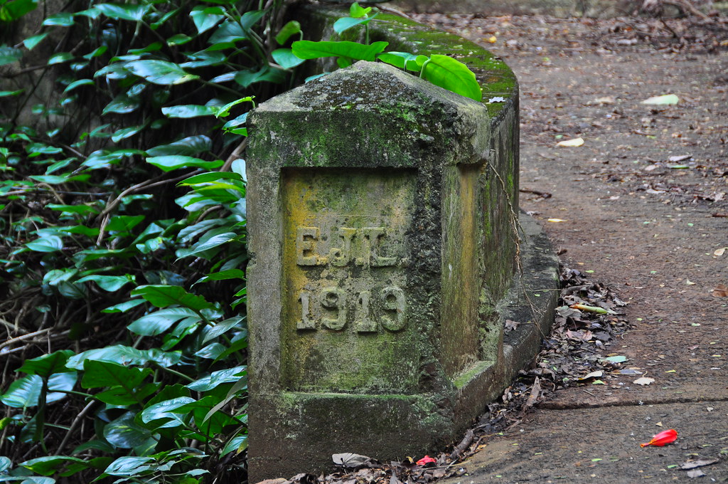
Nature's permanent marker.
We made the long drive back out of the forest reserve and back to Kailua where II departed back to town.  My mom and aunt also said their goodbyes and headed back to their house a mile down the road.

I was pretty bummed about the whole thing, especially since it was going to be months before I got another opportunity to go back to Poamoho.  However, when I got home my wife and her friend Marian decided to do a short family hike up in the little network of trails at the base of the Pali.  All was not lost!


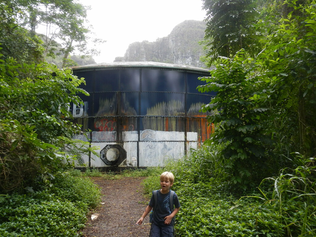
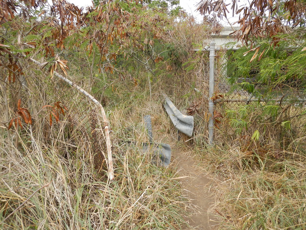
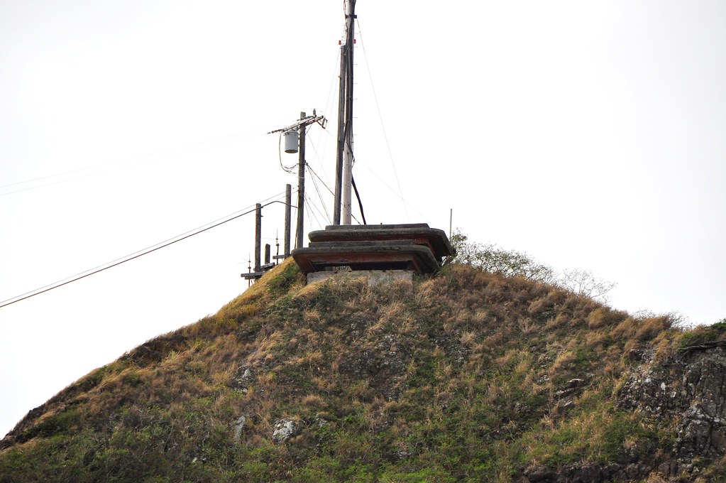
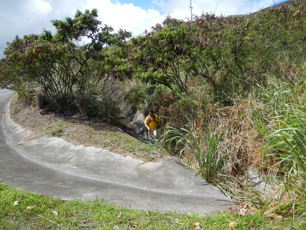
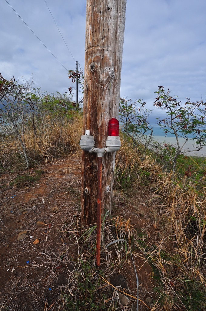
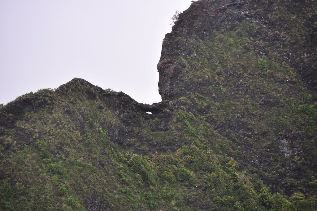
After parking we headed up the paved road to a water tank before veering left onto a well worn muddy trail that leads to a power line.  Unfortunately that power line kind of got in the way of the view of the east ridge of the Pali that leads to Lanihuli!  The vantage point did provide a clean shot of the Pali Puka though.


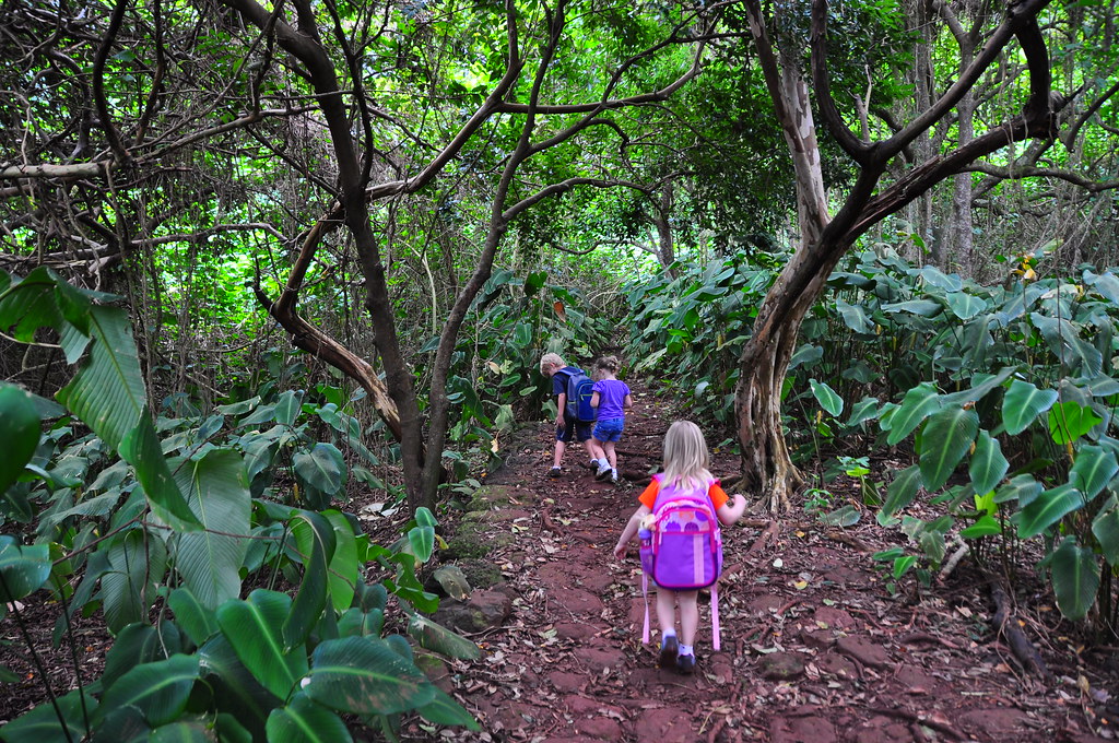
As we made our way though the introduced forest, the kids were having a blast while my wife and Marian chatted away.  I busied myself taking pictures of the kids and helping herd them in the right direction.


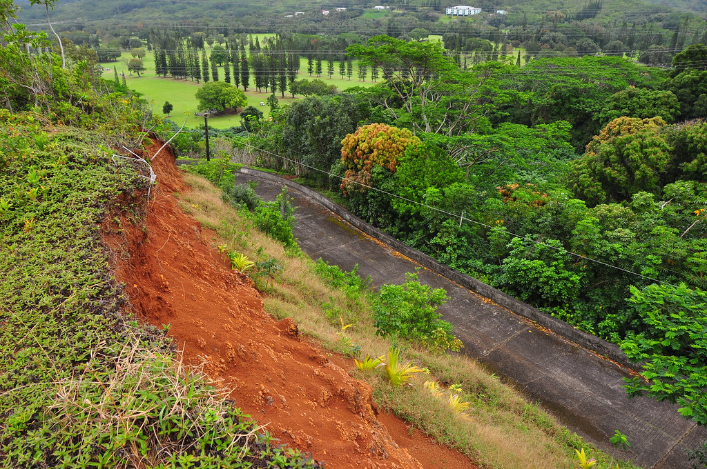
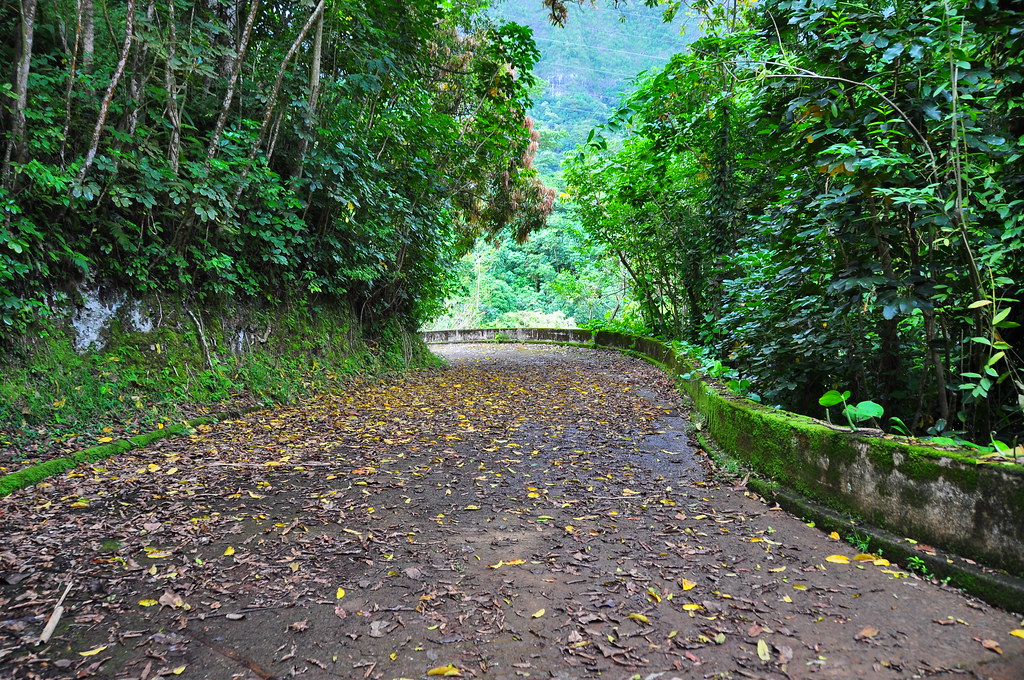
The gang made it's way up over the old, old, Pali Road with it's lava rock paving and then took a left turn along a contour trail heading east.


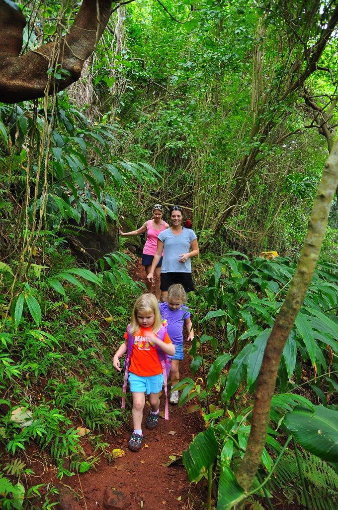
We ran across another family who eyed me curiously as I was still wearing all my gear from the failed Poamoho trip.  No doubt I was the most overdressed and equipped on this trail that day.

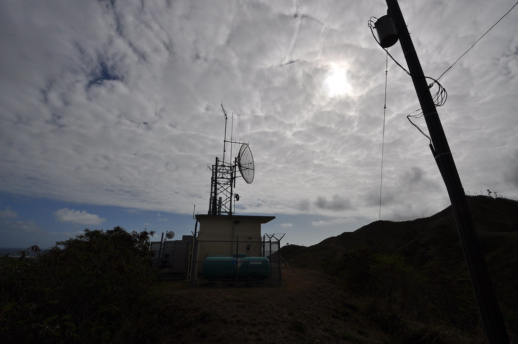
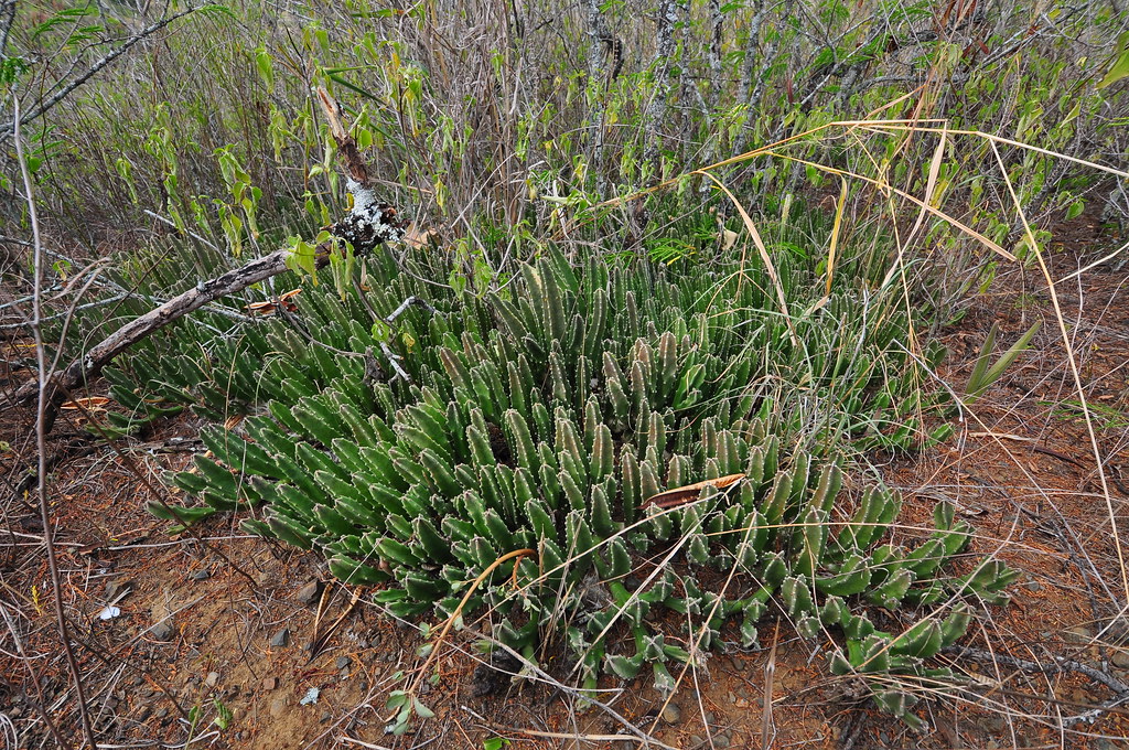
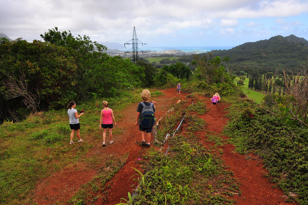
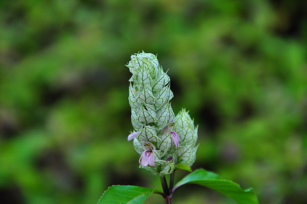
With three kids we opted to take a trail that would go down towards a large transmission tower and then to the paved Old Pali Road.  I spotted a nice Ohia blooming which was a nice change from the weedy surroundings.


Descending through some Hala trees required some careful footing for the younger members of the party.  We paired and assisted the kids down the crumbly hill.


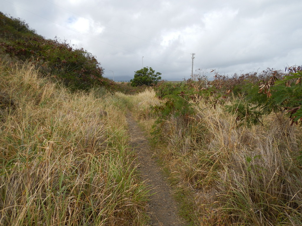
The trail gave way to a road used to service the power lines and the group fanned out again.

Marian (far left) brought their parrot with them for the trail.  The only hiking parrot I know.

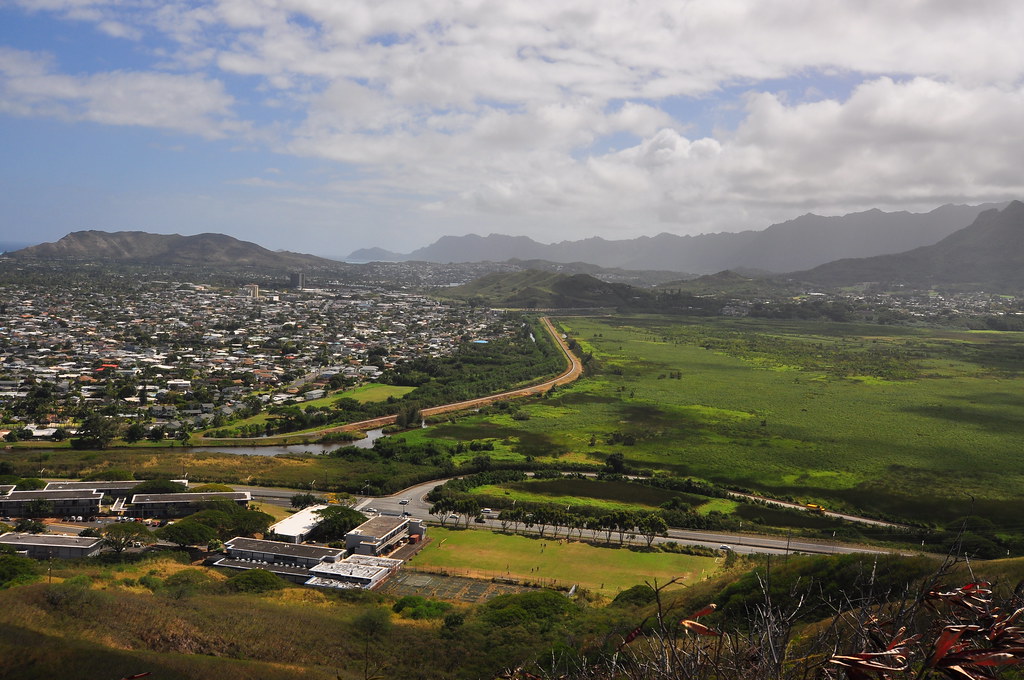
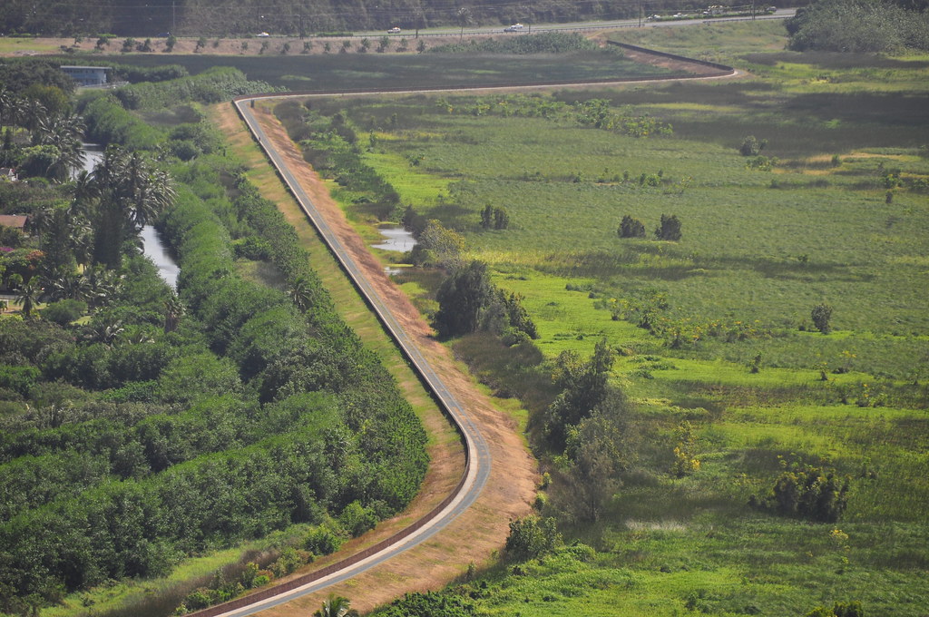
From this point we could see our exit route, old Kionaole Road, below.  Both moms went on high alert to keep straying keiki away from the steep drop.  Kionaole Road was closed sometime in the late 1970's or early 1980's because it was dangerously narrow, curvy, and there were some really horrific crimes committed in this dark secluded place. As the small number of residents along the road dwindled it only got worse so the government just shut it down.  Retired HPD officer Gary A. Dias summed up the problems on Kionaole Road in his book Honolulu cop: reflections on a career with HPD with this description, "...the real-life horrors occurred there over the years cemented its image as a place you avoided- because if you went there, something bad happened."  It's a very interesting read and the chapter is available free on Google Books.


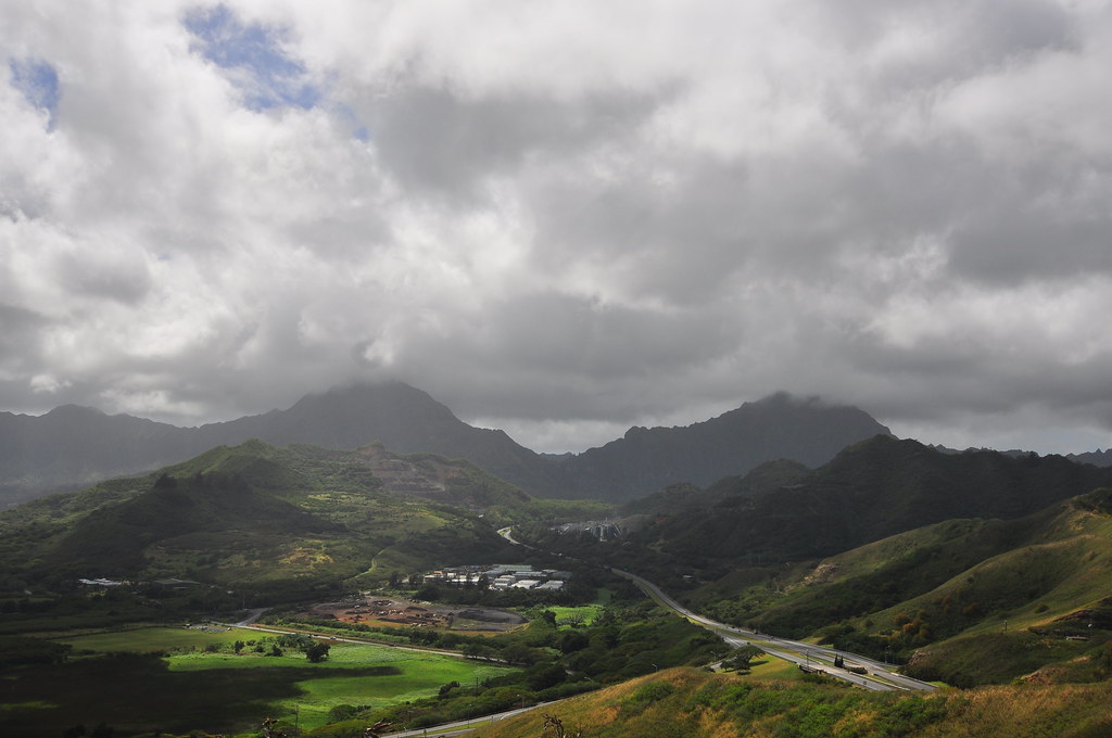
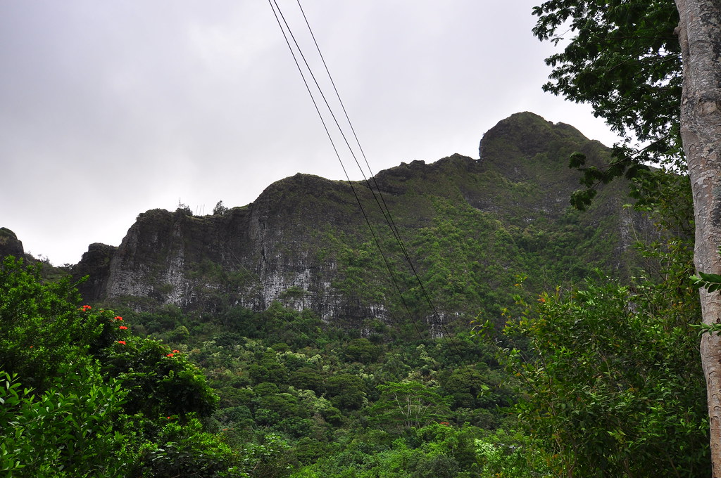
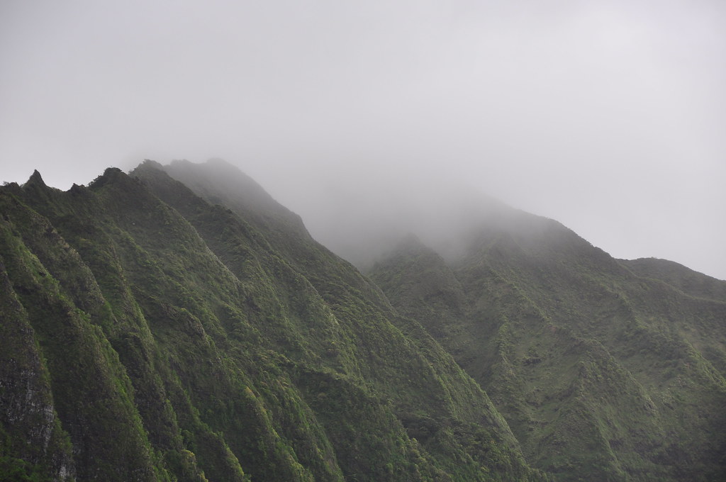
The dirt road also provided a great vantage point to see the cloud covered hanging valley of Lanihuli.  Someday I really need to get into that valley!


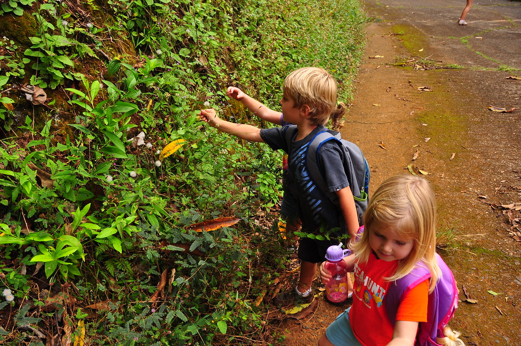
We worked our way down to the old road below and began the walk back to where we started.  Along the way I showed the kids some sleeping grass which is always a kid pleaser.


As disappointing as the day started it all worked out in the end as I got to spend some quality time with family and friends enjoying Kailua's beautiful back yard.

 
 More pictures from the Poamoho Failure and Family Hike- Kionaole Road, as well as pictures from other trails I've done, can be viewed on Flickr.  Aloha and mahalo for reading!


Thursday, March 15, 2012

Pu'u Papa'a and Mahinui Ridge

February 13, 2012

I awoke at 4:30 to check the weather in the Ko'olaus and even in the darkness I could see that it was going to be a cloudy day.  After some email exchanges with my hiking partner II we decided to scrap our planned outing and find another trail after the sun rose.  After considering a host of options we decided on an easy one right next to my house, Pu'u Papa'a that I'd done back in November of 2009.

Pu'u Papa'a is the peak overlooking the Nu'upia fishponds mauka of Mokapu Peninsula.  From the rocky peak of Pu'u Papa'a continuing towards the mountains is the ridge known as Mahinui.  Some confusion exists over it's name because in 1971 somebody thought it should be renamed Oneawa Hills which may be a tribute to the name of the 'ili 'aina that included the hillside so long ago.

Mahinui Ridge is connected to the often hiked Olomana and it's other two peaks through legend.  In ancient times the land from Makapu'u to Kualoa was the home of a giant warrior named Olomana.  A warrior from Kauai name Palila challenged Olomana to battle and defeated the giant splitting him in two.  One half is as the peak that bears his name and the other half becoming the hill known as Mahinui (Great Champion).

We parked a car on Kaneohe Bay Drive and walked back towards Kailua until we reached the fragrant Aikahi Gardens town homes.  I say fragrant because anyone who lives here in Kailua knows that the poo plant is right across the street and it's sweet scent drifts relentlessly across the road.  Walking around a chain link fence we reversed course towards Kaneohe again to the end of the town home complex and stepped off the pavement onto an old slightly overgrown road.


The road became a path until we reached the intersection with the service road used to maintain the various antenna on the top of the ridge.  We climbed steeply up along a chain link fence though haole koa and dried guinea and molasses grass.  I was surprised to see the tattered and decaying condition of the ribbons I'd hung on my first trip up the ridge.  They almost looked like they were biodegradable.


At the end of the first climb segment we reached on old cut up utility pole near a newer composite one.  The views were already getting good and we'd just started.


Heading east long the ridge we passed some old aviation obstruction lighting to reach a relay station.  Not sure who owns it but the sign on the pole next to us warned of high frequency radio fields.  Since I already have two kids and don't plan on more I proceeded passed the sign to take some pictures of the field below.  I noticed the first shrine of the day, a candle in a circle of rocks with both a fake flower and the remains of real flowers.


We departed the concrete block station to continue east using the ladder to help us make the transition down.


Our path led past three rocks of various sizes and one more weird shrine.  Reaching a large rocky outcropping we then contoured to the adjacent ridge that comes up from the Aikahi side.  We then headed down that ridge to visit the Battery Commander Station of Battery 405, also known as Battery DeMerrit.


The first clue one would have to the presence of something here is a large flat metal sheet mounted on some scaffolding.  I've wondered for years and finally I've determined the purpose of this feature, it's an old microwave relay antenna.  However, previously the roof of the Battery Commander's Station held a SCR-296A fire control radar antenna disguised by a wooden facade to look like a water tank that looked similar to this one in Alaska.

SCR-296A fire control radar antenna at Zeto Point on Adak Island, Alaska.  Courtesy of the Kodiak Military History Museum


Making our way down the ridge we caught sight of the old water tank which had a few kids on it "decorating" it with some spray paint.  Rumor has it that when the 8 inch guns of Battery DeMerrit were test fired the concussion cracked the tank and it was abandoned in place.

Past the remains of a dead Keawe tree is the entrance to the Battery Commander's Station (BCS) where the commander directed fire of Demerrit's guns.


The BCS consists of two rooms with steel doors of the same type used in the battery below.  The anterior room functioned as the radar operator's room and was designed to be sealed in case of gas attack while the other room had the typical slit style views with steel doors that would both secure the station and provide some protection from incoming fire.

All the equipment is long gone but the picture below gives you and idea of what it may have looked like during World War II.    If you've got spare time and bandwidth, this operation manual makes for some interesting reading.
Interior of SCR-296 Radar operations hut at Ulatka Head, Dutch Harbor, Alaska.  Courtesy of the Kodiak Military History Museum
Leaving the BCS we retraced our steps up the ridge towards the summit of Pu'u Papa'a, translating to either scorched hill or less likely, secure enclosure.  I'm unable to determine which translation is accurate but either seem like a fitting name for this hot dry mountain that once was home to a fortress armed with 8" coastal artillery.

As we climbed the ridge we past the feeble attempt of what must have been an effort to grow some pakalolo.  Kids these days.... ha ha!


Arriving at the double decked bunkers at the summit.  One is Base End Station designator B3 S3 and the other Triangulation Station Papa'a.


We paused to check out some of the views from the top of the emplacements at the summit. 

II about to top out.
The old seaplane hangars at Kaneohe MCAS.  The ramps where PBY's would exit the water and taxi up to the apron are still there.
Check out the view!
I dropped down into the bunkers and checked out the octagonal pads where the optical sights that aimed the guns below had once stood.


The cool breeze and awesome views made it hard to leave but eventually we continued towards the myriad of antenna just behind the Fire Control Station.  The first thing of note was the old geodetic marker for Pu'u Papa'a and the small lava rock platform where the larger marker was held.  I found it lying in the dirt next to the platform so I reinstalled it in the pipe.


One of the cellphone antenna sites had a couple guys working on it so we stayed to the Kailua side of the ridge until we reached a metal staircase that I'd used to get past the last platform on my previous trip.  We asked if they minded and the response was "T-Mobile owns this, I can't give you permission".  That was open ended considering he didn't say no but we went around their site anyway.

Mahinui Ridge
Laid out before us was the gently rolling ridge.  As I'd promissed II, there is an old trail here that last time had been in various stages of overgrown but this time with drying conditions was far more open.

The first descent was a little slippery with loose rock but nothing to be concerned about.  A small climb back up was just enough to get my heart pumping.

On our next small climb we were lucky to see all stages of the Carion's, Stapelia gigantea, reproductive cycle.  Most people assume this small succulent is a cactus of some kind but it's not.  It likes the arid climate of the low hills of the island and forms small dense populations.  The flowers are very beautiful but as do all of it's relatives in the Carion family, they smell of rotting flesh to attract flies and beetles to pollinate it.


Nearby there was another plant with a fruit capsule and another one with a capsule that had opened releasing it's seeds that are designed to carried away by the wind for dispersal.


The views were mostly on the Kailua side because of vegetation obstructing Kane'ohe.  I always enjoy the unusual angles of familiar sights when viewed from different perspectives.


The views of Kailua continued to dominated as we continued along the rolling ridge but as we reached the final segment of the trail we were treated to a commanding view of Kawainui Marsh, Olomana, Ulumawao, and H-3 as it snaked through Kapa'a Valley.

Kapa'a Valley
Kawainui Marsh and Kailua Town meet at the Levee
Another feature clearly visible from the ridge is the levee built in the 1950's to protect the Coconut Grove area of Kailua from flooding.  Back when I was young this levee was not much more than a big pile of gravel but after the flooding in 1988 of portions of Kailua the State added a flood wall to the levee which is about four and a half feet high.  When I was younger the levee was off limits and rarely did people venture out on to it but now it's a busy place filled with joggers, people pushing strollers, or out walking their dogs.  Recently the DLNR has been reviewing the effects of the levee on the health of the marsh. 


After passing Kalaheo High School below us we veered east down a small spur ridge to a drainage ditch that empties onto the side of Mokapu Blvd.  There's a camouflage netting shelter that's been set up here since at least 2009... purpose unknown.


A short stroll later we were back at the Jeep and finished this short trip above Kailua.  In fact, I'm sure writing this little adventure up took far longer than doing the trail!


Please be mindful that this is not a public trail!  More pictures from this trail and others I've done can be seen on Flickr.  Aloha and mahalo for reading!