November 14, 2011
After being out for three weeks my regular hiking partner was presented with a list of trails I'd hastily compiled on Monday evening to choose from. At the top of the list was the "Kahana Ditch" trail that Nathan Yuen had recently written about on
Hawaiian Forest. The Hawaii Trail and Mountain Club has started an effort to reclaim the trail that had been lost over the years and I'd been interested in checking it out. I reasoned that we do the portion they'd cleared and then take the Waiahole Ditch Trail which would allow us to make it a one way hike from Kahana to Waikane.
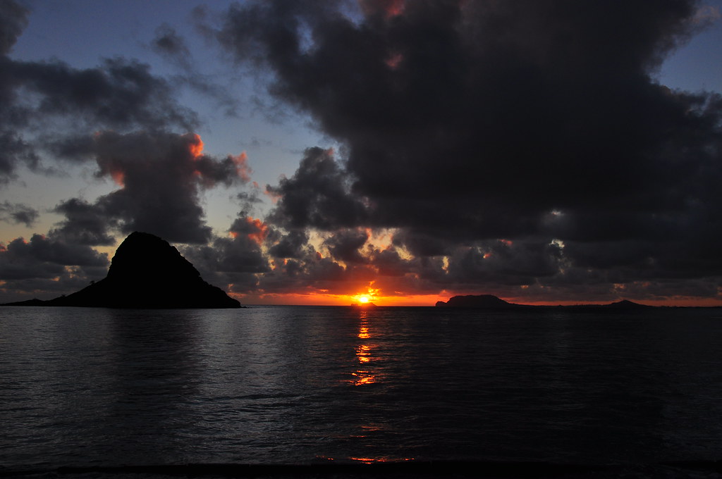
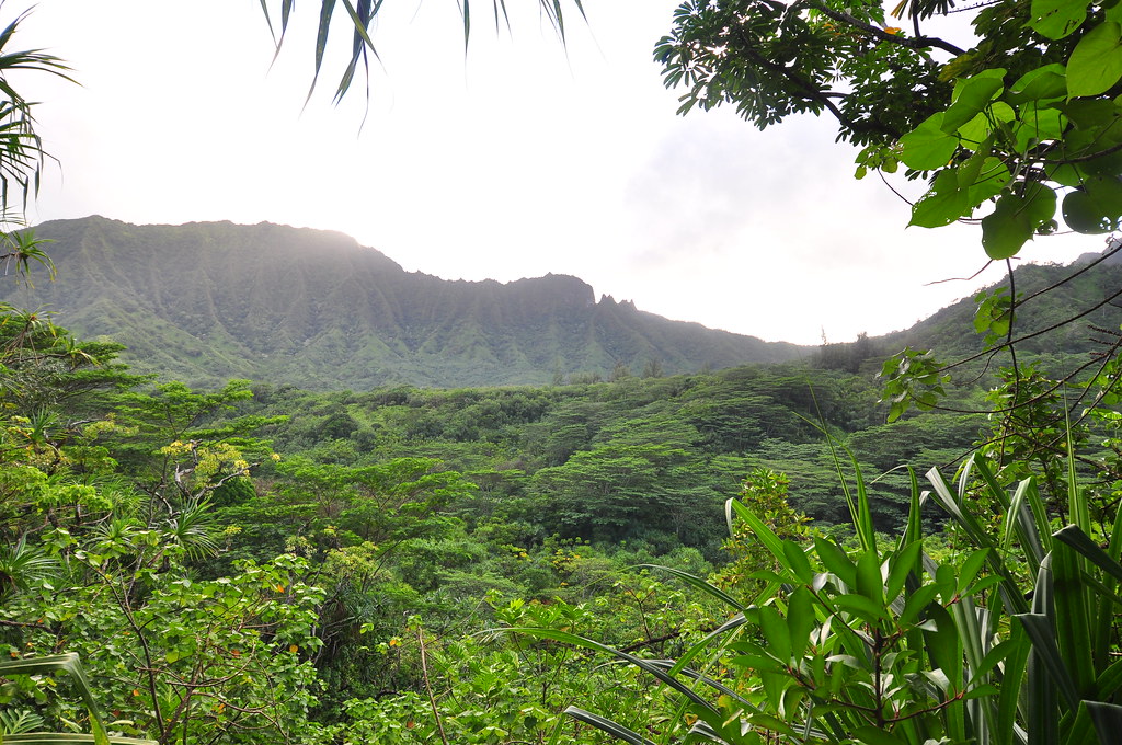
We met at the 7/11 across from the Hygenic Store at 6:00am and headed towards the North Shore to stage the cars. We elected to leave my partner's car at Waikane Valley Road and take the Jeep into Kahana. Along the way we stopped at Kualoa Beach Park to enjoy a beautiful O'ahu sunrise.
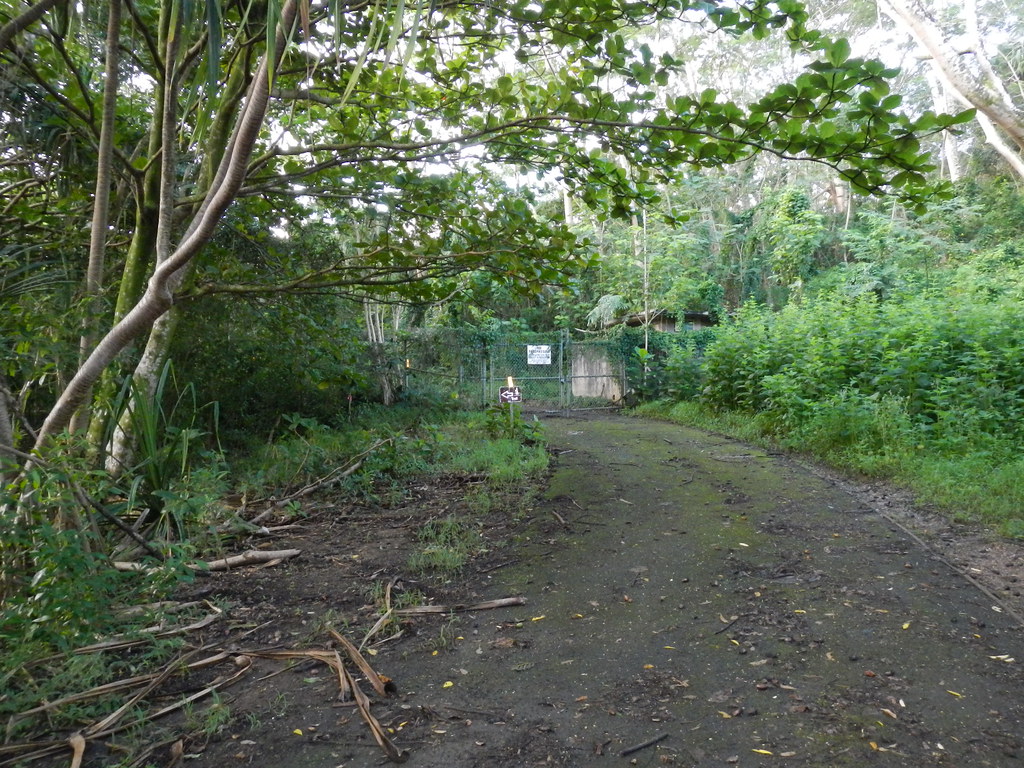
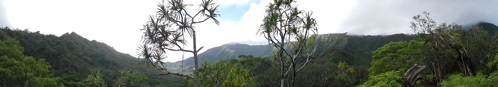
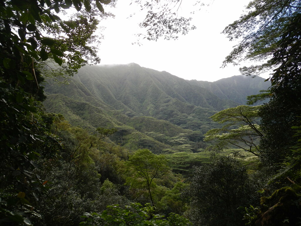
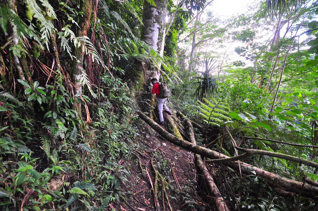
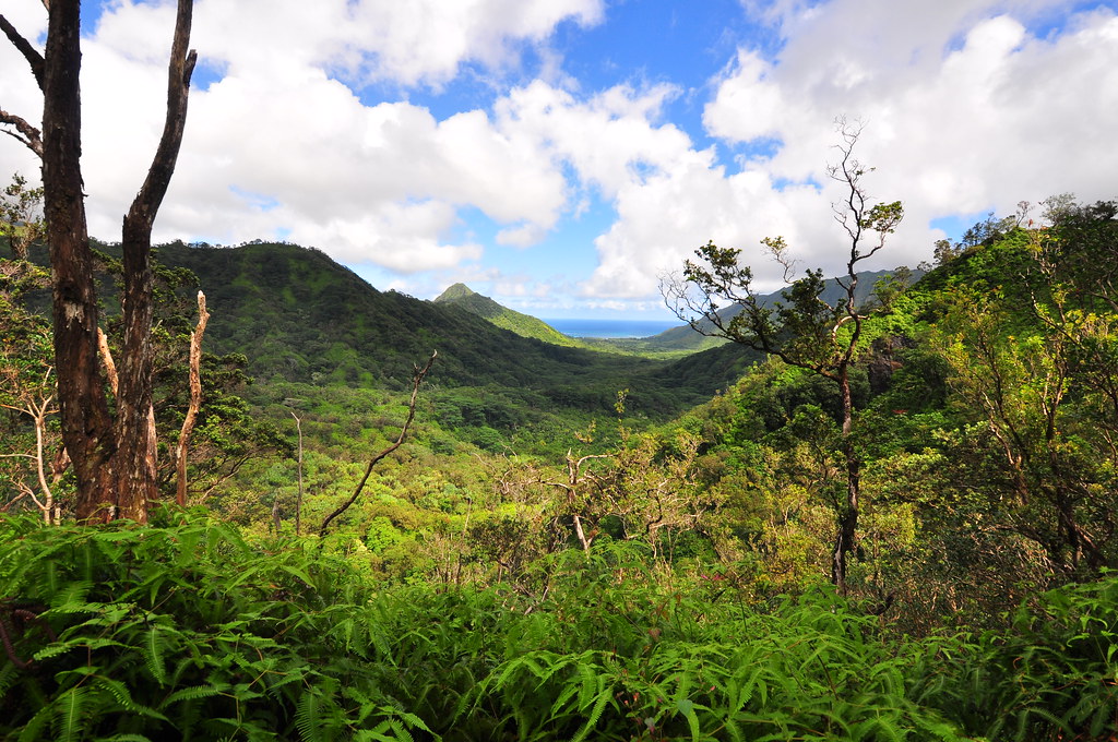
By the time we arrived at Kahana Valley it was around 7:15am. Walking quietly up the road towards the Hunter Checking Station. Veering right, we continued up the same road to the water tank that led me to Pauao Ridge months back. At the water tank we followed the Nakoa Trail which is clearly marked around the fence. The uluehe here had received a recent trimming which I'm guessing is also the work of the HTMC clearing crews.
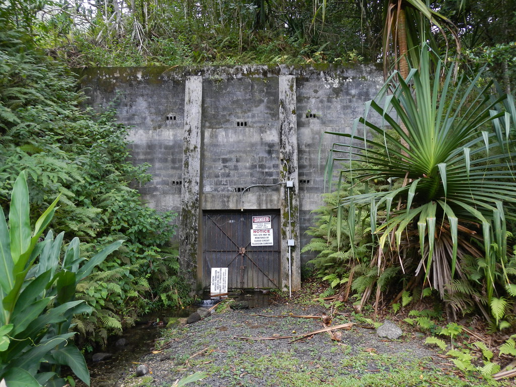
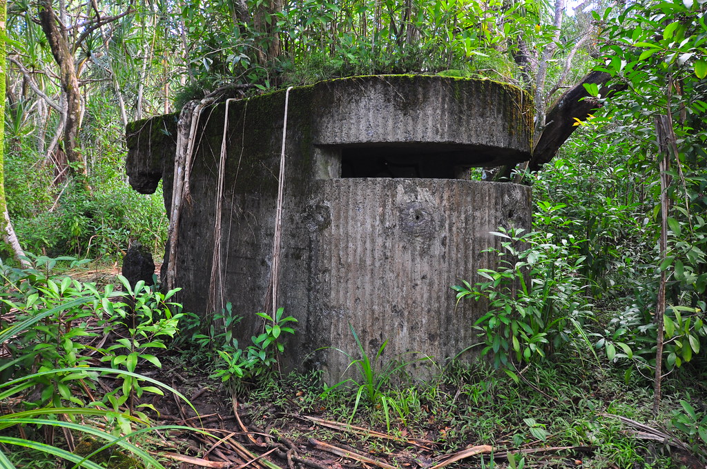
Soon we arrived at the old WWII concrete emplacements from the jungle warfare training conducted during the 1940's. We stopped to check them out as well as a nice view of the valley just beyond.
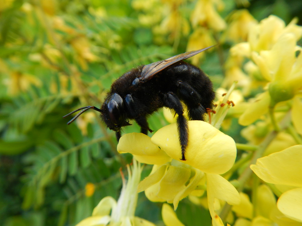
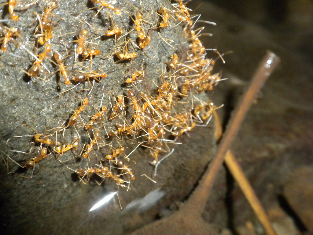
Done with the old war relics, we headed mauka to parallel Pauao Ridge. Here we passed several little streams and another junction. Staying to the ridge, we continued along the base of the ridge with the stream running below. At the stream we noted a whole bunch of ants which gathered on the rocks. They were identified for me later by Forest and Kim Star as
Anoplolepis longipes, or the Long legged Ant. It appears that they had gathered to drink at the stream.
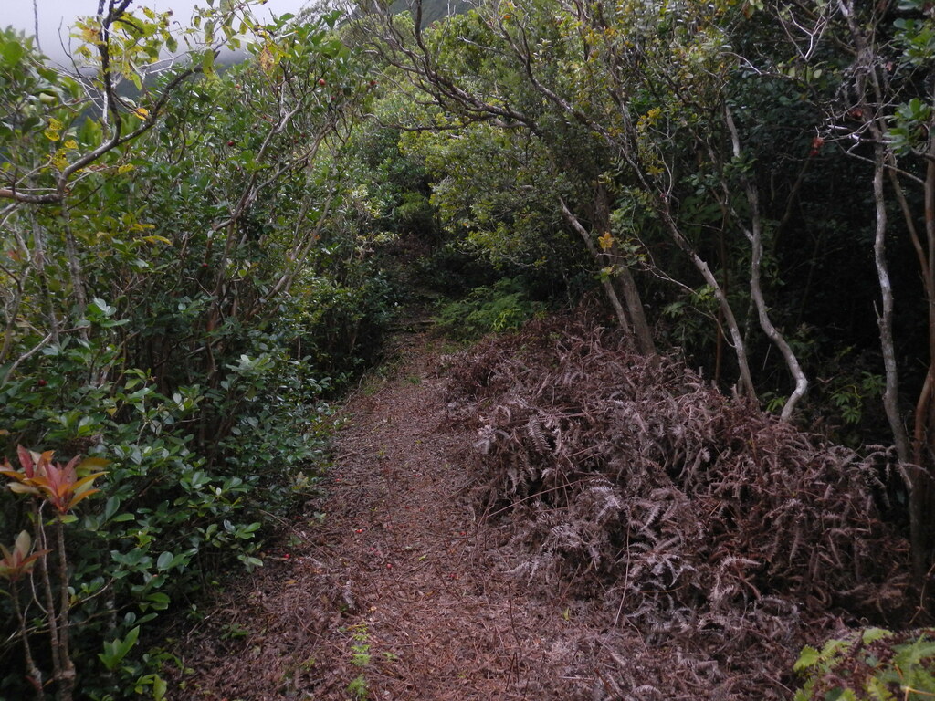
There were two cables along this section. First a white and later an orange rope had been installed where balance could be a problem along the contouring trail.
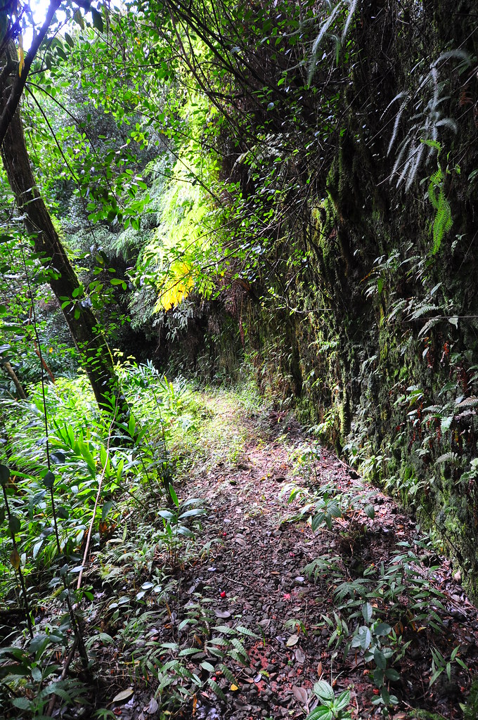
 |
| The trail above Kahana Stream |
Beyond the rope things got a little trickier. We missed another junction and ended up following what I can only assume is the Nakoa Trail to where it crossed the Kahana Stream twice after passing a stand of Hala trees. We paused at the second time we would have to cross the stream at a huge Albizia tree and another fallen tree.
 |
| First stream crossing |
 |
| Second stream crossing |
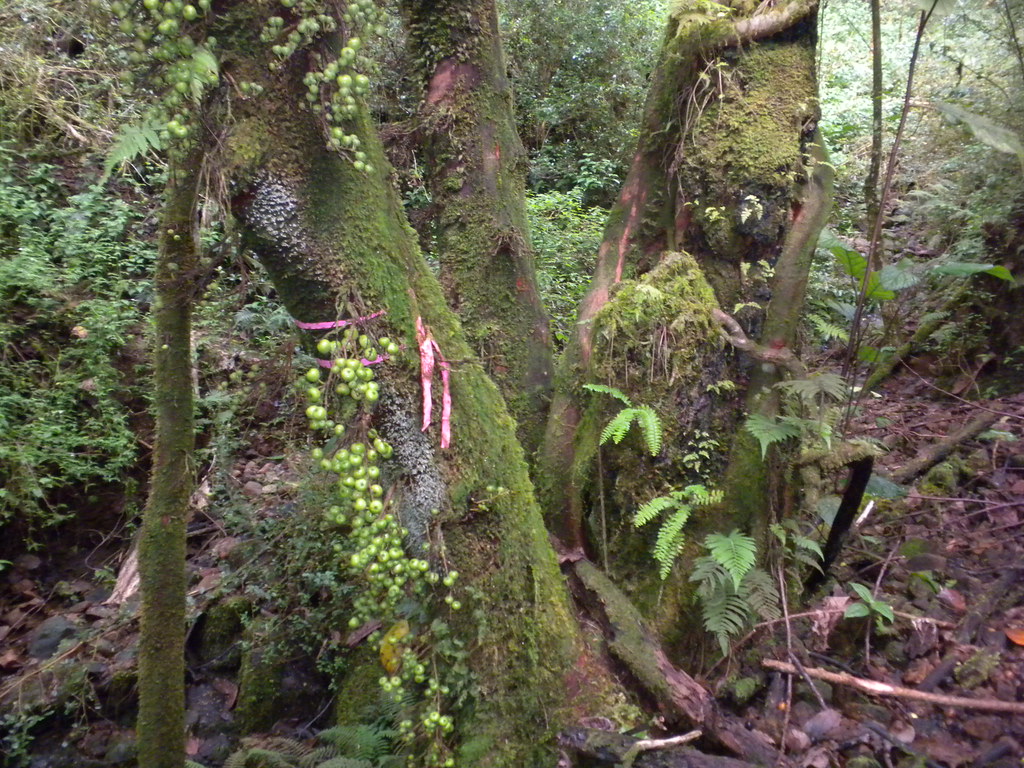
This seemed wrong as the trail was heading away from the Ko'olaus so after debating our options, we back tracked until we found a junction we'd simply walked past complete with two pink ribbons. Here I added two white ribbons for our own use.
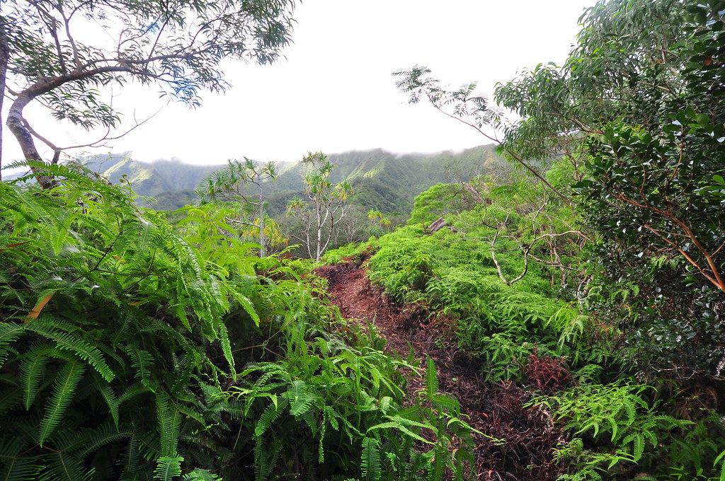
This is the part of the trail that Nate Yuen had described as "We then veered-off to begin a slow climb up a series of low ʻuluhe covered hills that parallel Pauʻao Ridge up to the Koʻolau Pali." Sure enough shortly we were walking through fields of uluhe where the weed eater had devastated it into a good four foot swath. The grade here is a little uphill and there was not a breath of air that morning so we were completely covered in sweat.
We made our way first through a koa, then maybe a quarter mile later, an ohia forest to another marked junction. The trail on the left had obviously been cleared so we followed it after I'd put another two white ribbons up.
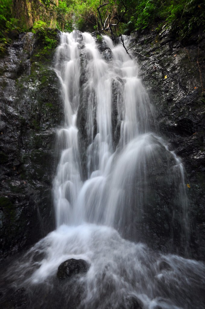
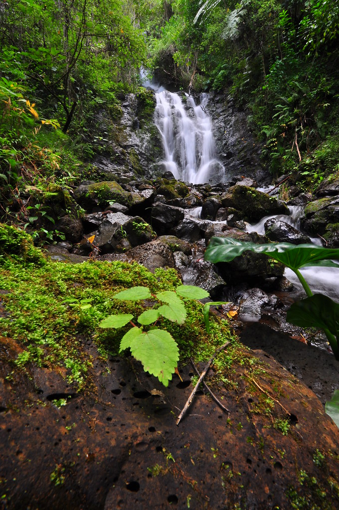
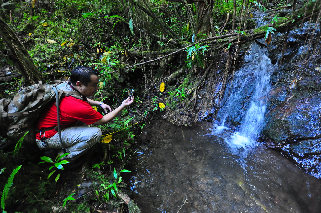
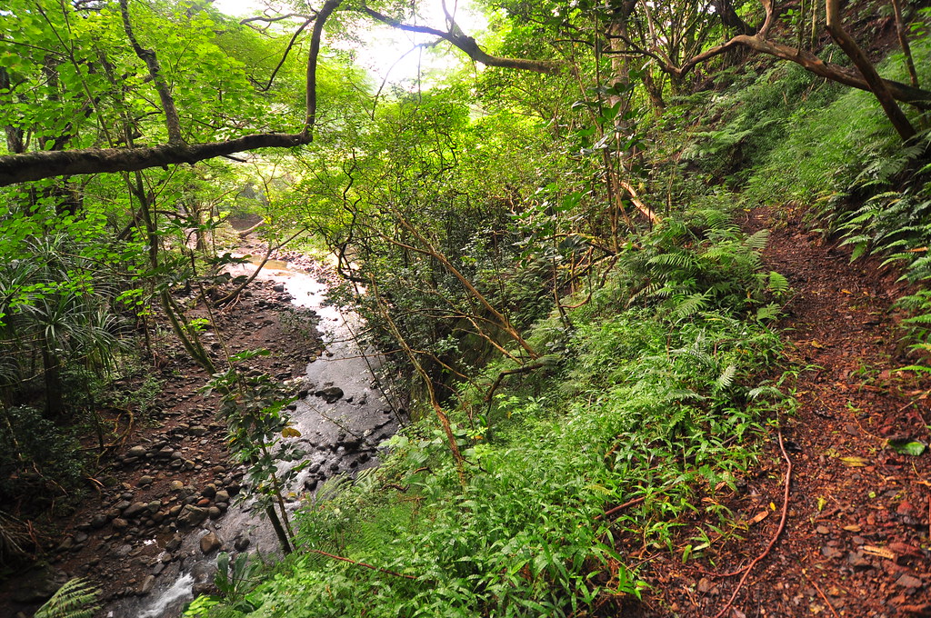
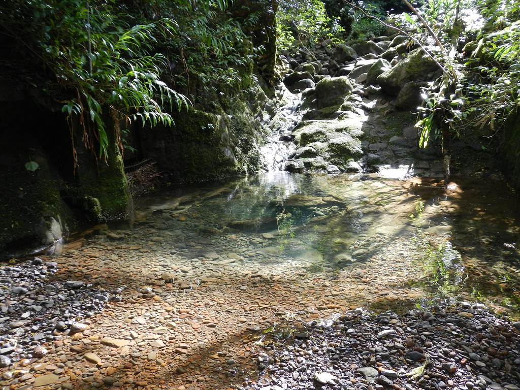
The trail made a muddy descent then a fairly steep short climb and passed a beautiful little stream.
 |
| Crystal clear water |
Then we reached the junction of the Waiahole Ditch Trail. It was fairly obvious because it was paved with lava rock like many of the old time trails were.
 |
| The Waiahole Ditch Trail |
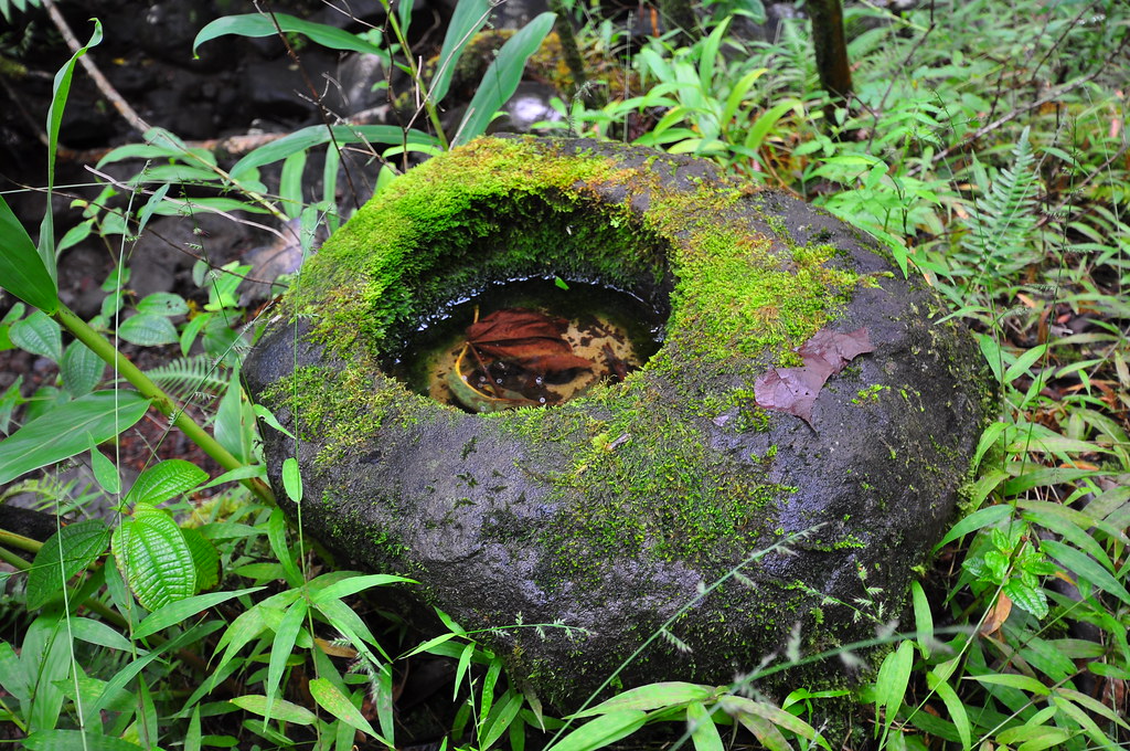
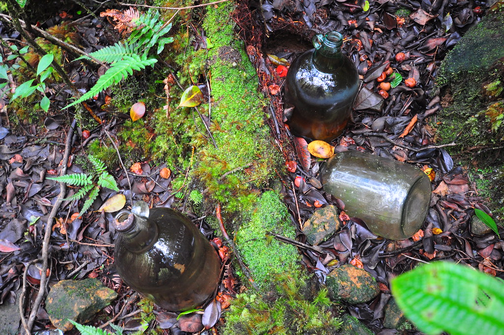
Making a turn east towards Waikane Valley it was still very evident that the trail clearing crew had been here as the branches were trimmed back nicely. Walking along the paved, graded, trail I was thinking how brilliant we'd been picking this nice trail which looked like a more refined but aged version of the Maunawili Demonstration Trail. We were completely clueless as to what awaited us! I recognized several of the things in the Hawaiian Forest article like this stone bowl and this very finely crafted vent in the Waiahole Ditch which is more like a tunnel cut into the side of the Ko'olaus. Later we saw all the bottles left from years ago too.

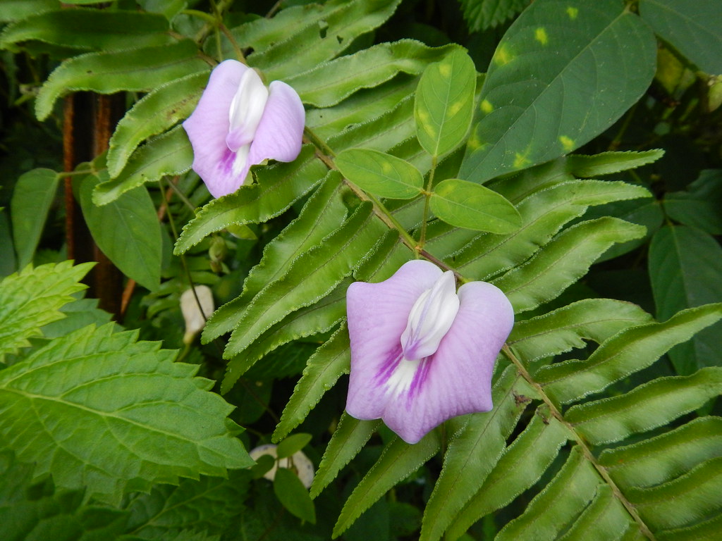
Moving further we spotted some Crytandra kalihii in another little valley. This one was pretty special as it's fairly rare.
According to local native plant expert Joel Lau, " It’s the only Cyrtandra on O`ahu whose petiole bases at a given node connect to form an obvious collar around the stem." I was in luck too as it was in flower.
It was a little disturbing to see the efficiency of the collection of the water here. The stream beds below the ditch hardly contained a trickle after the ditch collected the water. This short clip shows the workings of the ditch as water is carried in a tunnel to a small stream. There the ditch water flows out across the stream where more water is gathered and then passes through an intake with a metal grate over it to prevent debris from entering the tunnel. What isn't collected continues to flow down the stream. In this case, the intake grate is pretty clogged so ditch water is flowing into the stream defeating the whole purpose of the ditch. Sorry leeward residents, this water is staying on the windward side!
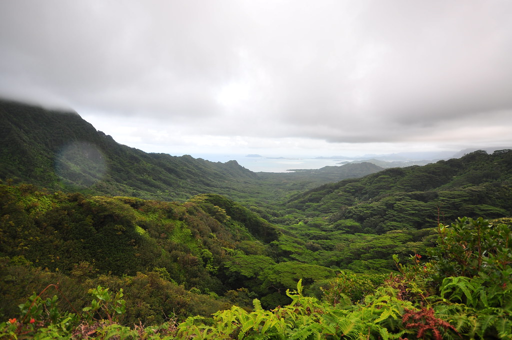
With this new understanding of how the ditch operates I immediately saw what the legal fights and the big sign down by the Waiahole Poi Factory were all about. It was obvious the impact this system had had on the amount of fresh water available to windward farmers. Progressing on, I mulled over the implications of taking water from this valley and sending it to the arid central plains of O'ahu. It gave me something to think about as I wandered the old trail.
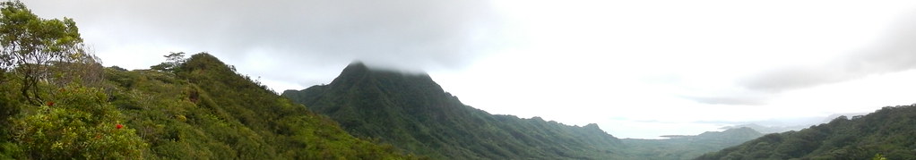
 |
| Kahana Valley from the Waiahole Ditch Trail |
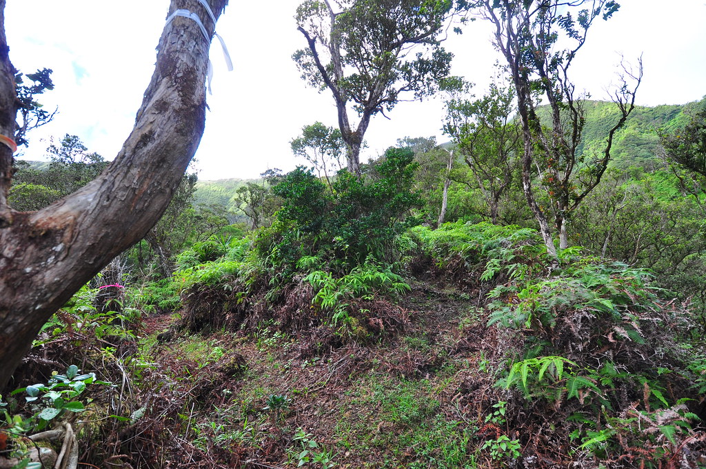
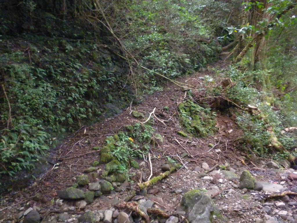
Around the next corner I spotted another cytrandra right along the trail and then as we rounded the corner we got our first taste of what the day would be like from that point on. In my notes I jokingly marked it as the "Valley of Death". A landslide, a fallen albizia tree, and a whole bunch of other blown down trees obliterated the trail. It was a sign of things to come as we'd soon discover.
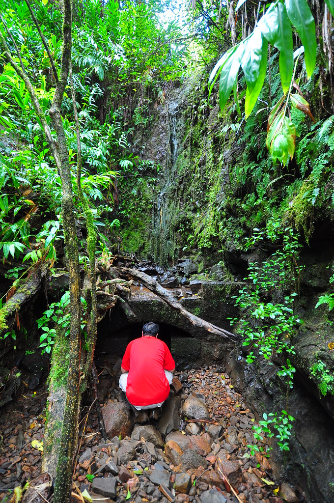
Around the next corner I spied another half cut 55 gallon drum. I have no idea what the purpose of these were but we saw a few of them placed seemingly randomly along the side of the trail. The trail's condition was becoming schizophrenic now with areas that were wide open and in good enough condition to ride an ATV on to areas that were completely wiped away in landslides and then blocked by fallen trees we had to either go up, over, around, or through. I was beginning to dread coming out of small valleys because it seemed like when I rounded the corner the worst conditions would hit. Looking at the track I plotted on Back Country Navigator I can see how we were pacing back and forth trying to figure out how to proceed as we came to areas that were wiped out or blocked.
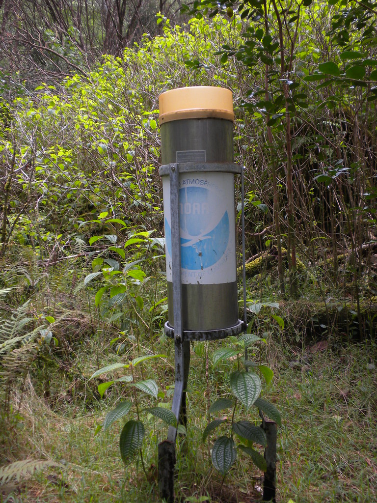
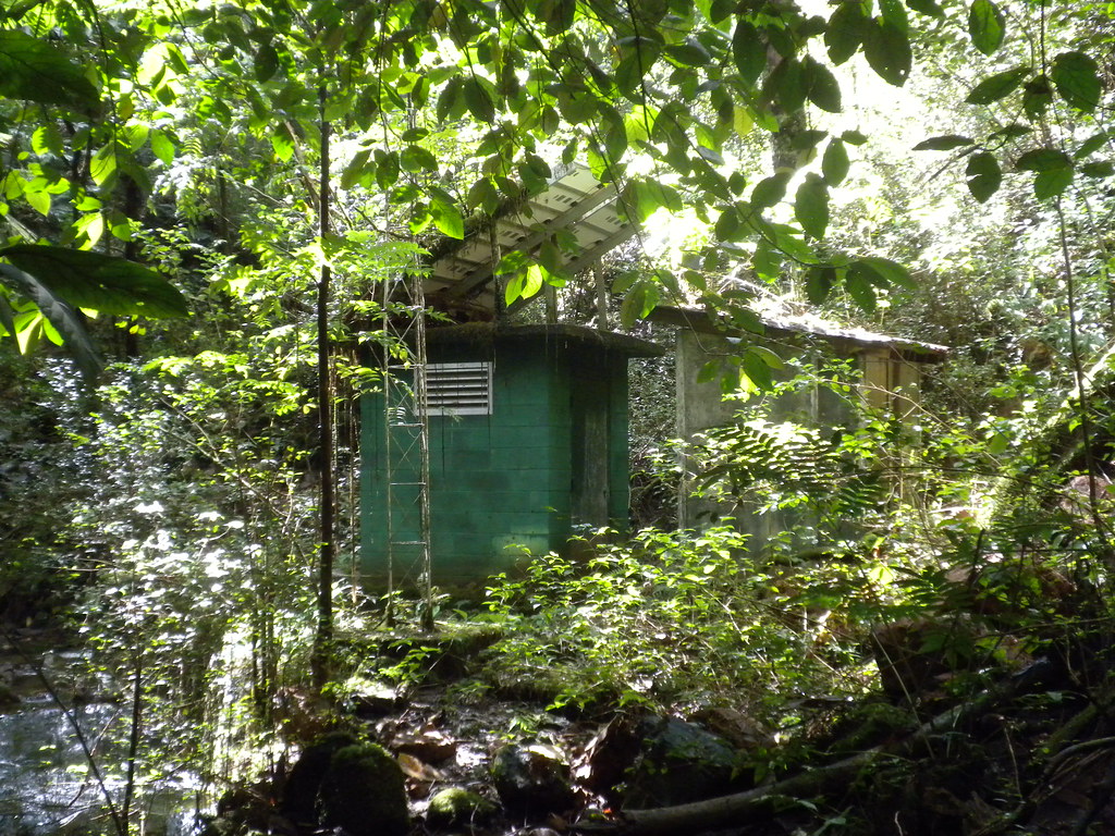
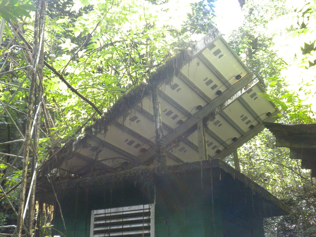
I lost the trail completely when we arrived at what looked like the old foundations of some buildings. I've been told there were parts of a workers camp which I assume dates back the time of the ditch's construction. Corrugated roofing material that was reduced to spongy stacks of rust were strewn around the ruins as well as assorted liter from the period and later. Mysteriously there was a NOAA rain gauge up there and what looked like two of it's predecessors tossed on the ground right next to it. The gauge said it was unmonitored on it's placarding so I assume that at some time in the past someone must have come down this trail often enough to actually collect data from it. I later called the NOAA and spoke with their Hydrology specialist named Kevin who was nice enough to take the time to explain the mysterious rain gauge to me. Apparently years ago some of the Waiahole Ditch maintenance guys would read the gauge for them. Kevin himself had been to the gauge via the tunnels of the ditch which he described as one of the highlights of his career. In recent years the rain gauge had become too difficult to get to for reading and inspections. In addition, the large trees that had taken over the area had made the readings less reliable so it was decommissioned. In the mix of foundations, junk, and even a pipe it was hard to figure out the trail but after backtracking we regained the path.
 |
| The crystal clear waters of the Waihole Ditch |
Shortly beyond we encountered another tunnel and a beautiful clear stream and lost the trail again for a time. Weaving in and out of small valleys we continued our progress. I'd seen several Cyrtandra, along the trail. They love wet valleys and finally I caught one that was in bloom. 99% sure this one is hawaiensis.
 |
| Ha‘iwale Cyrtandra hawaiensis |
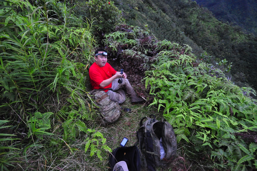
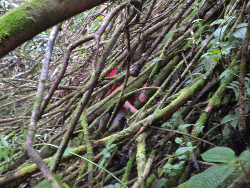
By now we'd decided that it was far too late in the day to ever make it out the way we came so our best course of action would be to continue. At times conditions were miserable and the demands of the trail were getting to my partner. I pushed and pushed due to the late hour to keep him moving but had to forge ahead to compensate for the times we'd lose the trail. I kept hanging white ribbons and at particularly nasty parts I'd wait for him to catch up to be sure he didn't miss an important turn. Where the trail switches back to head up the ridge between Kahana and Waikane I spotted two pink ribbons where a dry stream bed intersected the trail. I was mystified by them and after spending a few minutes trying to figure out what they were I whistled and shouted to my partner to make sure he wasn't too far behind.
I fought my way up the trail to a point where it crossed the same stream above. It was a fairly nasty section filled branches blocking the trail requiring more crawling. My partner was now at the bottom and I shout for him just to head straight up the stream bed as I figured it would be easier. I forged ahead again and shortly after arrived at another particularly bad spot. A big landslide had wiped out the trail and taken a huge albizia tree with it. The slide area was probably 20 yards of tangled logs and rocks to pick through. I didn't mark this section with ribbons but I just imagined where the trail would have contoured and aimed for that spot on the other side. Luckily, I found it but again I was confronted with another section that was totally blocked by branches I had to crawl through.
 |
| Rather nasty blowdown. |
Here again I paused to talk my partner through the section before forging ahead to scout the rest of the trail. The rest of the trail was not nearly as bad.
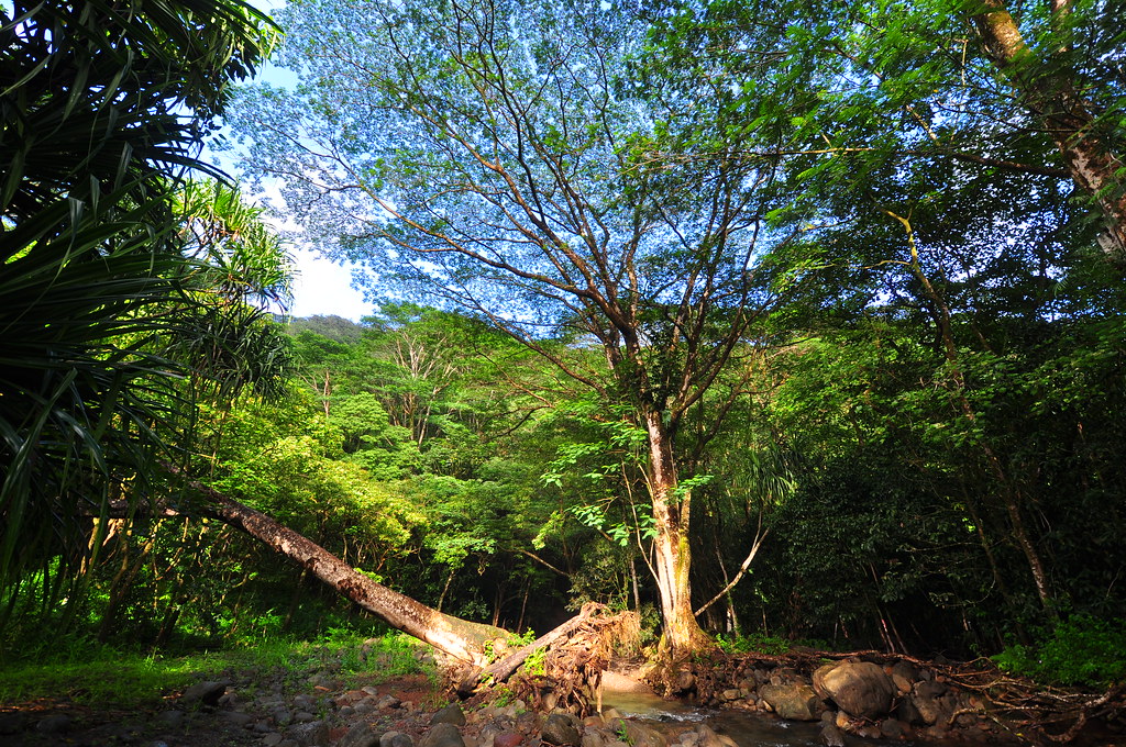
I passed a small section of uluhe and an iron wood tree and took my last shot of Kahana Valley.
The sun had already gone down behind the Ko'olaus and darkness was falling. I shouted encouragement and his reply was, "We ain't going to make it". I knew about how far we had to go on the map and was convinced if we kept moving we could arrive at the junction atop the ridge and follow the cleared trail out at night. If night fell we were screwed. It was tough enough finding the trail in the daylight and by headlamp our chances of getting out were minimal. We just had to make that ridge! Again I forged ahead and then I burst out onto a recently cleared section I recognized from when we'd done the Waikane to Pauao Trail via the Ko'olau Summit Trail months earlier.
I shouted victoriously and after a while my partner arrived and we took a well deserved break.
We broke out some hard candy left over from Halloween for some cheap energy and got our headlamps out for the remaining trail which would have to be done in the dark.
We called our families to let them know we were fine and then continued down the trail into Waikane Valley. Mrs. XJ was not pleased that she hadn't heard from me all day. There is no cell service in Kahana Valley and since I hadn't checked in she'd been getting a little worried about us.
 |
| Waikane Valley... there's still a long walk out ahead of us. |
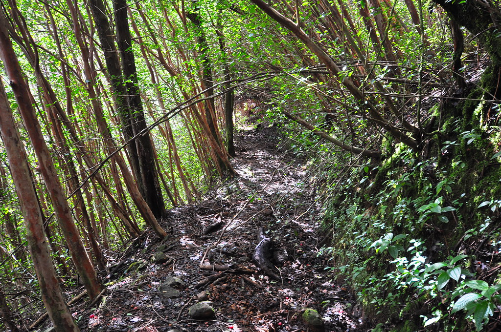
I'd forgotten just how long the trek out of Waikane would be. Darkness descended rapidly and soon the only illumination was from our headlamps. The trail was in fantastic condition compared to what we'd just experienced so our speed had picked up despite the lateness of the day and our fatigue. There was one spot we lost the trail in a small valley but with so many ribbons placed there for aid we were back on track in less than a couple minutes.
 |
| II's headlamp |
Down we went until we finally reached the shack adjacent to the ditch covered by steel grate. The trail portion of the journey now over, we continued on the road. Rounding the corner we didn't even bother to investigate the tunnel and stream, we just crossed it and kept moving. At some point we agreed to take a short break. We extinguished our lights and marveled at the blackness of the valley. There wasn't any light pollution under the thin canopy of trees and the remoteness of Waikane.
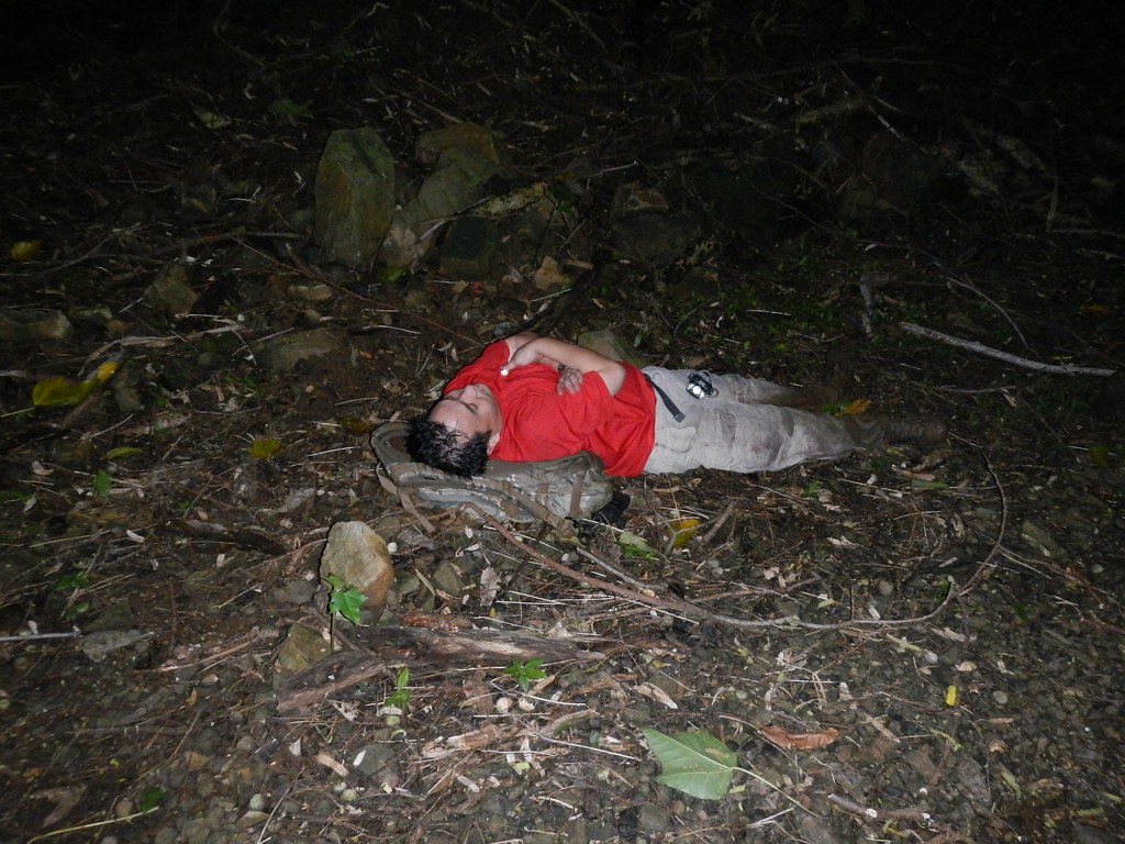 |
| II taking advantage of a 5 minute break. |
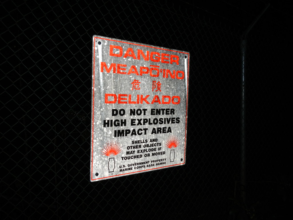
After a few minutes we started moving again to avoid our muscles from stiffening up. The road dragged endlessly by. Finally we passed the chain across the road, then we arrived at the chainlink fence with the explosives warnings on it. I didn't say anything to II but the "Mea po 'ino" on the sign was being worked into Bing Crosby's song Mele Kalikimaka as we trudged through the mud.
Mea po'ino is the thing to say on a dark Waikane Valley night
That's the military's warning that we send to you from the land where your legs could be blown away
Here there's unexploded ordinance so you should stay away
The flash of an explosion will turn night to day
mea po'ino is the way they say stay out of here to you
Okay so I may have been losing my mind a little...
We knew the next landmark would be interesting- a small farm far from the other houses in the valley. There was a Volkswagen Van parked here for years and of course at least three large dogs that guarded the place. We spotted some ti plants behind a chain link fence signaling our arrival. Sure enough, the glowing eyes of three big barking dogs rushed towards us. I'm not ashamed to admit that it was pretty damn scary. I summoned the bravest sounding voice I could and told the dogs, "Easy! Good dogs" Thankfully they continued to bark but seemed satisfied to just warn us to continue on our way rather than attack. Whew!

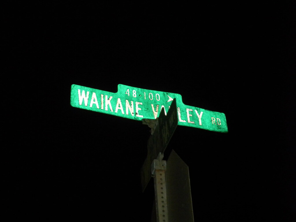
Onwards we marched down the now muddier and muddier road. Eventually we reached the fork in the road where the smaller sign warns people of the explosives danger in the valley, then the yellow gate at the end of Waikane Valley Road. Although we tried to be quiet, neighborhood dogs barked in a chorus of whining, howling, and barking that I'm sure didn't win us the affection of the residents. Finally, we arrived at Kamehameha Highway and to II's car which should have signaled the end of the day. However, a weak battery in his car meant another delay. We called AAA but after a half hour his Camery's battery had recovered enough that it was able to start the engine. A short drive to Kahana to retrieve the Jeep and the day was over.
 |
| The End! |
The Waiahole Ditch Trail is awesome. It's a lot like the Maunawili Demonstration Trail but far more interesting with the various ditch intakes, ruins, stations, tunnels, ect. The trail can be scenic at times but what it really does is provide an opportunity to experience the size of Kahana Valley. The distance from Kahana to Waikane Valley Rd is roughly 11 miles according to my track. Most of them are fairly easy miles but spots on the ditch trail are in dire need of a chainsaw. Those sections are demanding and in some areas pretty dangerous as the ground is unstable and the grade very steep. I worried most that the collection of limbs and loose dirt would collapse under my weight and I'd slide down the hill and be crushed by the huge logs. An emergency back there means someone has to hike out a long way to call for help with no cell service anywhere along the trail. It convinced me to buy a
FastFind PLB with GPS to carry with me from now on. That way, hopefully, if we run into emergency we don't need cellular service to get help. Under Murphy's Law, the two hundred bucks and change that it cost will be insurance enough I'll never need it so it's already money well spent.

When this trail is cleared again it will be a fantastic trip through O'ahu's back country. More pictures from
this trail and others I've done can be viewed on
Flickr. Aloha and thanks for reading!
 |
| Sunrising over the Islet Moku Manu and Ulupau Crater |