
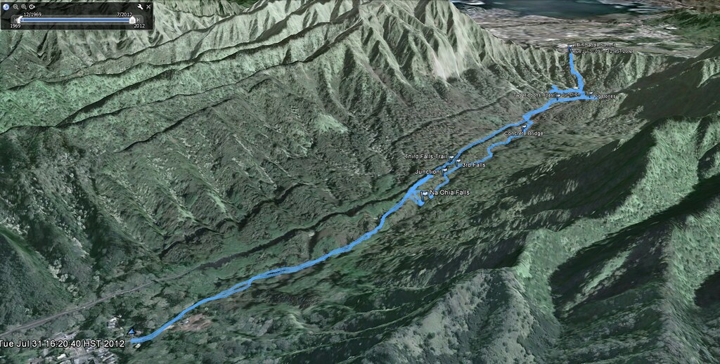
July 31, 2012
Today was supposed to be an easy walk in the park kind of hike to Na Ohia Falls. The "ice ponds" as they're known by locals are a less than well kept secret which is one of the reasons I've never really cared to venture over to check them out. Directions to this trail are all over the internet. Yelp will even provide navigation to the trail head! However, I've been so busy lately I figured a nice easy and short trail would be just right since my old hiking partner II would be rejoining me after a few months off the trail.
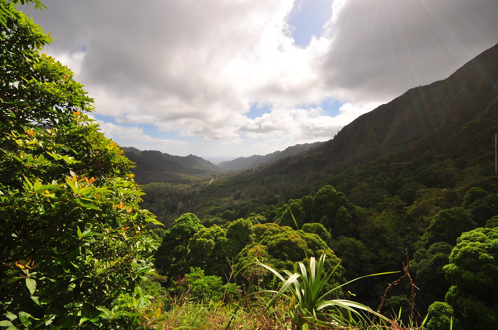
In all these years I've probably only set foot in Kalihi Valley a handful of times excluding the zillions of trips over the Likelike Highway. I've done neighboring Kamanaiki Ridge and the Bowman Trail but just the drive into the heart of the valley was an education. Tucked away the residents enjoy more relaxed country style atmosphere than I do in the ever increasingly busy Kailua.
Our day began at the end of Kalihi St around 8:30 am as we found a couple spots to park the cars. Careful not to block mailboxes and driveways we quietly locked up and headed up the road on foot.
 |
| Old school wooden bridge near the end of Kalihi Street |
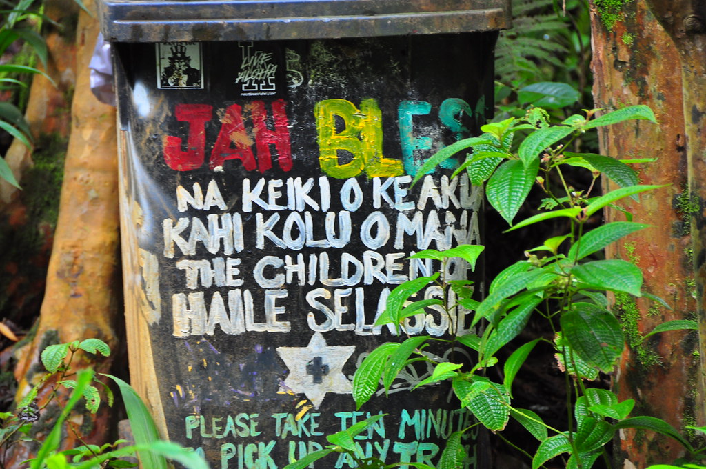
Almost immediately after leaving the cars behind we crossed over a wooden bridge and past the famous sign featured in the photos of anyone who's ever done this trail a camera. I stopped to grab one of my own.
 |
| Almost as famous as the waterfall... |
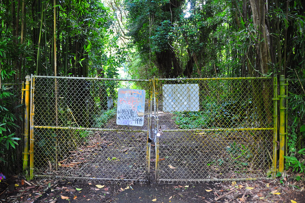
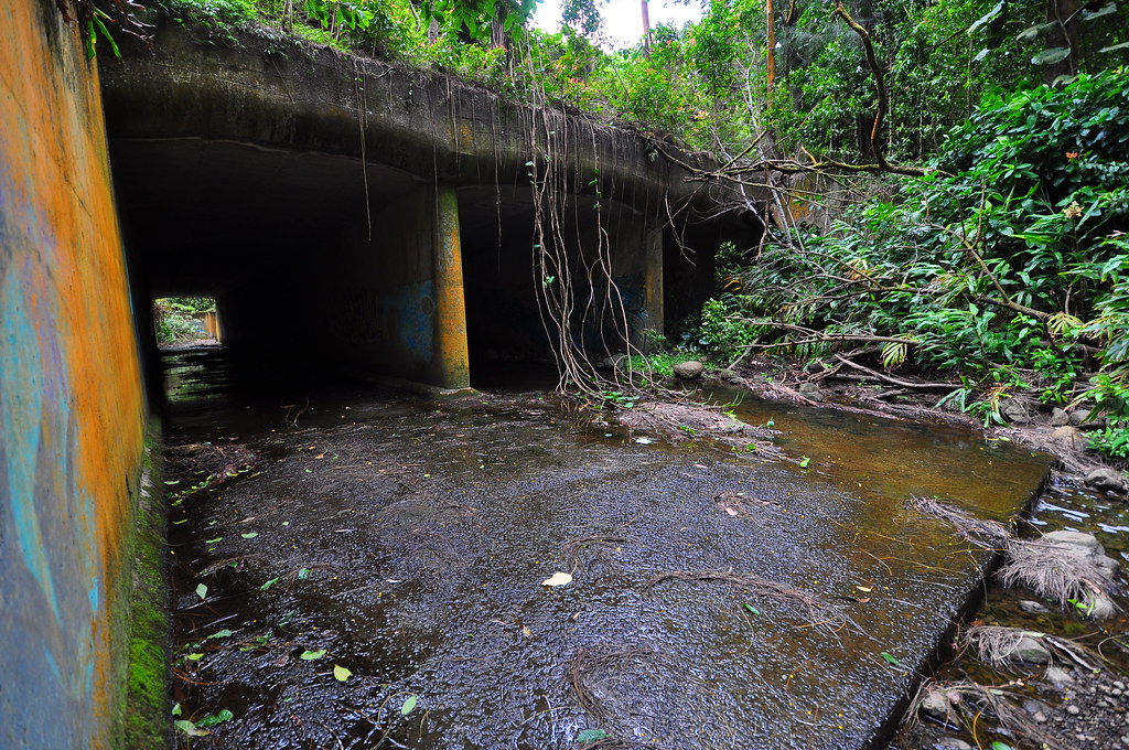
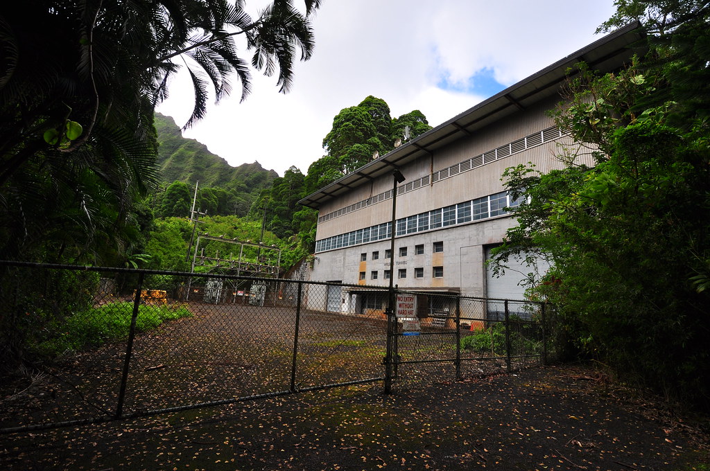
Making our way past the gates and up the road we passed the water tank and then what I assume is a pump house in a graffiti covered building. Along the way we spotted plenty of trash... sigh.
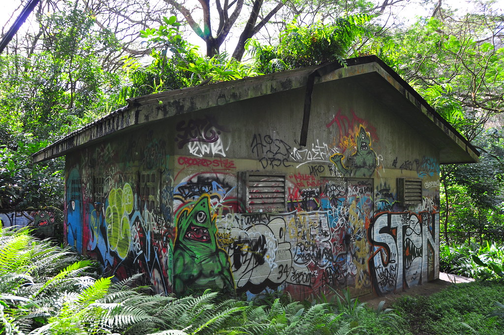
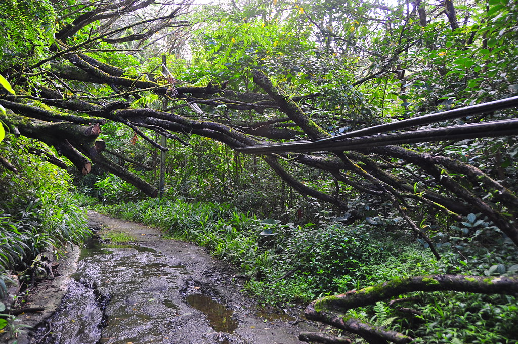
Some of the graffiti was pretty good so I stopped to take a few shots before we continued up the old road. The only other thing of interest beside the remnants of an abandoned care and how the road was also a stream in some areas and the power lines with downed limbs threatening to pull them down. The lines must be dead now or I'd imagine HECO would have cut them free.
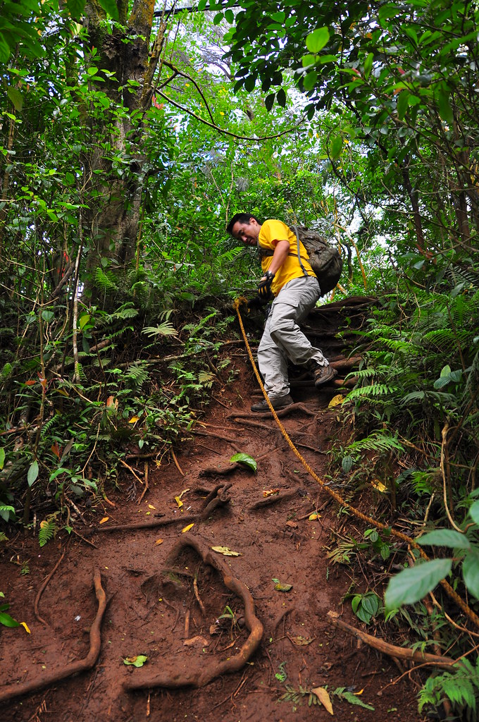
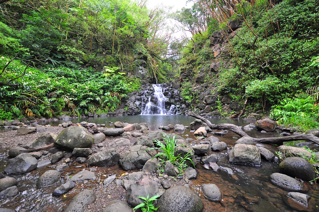
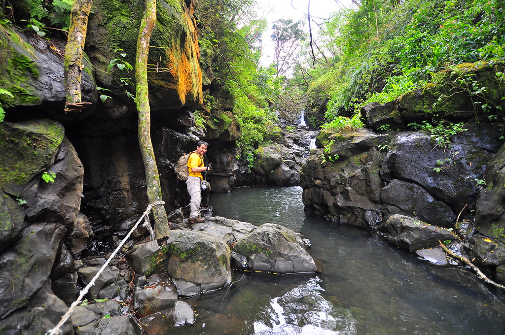
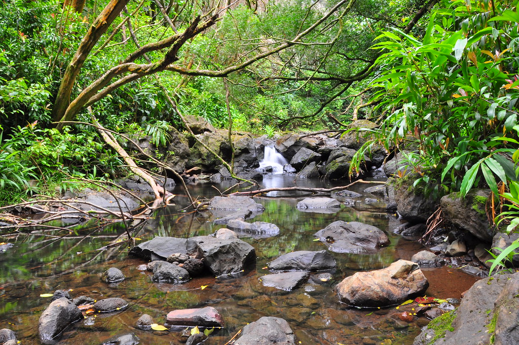
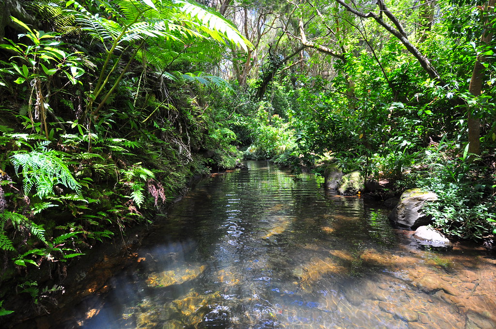
After a short walk we arrived at the only really hiking part of this adventure, the steep descent to Na Ohia Falls. Before we headed down we continued up the road a bit so explore a little. There are plenty of ropes here for assistance on the slippery slope and at the bottom is one of the most beautiful waterfalls on the island.

At the bottom of the trail someone has placed a garbage can to try and help keep this easily accessible place clean- mahalo whoever you are! I picked up a few scattered piece of rubbish but put them in my backpack instead of the can.
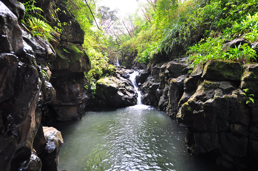
Being a week day morning we had the falls all to ourselves and I was able to take dozens of photos of the beautiful scenery.
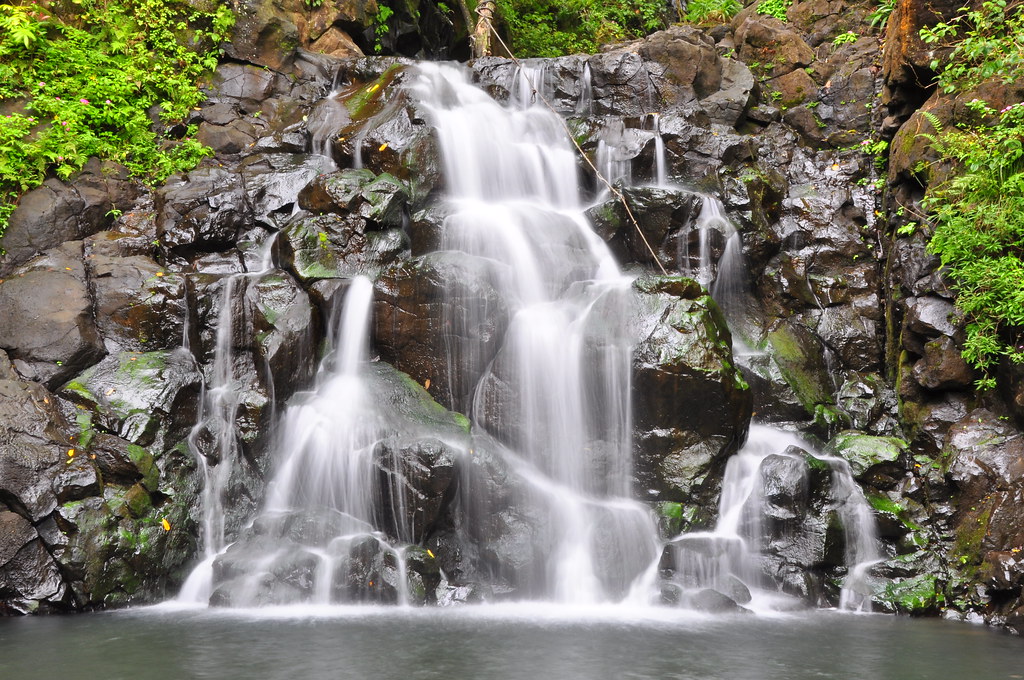
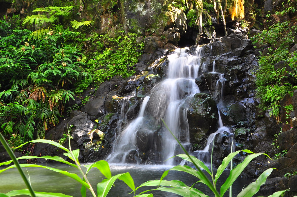

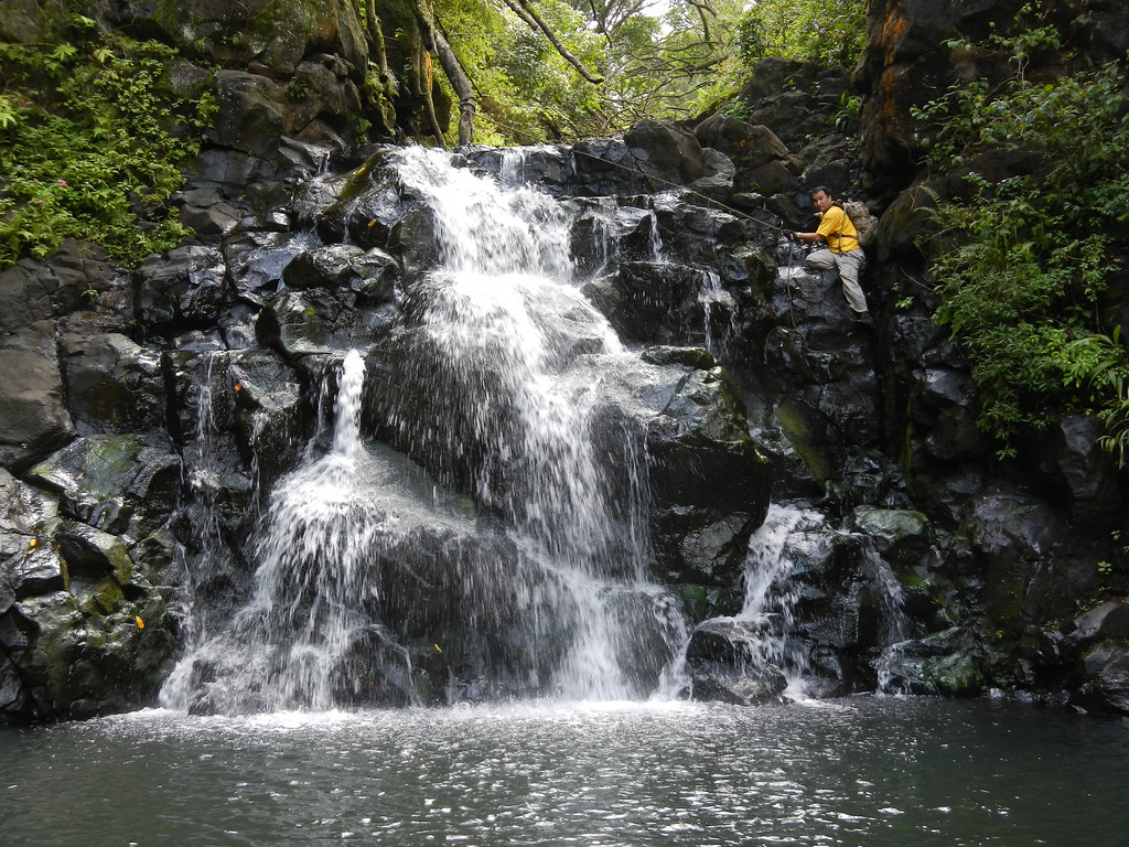
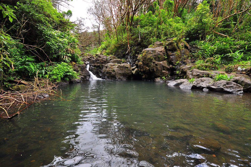
II waited patiently for me to get all the angles I wanted while he enjoyed the water cascading down over the rocks. Finally satisfied with all my shots I packed my gear up and we headed up the waterfall to the small but deep pool above. II attacked the climb from the left while I chose to take the right with the aid of an old rope. I didn't really trust it because if flexed quite a bit if I put any kind of weight on it. Using the rope mostly for piece of mind I made my climb safely as did he without it on the other side of the falls.

The upper pool was very deep but smaller than the one below. The falls weren't as impressive either so after snapping a few shots we examined our options from here.
Going upstream looked like a lot of work so we headed back down the first falls with me breathing a sigh of relief that my Nikon and lenses were still safe and dry. II wasn't so lucky and lost his footing right at the bottom and fell into the pool. We were lucky several ways. First, he wasn't hurt. Second, his camera was in a Zip-Lock bag. Third, I captured it on video!
 |
| II's last few moments of dryness! |

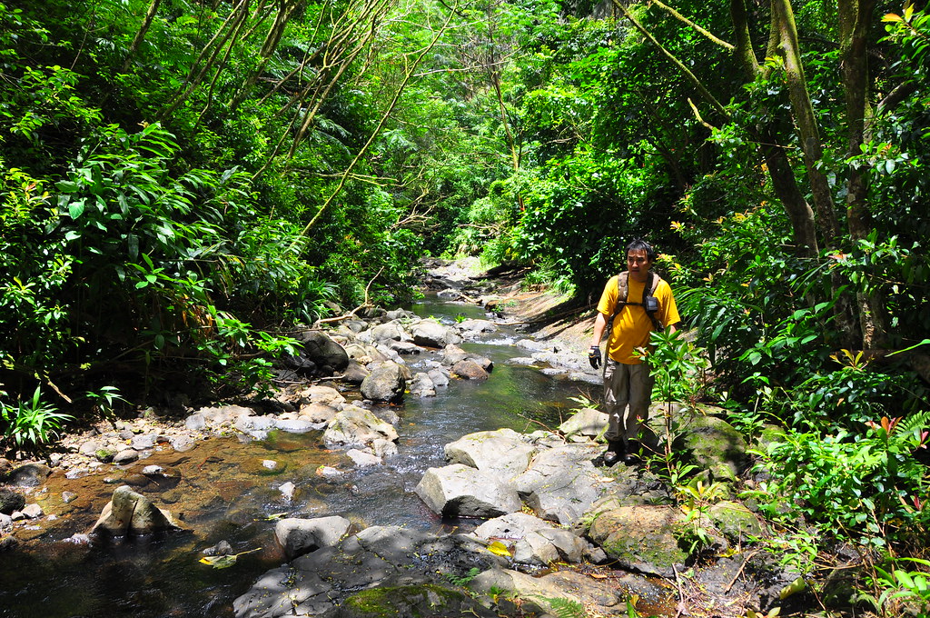
Despite our little explorations and my lengthy photo sessions it was still early, only a little before 11:30am. We decided to head upstream and explore the valley. I didn't take any notes or mark any waypoints in Back Country Navigator along this portion. At times obsticles in the stream slowed our progress but for the most part it was an easy walk. Along one shallow section the water pooled under a fallen strawberry guava tree so I posed for a quick shot.
 |
| Photo by II |
Further on the stream split around a large rock formation in the middle of the stream bed.

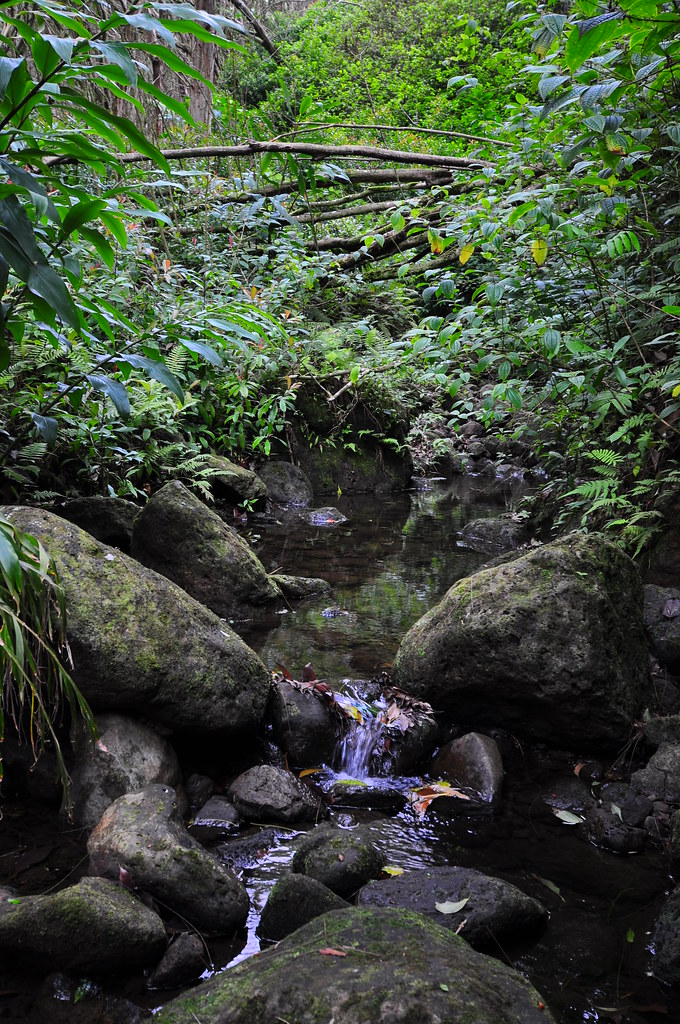
Later we passed another scenic spot I felt worthy of a photo.
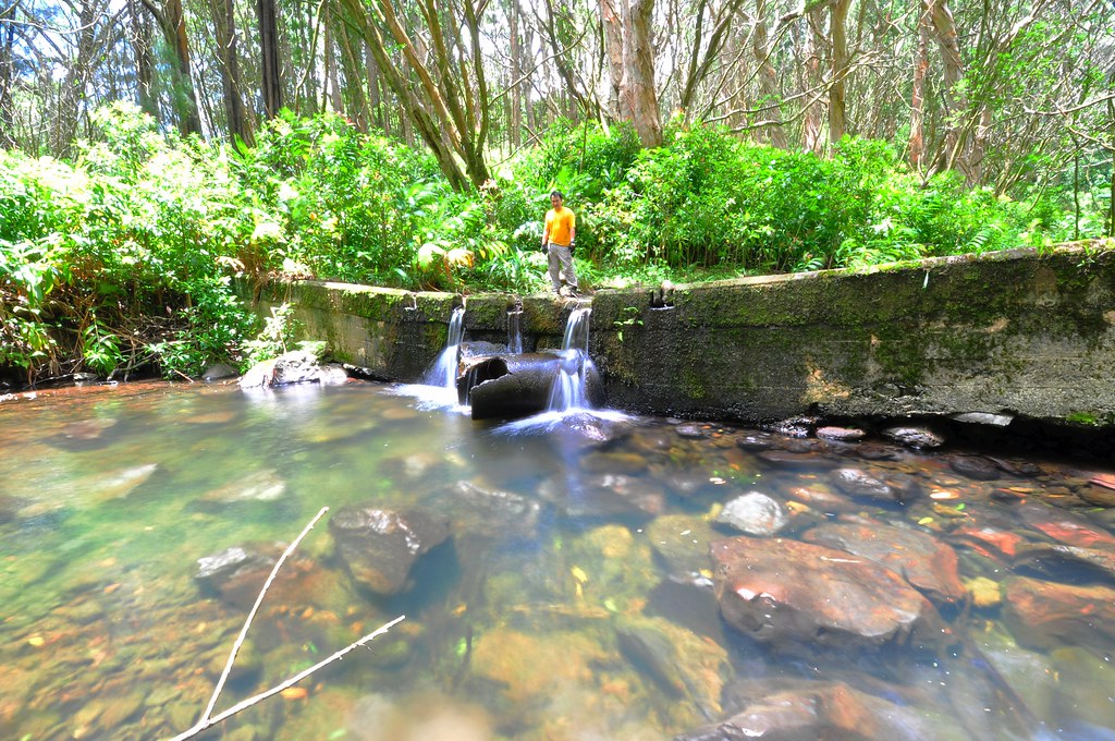
Fresh from the beauty of some of the small pools and falls we stumbled across a steel pipe dumping water down from the highway into the stream. This and the sounds of traffic along the highway also tried to spoil the mood but couldn't.

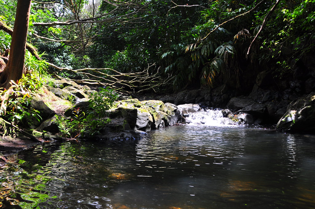
We wandered upstream leisurely stopping to investigate whatever caught our eye. It seemed odd to have this beautiful little stream wandering down the valley right next to one of the main arteries between the windward and leeward sides of the island.
Almost exactly one hour after leaving he top of the second falls we arrived at the third pool and falls of the valley. Here there was no trash can and there was plenty of litter scattered about. Auwe!
The rope hanging down over the pool looked inviting but being shaded most of the time by the trees lining the stream neither of us was hot. We decided to just continue upstream to see where it would lead us.
One of the pools we passed teamed with 'Opae pake, Red Swamp Crawfish which were first introduced into taro patches near Ahuimanu Stream, O`ahu in 1923. 'Opae is the Hawaiian word for shrimp and pake is Hawaiian for Chinese. I'm not sure how this alien species got it's name. Perhaps from Chinese farmers working in the flooded rice fields? I was amazed at how curious these were. Instead of running away from us they ran too us. We stopped for photos and some video with the waterproof AW100. One particular 'opae really wanted my camera.


Continuing up there stream we passed more 'opae and what may have been an endemic species of golby but I didn't get a good shot of the shy little fish.
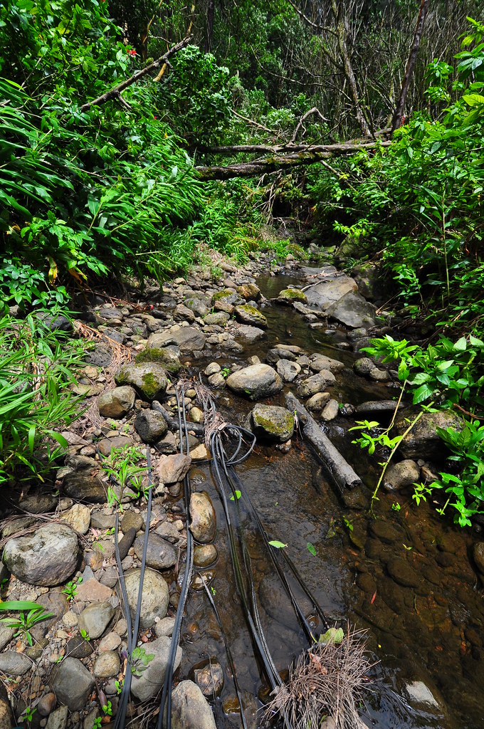
The stream presented a few more obstacles like this large blow-down we had to climb but nothing too bad.
A short distance beyond we waded through a tranquil straight section of the stream lined with ferns.
Later we passed an old car battery lying in the middle of the stream. Why someone though this was a good place to dispose of it baffles me!

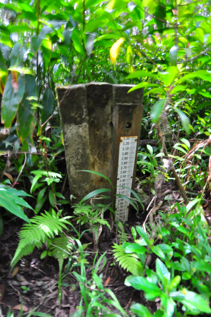
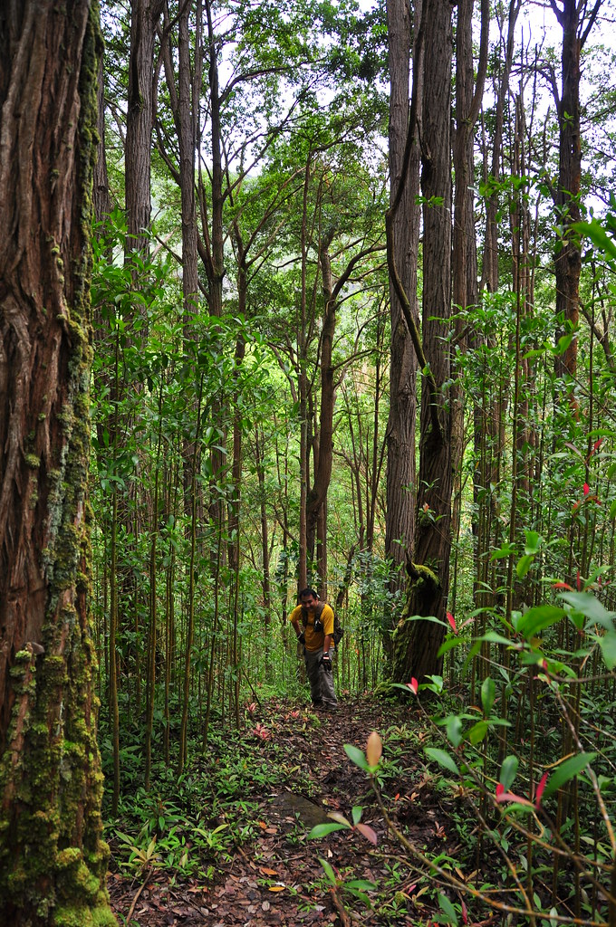
Heading still futher into the upper reaches of the valley we made another beautiful discovery, the remains of the old road that used to run up the valley towards Pu'u Nukohe.


Just beyond the old road was a stream gauge. Since the upstream side of the road is silted completely to the level of the road now it's completely useless. Again we headed upstream past some some pretty fungus and scenic landscape until we discovered some stripped insulation. Copper taken and no doubt recycled for a profit, someone had tossed the remains into the stream.


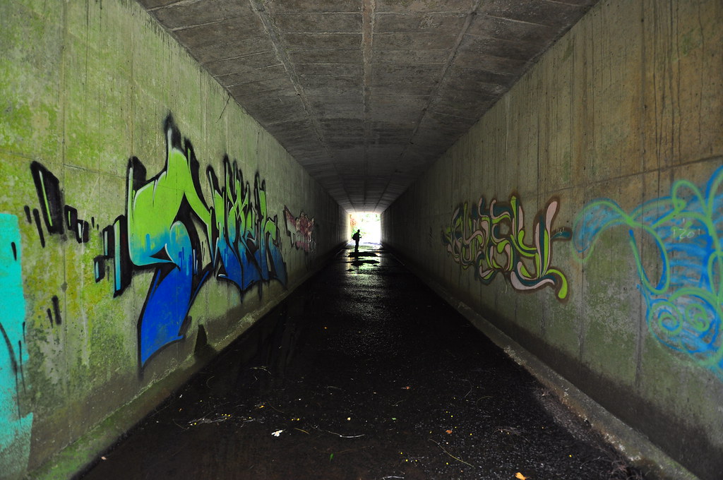
Making a sharp left turn with the sounds of the highway we approached something I'd never noticed before while driving, a set of three tunnels under the highway. I grabbed a few shots of the graffiti and the tunnels themselves before passing through them.
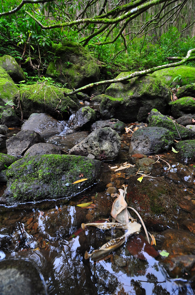
Once on the Ewa side of the highway the concrete channel that was now home to the stream split mauka and makai. We took the mauka turn and climbed a slippery slope of moss coated concrete before turning back to the right. The channel ended after going under the service road to the tunnel ventilation building. The stream had narrowed considerabley and we were forced to climb through the vegetation to continue. After forging our way though the tangles for a while it became clear that it would eventually lead to the waterfalls that flow from the west side of Lanihuli during heavy rains. The turn around point was at the skeletal remains of a pua'a in the stream which seemed like a fitting finale to the stream portion of the hike.
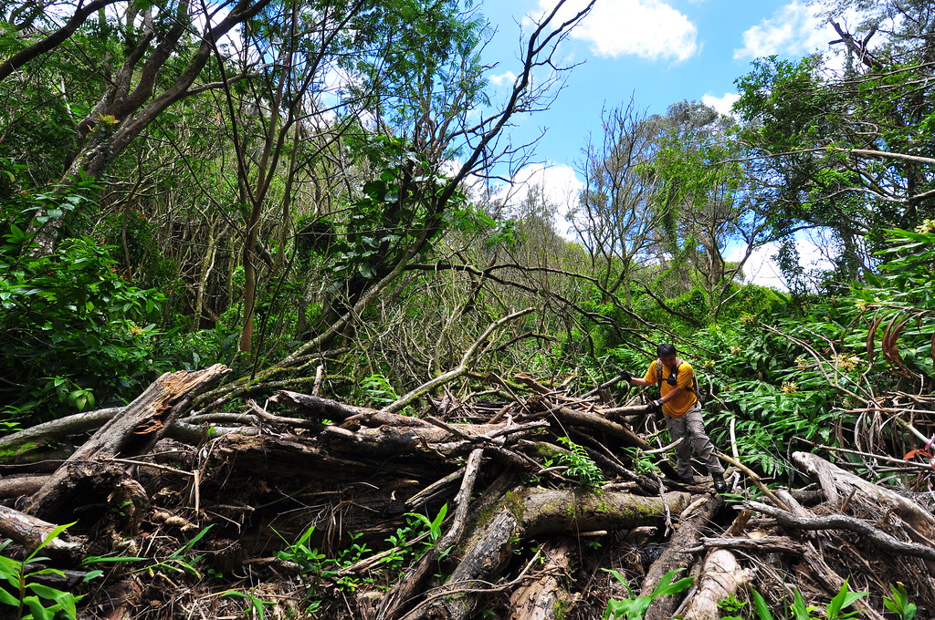
Reversing course back to the spot where the stream passed under the service road. To get up to it we had to bushwhack though the heavy introduced growth. There were plenty of vines which made forward progress difficult at times and made me wish I'd brought a machete. After a few route changes I crashed onto the service road with II in trail. He and one of the plants got into a disagreement and blows were exchanged. He won the fight arriving at the road but he'd suffered a painful scrape to his jaw doing it.

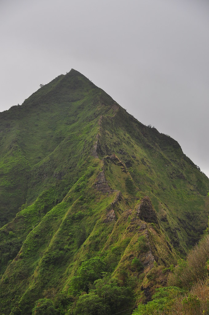
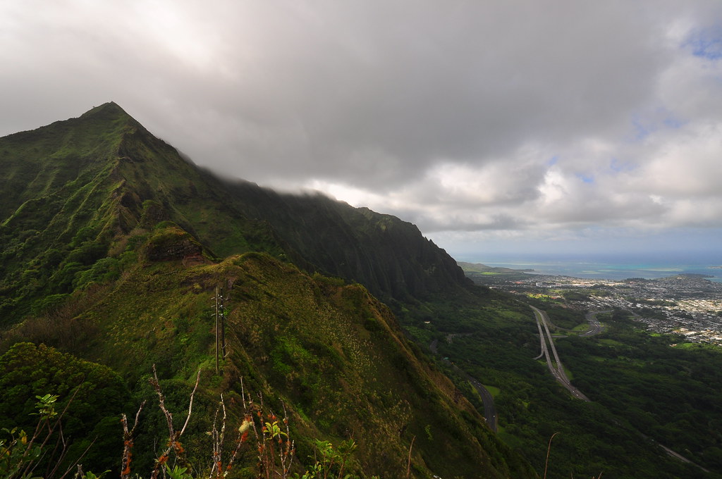
Since his injury was mostly superficial we elected to continue up to the summit of the Kalihi Saddle. After a short walk up the service road we arrived at the ventilation building. Since we hadn't planned on adding this to the day we made a few guesses as to where to begin. I've forgotten to mention the clouds of mosquitoes that had been swarming us ever since we'd crossed under the highway. II brought out the repellent and I marveled at how they hover just over my arm but just never land. Soon they found weaknesses in our defenses and began attacking our faces. There were so bad I was having trouble holding still long enough to take pictures.
Following the fence around the building we saw a nice little contour trail and elected to follow it. After winding in and out of a few little valleys we decided it was not the correct route and headed back to the building to regroup. At the main gate we elected to follow the fence and I scouted ahead through the bamboo past the exhaust vent for tunnels. The mixture of diesel and gas fumes eminating from the vent seemed a bit odd considering I was weaving my way though a dense stand of bamboo deep in the valley. I managed to find a feint trail and yelled for II to follow. The path led up a spur ridge that would take us to the saddle but I had my doubts as to which part. To be honest, I didn't really care, I just wanted to get a good look at those nasty teeth I see from H-3 on my way to and from work.
The initial climb was a bit steep but manageable with little trouble. About midway up the it got a bit tougher with loose earth and fewer and fewer handholds but there was little danger. Every so often the trail would level out a bit and I'd try and snap a shot or two. The Bowman side of the saddle came into view off to our left.
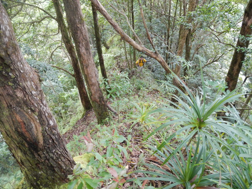
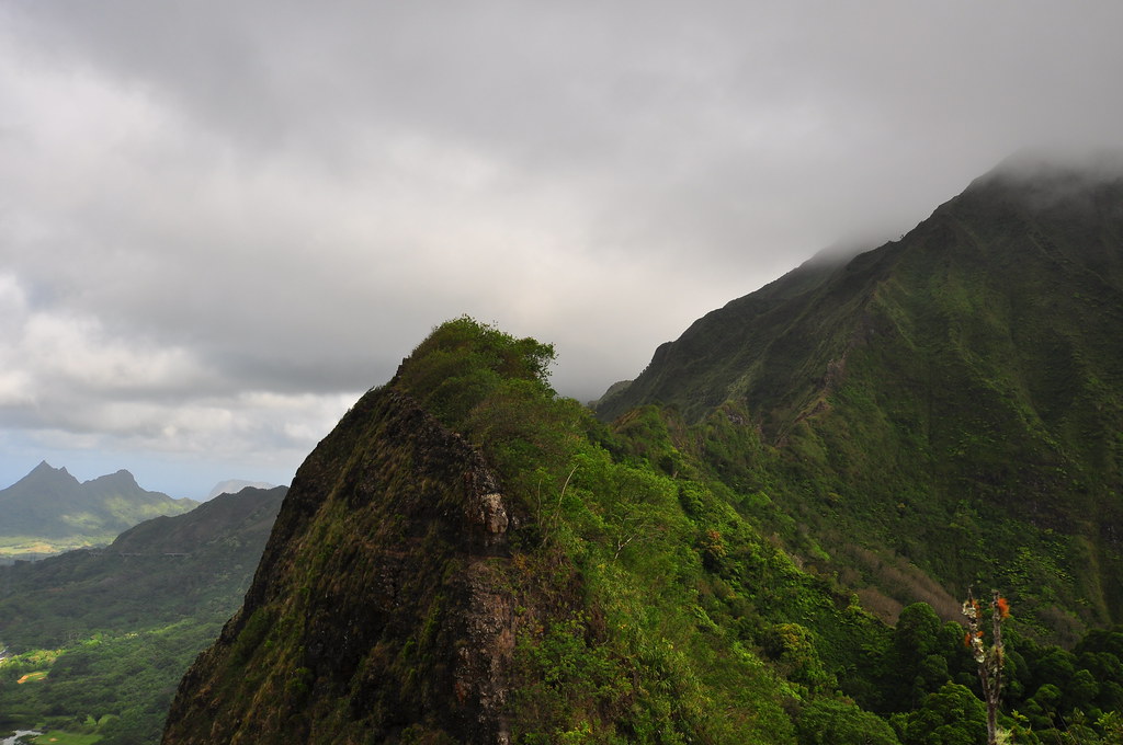
At one point the trail passed through some 'ie'ie vines. Normally they're about the last thing I grab on the trail because they tend to break off. These were think enough to support our weight. Somewhere along the way we also got our first glimpse of the Lanihuli side of the saddle which looked a little less daunting but not much! Thankfully the breeze kicked up a bit keeping the mosquitoes at bay from here on out.


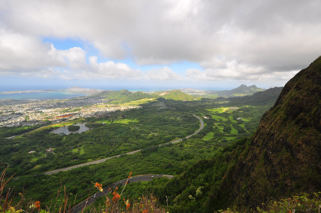
Just before the last climb there was a small spot I could take my camera out and get a quick shot of the afternoon sun illuminating Kalihi Valley behind us before we made the final climb to the top of one of the teeth.
Putting away my camera again I made the final climb up to the top of one of the teeth. The only part that gave me any trouble was just before the summit where I had to transition east towards Lanihuli on very loose ground with little to hang onto. A few moments later I pulled myself up to the top of the tooth and into a christmas berry tree that made moving around and getting and good shots pretty difficult.
 |
| West view over H-3 and Kaneohe |
 |
| East view over H-3 and Kailua and Ho'omaluhia Botanical Gardens |
 |
| The east saddle |
After a quick self portrait I packed up my stuff and met up with II again below. I waited while he had his turn to make the final climb.
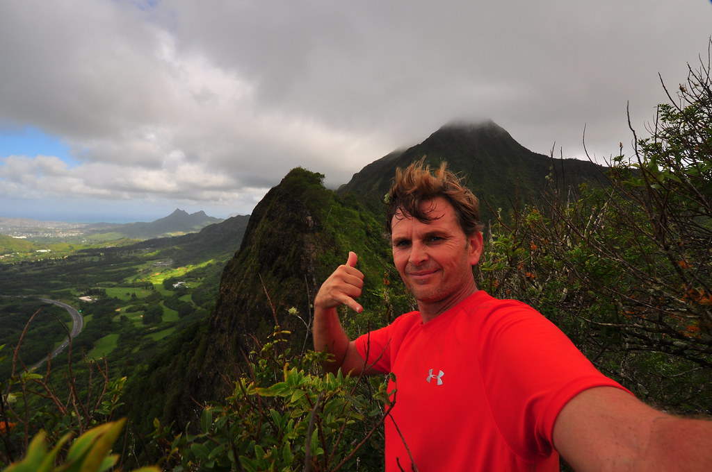 |
| Not So Great Hiker in the Saddle. |


After making our way back to the highway we debated dropping down to the tunnels below to cross traffic but instead decided to practice our car dodging skills instead.
 |
| II's best lolo face as he prepares to cross rush hour traffic |

Making the short walk down old Kalihi Street we retraced our steps back to our cars. What had started out to be just a short walk to a well known and beautiful waterfall had tuned into a fantastic journey though the valley up to the Kalihi Saddle. We didn't cover that much ground but what we saw will definatly bring us back again to explore further.
 |
| "Thirty minute waterfall" hike complete! |
I've strung together a few clips of video of a few of the sights from the day including II's fall from the falls and far too much of the 'opae in the stream. Not So Great Video of course!
Aloha and mahalo for reading, as always, more pictures from this trail and others I've done can be seen on Flickr.