August 23, 2011
Sticking with my plan to familiarize myself with some of the trails along the Ko'olau Summit Trail, La'ie Summit made perfect sense. I got a really late start after sleeping in and having to drive the just under 30 miles out to La'ie didn't help but it did afford me the chance to get a permit and legally access the trail.
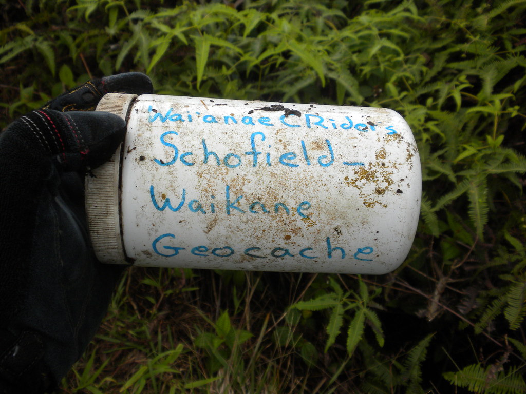
Hawaii Reserves Inc. manages over 7000 acres of land in La'ie that the Church of Jesus Christ of Latter Day Saints purchased in 1865. I stopped at their offices in the La'ie shopping center and filled out a really basic form that grants me one year of access as long as I agree not to sue them and follow their rules. You can do this in advance too and it only seems right considering they're nice enough to allow people to come on their property, right?
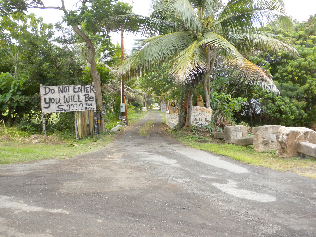 |
| E Komo Mai! |
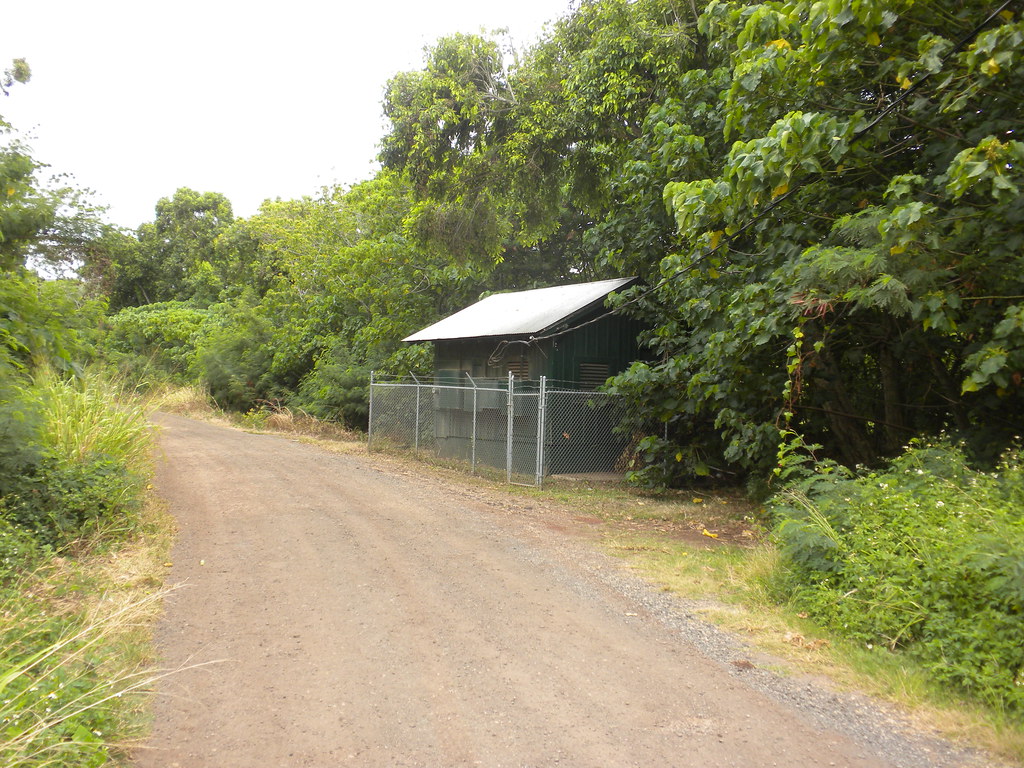 |
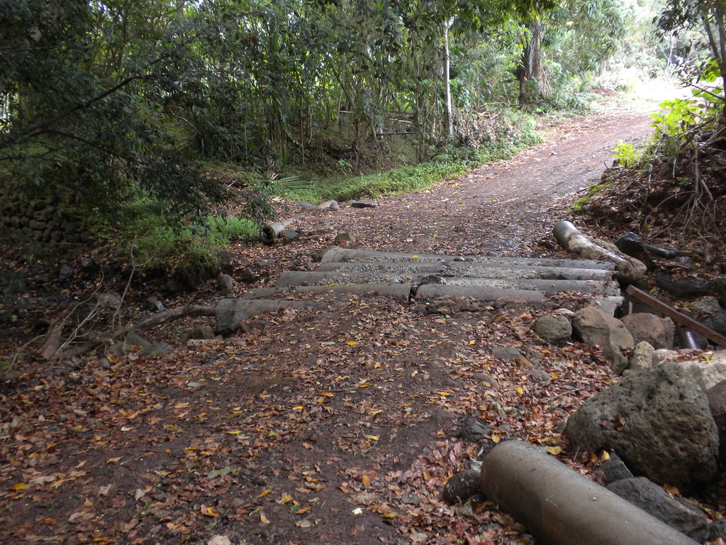
| The pump house |
I parked at the
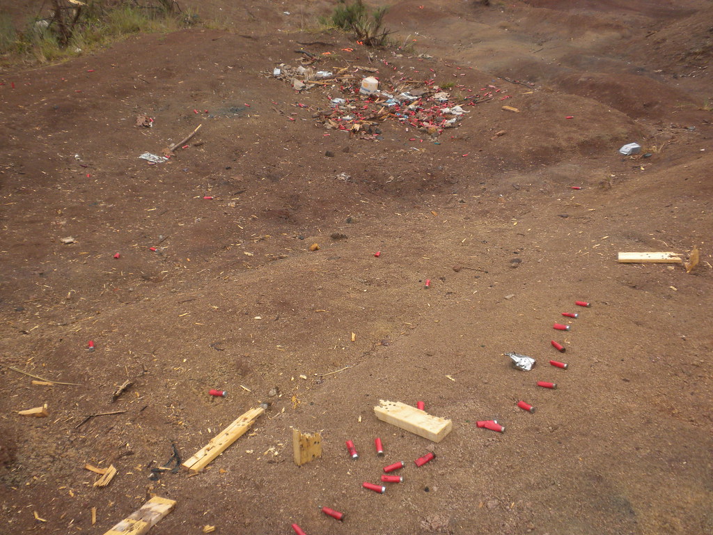
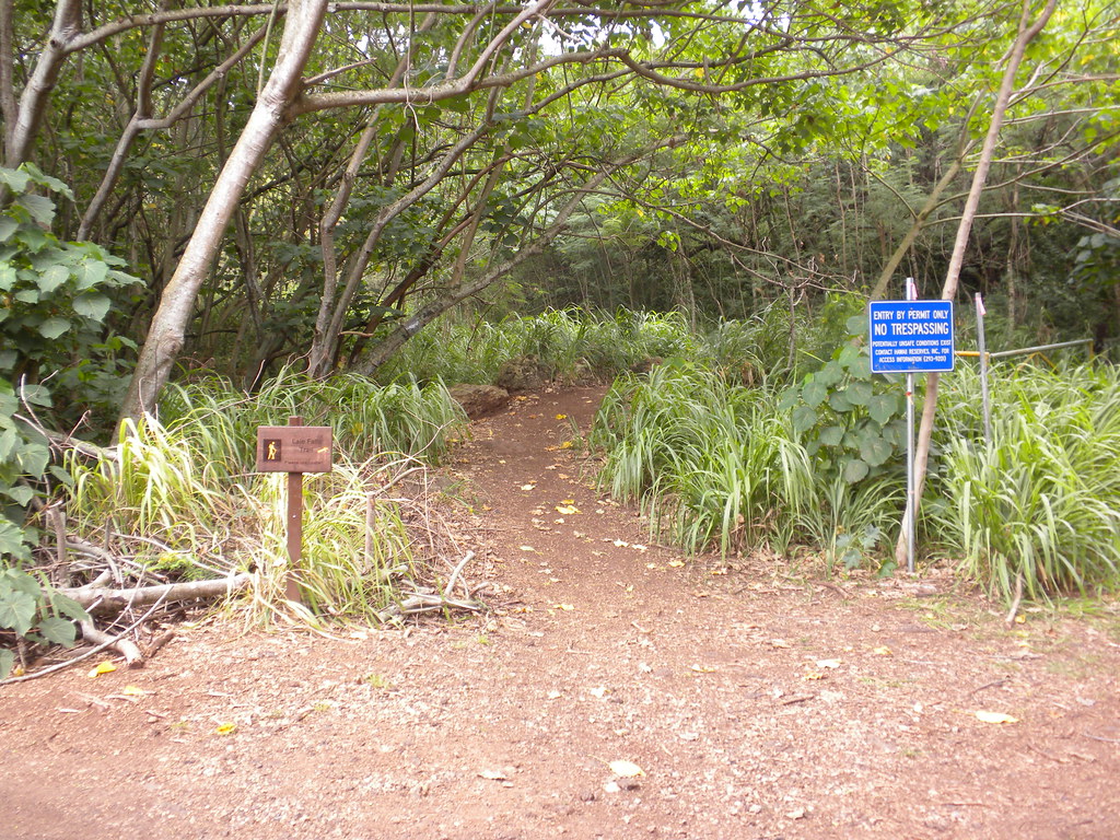
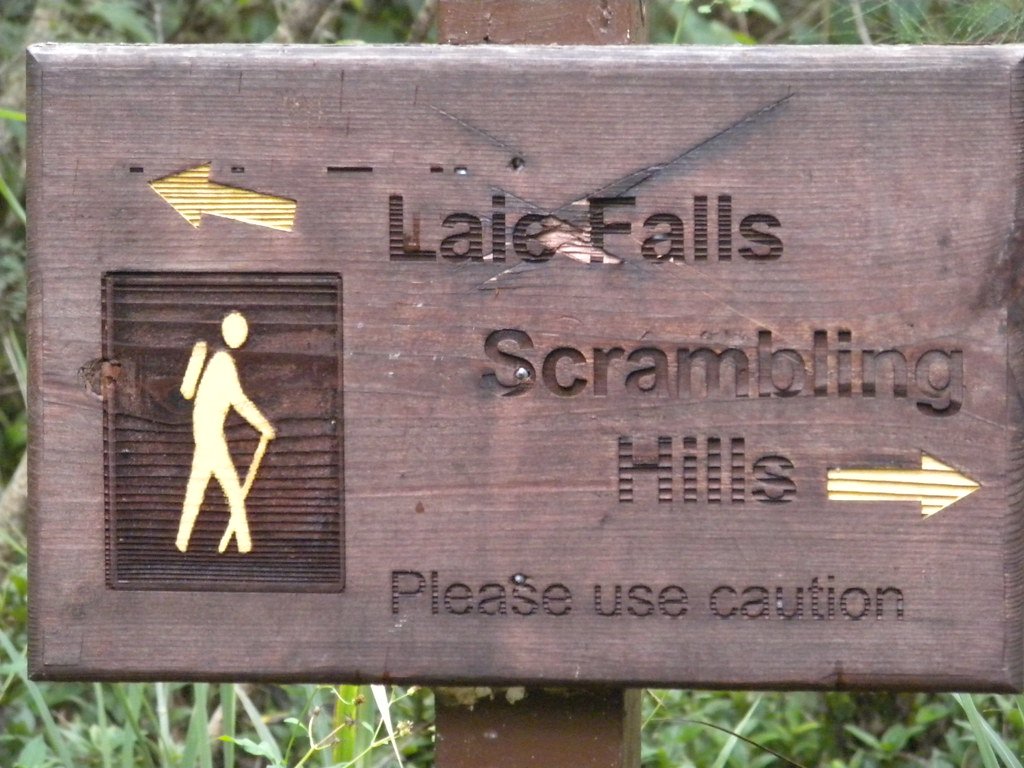
La'ie Ball Field on Poohaili St. and headed mauka down the road through an open gate on the right where the road forks. Walking past another field, apparently for cricket which I didn't know anyone actually plays here, the road veered to left and past the pump house mentioned in Stuart Ball's instructions. There's a driveway on the right with much signage suggesting no one trespass there. I complied. After some more road walking I reached a gate on the left side of the road with a La'ie Falls sign which is the same trail as the La'ie Ridge. It's a guinea grass lined road that would eventually shrink into a trail later. A short while in I came across another sign at a fork with the falls/ridge to the left and a hill scramble to the right. That sounded fun so I took off in that direction to see where it led. After a few minutes I arrived at an eroded area littered with shot gun shells and clay pigeons that had been used as a skeet range. This is one of my pet peeves because I like shooting, four wheeling, and hiking and it's morons that leave their crap behind that close off areas to all three! This little side adventure got me thinking. I knew that the Malaekana Ridge Trail started nearby and if I took it up to the summit I could take a short section of the Ko'olau Summit Trail to the La'ie Ridge Trail making the day into a loop. As I headed back to the La'ie Falls Trail sign I did some reading on my Droid and came up with my sources for my new plan. They were a mixture of Stuart Ball's Hiking Hawaii which I'd been using for the La'ie Trail, an
Around Hawaii article, and of course a
Dayle Turner Hike O'ahu article written by Wing Ng describing the loop to get me through the day.
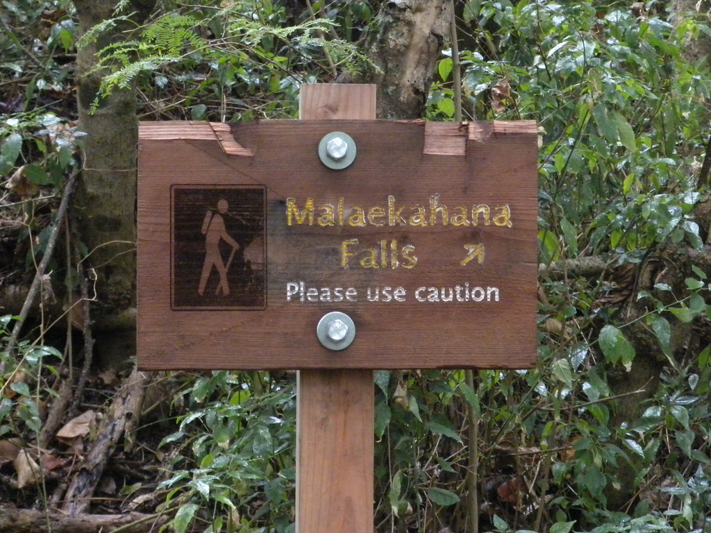
Once back at the road I headed deeper into the back country. I was on the lookout for a spot where the stream crossed the road. The Malaekahana Ridge Trail would start at the first left turn past that stream. There was another sign denoting the Malaekahana Falls along the way. How helpful is that! I passed fields of different crops like papaya and banana until I reached the stream crossing. On the left there was a gated road that seemed a little pointless because right next to it was a huge opening that bypassed the gate. Hmmmm no sign. A little spoiled at this point, I figured I'd keep going until I found one. The road dead ended at a field but there was a road to the left. No sign. I gambled and took it. The road climbed above a guy on his tractor working his fields below. There was some horse poo strewn along the road as it climbed into the introduced forest of iron wood and some kind of eucalyptus. After about half and hour I realized I was on the wrong road and turned back. I arrived at the gated road at just before noon. Way to blow 6 hours of good hiking time on my precious weekend! Should have followed the instructions and got out of bed earlier!
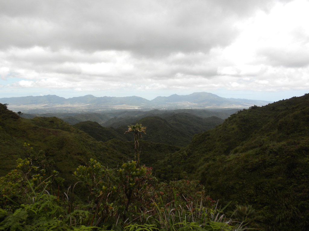
Now on the trail, I knew time was precious because I had some miles to cover before dark. For about the first third of the way I was on an old dirt road. It climbed slowly up into the mountains until I reached a grove of ironwood trees with a lean-to built. I paused here to catch my breath and take a look at the landscape around me.
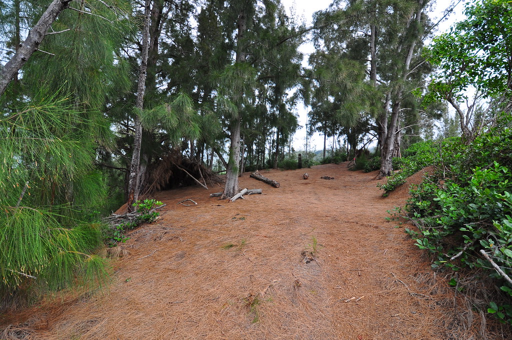 |
| The ironwood tree campsite |
 |
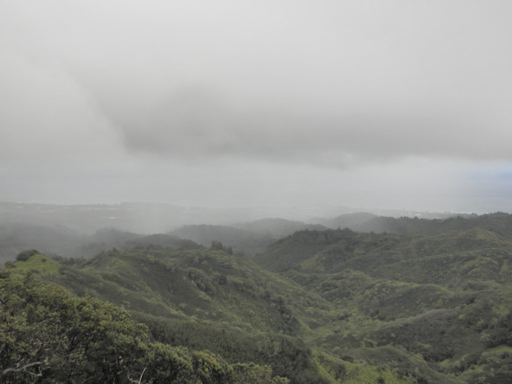
| Looking back makai from the campsite |
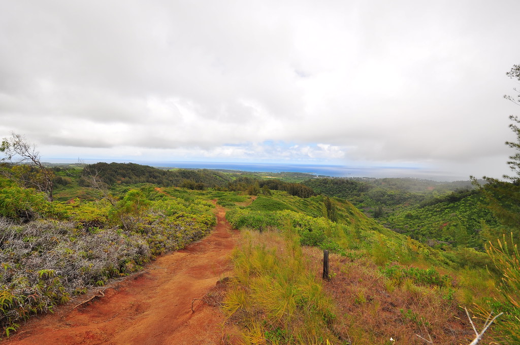
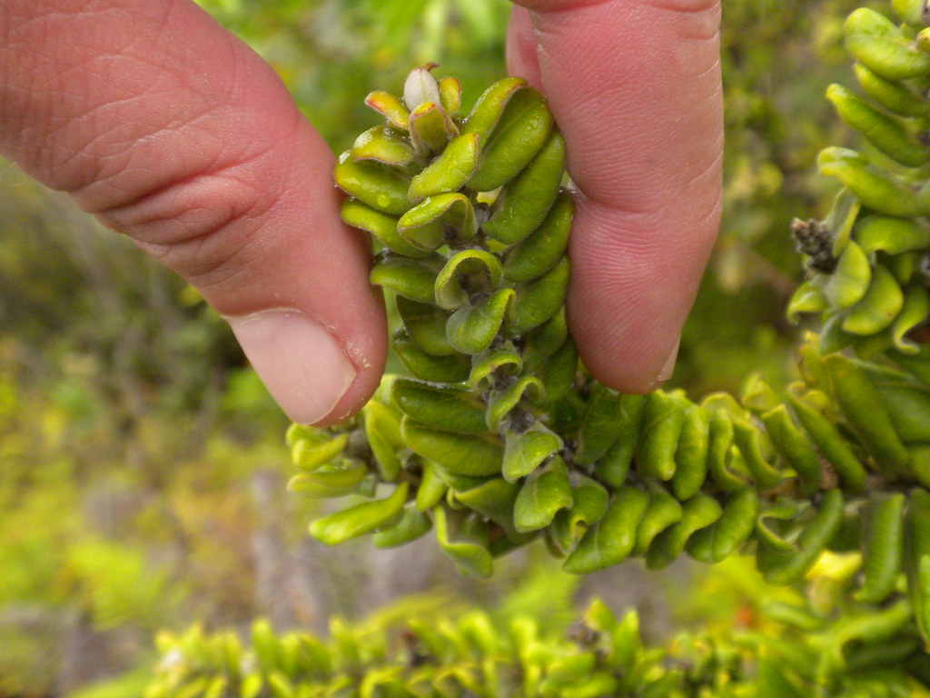
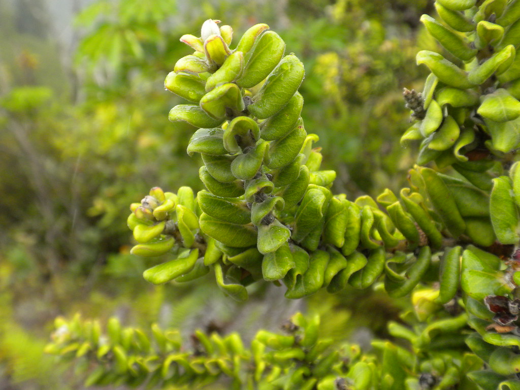
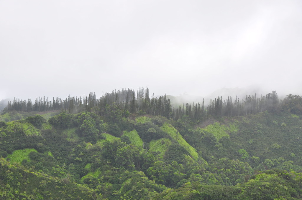
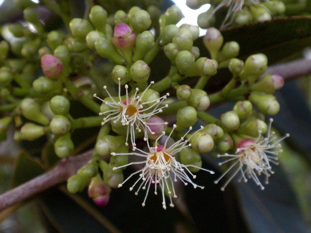
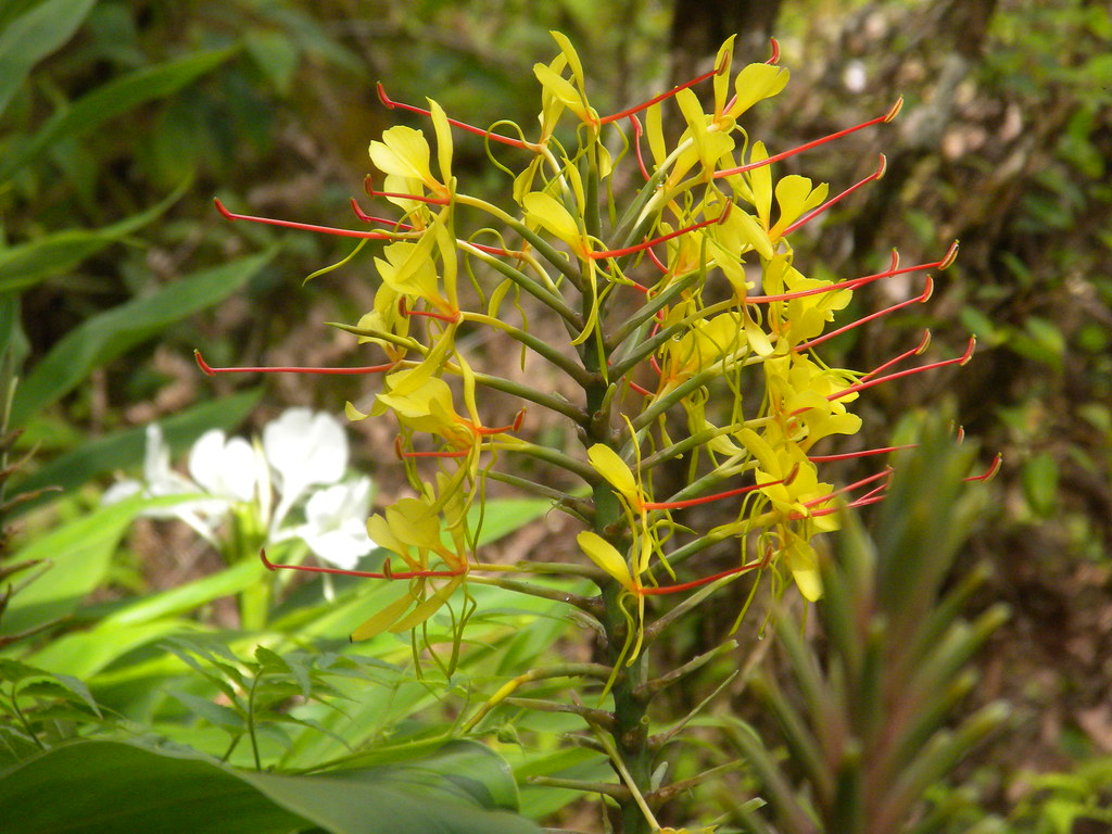
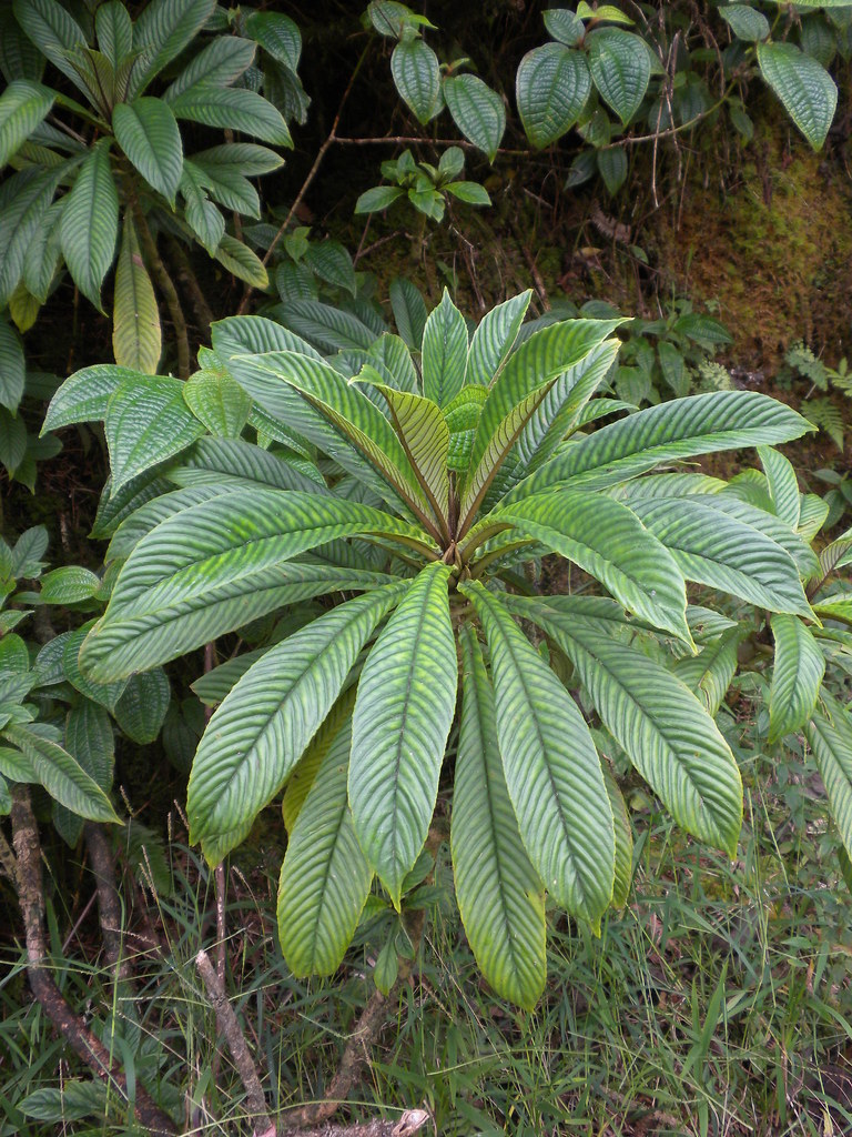
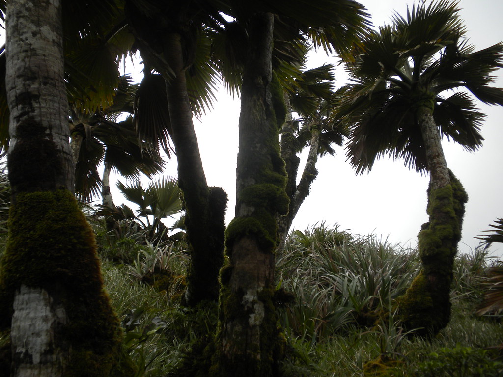
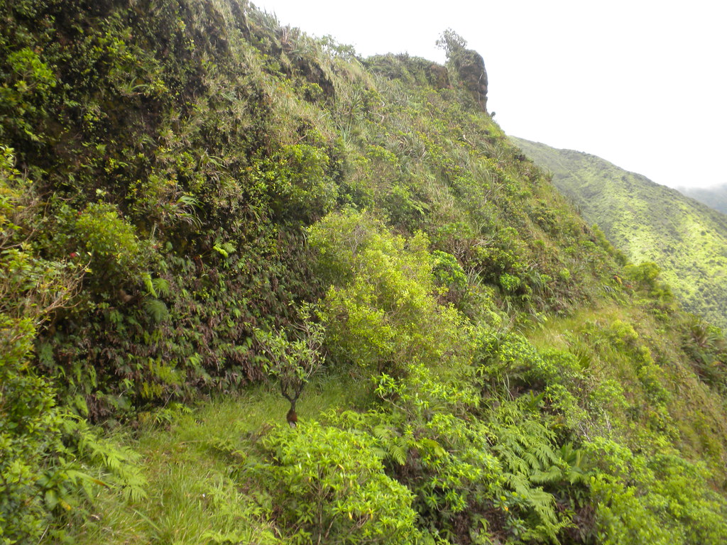
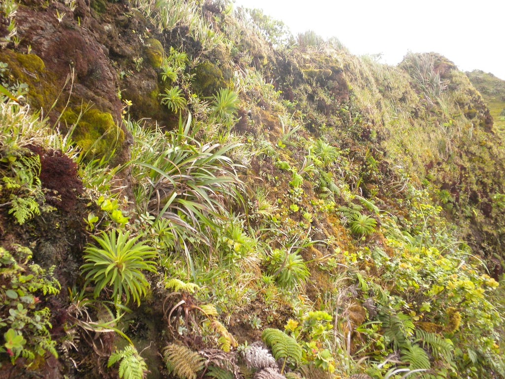
Although up until now most of the plants around me were introduced there were a few endemics to be seen. Most interesting of them was this ohia. People tend to think of it as an upland tree that enjoys rain and cooler conditions but prior to the slashing and burning of the lowlands first by the Hawaiians for their crops, and then the westerners sugar, pineapple, and ranching, ohia and many other species once extended much further down to the coastal zone. This particular form had a really small and compact leaf design. I added a shot with my fingers for some scale.
It had been pretty hot and muggy up until now but the weather was changing and I'd been eying some rain showers as they moved in off the ocean up towards me. Before I left I got my first shower of many I'd be receiving but this one passed through pretty quickly and it just made it even muggier. My forward progress was dismal with the heat which sucked the energy out of me.
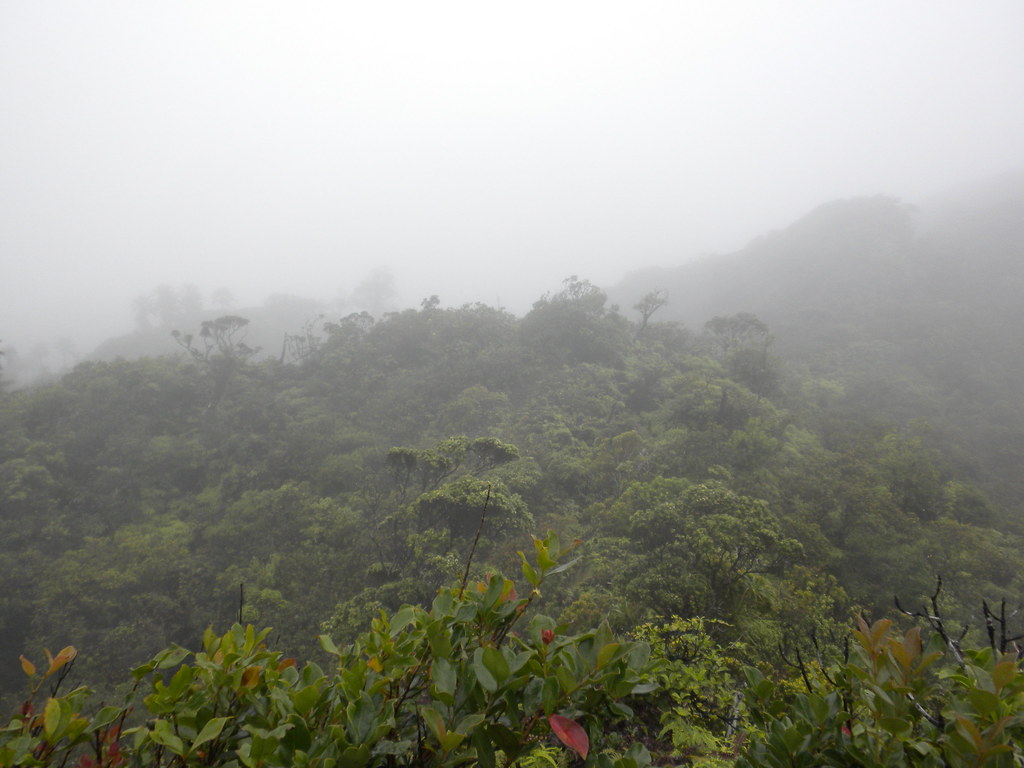
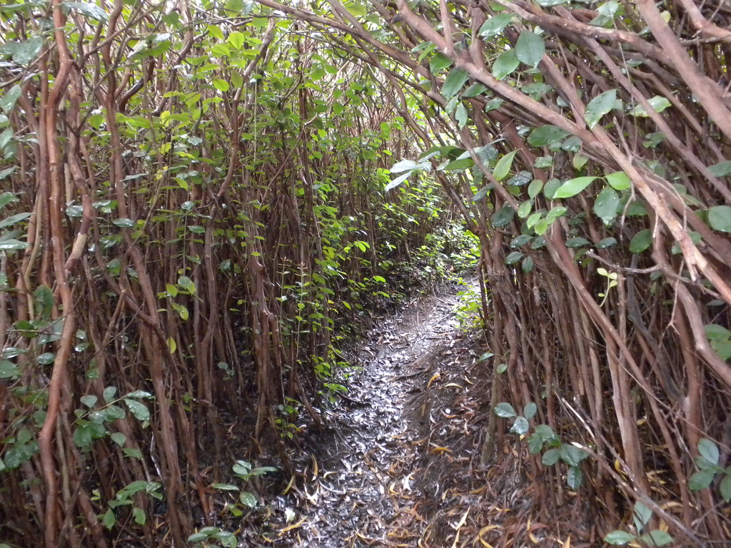
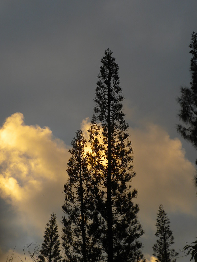
Following the trail upwards I was soon encased in Strawberry Guava. I now understand how the world looks to all the pua'a that tunnel their way across the mountains on their own network of trails. The strawberry guava section continued and the ridge began to roll. Up and down I climbed while watching the clock. Initially, I'd set an unrealistic turnaround time of 2pm. It was clear there was no way that was going to work so I bumped it to a still very conservative 3pm considering the sun would set just before 7pm.
The clouds rolled in cooling me off but the summit had been obscured by both the rolling ridge and clouds so I had no idea how much further it was. At 3pm I bumped it to 4pm which I decided was as far as I'd push things.
 |
| Here comes the rain again! |
As I'd moved higher into the Ko'olaus the native vegetation had become more dominant but strawberry guava still permeated the landscape. At around 3pm I found a sign labeled "Alternate to the KST" or "Shortcut to KST"- I can't remember and didn't take a picture. I had no idea what that was all about and the route it pointed to was visible but overgrown. Being late in the day and already running up against the clock, I was in no position to investigate so I continued on the Malaekahana Trail. I found this information later on the Hawaii Hiking, Backpacking, and Camping blog.
"It was there we left the ridge trail (heading right) to begin a segment we called "The Shortcut to the KST," a longtime brain-child of Bill Gorst. This route drops down to a little stream, passes some paperbark trees, winds around some low ridges and ravines, crosses little streams at least twice more, and eventually gains the summit trail about a half mile (as the mynah flies) north of the KST/Malaekahana junction. It takes about half an hour."
By now I had entered a miniature forest like those I've seen in the Poamoho area. It was pushing 3:30pm when, frustrated, tried, and wet, I gave up. Based on the Turner/Ng loop article I estimated that I needed one hour to get from the KST-Malaekahana junction to the La'ie junction then another three to get back to my car. That added up to an 8pm finish if everything went perfectly and left no room for error on a trail I'd never been on. It seemed too risky so, resigned to throw in the towel, I marked the point in my Back Country Navigator app on my Droid and stood there cursing the strawberry guava that was taking over this fantastic little section of forest. I wondered how many years it had left before it was swallowed up like the lower sections. Then, although I'm really not sure why, I continued up the trail towards the summit.
 |
| The always amazing upper forest of the Ko'olaus |
At a small clearing I noted some really bad pig damage that had toppled an ohia tree. I reached the three ribbon end of the Malaekahana Trail at 3:48 and continued past it to the junction with the KST which I reached at exactly 4pm. That put me back at my car at 8pm according to the loop article. No time to screw around.
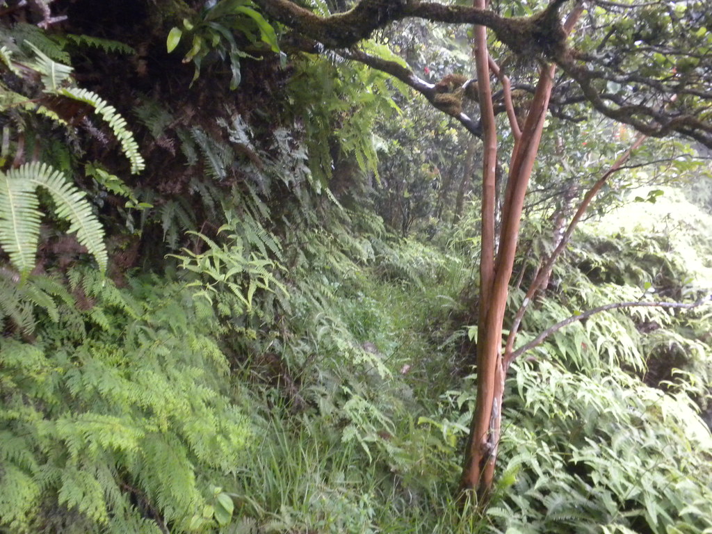
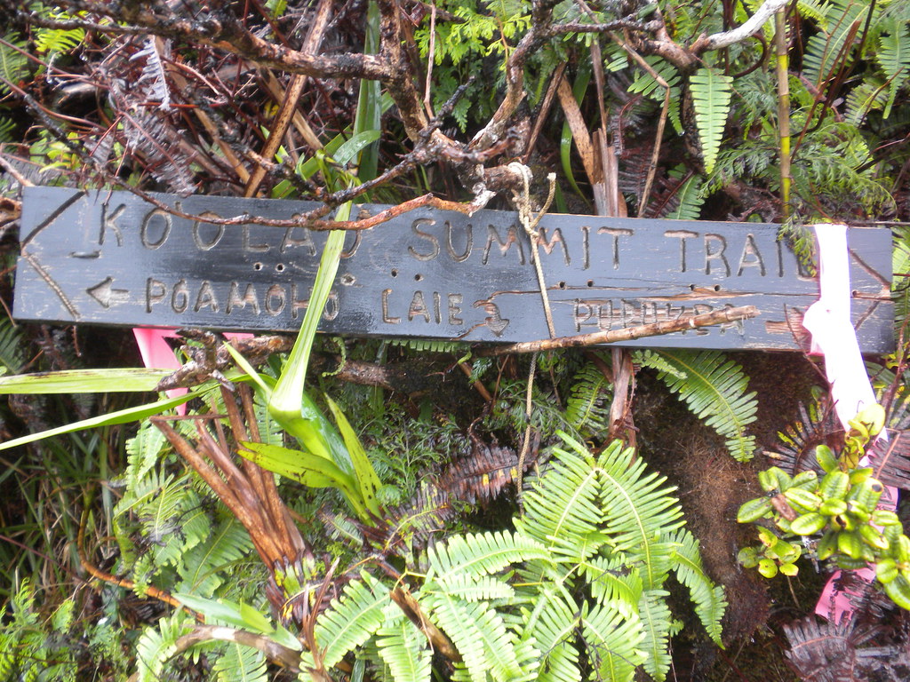
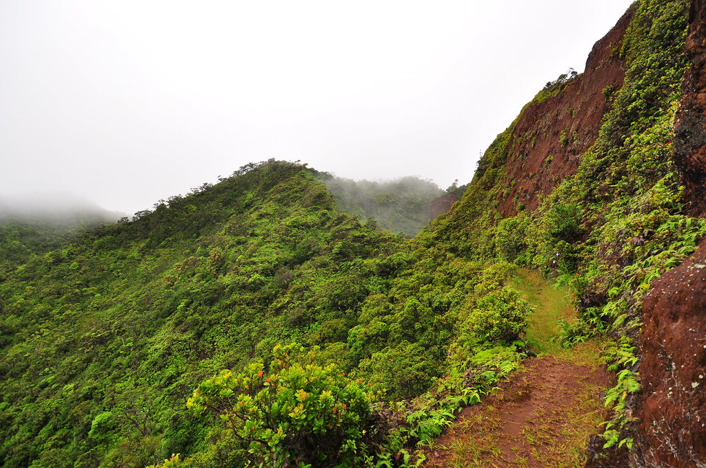
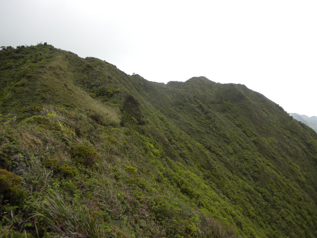
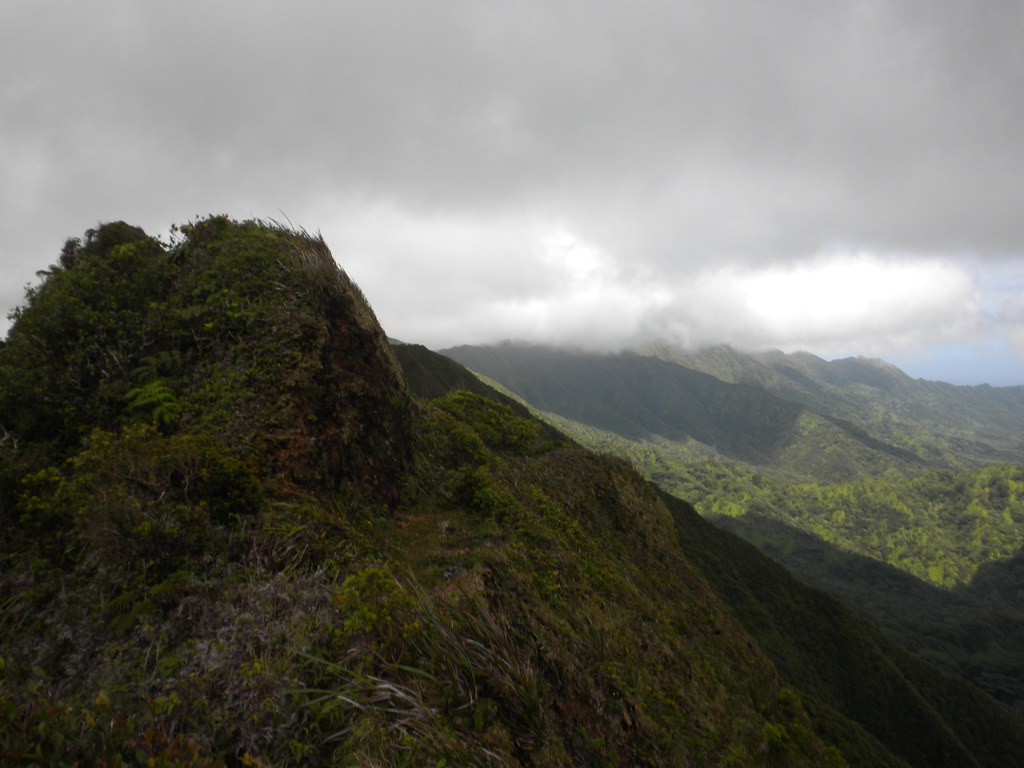
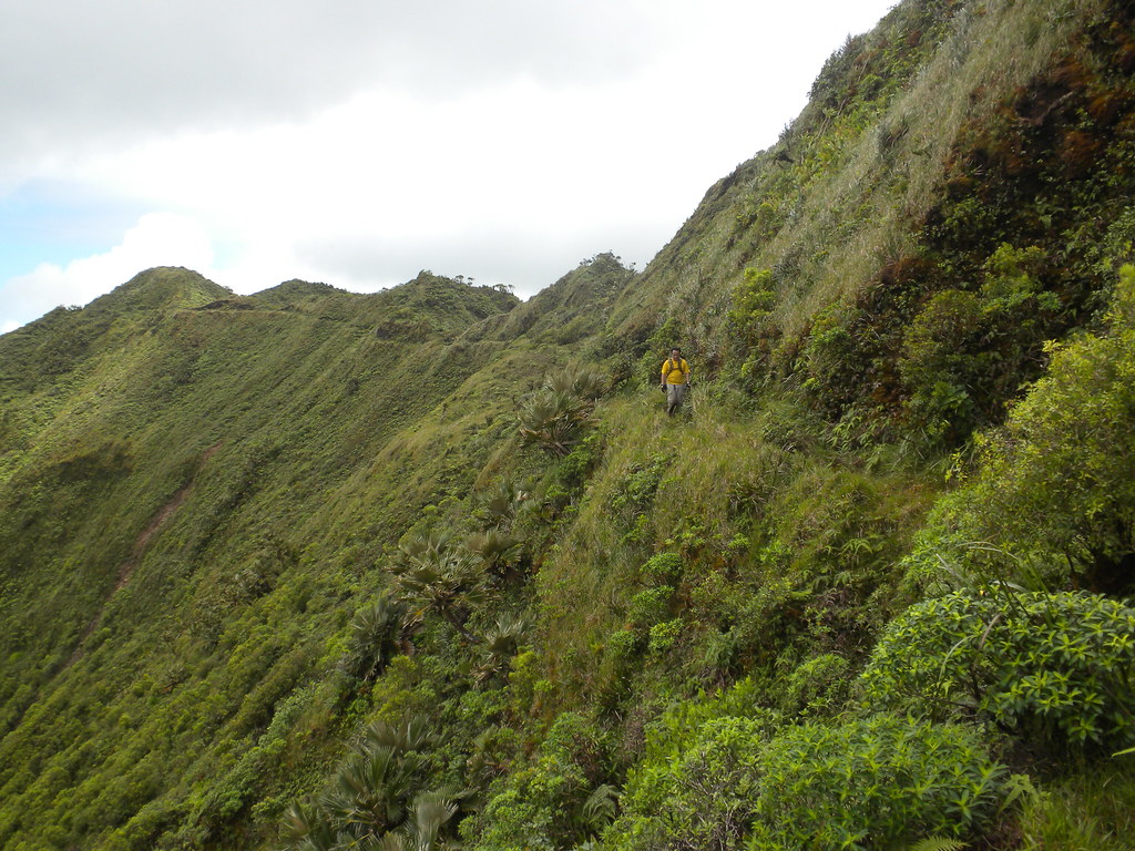
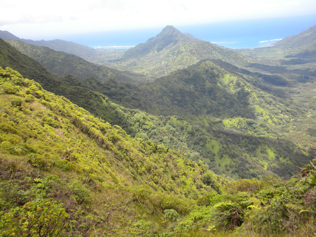
The arrival onto the KST was unceremonious. If there was a sign, I didn't see it. I set off eastwards and although the trail is fairly recognizable, there are some sections where it looks like it has been bypassed. Thankfully there are a few ribbons to follow along the summit because I almost took a wrong ridge in the clouds. I think most of the initial portions are leeward of the summit but occasionally for reasons of overgrowth, slippage, or whatever the trail now sometimes hops over to the windward.
 |
| The Ko'olau Summit |
 |
| Malaekahana / Ko'olau Summit Trail Juntion- just some uluhe fern to greet you. |
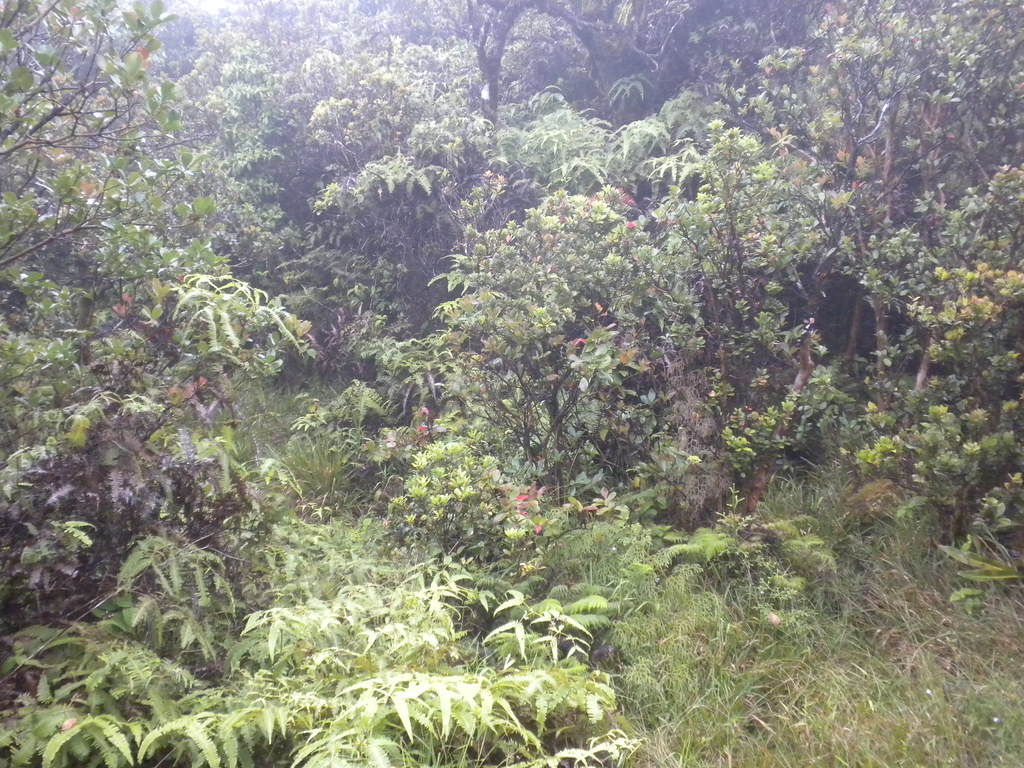
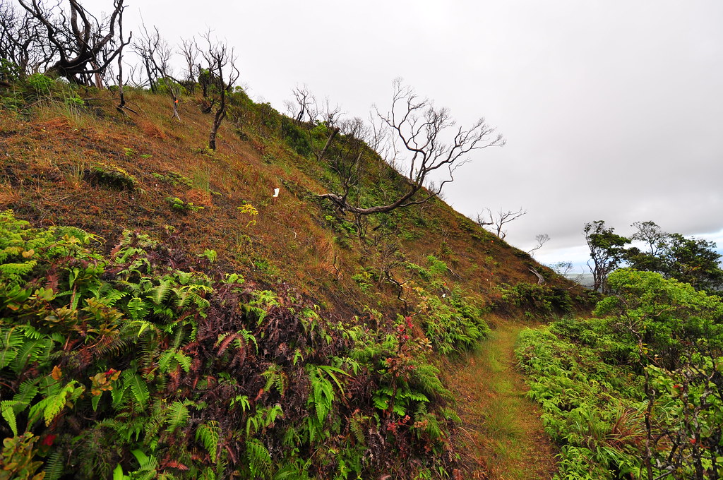
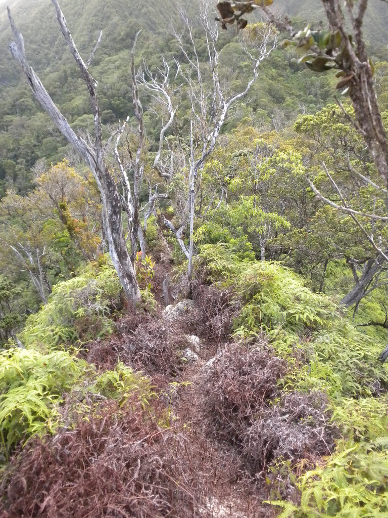
Trying to move as quickly as possible I didn't linger to look at much but I did get enough glimpses of sections that weren't damaged or overgrown to imagine what this trail looked like in the 1930's when it was new. It must have been among the most beautiful in the world. Such a shame it's fallen into disrepair! Eventually the trail switched sides to the windward and weaved in and out along the summit. Most of the trail was evident but every once in a while I was left to guess a little. My time put a little more pressure on me and I guesstimated the La'ie junction on Back Country to make sure I didn't blow past it.
 |
| You can get a sense of what the entire KST once looked like from this small section which has weathered the years. |
 |
| Cloudy windward section of the KST |
At 4:46 I reached the sign announcing my arrival at La'ie Junction. Whew, I figured I was in good shape now. After the battling Malaekahana uphill all afternoon the La'ie Trail was nothing short of a dream come true. Although both were originally built by the CCC in the thirties, the Malaekahana Trail was lost to time and the new trail was carved mostly by clearing the ridge line itself by the HTMC and the Boy Scouts back in the 1990's.
 |
| KST Junction with La'ie Trail |
 |
| Slippery as ice! |
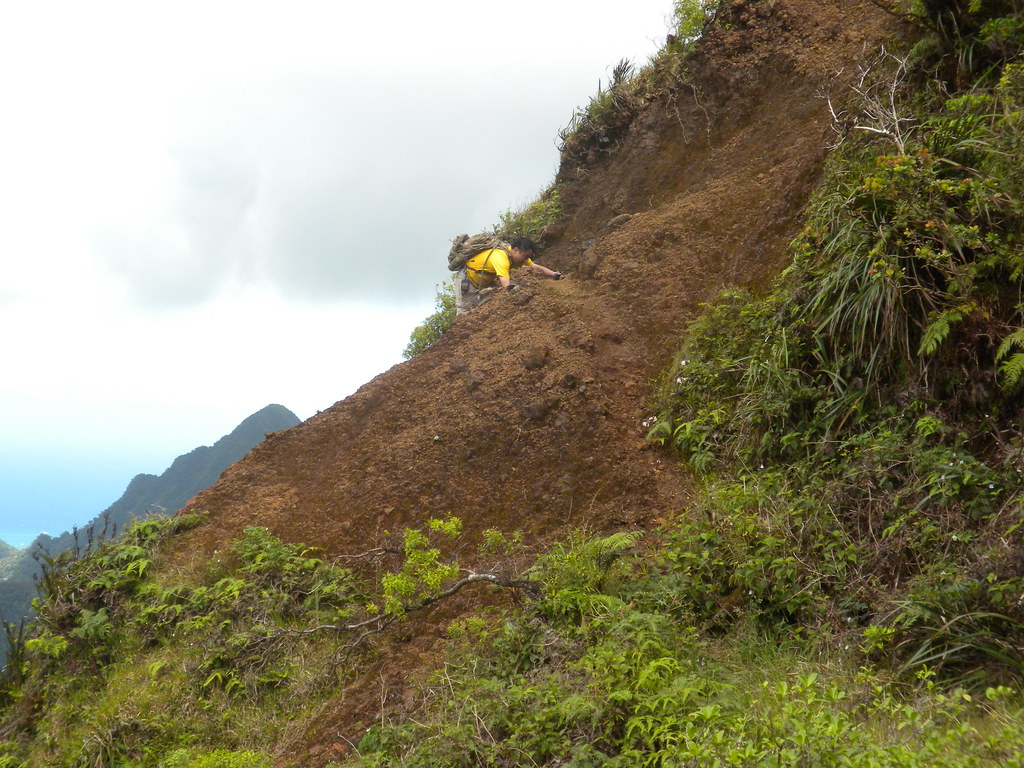
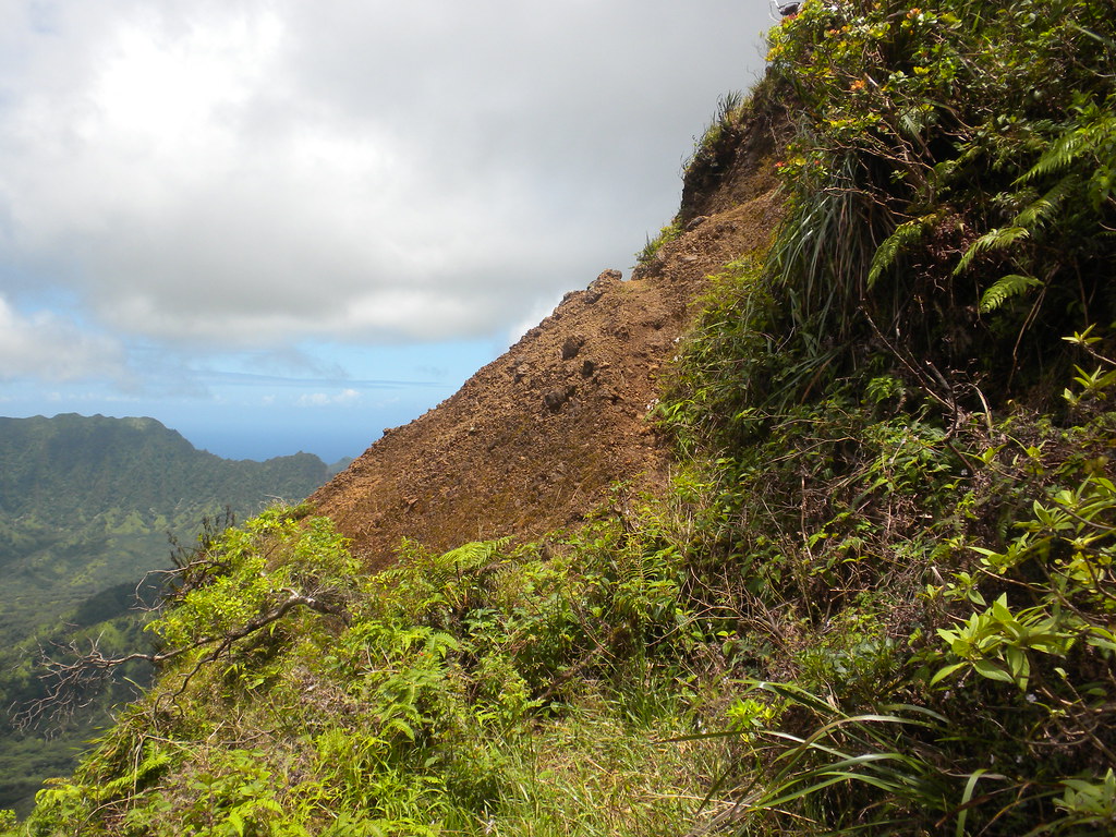
Lucky for me, La'ie is still in it's original graded condition as it cuts it's way down from the summit. The only hazard now was that the continuing rain and clouds left the trail ultra slick in areas where it's worn down to reddish brown rock. It's a fascinating process how the incredibly strong igneous rock is broken down over time. As water soaks the rocks over thousands and thousands of years it oxidizes the iron in the hard volcanic rock turning it a rusty reddish brown color. As the process continues, the rock literally melts away or crumbles. It's one of the biggest reasons all the current Hawaiian islands will eventually suffer the same fate as those to the west of Kauai- to become nothing but a small atoll in the vast Pacific.
Happy with myself for getting to La'ie a little ahead of schedule I continued to make my way down the trail quickly- until I slipped and rolled my ankle. A whole host of words went through my head and I probably uttered a string of curses too. I fell to the ground as the pain seared through my ankle. I lay there on the wet muddy trail pondering my fate and wondering just how bad this was going to slow me down- or worse.
After a minute or so I tentatively stood up and put a little weight on my ankle which really didn't feel too bad. Carefully I flexed it around and began walking cautiously down the trail. Luckily, it was just a tiny bit sore and I walked off the lingering pain. Lucky!
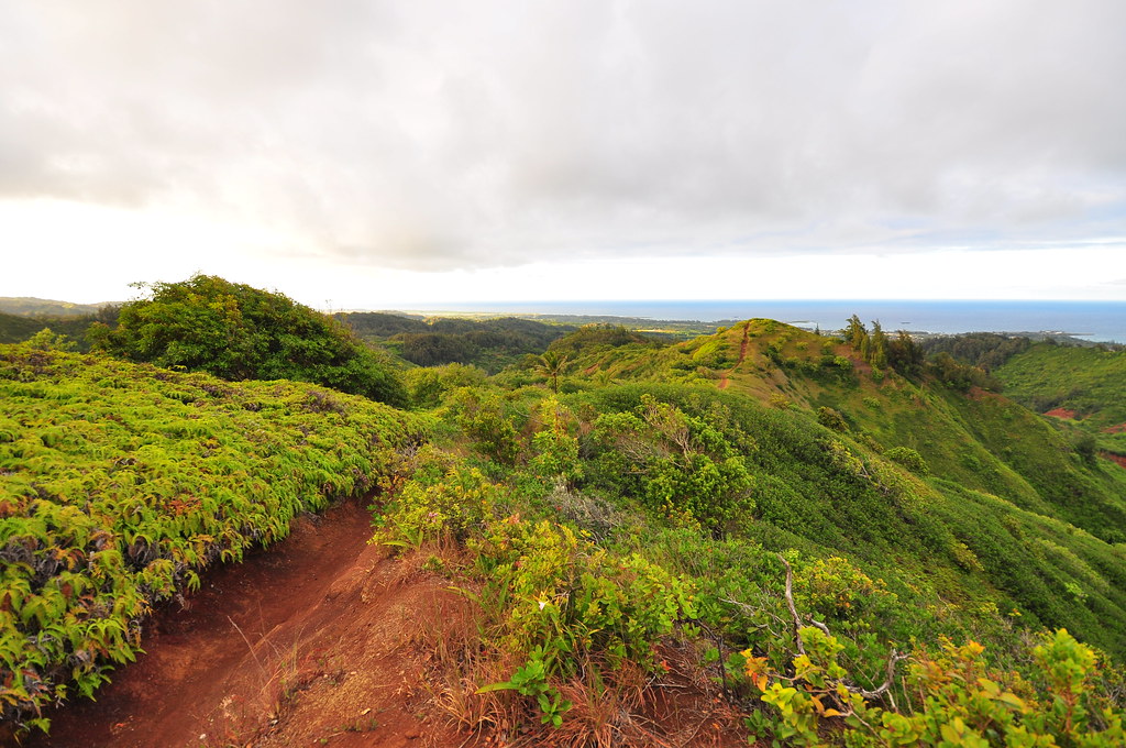
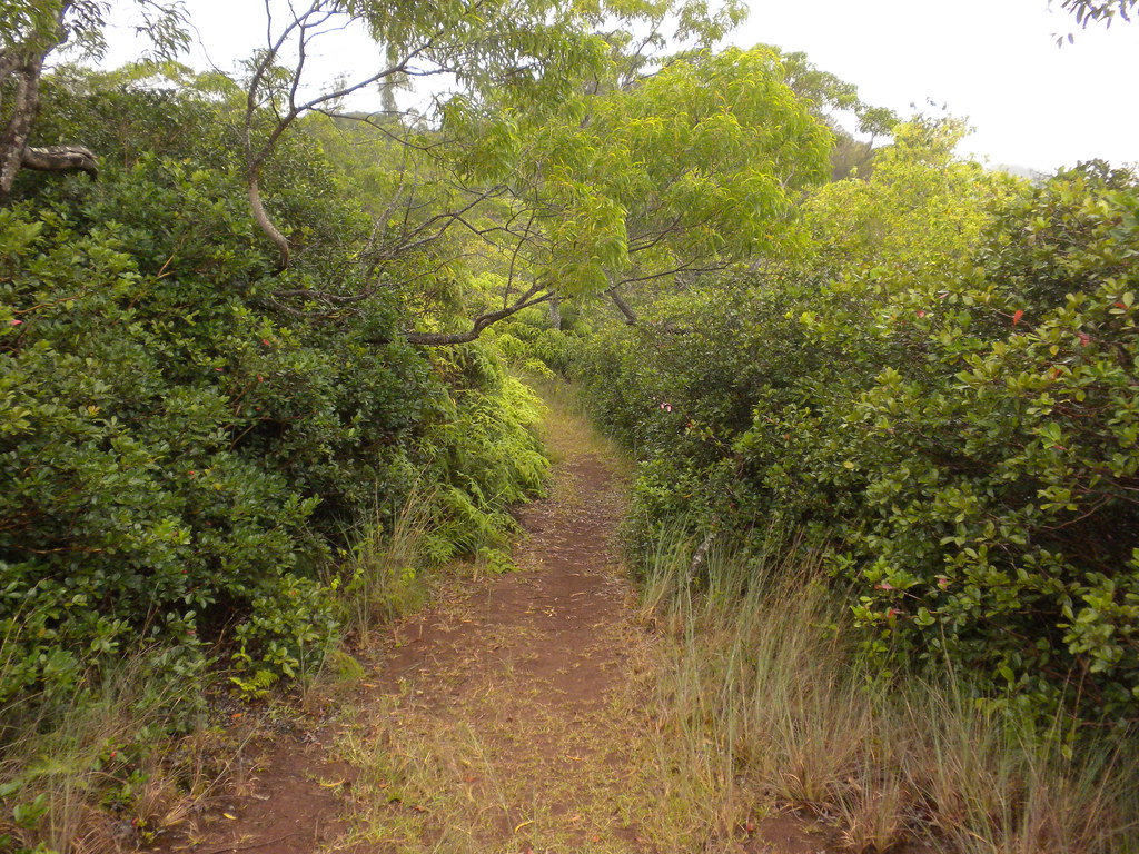
I marveled at what a pleasure this was, heading down hill on a fantastic trail, cooled by the rain. There were some beautiful sections of trail on the way down and after an hour I exited the clouds and took out the Nikon for some shots.
 |
| Beautiful La'ie Trail. |
 |
| Awesome.... |
 |
| Fantastic... |
There is an area that looks like it's being replanted with koa. I'd be curious to know what has happened here because it looks like all the ohia was killed. Why you'd kill one native to replace it with another is beyond me.
 |
| Koa planting area |
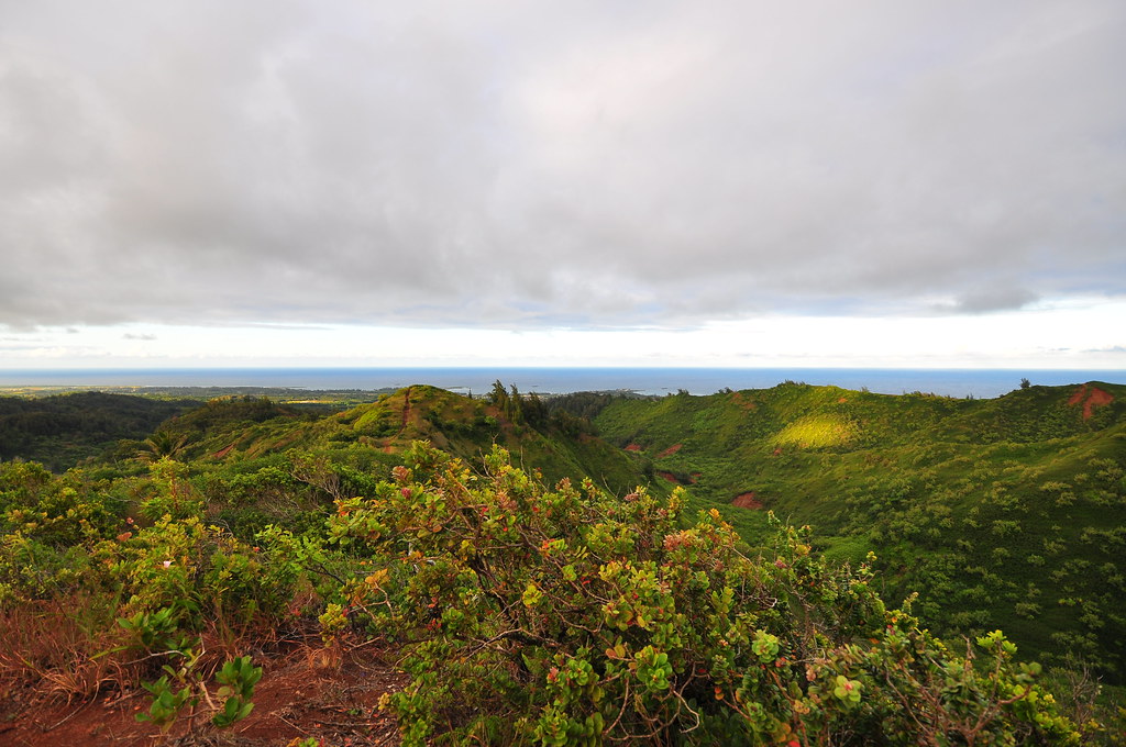
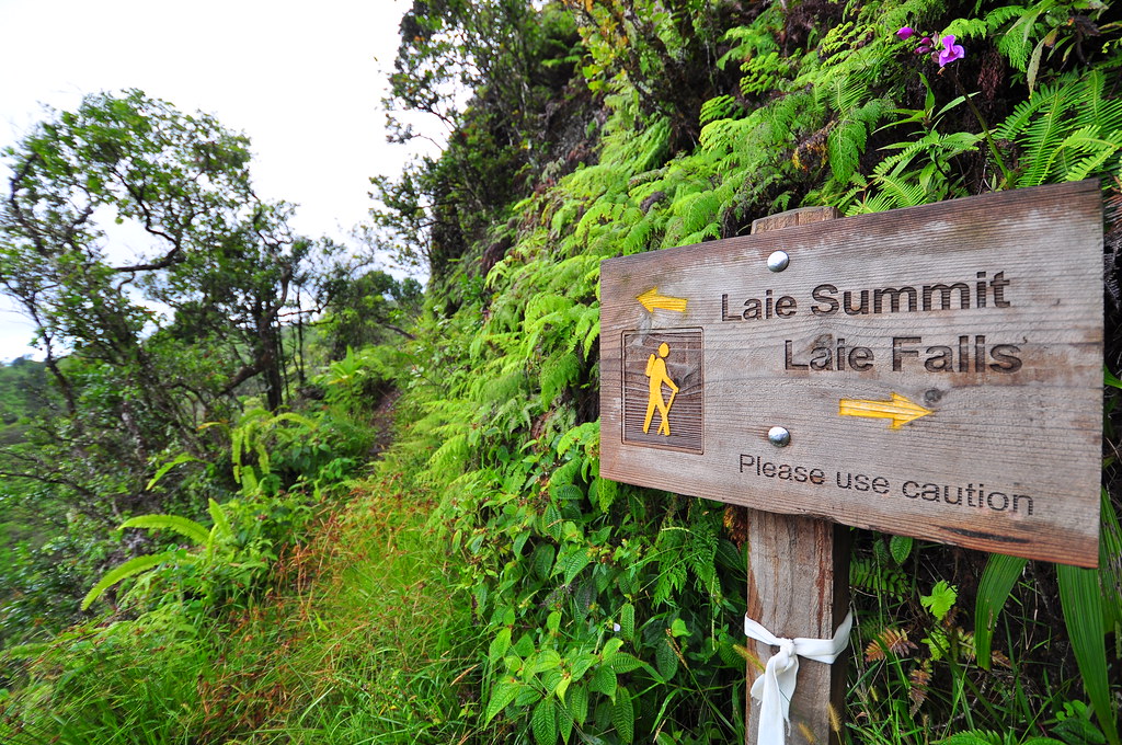
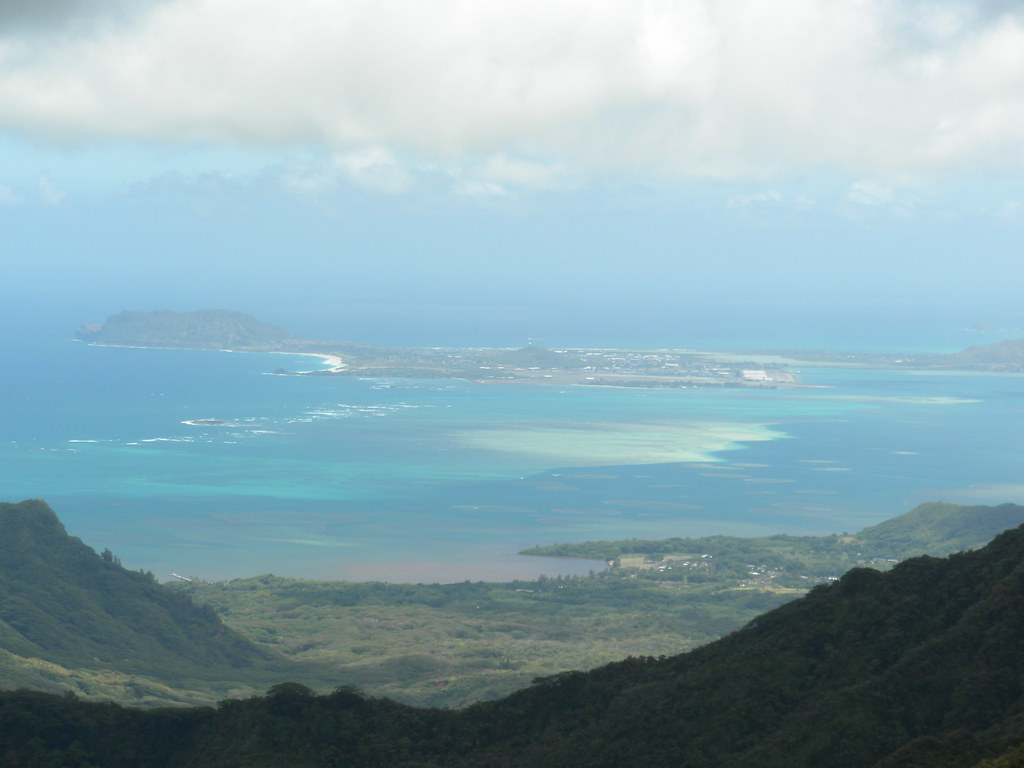
I entered another area of strawberry guava as the trail lost elevation and passed the junction with La'ie Falls Trail at 5:40. Hat's off to Hawaii Reserves Inc. for the great signage. I hope people can manage to respect them enough not to trash them- or, more realistically, that they're far enough up that the type of people who do things like that are too lazy to get to.
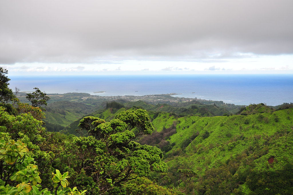 |
| La'ie |
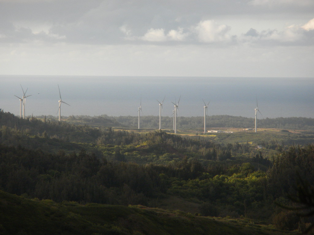 |
| HECO experimental wind farm at Kahuku. |
Keenly aware that sunset was at 6:58, I'd picked up a lot of speed by now and departed the grove of Cook Pines at 6:40.
Earlier I'd heard the very loud bird calls from a ridge east of the trail. It was very loud and sounded like a pretty big bird. As I walked through the pines the bird flew by out of sight so I never got a look at it. I took out my phone for some quick video hoping someone else could identify it by the calling. No luck so far figuring out what kind of bird it was. My personal theory was it was a pterodactyl that eats hikers who don't get off the ridge by sun down.
From there the number of trails and roads got a little sketchy but I manged to get to the bottom of the trail and out to the road and to my Jeep at the La'ie field a little after 7pm- about an hour earlier than anticipated.

What had started out as a lazy day of sleeping in had turned into a bitter test of my will to keep going. I feel a little bit bad about having to just bang out the miles without taking enough time to explore and enjoy but I have no one to blame but myself for electing to add mileage and decrease the time to do it in. Next time I do Malaekahana I'm getting an early start because it's brutal in the early afternoon sun. Another thing I've really learned to appreciate over the last few months are the fantastic CCC trails. Graded ridge trails are a real pleasure and make hiking in the Ko'olaus more like touring. Not that I don't enjoy a challenging ridge trail like Pauao or Aiea but these seem a little less intense and more relaxing- especially after the battle up Malaekanana. I can only imagine how they looked when they were new and maintained. If these were ever resurrected to their former glory... wow!
More pictures from
this trail and others I've done can be seen at
Flickr. Aloha and mahalo for reading.
 |
| Ohia thriving in the arid lowlands above La'ie |


