Thursday, February 24, 2011

KSRT: Makapu'u to Mariner's Ridge


February 22, 2011 KSRT:  Makapu'u to Mariner's Ridge


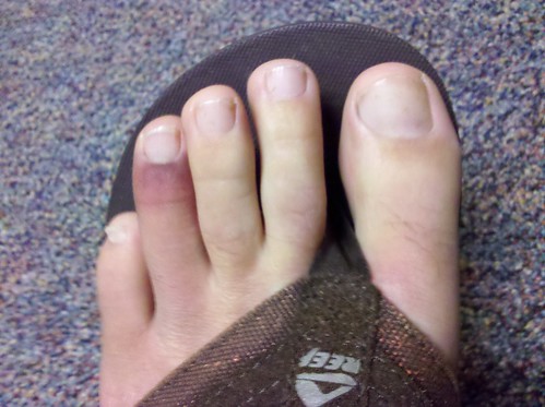
My toe a couple days after I broke it.
I was more than a little annoyed at work this week watching a huge radar return hover southwest of Kauai.  It wasn't that this great big weather system was causing me any grief with inbound flights to Honolulu, it was that I KNEW it was WAITING for me to get off work Monday afternoon so it could swoop in and ruin my days off and force me to cancel my weekly Tuesday venture in the the mountains!  To further complicate things, I'm pretty sure I broke my toe this week on one of my trips up Ka'iwa Ridge.  Sure enough at 2:30am this morning I was standing on my front porch in Kailua unable to see the silhouette of the Ko'olaus.  My hiking partner who'd been out with a knee problem for the last couple weeks emailed me just before 3 am saying it wasn't raining on his side so we went with Plan C- head for a dry area.   Hasty plans and shoddy research was done and in keeping with our goal of completing the KST from Mokapu'u to Konahuanui we decided we'd do Makapu'u to Kuli'ou'ou leaving us with just one section incomplete.

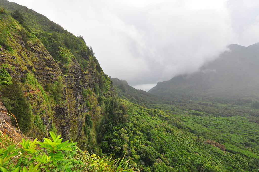
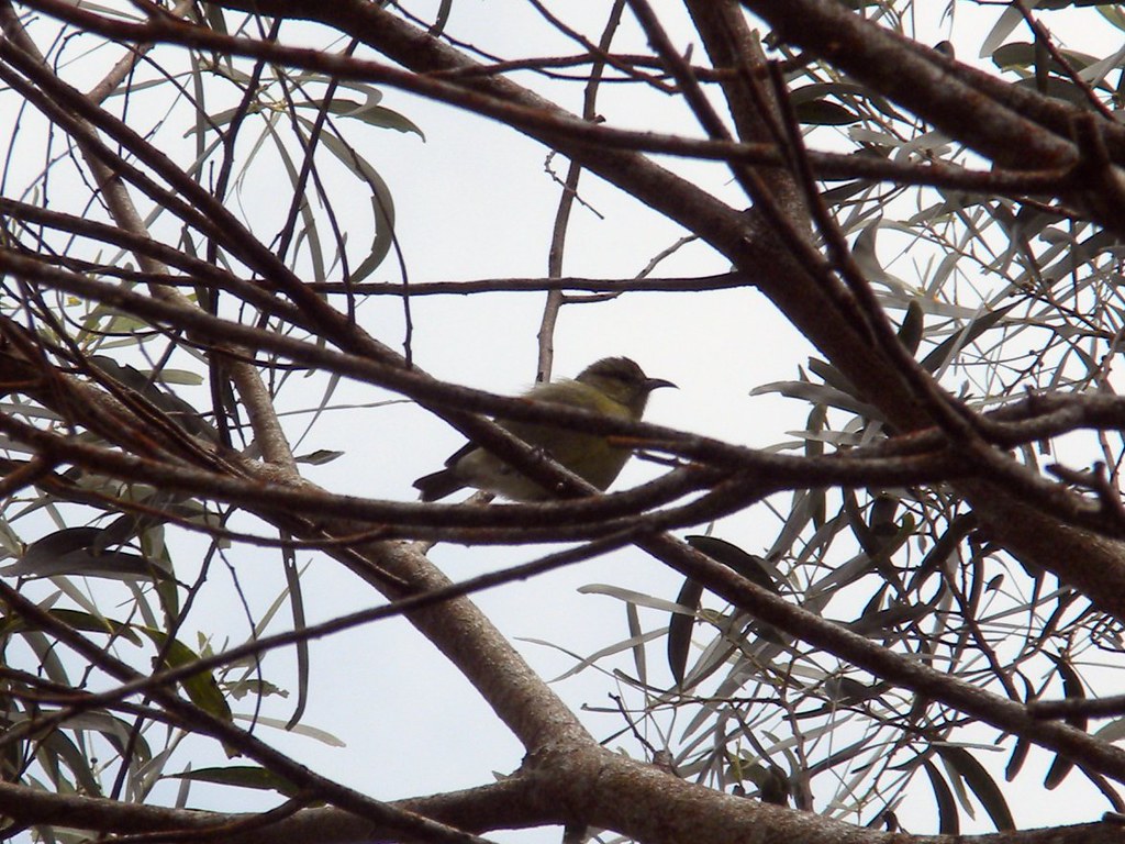
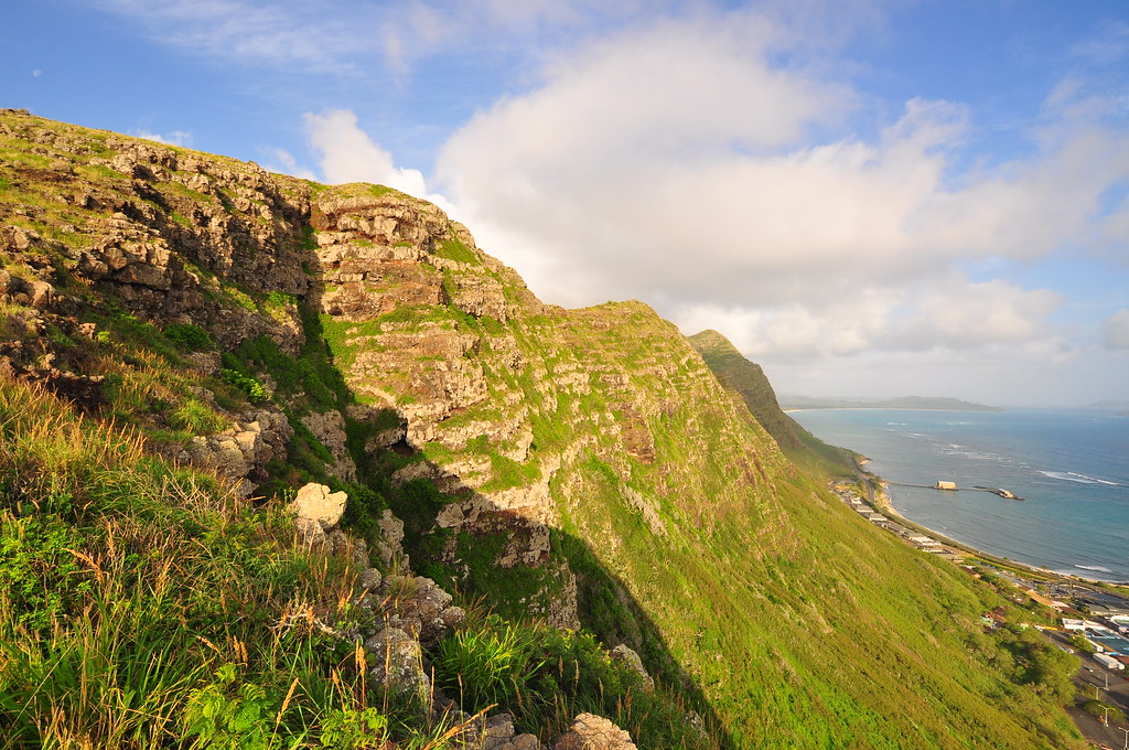
We agreed to meet at the Costco Parking lot in Hawai'i Kai at 6:30 but traffic was bad from town so my partner arrived a little after seven.  We dropped a car off at the trail head of Kuli'ou'ou which was shrouded in clouds and headed to Makapu'u.  Some time after eight we crossed the highway and started up the ridge following a chain link fence. The views were amazing in the golden morning light.  The initial climb along the fence was quite reasonable and where it ended we could see the anchors that hold much of the chain link and cables the state is using to control rock falls onto the highway below.  We paused for a while to check out the view and I snapped some shots of the landscape.  This part of the trail was filled with coastal vegetation and the entire trail was alive with butterflies.

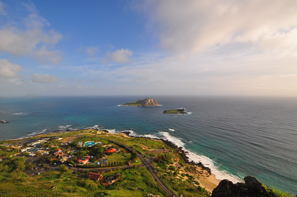
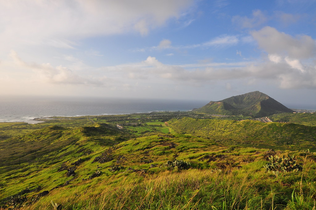
What had initially looked like a bad day for hiking was shaping up to be fairly decent.  A little haze and some high clouds but no rain!  Continuing along the ridge we climbed above Sea Life Park and the sounds of a seal barking below drifted up.  So far the climbs were pretty tame and the rewards great.  As we topped out at the first peak we discovered that as we continued we'd be giving up a lot of the altitude we'd just gained crossing above Kapalama Valley.  Easy come, easy go!

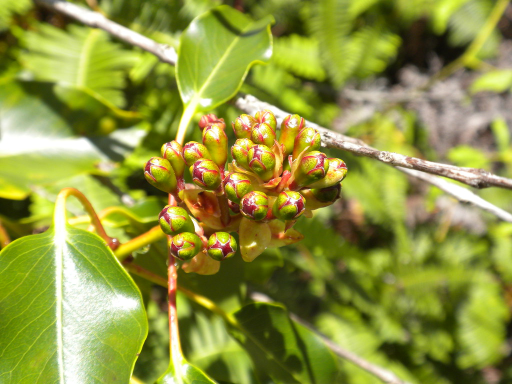
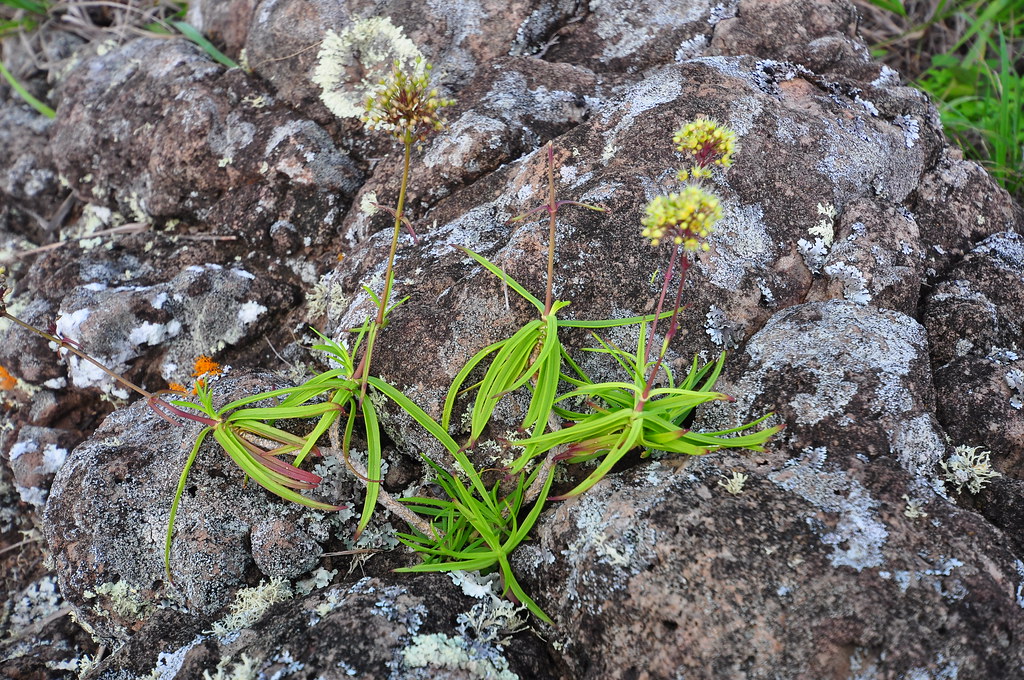
On the descent I began to notice the maoli'oli, Schiedea globosa, with it's really neat globe clusters of flowers.  I had never noticed this plant prior to doing the KST from Wiliwilinui to Kuliou'ou.  It's numbers steadily increased on this section of the trail up to and past Kamehame Ridge which would be our next stop after passing the not so greatly named peak just prior to it:  Waimanalo 2!

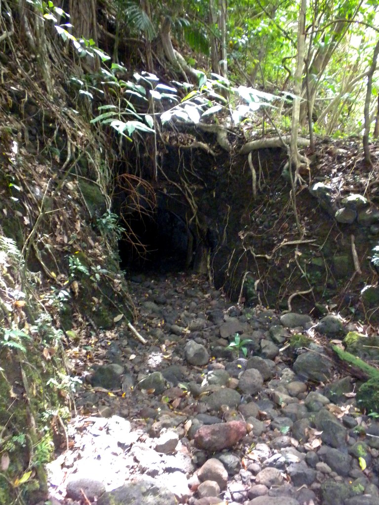
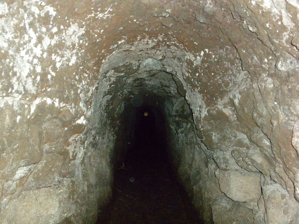
As we picked our way across the ridge we passed the Makapu'u Puka which the wind has carved over the years.  This puka is smaller than the one at the Nu'uanu Pali but the view through it is just as cool.


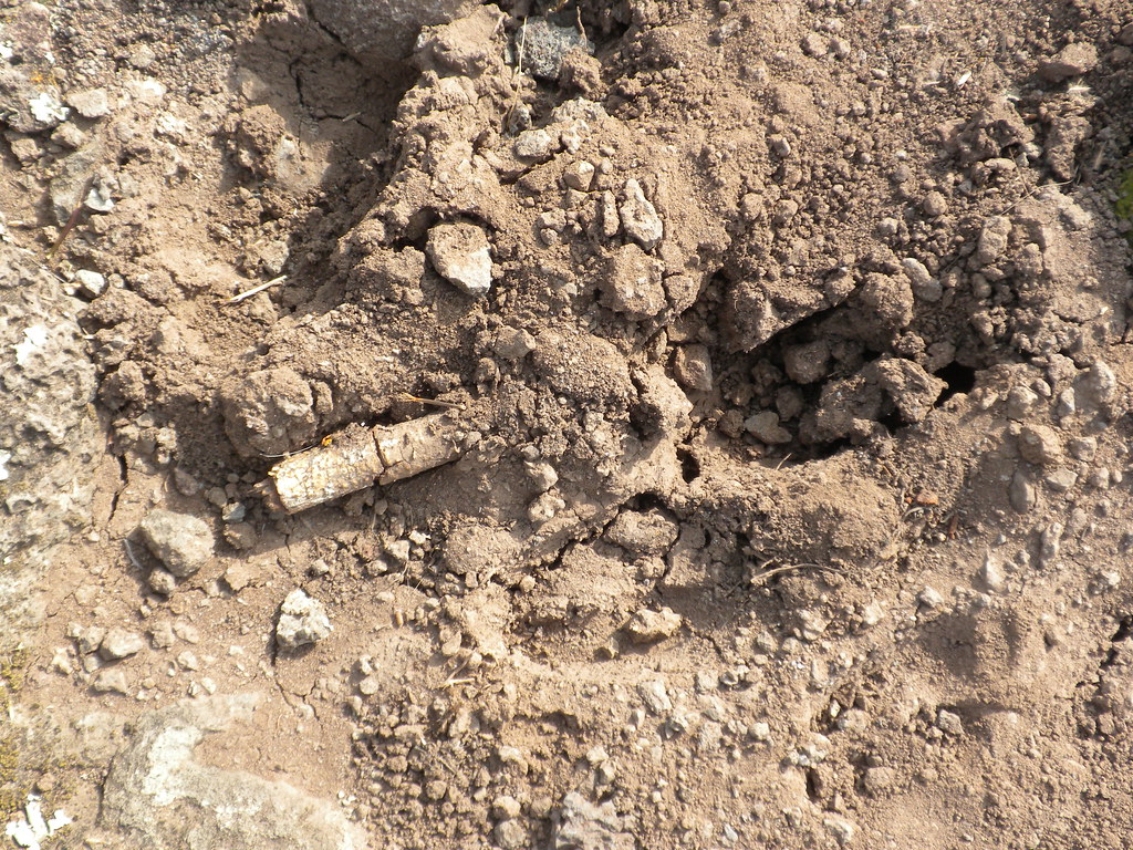
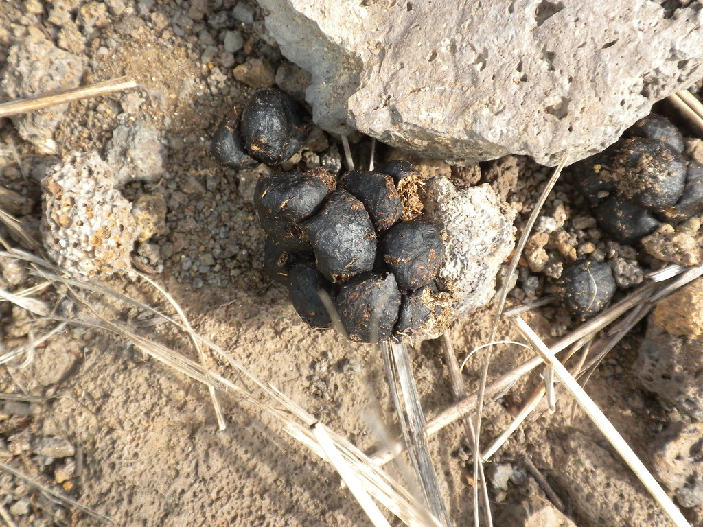
Continuing past the puka, the poo started.  I've never seen a goat up here but it sure looks like goat poo.  Further down the trail I found what appear to be goat tracks. Passing the puka the trail began to climb again so we could regain all the altitude we'd just given up.  Thankfully it wasn't super hot because of the high clouds and the trade winds blowing over the ridge kept us cooled off most of the time.  Every once in a while the trail would go to the leeward side away from the ridge and the breeze would stop meaning we'd start sweating again.

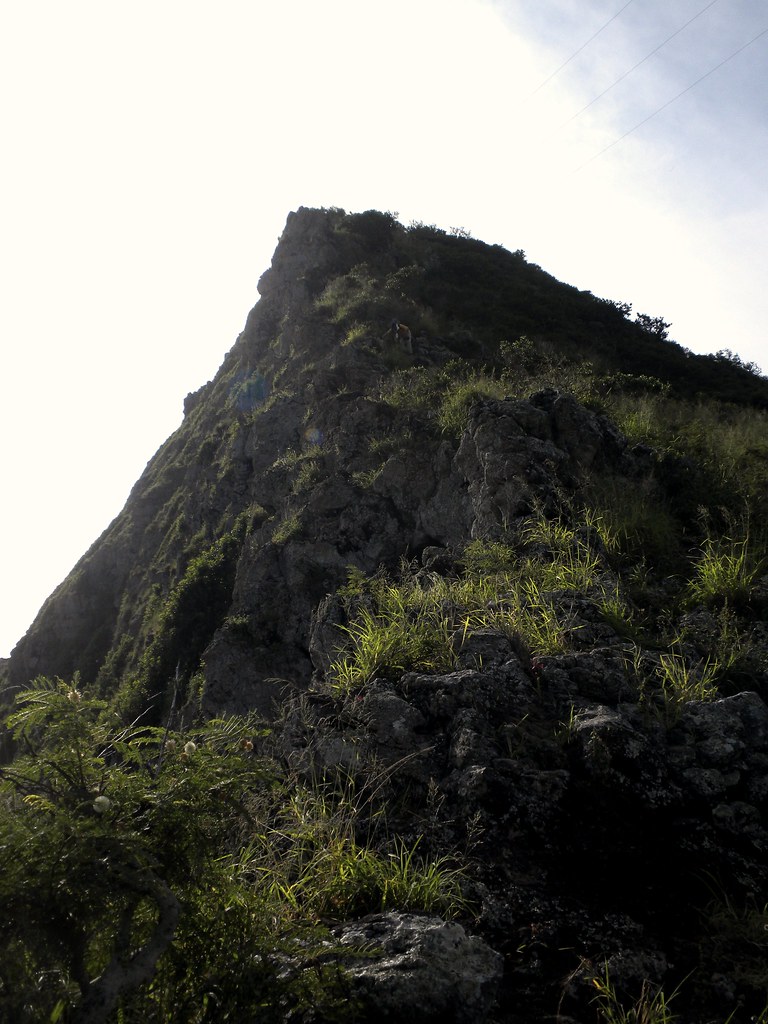
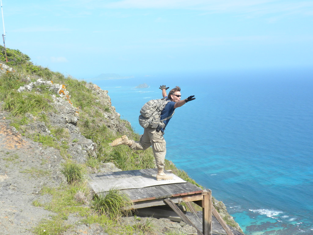
A brief level off then the final climb up Waimanalo 2 which was pretty steep but not risky at all.
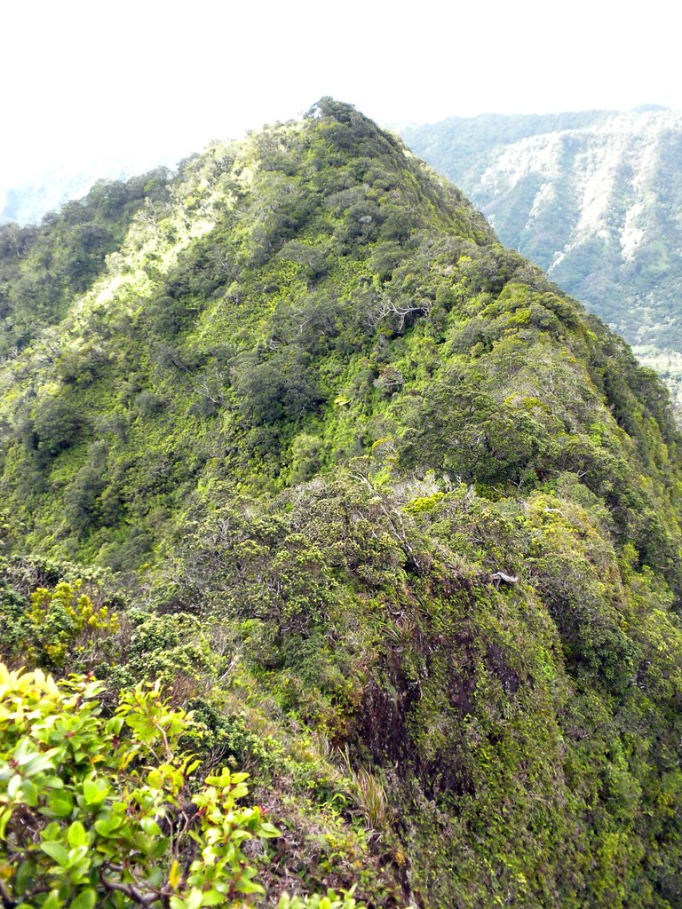
Topping out to Waimanalo 2

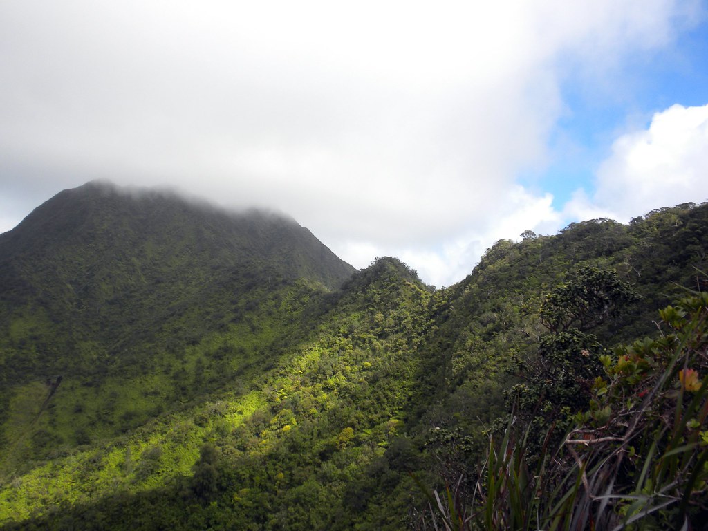
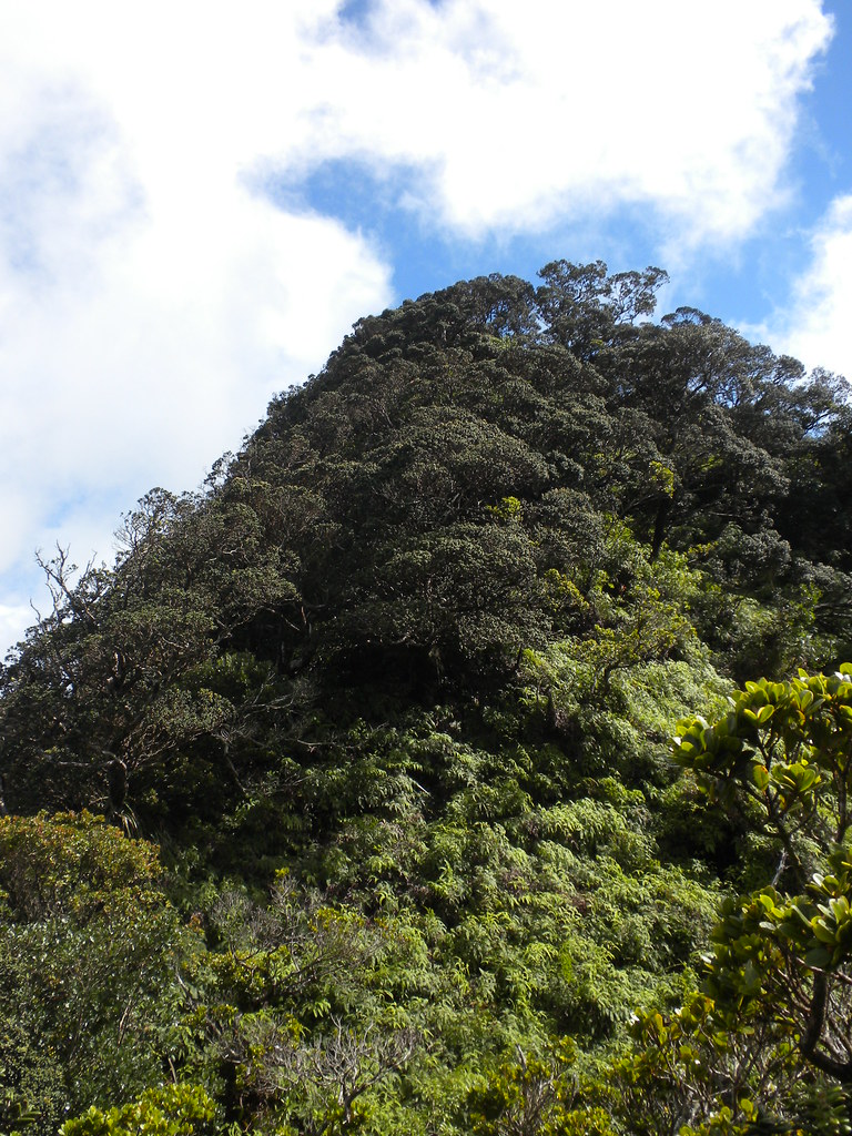
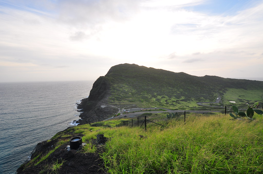
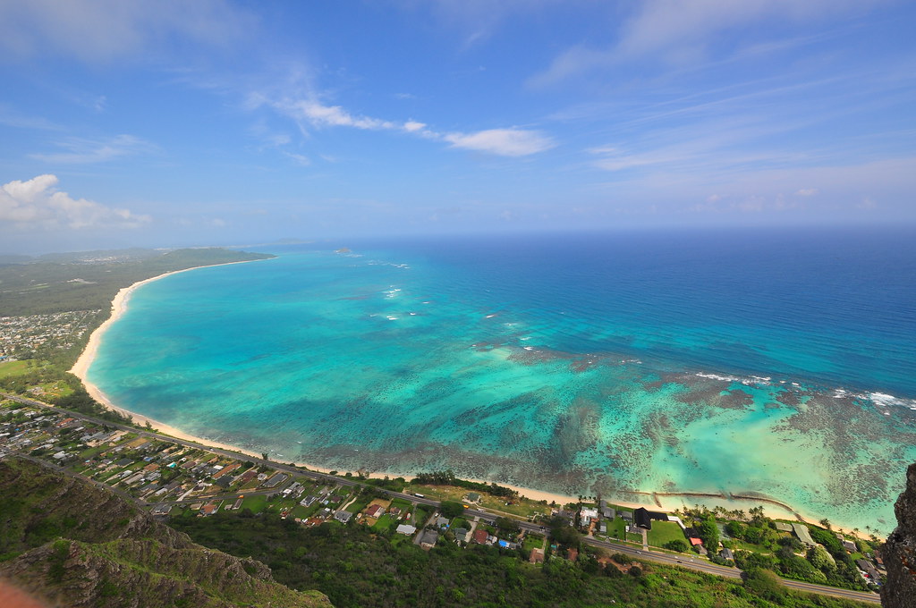
Looking back at the trail so far.  I will never whine about a roller coaster ridge again unless it looks like this.
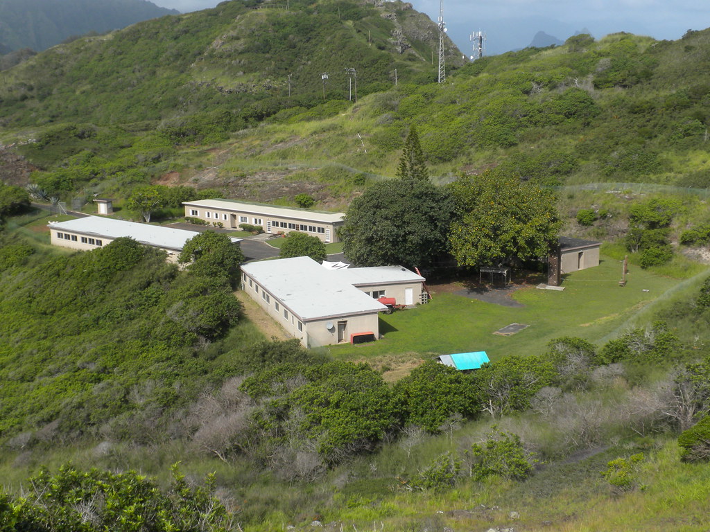
Kamehame Ridge is pretty interesting.  There are a couple buildings that were associated with the Nike Missile battery that was based at Bellows decades ago.   According to my Google search the property is owned by Kamehameha Schools and they've let an organization called Winner's Camp move into them as their headquarters.    There's a wooden hang glider launch pad a little further down the trail.  I tested it out.

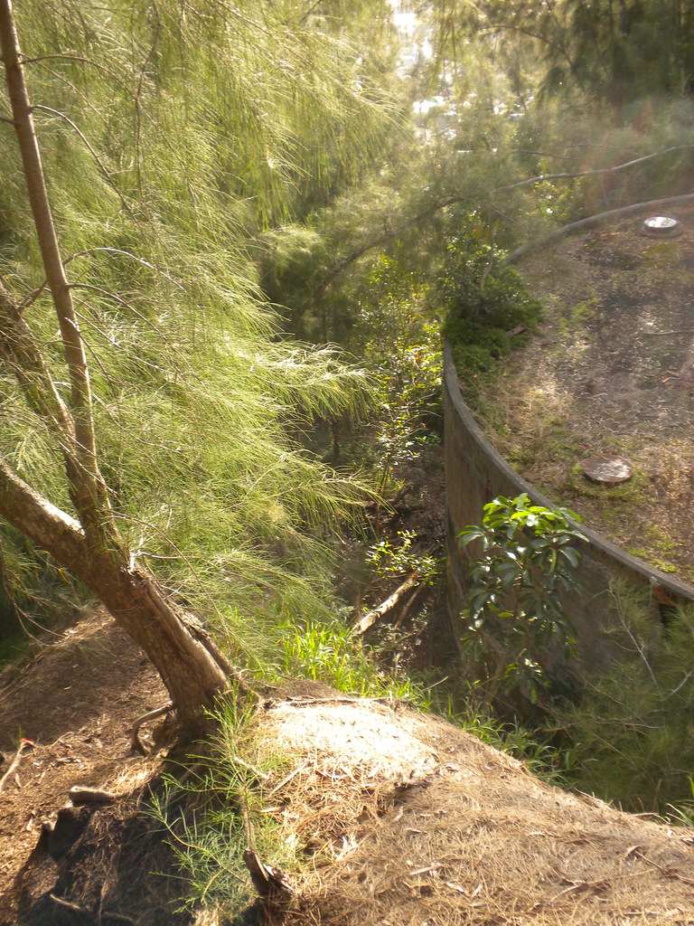
Continuing down the ridge we walked into a area where civil defense, the FAA, and others have antennas.  Due to problems with vandalism this are is fenced off.  The antenna inside are critical to air traffic control operations and entry into the site is forbidden.  The site is easily contoured around so please remain outside of the fence.
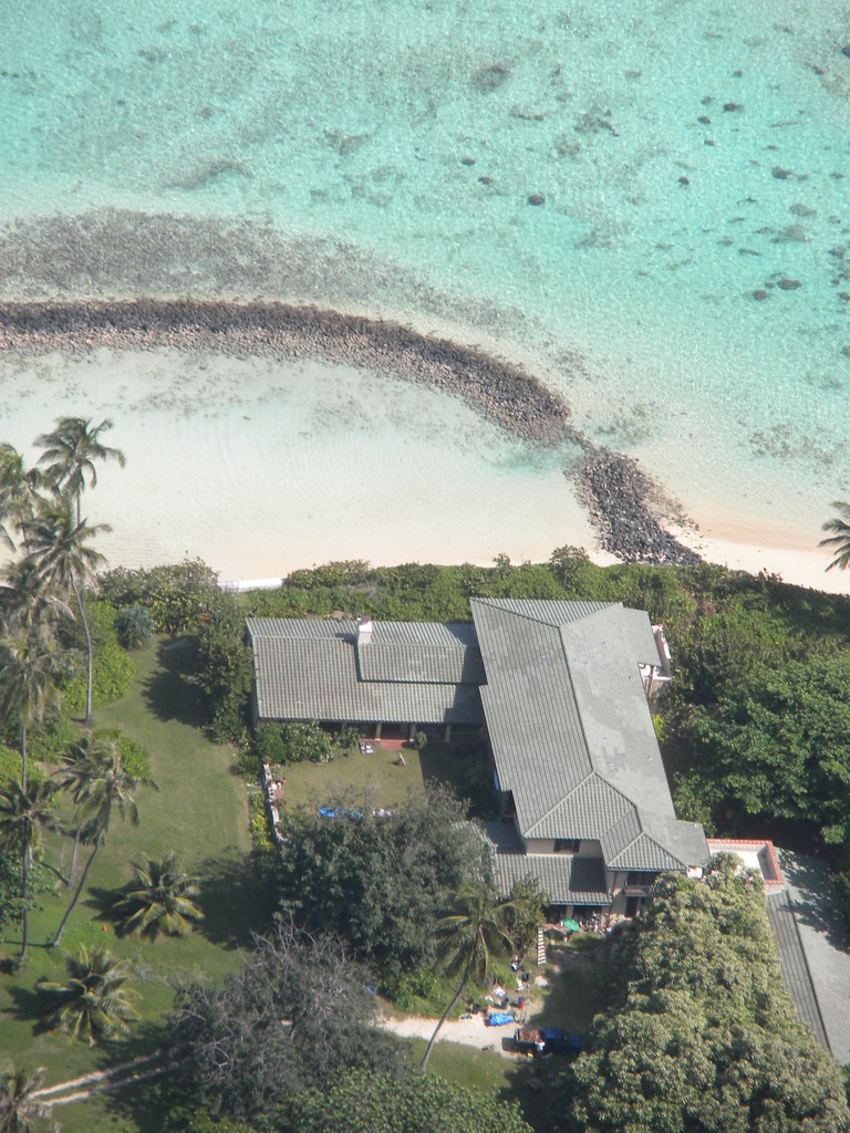
Just below is the estate used in Hawaii Five-O and, more famously, in Magnum PI as The Robin Masters Estate- Robins Nest.  

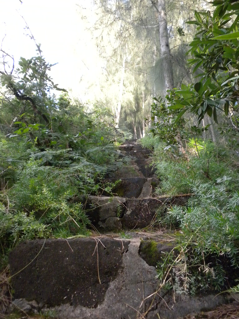
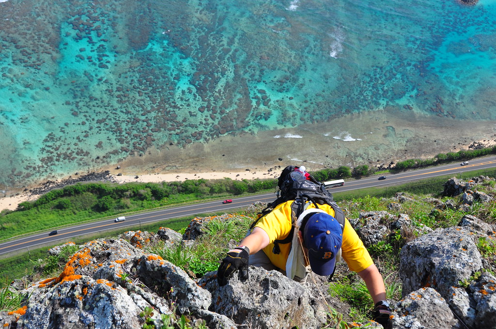
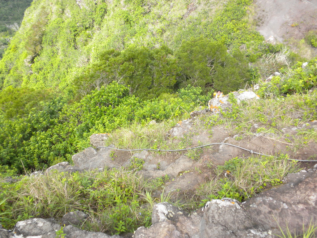
The descent down from for the communications site was steep but thanks to a double cable/strap the descent is pretty safe.   In keeping with the theme of the section we gave up most of the altitude we'd just worked so hard to get.  Gone were the views of Mokapu'u and in were the views of Waimanalo from here on out.

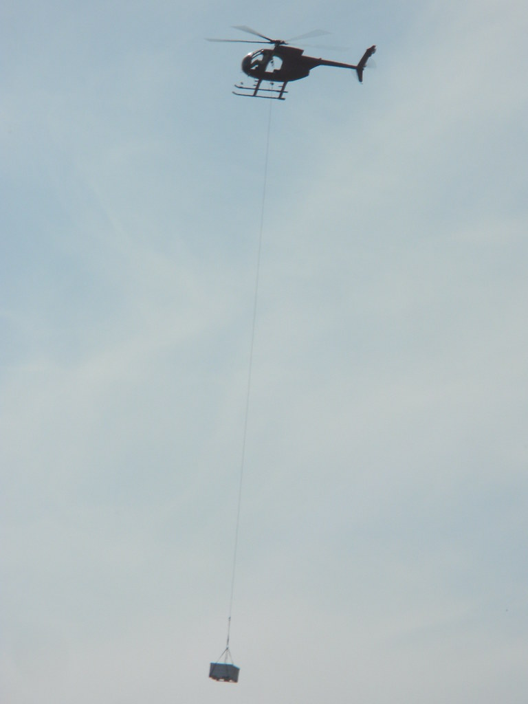
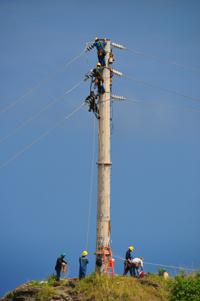
I almost forgot to mention that in keeping with tradition, Hawaiian Electric was doing some work on the lines with a helicopter.  It seems I'm always running into these guys on the KSRT.  I don't know the guy who flies this chopper personally but he's got some really great areal photos on Flickr.  The chopper made a couple trips between this pole and Kamehame Ridge while we traversed the Ko'olau Summit.  As we passed by them the HECO guys were pretty friendly even though their work had to stop with us under the lines. 
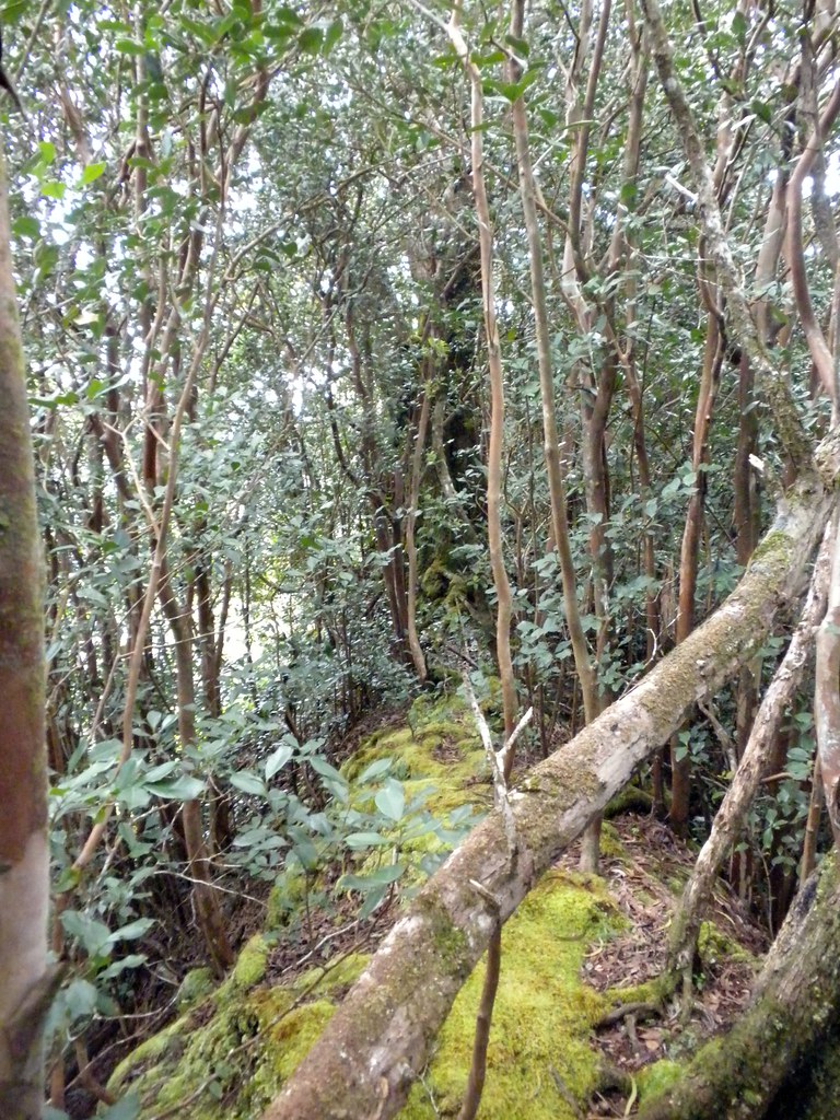
Leaving the HECO guys behind the trail continued into mostly introduced vegetation.  Christmas Berry, Iron Wood, and all their usual companions were present.  After the pu'u with the power lines the trail rolled up and down until a steeper section with a cable to assist the climb. 
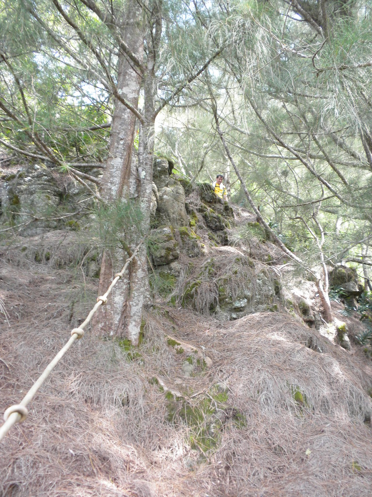
 As we descended down there was a yet another cable.  This one seemed more to help with the Iron Wood pine cones and needles that made it pretty slippery.  From here on out the trail was just a series of less pronounced ups and downs to Mariners Ridge.  As you recall the plan was to hike to Kuli'ou'ou right?  Well, on every down hill section my toe was pressing into the front of my boot which didn't really feel all that great.  Although I'd have pressed on my hiking partner's knee was getting pretty sore so, disappointingly, we bailed out and made a left turn at Mariner's Ridge.  It was getting later in the afternoon anyway...
The segment that got away...
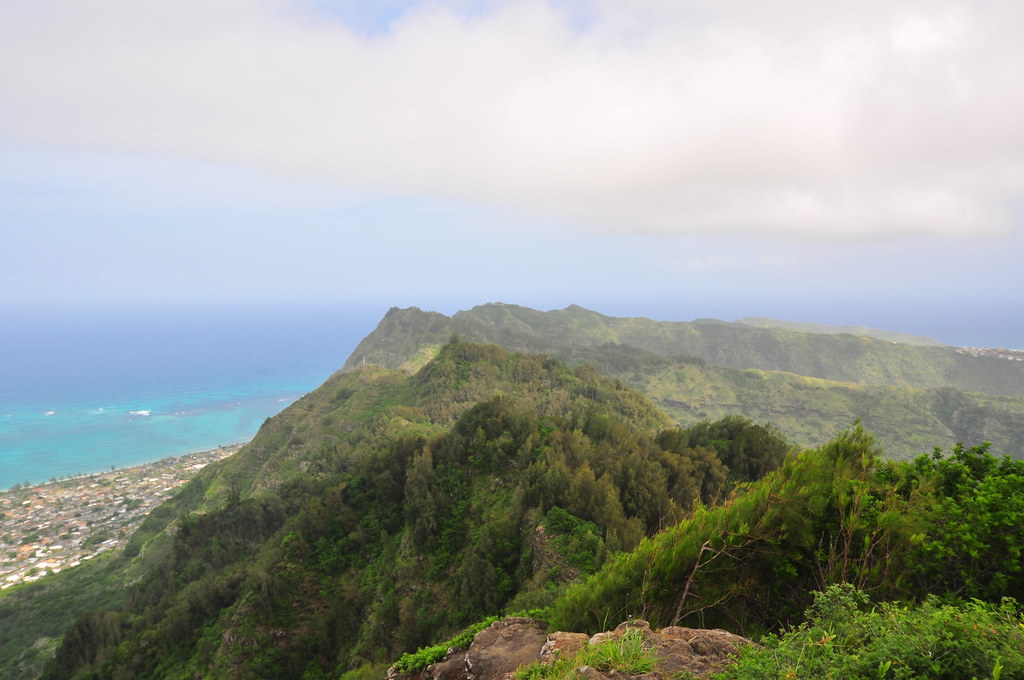
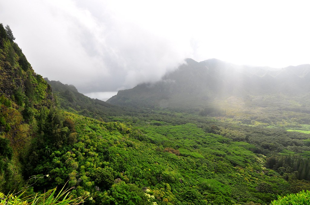
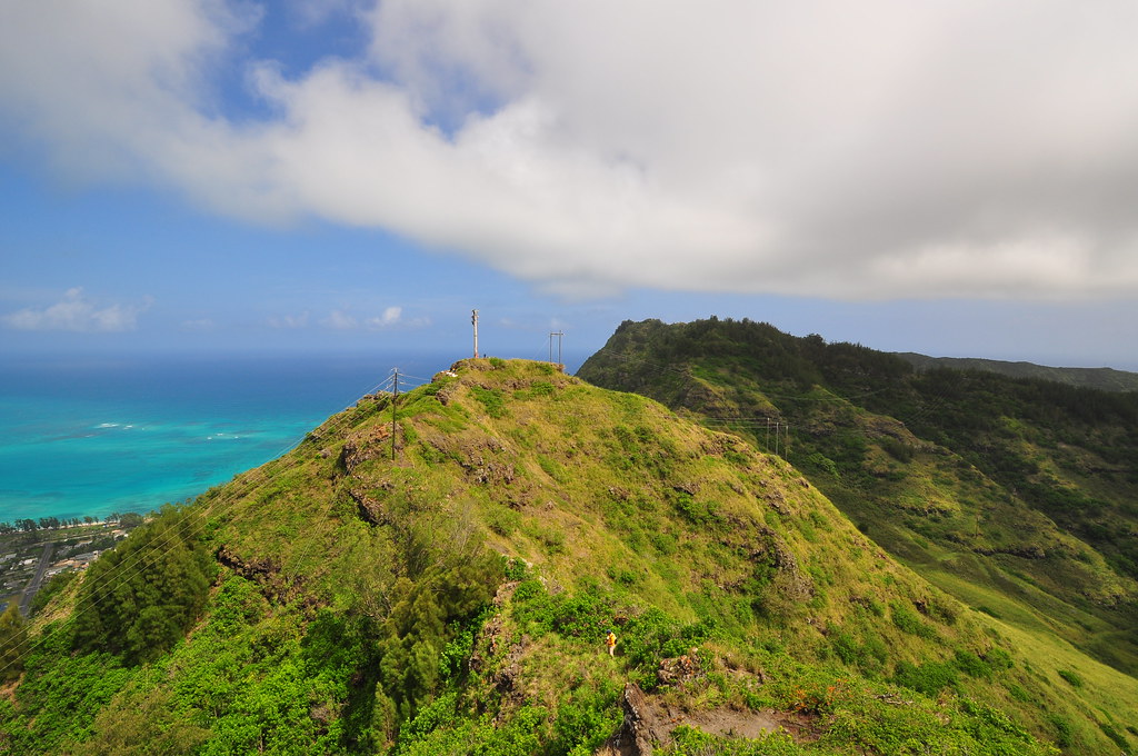
Looking back to Mokapu'u from Mariner's Ridge at the day's trail.
Last Shot of the day... 422, 22, 22
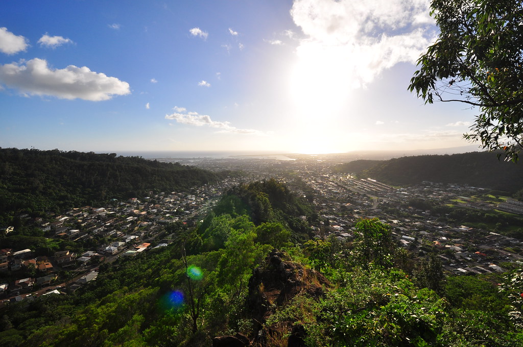
I'd never done Mariner's Ridge before.  It's a super short hike that took me about twenty minutes to get down.  I was in a huge hurry though because I didn't want to miss the taxi we'd called to take us one valley over to retrieve the car we'd left at Kuli'ou'ou.  The ride only cost us $25.00 and we headed back to the Mokapu'u Lookout to get my Grand Cherokee.  I'd been worried all day about it because the lookout is famous for broken windows and there was a ton of shattered glass right next to where I'd parked.  Thankfully the windows were all intact! 
While today's hike didn't go exactly as planned, I'm thankful that we had good weather.  The rest of the island was pretty cloudy and we didn't get a drop of rain.  The tradewinds kept us pretty cool and aside from our previous injuries the trail was trouble free.  There are tons of ribbons to follow and the trail is very well defined most of the time anyway.  While the trail is a really great workout I think I'll skip the last part after the power lines next time.  It's really not all that great and I think the Tomtom trail is the way to see this part of the island. 
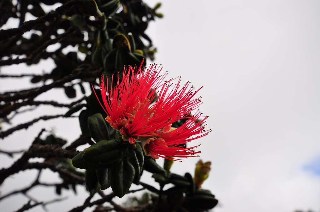
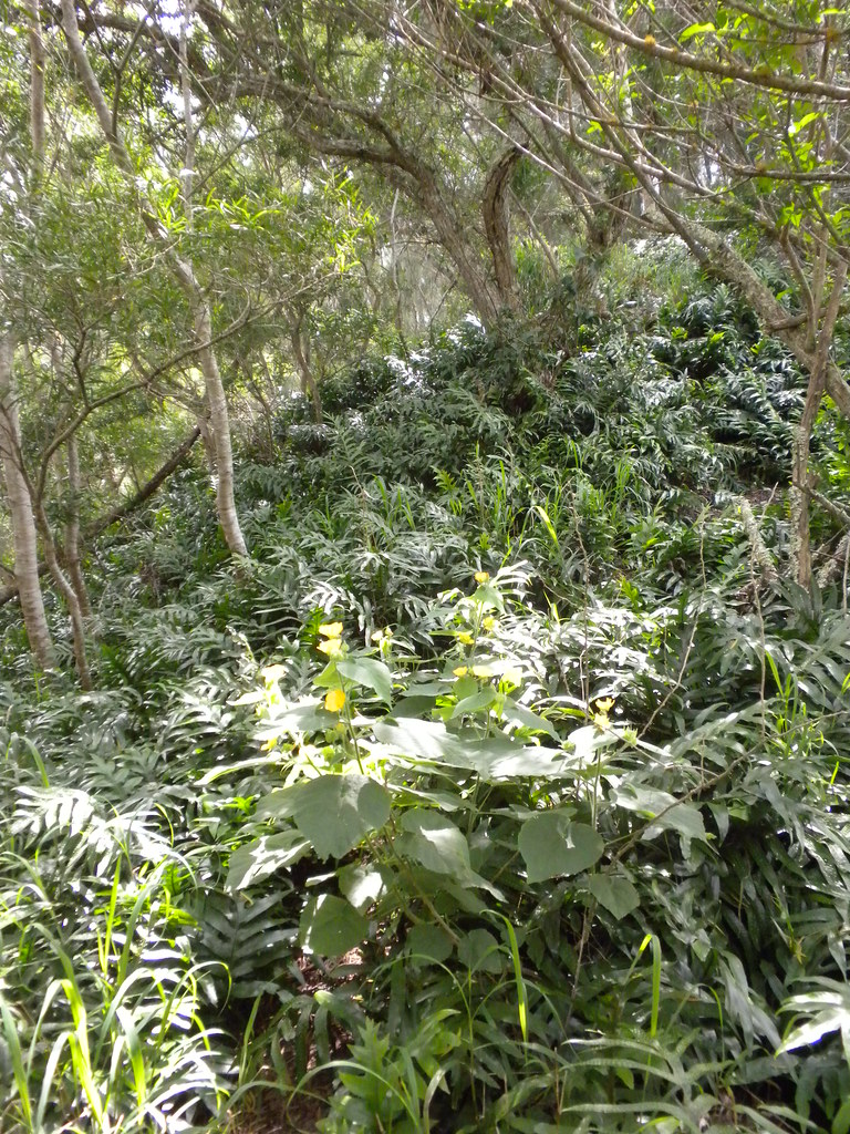
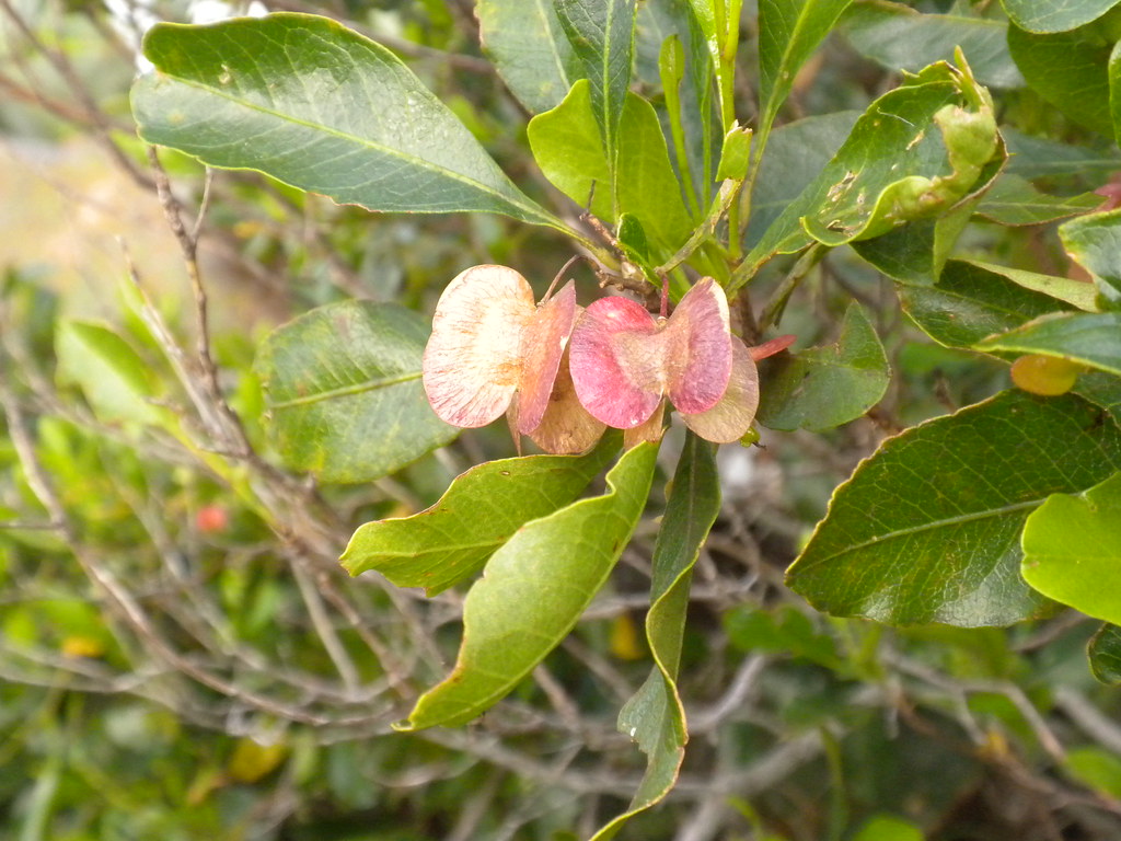
Maʻoliʻoli


More pictures of this trail and others I've done are can be viewed  Flickr.  Aloha and mahalo for reading.
'A'ali'i


Tuesday, February 15, 2011

Nu'uanu Scouting

February 15, 2001 Nu'uanu / Mo'ole Scouting
Another solo mission into the Ko'olaus today.  Might be another week until I have a hiking partner so I thought maybe today would be a good chance to scout out a couple trails I've been thinking about over the last week.  For some reason I'm still stuck on the Lanihuli area.  Lanihuli is beautiful although not quite as spectacular as Konahuanui.  However, it seems more remote considering the amount of distance I have to travel to get to the actual Lanihuli Trail.  Another reason I'm still stuck here is because there are so many ridges that feed to the main trail.  I've only done two and there more than a couple left to try.  After the initial climb 3 weeks ago, I returned to do Kamanaiki Ridge last week, and today I was exploring Mo'ole Valley and a ridge in Nu'uanu Valley that might take me to the summit.  The red track is the ridge and the blue is the rambling path I took to Mo'ole Valley.


Round One:  Nu'uanu Valley - Ridge

I usually take a few notes and a whole lot of pictures but today I forgot my little notebook and my larger camera stayed in my backpack except for a few special shots so I apologize for the lack of details and the shortage of pictures in advance.  So here we go...

  I parked my car off of the Old Pali Road on the Ewa side of the Pali Highway sometime this morning... hey, no notebook.  With no real plan and some pretty vague descriptions of the trails I was interested in I headed off into the bushes with the usual prayer for the safety of my vehicle.  The only card I was holding was my Back Country app for my Droid phone.  It's like Google Maps but with topographical mapping and that's exactly what I'd be needing for today's explorations.

I'll be back...
As luck would have it, I immediately ran into some pink duct tape ribbons which I decided to follow.  They lead to some blue ribbons which I also followed for a while.  Part of my loosely devised plan included a trip to a tunnel which was used to route water coming from Mo'ole Valley to the Nu'uanu Reservoirs.  That's my theory anyway.  I kept veering makai because the tunnel was in that direction but decided to explore to the steep cliffs lining the valley first.  I started up a ridge and decided to see where it took me.  Then, in a rare break in the vegetation I got a view of the ridge mauka of me and decided I liked that one better.  I crashed down the little valley separating them and started working my way up the new ridge.  The vegetation continued to close in on me making it harder and harder to keep going.  My larger backpack I keep my Nikon in kept snagging on the saplings and I pushed through the dense stands of strawberry guava and other weed trees driving me insane.  I continued until I reached a spot that gave me a view of the valley below and the ridge above.  The ridge looked pretty manageable all the way up from there but the clouds were moving in and with my backpack driving me crazy I decided to mark the spot with a waypoint and track the trail back down to the car where I'd regroup and head for Mo'ole Valley.  Slipping, tripping, cursing, I pressed down until I got back down through the worst of the brush. Finally, the more open forest near the road appeared as I approached the car.  I paused to regroup and charge my phone for a while before pushing back into the brush to see about getting to Mo'ole Valley.
Clouds rolling in and a couple sprinkles convinced me to retreat.
Check out those cliffs...
Round Two: Nu'uanu - Mo'ole

Initially things were pretty smooth.  Following the topo map on my phone I wandered through the understory until I came upon a black tarp shelter set up in the trees.  I reversed course quietly and swung around it from a distance not wanting to know anything about it.  Then I discovered some plastic pots stacked together.  I'm going to guess and say that it wasn't someone engaged in a private native forest restoration project who left them behind.  I decided I'd had enough of the pakalolo growers habitat and moved back to the road and walked out onto the Pali Highway.

 A short walk down the busy highway later, I spotted a concrete ditch that was obviously part of the system I'd be following so veered off the road an into it.  I followed it for a while ducking fallen bamboo, branches, and debris until I saw a chance to move onto what looked like a trail.   From here on out I followed what I assume are hiking, pig, and hunter trails.  I reversed course a bunch of times trying to find the easiest way to the tunnel that would bring me into Mo'ole.  Finally I found the stream and the ditch I needed to follow.  Too bad I was in the ditch and didn't realize there was nice trail running shoulder height off to my left paralleling it!  I ended up missing the tunnel and following a trail that crossed the ridge and deposited me at the other end of the tunnel.  Sigh.  From here I continued up the stream to a small waterfall, then to a big waterfall.  


Mo'ole Entrance


There was an inviting looking trail to my left with some orange ribbons but after a while I lost the ribbons and decided to call it a day.  Back at the tunnel I decided that it would be far shorter to take it than climb back up and over the ridge so out came my flashlight and into the tunnel I went.  It looked a lot smaller from the outside but once inside I could walk hunched over pretty well.  It's not terribly long but the sound of nothing but water dripping from the ceiling and being able to see my breath in the cold, dark, damp tunnel wasn't exactly comforting.  I picked up speed and was soon cruising on the trail along side of the ditch this time instead of in it.  Eventually the trail got fainter as I approached the Pali Highway again.  I decided I'd head for the highway and figure out how to deal with the fence when I got there.  After a whole lot of searching and back tracking I ended up hanging my pack on the fence and doing some acrobatics in a tangle of Hao trees to get over it.  As luck would have it, not 5 feet away, but hidden by the bushes where I had been, was a downed section of the fence I could have walked over trouble free!  A short walk up the highway and back down Old Pali Road to the car, thankfully intact, and the day was over.
Pig Wallow
Ribbon collection. 
Today wasn't exactly a glowing success with a summit top or ridge trail but hopefully it laid the foundation for a future hike that will. 

More pictures of this trail and others I've done  can be viewed at Flickr.  Aloha and mahalo for reading.

Wednesday, February 9, 2011

Kamanaiki Ridge Via Lanihuli

February 8, 2011 Kamanaiki Ridge Trail Revisited via Na Pu'eo Bypass, Kapalama Loop, and Lanihuli Trail. 

Back in November of last year I made a mistake.  Early one Sunday morning the weather looked great and I had an entire day to go and do whatever I wanted.  I headed out the door with Stuart Ball's Hiking O'ahu book and as I filled up my car at the Shell station in Kailua I flipped through the pages trying to find a hike to do.  I ended up on Kamanaiki Trail.  I didn't read the entire description and what followed was a frustrating, hot, and miserable afternoon wading through uluhe ferns and encased in seemingly endless strawberry guava.  As I made my way up the ridge that day I figured I would hit the ridge running up to Lanihuli from Alewa Heights.  Visions of me on top of Lanihuli pushed me deeper and deeper into what was obviously a neglected trail.  Finally, tired and miserable I did a Google search for Kamanaiki Trail and came up with Dayle Turner's description.  Realizing that the normal trail had ended a while back I threw in the towel and reversed course.   I learned a pretty valuable lesson from that hike- know what you're getting into.  Now I try and read at least a couple write-ups on trails before I do them so I don't repeat that experience.  I didn't have much nice to say about this trail when it was all over when I last reviewed it.

Na Pu'eo Bypass Trail
Happy ribbon
Last week I did Lanihuli and saw how close I had actually been to finishing Kamanaiki Ridge that hot November day.  Today's original hiking plans had been canceled due to the bad weather but the rain had stopped and the sun was shining.   By 9:30 I was already bored and knew I couldn't stay home now that the clouds had cleared.  With my recently gained experience with the Na Pu'eo Trail, Kapalama Trail and the Lanihuli Trail it was time to pay Kamanaiki Ridge another visit.
The trail began at Na Pu'eo Park in Alewa Heights at 10:50am.  I headed straight for the trail I had spent an hour looking for last week and followed my new ribbons up to the Kapalama Loop Trail.  The only change from last week was that the ground was gooey from the recent rain.  

Nu'uanu Valley and O'ahu Country Club
Ohia budding (M. Macropus)
Even my panama sole jungle boots were choking on this stuff!  About 20 minutes later I arrived at the Kapalama Loop Trail junction.  I dropped my gear and ran down the loop trail to retrieve the ribbons I had placed last week when I missed the Na Pu'eo Trail junction and ran back to my pack.  Since I'd been on this trail so recently I didn't spend much time taking pictures or looking at things.  I did note the damp smell of eucalyptus hanging in the air though.  The later start also had me moving a little quicker because I didn't know how much time I'd need to come down Kamanaiki Ridge and I really wanted another shot at the summit of Lanihuli.  Two hours after I started I was at the big gnarled koa tree where the Lanihuli Trail started.  It was now 12:47pm.  I sat down on the ancient tree and thought about my options.  There was also that HMTC trail down to Nu'uanu valley I could do which would probably be shorter than the Kamanaiki trail and that might even allow for enough time to get to the summit.  Then again, a new trail at the end of the day with only the barest of descriptions didn't seem like a great idea either.  Sitting on the tree wasn't getting me closer to the top so I continued up the trail after catching my breath.

'Amahiki in koa tree
The initial sections of the Lanihuli Trail were just as fantastic as they were last week.  The number of large ohia trees and the endemic birds flitting from one branch to another are hard to ignore.  I managed to get a shot of what I believe is an Amakihi in a koa tree.  The butterflies were also out in full force and I spotted two of the humming bird butterflies.  Despite my rush I couldn't help but pause here and there to enjoy the beautiful scenery around me.

About an hour and a half later I arrived at the Kamanaiki Ridge junction.   I decided to scout ahead and take a look at the summit and determine if it was possible to do both the ridge and the summit.  When I arrived at the rope section with the long double rope/cable combo I paused to make a decision.   It had taken me an hour and forty minutes to get from the summit to the top of the Kapalama Loop Trail last week and it was almost the same time I'd left the summit now.  I figured that I could make the summit and get down before dark with time to spare if I returned the way I came but going down a new trail, especially one that wasn't in good condition meant I needed a buffer.  My grudge with Kamanaiki Ridge won and I turned back to the junction.  I attached a new ribbon at the junction and crashed through some strawberry guava and onto Kamanaiki Ridge.
Lanihuli viewed from Kamanaiki.  The first dip is the double rope/cable section and as far as I went today before turning back to Kamanaiki to settle the score.
Kamanaiki Ridge 2:00pm


Kamanaiki Trail-  Looks promising right?
Initial section of Kamanaiki
Looking back up the initial descent
No discernible trail on this segment
There was no discernible trail after about 4 feet of leaving the Lanihuli Trail.  Ridges are easy though, there's nowhere to go but on the ridge so I worked my way downwards.

There was enough vegetation that I was having a hard time telling which way the ridge line was going and only 30 yards in and I was having to back track to get a better view of the terrain.

With a fresh idea of the layout, I continued back down and ended up on a steep cliff edge.  There were enough trees that I was able to keep hold of something the entire time.  Slowly and painfully I fought my way through the uluhe ferns and tangles of ohia and koa trying to do as little damage to things as possible. At one point I became completely entangled in uluhe as I slipped down a steep section and struggled to free myself from it's grasp.

Uluhe fern everywhere!
 
Leggy Ohia tree

 There were some really fantastic ohias on this ridge.  One had some serious legs on it so I had to stop and take a picture.  I kept my Nikon in my bag because I was still concerned about time and dragging that big guy out and putting it back takes too long.  I don't know how long it took me to get back to where I'd thrown in the towel in November but it felt like a long time.  Every once in a while I'd get a feeling that I was on an old trail but I can't be sure.  Later into the bushwhacking I definitely  saw signs of pig activity so the "trail' was I was seeing could have just been from the pua'a. 


Cable section where things improve a little
It wasn't until I reached the cable section that things began to improve.  At times I was up to my neck in uluhe ferns that kept untying my boots, scratching me, tripping me, and even opening up my pack.  Even after the rope section things only improved a little.  Here it looked like someone had tried to open the trail up so I picked up a little speed only to find myself immersed again.  The ridge's ups and downs continued as I fought on and entered large stands of strawberry guava.  It's pretty strange to be walking on a ridge as wide as your body
without any kind of worry because had I slipped there was so much strawberry guava I would have caught myself instantly.  
 
Strawberry Guava ridge with Koa tree.
Right in the middle of the ridge there's a huge koa tree with a truck as wide as the trail I had to go around.  Continuing onward still concerned about the time I had forgotten  about the beehive on this trail.  This time I was coming downhill and there was no warning other than the immediate flurry of activity as I passed about a foot from the entrance of their busy hive in a large tree in the middle of the trail.  I was buzzed by a couple of them but kept moving and they didn't attack. 
Face height bee hive
Eventually I reached what is the end of the normal trail, as advertised, at a large ohia and a fallen koa.  From here on out it was smooth sailing.  I could actually see the ground again!  I really started to pick up speed and barely stopped for anything.  I did pause once to check out some iliahi, sandalwood, trees but that was about it.  The sounds of Kalihi Valley intensified as I made my way back towards civilization.  Cars, chickens, dogs, and screeching tires all warned me that I was getting closer to the end.  A quick call was made to Mrs. XJ to let her know that I was almost done.  I figured I was about forty-five minutes from Manaiki St. and it would take her about that long to load up the kids and get there. 
Approaching the turn around point of the normal Kamanaiki Trail from up the ridge.
I passed the small segment of this trail that I like and tried to enjoy it a little.  Most of the end of the trail is introduced invasive stuff like christmas-berry, iron wood, eucalyptus, ect but this little section is filled with ohia although not as old and impressive as the stuff further up the ridge.  Continuing on I began to question my timing and the last thing I wanted was an angry wife waiting with to small kids so I really picked up the pace and almost ran down the rest of the tail.  Once I saw the short steep section I knew the water tank near the beginning of the trail was close.  
Top of the small climb segement looking down the remaining ridge.
The watertank
Lava rock steps
I climbed down the rocks and a short while later spotted the watertank and the hundreds of spray paint cans people use to decorate it.  The lava rock strairs started, then stopped.  I figured I should try to count them.  There are 152 continuous steps, by my count which may be a little off, with another 12 or so in another section further up, from Manaiki St to the water tank.  At about 5:30 I walked down Manaiki St and waited for my wife to pick me up and take me back Alewa Heights to retrieve the other car.


Manaiki St and the end of Kamanaiki Ridge Trail.
The most disappointing thing about the trail today was not topping Lanihuli.  It sucks to be that close to the Ko'olau Summit that I love and not get to spend some time there.  However, Kamanaiki Ridge and I have settled the score and that made it all worth it!  With a whole lot of clearing this ridge trail could be another way up Lanihuli and would take about the same amount of time as Kapalama Loop.  

Last shot of the day... back at Na Pu'eo Park


I have one more trail on this ridge to do and that's the HTMC trail up from Nu'uanu.  I'm sure I'll see the top of Lanihuli again soon.


More pictures of this trail and others I've done are can be viewed at Flickr.  Aloha and mahalo for reading.