January 18, 2011 KSRT: Mt. Olympus - Wiliwilinui Ridge
Wa'ahila Ridge to Awa'awaloa
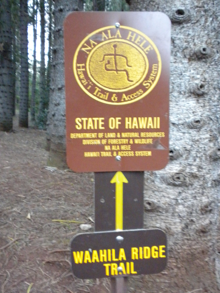 The morning began at the Vineyard St. Zippy's just after 6am. We headed straight to the Wiliwiwlinui trail head to drop a car off. Bob, the Waialae Iki subdivision security guard, and I are on a first name basis by now. I'm not sure he believes I'm not actually hiking but tending to a pakalolo patch or casing the expensive houses all day. Car one dropped, we head to Wa'ahilia Ridge State Recreation Area via Google Navigation (hey, I'm from the windward side...). We departed up the Wa'ahilia Ridge Trail just after 7am.
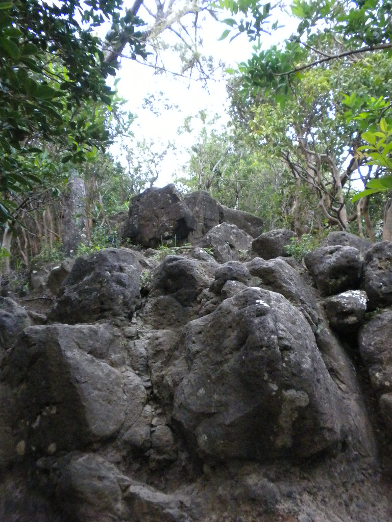 |
| Small rock climb section |
 Initially this trail starts out as dirt road sized trail through some large Norfolk Pines and soon shrinks to a Strawberry Guava choked pathway. The first downhill leg starts at a grove of Ironwood trees and turns into a dry, rocky ridge trail with tons introduced forest species like Fiddlewood, Christmas Berry, and others. This trail has received so much traffic over the years that the roots and rocks are worn smooth and almost have a sheen to them. The ups and downs include some very small climbs and descents over small rock ledges but every one of them seems to have a bypass if you don't feel inclined to use your hands. Someone found the time to carve 1963 or maybe '68 into a boulder at one of them. Graffiti that will last for the ages. Eventually we reached a fork in the trail with the customary signage begging us not to go further up the ridge but to take the left fork. According to Na Ala Hele, " This trail ends at an intersection with Kolowalu Trail. Do not go up to the summit beyond the Kolowalu/Wa`ahila junction - it is a Restricted Watershed Area. You may continue down Kolowalu Trail, which descends steeply down into the back of Manoa Valley"
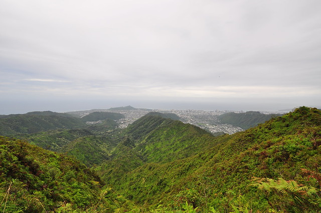
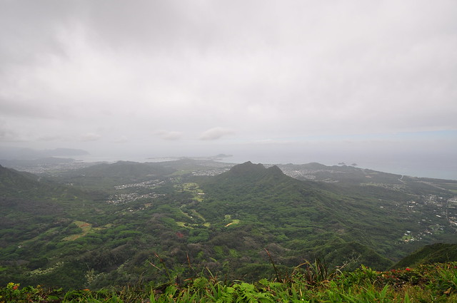
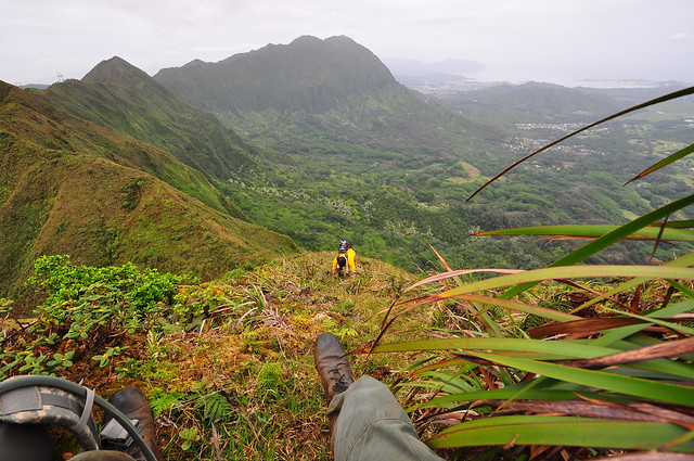
 Signage disregarded, we continue up the ridge trail. The series of climbs and descents continue until we reached the first clearing. We stopped for a few minutes and enjoyed the views of downtown.
Continuing up the trail there were some large, by O'ahu standards, Ohia trees. One of them had a huge limb across the trail that was bigger than the trunks of most Ohia on the island. I pondered how the forests had changed since the arrival of first the Polynesians and then by the arrival of the Europeans. I have yet to see any old growth 'ohia or koa forest left on O'ahu like still remain on the other islands. A few more ups and downs and we arrived at the second rest stop where we soaked in more of the awesome views of Manoa below. Not really much different than the view of the first other than town being smaller we departed after remaining just long enough to snap a couple more shots and catch our breath.
 |
| First "Rest Stop" view of Manoa Valley and Honolulu |
 |
| Third "Rest Stop" |
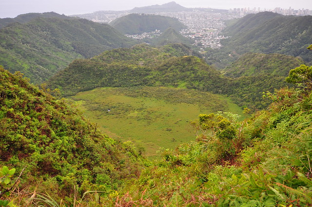
The section between the second and third rest stops felt different. The cool mountain air, quiet, smells, and the now native forest combined reminding me of the Big Island and Kilauea. Along the way we got our first glimpses of Ka'au Crater. Another steep climb took me out of my daydreams and we arrived at the third and final rest area. Not to sound spoiled but the view of Manoa and downtown was getting pretty redundant. Aside from noticing that someone had built a camp fire here not to long ago and some pig droppings we didn't stay long. The final push to the top of Mt. Olympus looked like it was going to be fun!
 |
| It won't win any awards but here's my shot of the 'Apapane |
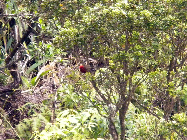
We set off on last section to the top and the view of Ka'au Crater was complete. As we made our way up what was increasingly becoming a steeper and steeper trail we spotted a pair of red birds flitting from tree to tree. 'Apapane! While estimates done in 1991 guestimated 20,000-50,000 remaining they aren't something you see every day. I quickly grabbed at my Nikon point and shoot and zoomed all the way in to try and catch a shot. What I got were 3 pretty terrible pictures. One blur, the one here where you can see a red thing in a green thing, and the last was a total fail- blurry and no 'Apapane.
 |
| Last segment to Summit |
 |
| Summit cloud forest |
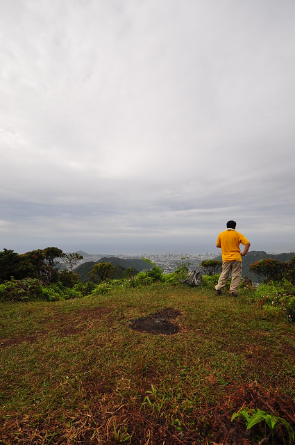
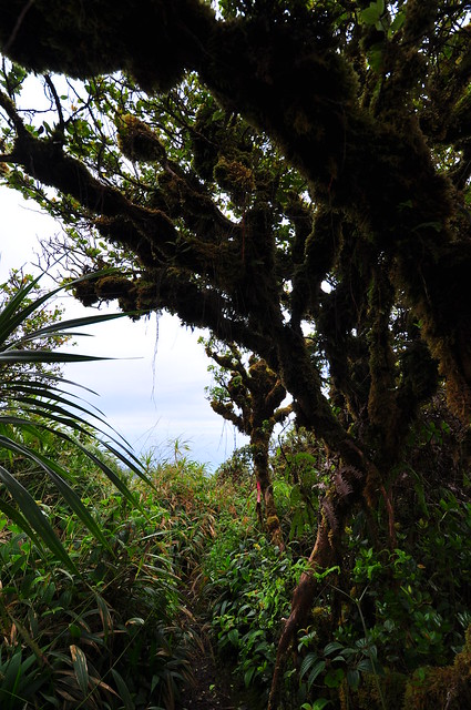
Spirits renewed with the sighting, we continued on an increasingly difficult trail. As the peak loomed up ahead it became obvious there was a fairly decent climbing section. Near the top there was a welcomed rope section which eased the climb Huffing and puffing we pushed through a summit area that included a really cool cloud forest filled with moss coated trees and arrived at summit of Awa'awaloa AKA Mount Olympus. I grabbed a shot of the view from the summit with my Droid phone and posted it with a caption "Mt. Olympus... call me Zeus" then powered off my phone in case I needed it later if we got into trouble.
 |
| Leeward View from Mt. Olympus / Awa'awaloa Summit |
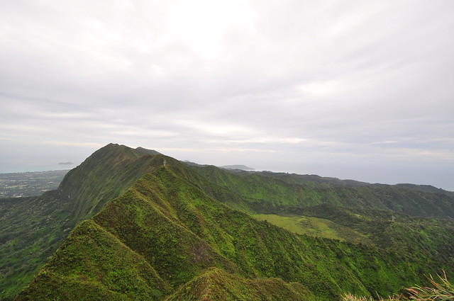 |
| Ko'olau Ridge, power line section and, Ka'au Crater from Awa'awaloa |
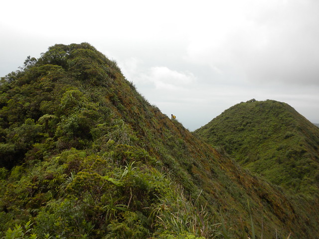
Awa'awaloa - Palikea
 |
| Working carefully down Awa'awaloa |
After we had scoped out the view for a few minutes I checked the trail ahead. It got right down to business. We had a steep descent with a big drop right away. We'd then traverse the Ko'olau ridge line to the power lines above Ka'au Cater then make the climb to Palikea. I scooted ahead on my butt down the steep decline absorbing the view of the valley far, far below and near the bottom I spotted two lobelia hypoleuca near a loulu palm. I snapped pictures of them as my partner worked his way down. There was a 8 foot section that required some real attention putting you on the narrow ridge high above Maunawili.
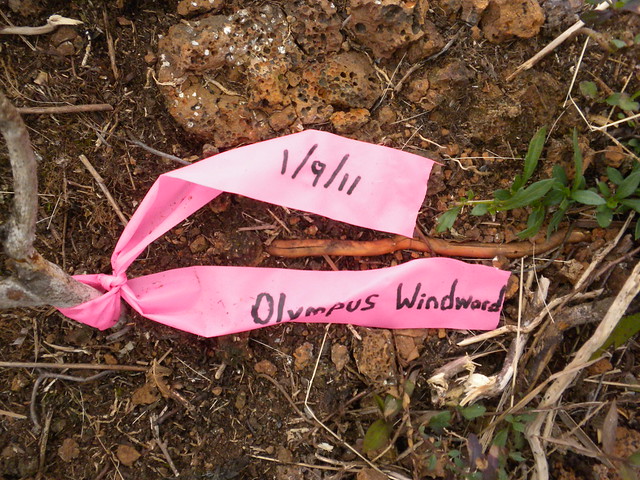 Here I made another discovery. A pink ribbon placed there by a group of pretty advanced hikers a little over a week before. They had climbed up to the ridge from Maunawili below. I'd read about it just a few days before on Hawaiian Forest. I guess when you run out of regular hikes to do you have to start making your own! I spied the trail below from the Maunawili Demonstration Trail to the base of the Ko'olaus and marveled at the climb up the ridge that they had made. Too advanced for a not so good hiker like me!
Continuing onwards we headed past the twin power lines behind Ka'au Crater. I was hoping for a really great shot of it from the ridge but the vegetation didn't cooperate so we kept moving. I didn't look very hard anyway because I plan on coming back for the Ka'au Crater Loop Trail anyway. The best I could do was this one.
Here I made another discovery. A pink ribbon placed there by a group of pretty advanced hikers a little over a week before. They had climbed up to the ridge from Maunawili below. I'd read about it just a few days before on Hawaiian Forest. I guess when you run out of regular hikes to do you have to start making your own! I spied the trail below from the Maunawili Demonstration Trail to the base of the Ko'olaus and marveled at the climb up the ridge that they had made. Too advanced for a not so good hiker like me!
Continuing onwards we headed past the twin power lines behind Ka'au Crater. I was hoping for a really great shot of it from the ridge but the vegetation didn't cooperate so we kept moving. I didn't look very hard anyway because I plan on coming back for the Ka'au Crater Loop Trail anyway. The best I could do was this one.
 |
| Ka'au Crater |
The easy walk below the power lines quickly faded as we made our way up to the top of the first peak. It was long, steep, and the mud was the consistency of fudge. Slipping and sliding we reached the top and paused to talk with two guys that had just made the climb up from Palolo Valley to Palikea Summit.
Palikea- Lanipo
We set off towards Pu'u Lanipo along the windblown ridge which for the most part was pretty easy. As we approached Lanipo it looked bigger and bigger. Fun, fun! I arrived at a really cool little windswept microvalley at the base of the peak and marveled at the cliff edge below and the really neat miniature hapu'u ferns dwarfed by the wind that must howl through here on a regular day. Thankfully, this day it was calm so at least we wouldn't be hammered by gusts of wind as we scaled our way up.
It took a minute to figure out exactly how to proceed at this point. There really wasn't a defined trail anymore. There was a dry waterfall that looked like it would work but the side facing the cliff looked like it had been used before so it's the path we took.
 |
| Lanipo- We may have cheated the ridge but we still had to climb the summit. |
Eventually we topped Pu'u Lanipo and were rewarded with a 5 star view of Kailua even under the overcast and voggy skies. All the reward of the view without tortuous Lanipo trail!
 |
| Lanipo windward view |
Lanipo-Wiliwilinui
 |
| I enjoyed this section of ups and downs |
 |
| Clidemia forest |
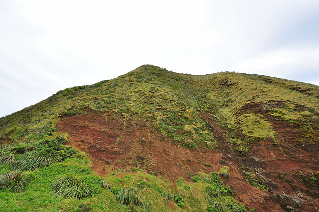
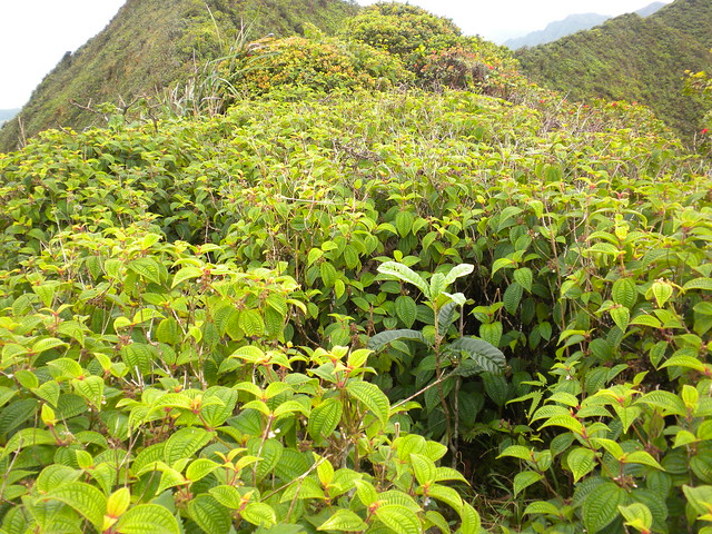
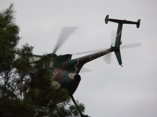
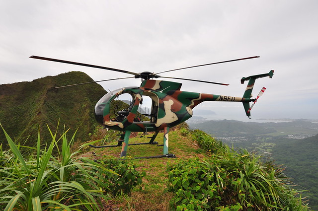
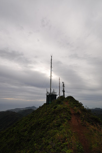
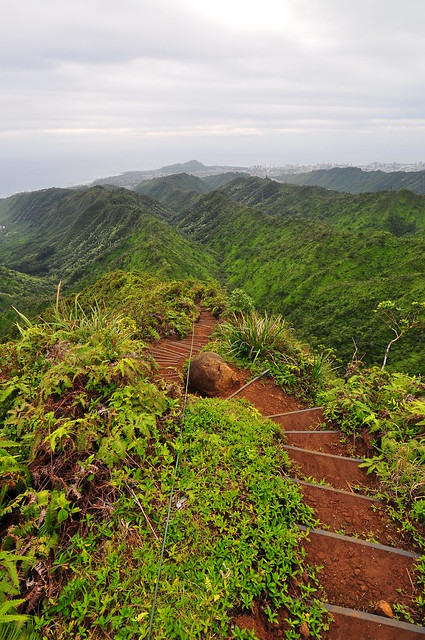
The next section was a series of peaks with some steep drops and areas of heavy and light vegetation. All morning we'd heard helicopters working in the distance and dropping workers and equipment off near Wiliwilinui. I wondered what they were up to and if they'd still be there when we arrived. I was shocked to see entire areas filled with clidemia, a super invasive and seemingly ever-present plant along the trails here. This particular section of the trail seemed drier than the others and I wondered if that was part of the reason for the huge stands of this noxious pest. We crossed about four relatively small peaks before the massive descent down to the saddle to Wiliwilinui.
As the chopper worked dropping off men and moving equipment we figured out what they were doing... replacing the lines to the radio station. I wondered if this was going to be problematic and decided if they gave us any trouble about passing through their work area then they could give us a ride on their whirly bird because there was now way I was turning back this close to the last segment. My attention turned to the descent from this peak down to the saddle that would take us to Wiliwilinui ridge. Believe me, the helicopter ride sounded pretty good as I looked below. The decent down was fairly serious at first then went to crazy. I took the easy way and slid down feet first and let my butt serve as a brake. I accidentally dislodged a piece of dirt held together by plant roots and watched it bound down the decline towards the abyss. It was a sobering sight. Meanwhile the helicopter landed at a small clearing on the trail ahead. At the last segment there is about a eight to ten foot segment that requires extreme care.
 |
| This part actually scared me a little. I paused at the end to snap this shot |
 |
| The final and mentalist descent of the day |
The drop is hundreds of feet straight down on the windward side and leeward side is choked with plants along a small outcropping the another drop too steep to risk either. I used the 'uki plants as hand holds and felt below for the small foot wide ledge below. A slip here was sure to be fatal. I waited for my hiking partner to catch up and we set off towards the power lines where we ran into one of the workers. We chatted with him for a few moments and continued towards the helicopter along the saddle. Maybe I was getting tired but I thought the tail number was hilarious. My imaginary conversation with the chopper was, "Hey, can we get a ride?" and the response, "Nine, F, U".
 |
| Last shot of the day. |
Near the bottom there were a bunch of work trucks and some boom trucks parked along the dirt road north of the water tower belonging to the contractor doing the line work above. As if on cue, just as we were about to finish the trail along came the helicopter overhead which did a quick circle a hundred feet above us before landing near the water tank. My streak of helicopter landings every time I'm atop Wiliwilinui is unblemished and seems to be intensifying! Hopefully this doesn't mean I'll be riding in Air 1, the fire department's rescue helicopter soon. Trail completed, we hopped into my car and headed back to Wa'ahilia Ridge State Recreation Area where we were glad to see the other car sitting safely and unharmed. Although shorter than last week's KSRT adventure this segment was a little more challenging. There were a couple serious parts where falls would have been disastrous and extreme care was required. Of course, your mileage may vary because I'm a not-so-great hiker and others have flown through this and other trails I've done. I've read where someone did Judd Trail to Konahuanui and the Ko'olau Summit Ridge Trail all the way to Mokapu in a day. I like to take my time anyway because there is so much to see. I'm shooting video too on the trail, which I haven't gotten around to editing yet, and I'm always seeing stuff I didn't notice on while I was hiking. Those are just a few of my many, many excuses anyway!
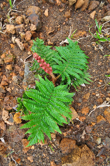
 |
| A shot on the climb up Lanipo |
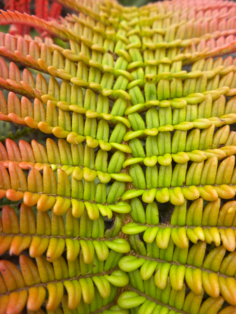
 |
| Ama'u Fern near Lanipo |
My usual disclaimer:
I would NOT recommend this trail to anyone who's unfamiliar with the ridges along the route and doesn't have some fairly advanced hiking experience. There is a whole lot of potential for some really bad things to happen and getting stuck on any section of this trail at night would be extremely dangerous.
More pictures of
this trail and others I've done are can be viewed
Flickr. Aloha and thanks for reading.
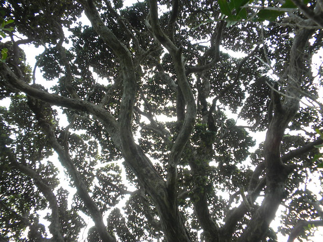 |
| Seldom seen view on O'ahu of a large 'ohia tree canopy. |


No comments:
Post a Comment