February 15, 2001 Nu'uanu / Mo'ole Scouting
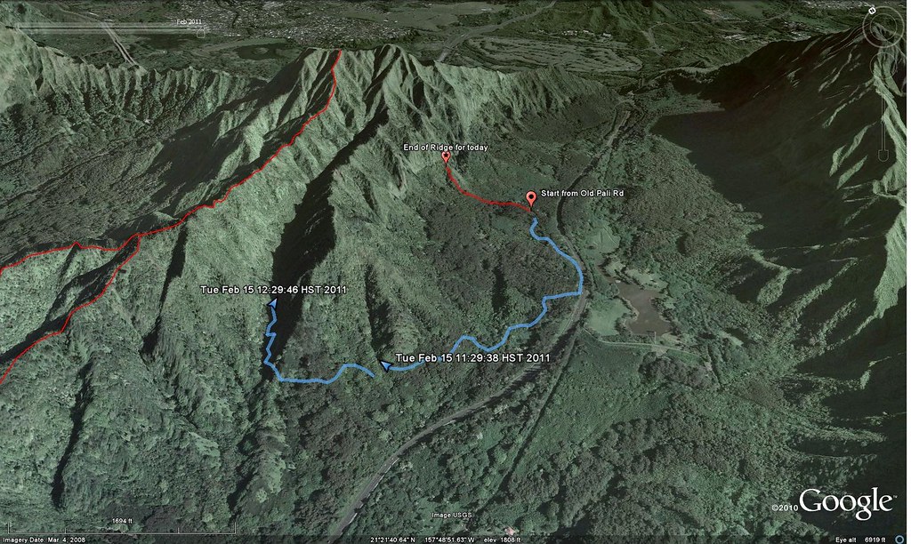
Another solo mission into the Ko'olaus today. Might be another week until I have a hiking partner so I thought maybe today would be a good chance to scout out a couple trails I've been thinking about over the last week. For some reason I'm still stuck on the Lanihuli area. Lanihuli is beautiful although not quite as spectacular as Konahuanui. However, it seems more remote considering the amount of distance I have to travel to get to the actual Lanihuli Trail. Another reason I'm still stuck here is because there are so many ridges that feed to the main trail. I've only done two and there more than a couple left to try. After the initial climb 3 weeks ago, I returned to do Kamanaiki Ridge last week, and today I was exploring Mo'ole Valley and a ridge in Nu'uanu Valley that might take me to the summit. The red track is the ridge and the blue is the rambling path I took to Mo'ole Valley.
Another solo mission into the Ko'olaus today. Might be another week until I have a hiking partner so I thought maybe today would be a good chance to scout out a couple trails I've been thinking about over the last week. For some reason I'm still stuck on the Lanihuli area. Lanihuli is beautiful although not quite as spectacular as Konahuanui. However, it seems more remote considering the amount of distance I have to travel to get to the actual Lanihuli Trail. Another reason I'm still stuck here is because there are so many ridges that feed to the main trail. I've only done two and there more than a couple left to try. After the initial climb 3 weeks ago, I returned to do Kamanaiki Ridge last week, and today I was exploring Mo'ole Valley and a ridge in Nu'uanu Valley that might take me to the summit. The red track is the ridge and the blue is the rambling path I took to Mo'ole Valley.
Round One: Nu'uanu Valley - Ridge
I usually take a few notes and a whole lot of pictures but today I forgot my little notebook and my larger camera stayed in my backpack except for a few special shots so I apologize for the lack of details and the shortage of pictures in advance. So here we go...
I parked my car off of the Old Pali Road on the Ewa side of the Pali Highway sometime this morning... hey, no notebook. With no real plan and some pretty vague descriptions of the trails I was interested in I headed off into the bushes with the usual prayer for the safety of my vehicle. The only card I was holding was my Back Country app for my Droid phone. It's like Google Maps but with topographical mapping and that's exactly what I'd be needing for today's explorations.
 |
| I'll be back... |
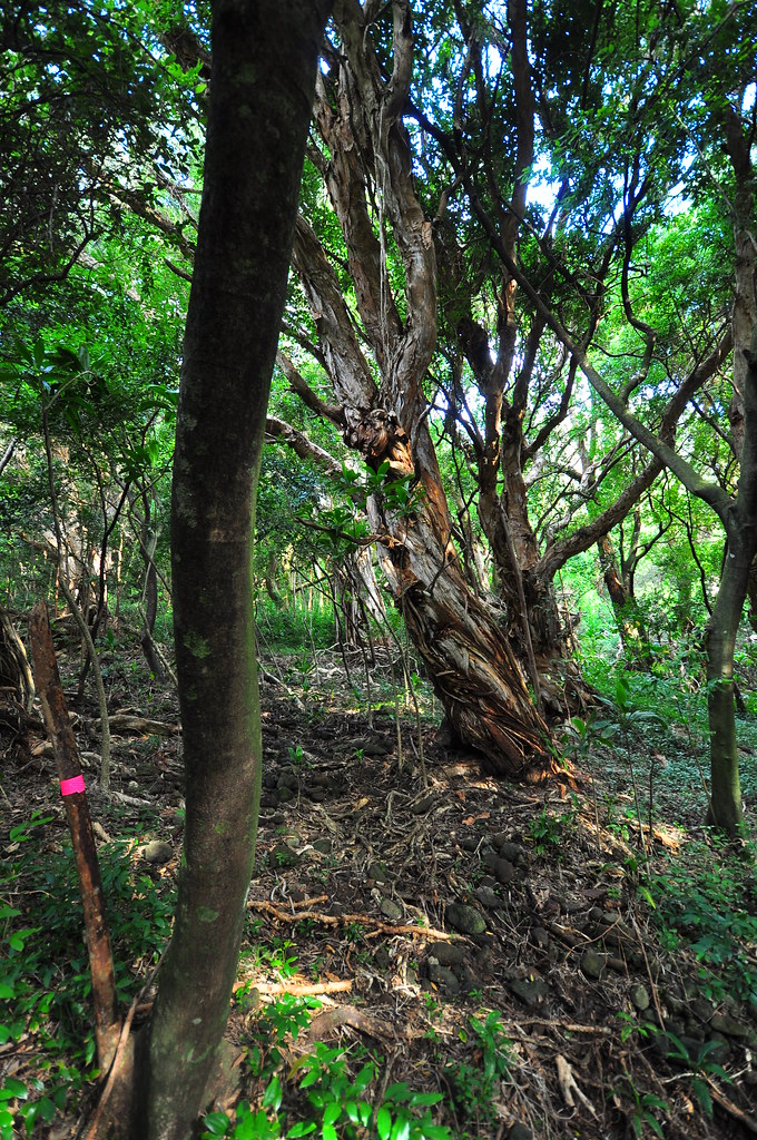
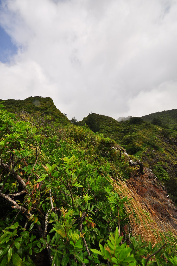
As luck would have it, I immediately ran into some pink duct tape ribbons which I decided to follow. They lead to some blue ribbons which I also followed for a while. Part of my loosely devised plan included a trip to a tunnel which was used to route water coming from Mo'ole Valley to the Nu'uanu Reservoirs. That's my theory anyway. I kept veering makai because the tunnel was in that direction but decided to explore to the steep cliffs lining the valley first. I started up a ridge and decided to see where it took me. Then, in a rare break in the vegetation I got a view of the ridge mauka of me and decided I liked that one better. I crashed down the little valley separating them and started working my way up the new ridge. The vegetation continued to close in on me making it harder and harder to keep going. My larger backpack I keep my Nikon in kept snagging on the saplings and I pushed through the dense stands of strawberry guava and other weed trees driving me insane. I continued until I reached a spot that gave me a view of the valley below and the ridge above. The ridge looked pretty manageable all the way up from there but the clouds were moving in and with my backpack driving me crazy I decided to mark the spot with a waypoint and track the trail back down to the car where I'd regroup and head for Mo'ole Valley. Slipping, tripping, cursing, I pressed down until I got back down through the worst of the brush. Finally, the more open forest near the road appeared as I approached the car. I paused to regroup and charge my phone for a while before pushing back into the brush to see about getting to Mo'ole Valley.
 |
| Clouds rolling in and a couple sprinkles convinced me to retreat. |
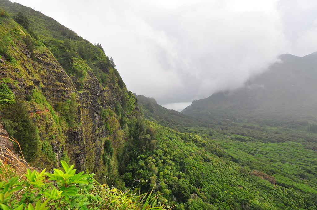 |
| Check out those cliffs... |
Round Two: Nu'uanu - Mo'ole
 Initially things were pretty smooth. Following the topo map on my phone I wandered through the understory until I came upon a black tarp shelter set up in the trees. I reversed course quietly and swung around it from a distance not wanting to know anything about it. Then I discovered some plastic pots stacked together. I'm going to guess and say that it wasn't someone engaged in a private native forest restoration project who left them behind. I decided I'd had enough of the pakalolo growers habitat and moved back to the road and walked out onto the Pali Highway.
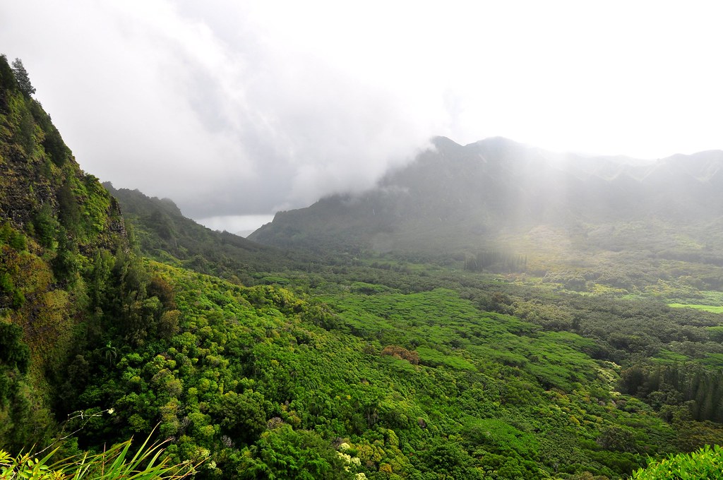
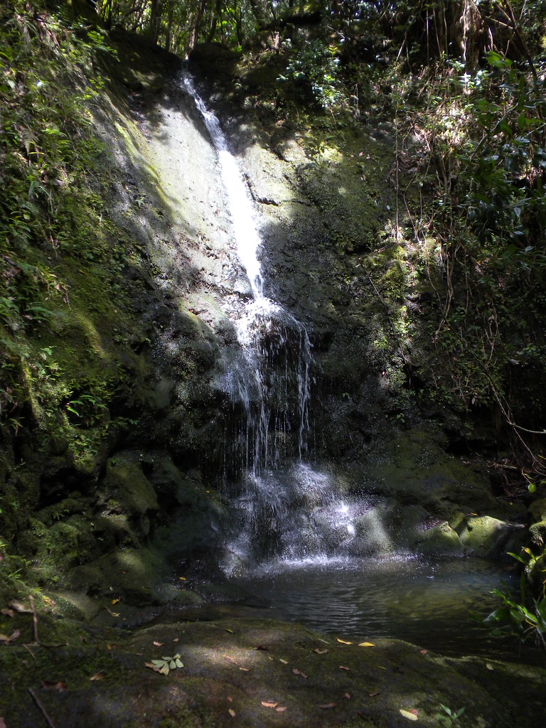
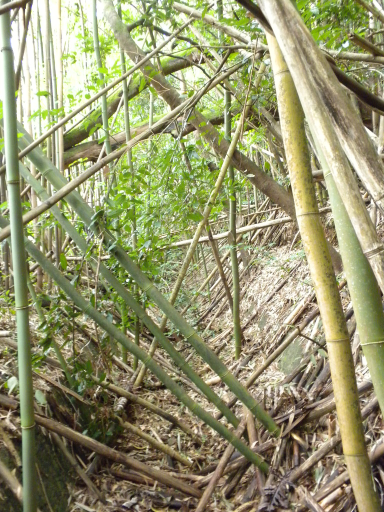
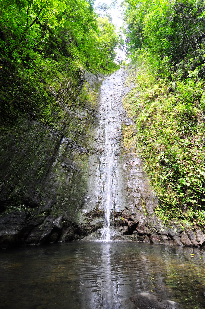
 A short walk down the busy highway later, I spotted a concrete ditch that was obviously part of the system I'd be following so veered off the road an into it. I followed it for a while ducking fallen bamboo, branches, and debris until I saw a chance to move onto what looked like a trail. From here on out I followed what I assume are hiking, pig, and hunter trails. I reversed course a bunch of times trying to find the easiest way to the tunnel that would bring me into Mo'ole. Finally I found the stream and the ditch I needed to follow. Too bad I was in the ditch and didn't realize there was nice trail running shoulder height off to my left paralleling it! I ended up missing the tunnel and following a trail that crossed the ridge and deposited me at the other end of the tunnel. Sigh. From here I continued up the stream to a small waterfall, then to a big waterfall.
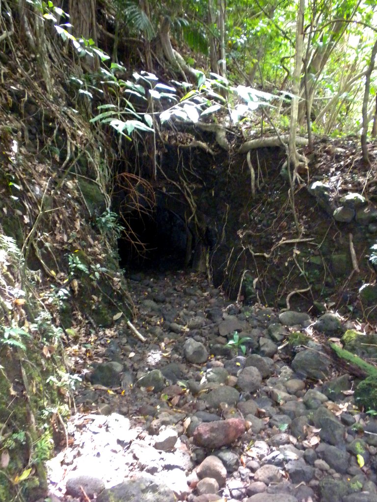 |
| Mo'ole Entrance |
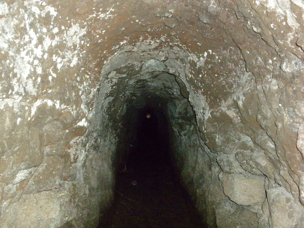
There was an inviting looking trail to my left with some orange ribbons but after a while I lost the ribbons and decided to call it a day. Back at the tunnel I decided that it would be far shorter to take it than climb back up and over the ridge so out came my flashlight and into the tunnel I went. It looked a lot smaller from the outside but once inside I could walk hunched over pretty well. It's not terribly long but the sound of nothing but water dripping from the ceiling and being able to see my breath in the cold, dark, damp tunnel wasn't exactly comforting. I picked up speed and was soon cruising on the trail along side of the ditch this time instead of in it. Eventually the trail got fainter as I approached the Pali Highway again. I decided I'd head for the highway and figure out how to deal with the fence when I got there. After a whole lot of searching and back tracking I ended up hanging my pack on the fence and doing some acrobatics in a tangle of Hao trees to get over it. As luck would have it, not 5 feet away, but hidden by the bushes where I had been, was a downed section of the fence I could have walked over trouble free! A short walk up the highway and back down Old Pali Road to the car, thankfully intact, and the day was over.
 |
| Pig Wallow |
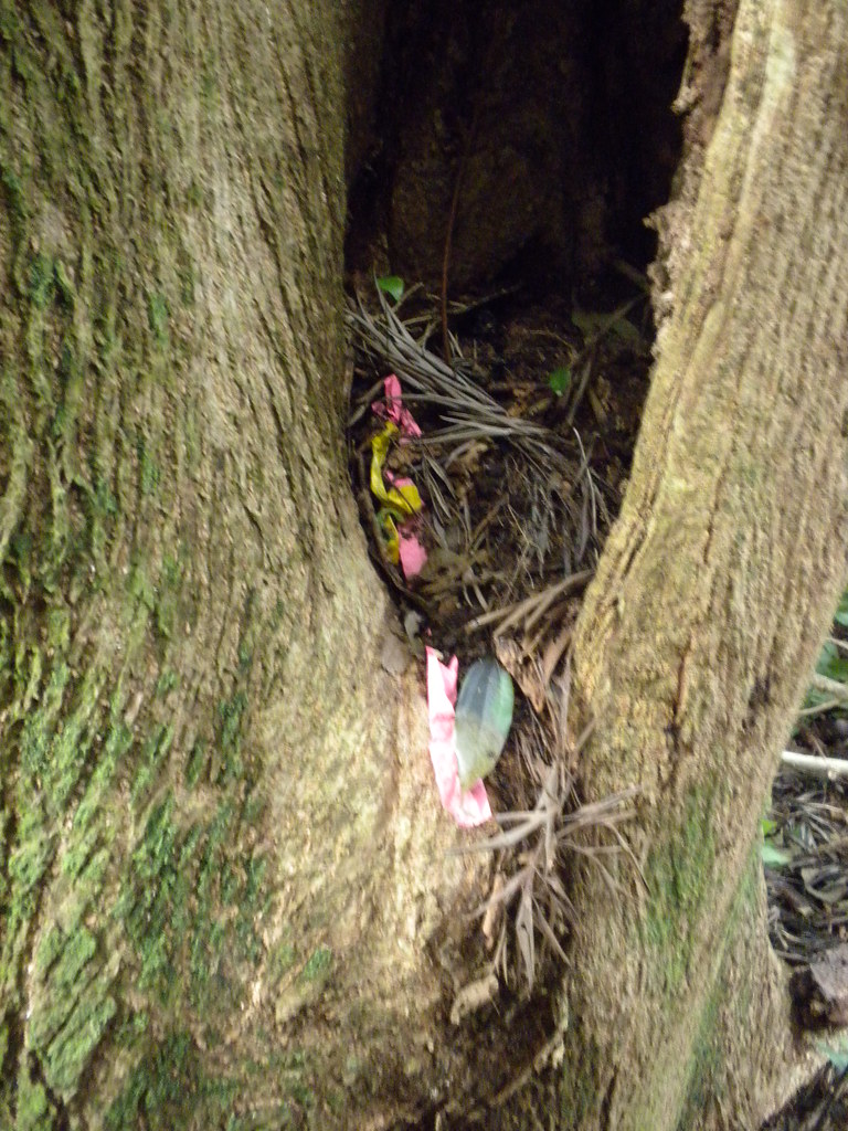 |
| Ribbon collection. |
Today wasn't exactly a glowing success with a summit top or ridge trail but hopefully it laid the foundation for a future hike that will.
Thanks for the post. Been searching for a photo of the big waterall in Mo'ole to no avail. Yours may be the first on the 'net. Good job.
ReplyDeleteBTW, to get past that first big falls, there is a bypass on the right, which begins not too far downstream from the falls.
As for exiting Moole to get up to the Lanihuli Trail, that route may be long gone/overgrown. It's at a non-descript spot. Perhaps there are old ribbons there.
Good luck in your attempt.
Thanks for the information! I've reread some of the writeups you've done on Mo'ole Valley too and have a little clearer picture of what to expect the next time.
ReplyDeleteAlthough Konahuanui valley seems great but reaching waterfall after crossing a stream is good. Travellers can enjoy waterfall and great Konahuanui valley.
ReplyDeletemeet and greet at manchester