At four thirty in the morning my alarm went off. I stumbled outside and looked at the Ko'olaus to get an idea of what kind of day to expect. It looked windy and cloudy so I emailed my hiking partner that it looked bad for the planned Aiea-Halawa crossover. I was actually a little relieved because I could probably get another hour or two of sleep before selecting another trail. A few minutes later he emailed that it was nice on the leeward side and he wanted to continue with the planned trail. I took a shower, gathered my gear, and prepared to depart with very little enthusiasm. It took me longer than anticipated to get my stuff together and a stop at the gas station meant I was running late. Twenty minutes after I was supposed to arrive, I pulled up next to II's car on Iwaena Street in Halawa Valley’s Central Park industrial area. I left my Jeep there and we headed up to
Keaiwa Heiau State Park where we'd begin the Aiea Ridge Trail. Looking at the weather I don't think either one of us really thought we'd be doing the crossover so we parked inside the park despite the fact it was in all likelihood going to close before we got back considering our later than ideal start and less than average hiking skills. We set off up the Aiea Loop Trail about a quarter to seven. I have to admit, my motivation levels were still suffering greatly because it felt pointless to keep going after we split from the loop to the ridge trail.
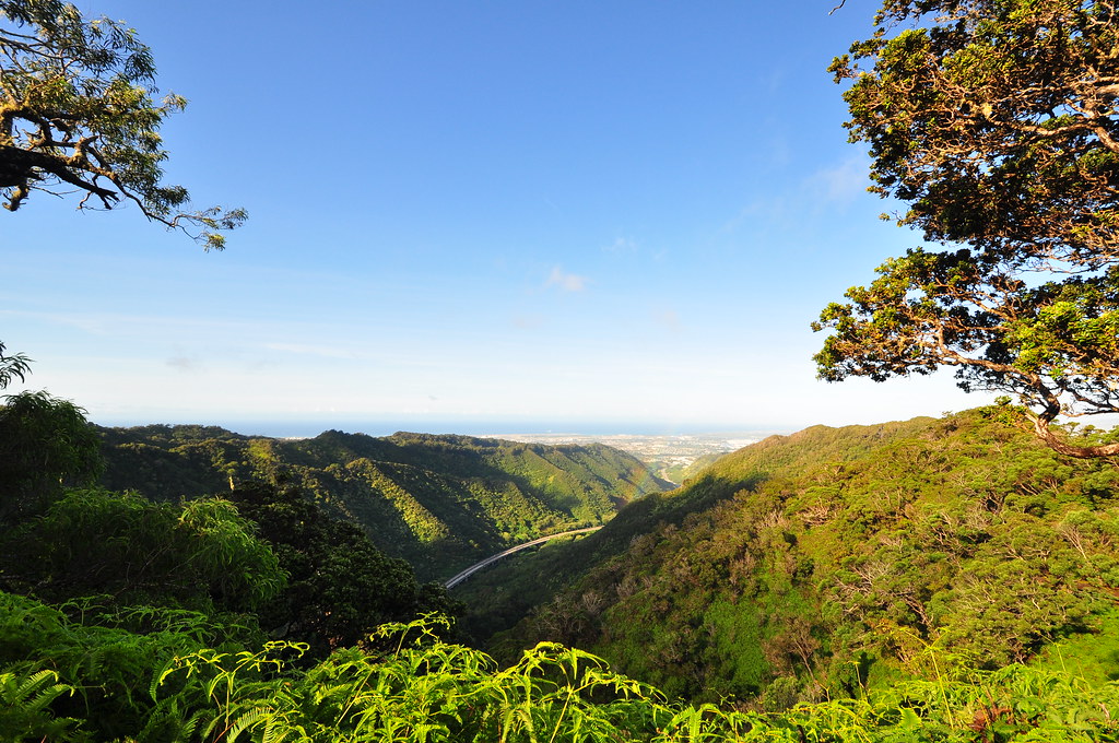 |
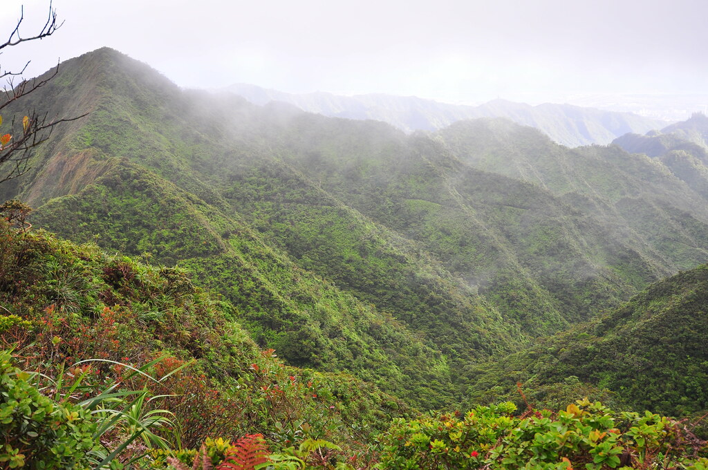
| Early section of the Aiea Ridge Trail. Even got a little rainbow in this one. |
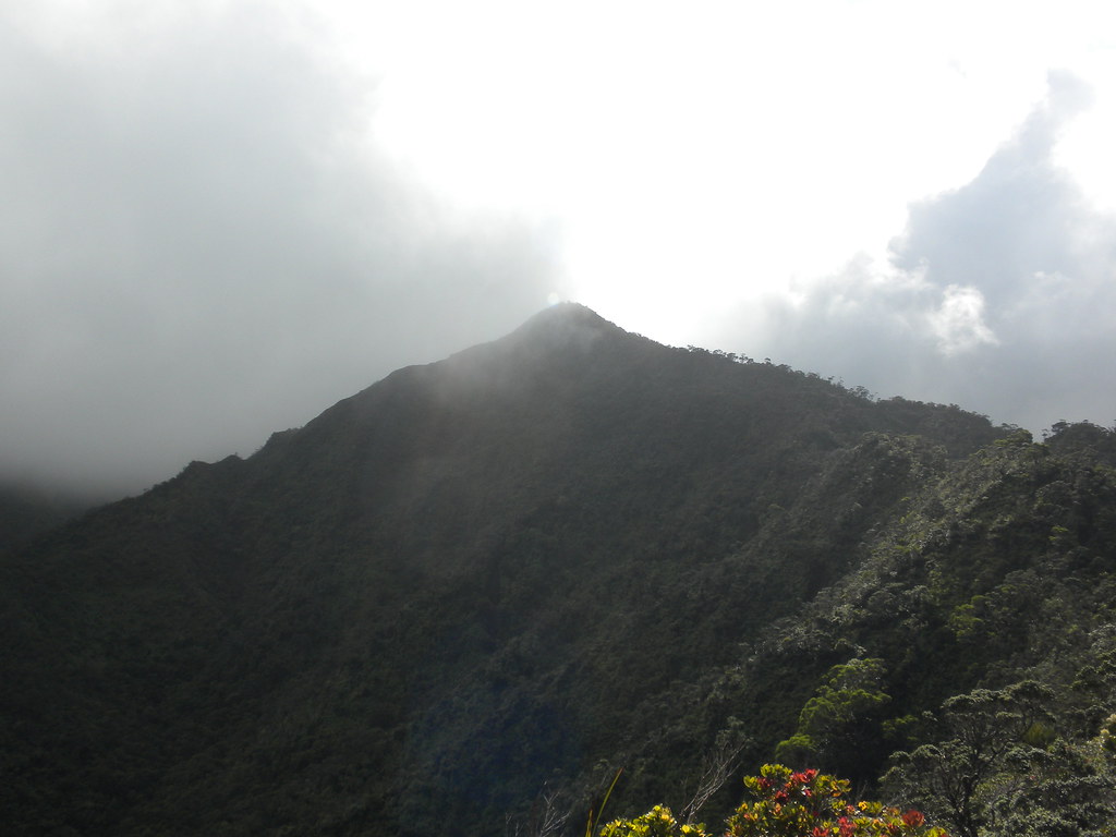 |
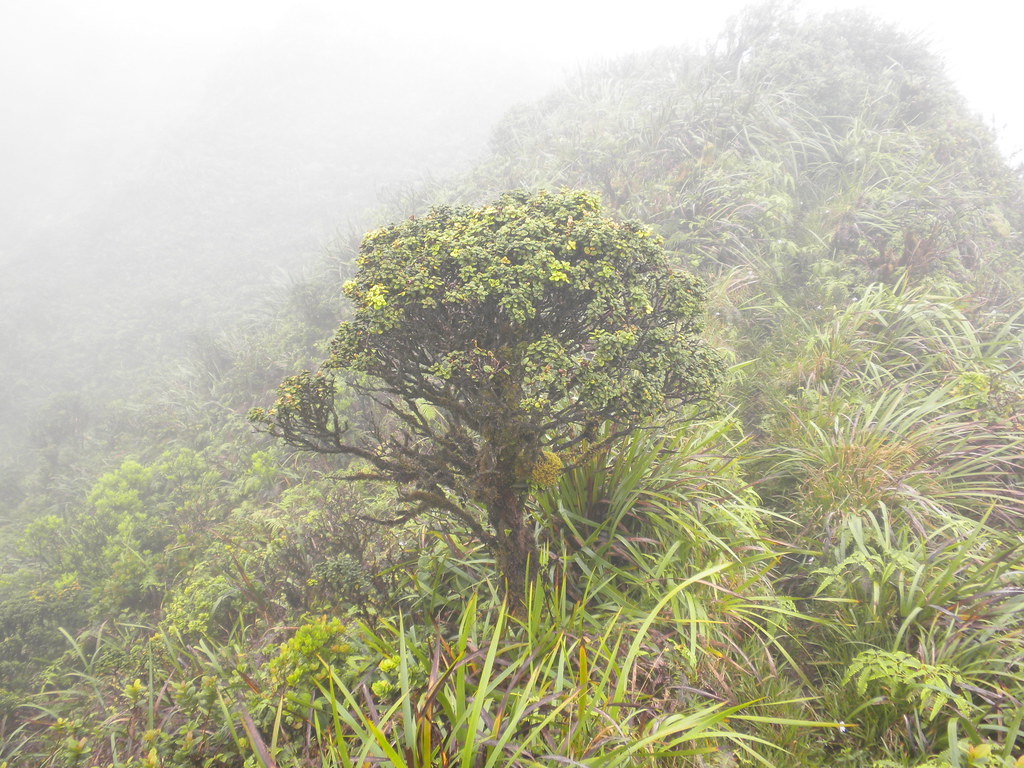
| Pu'u Kawipo'o |
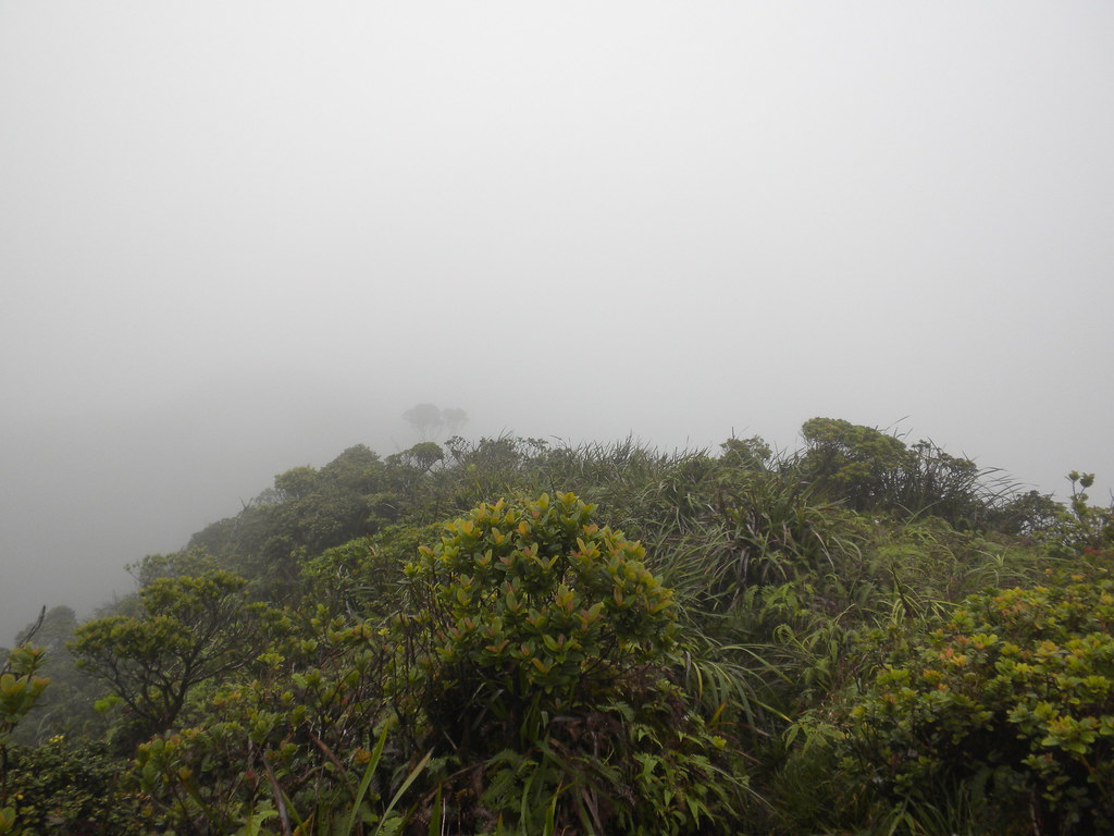
The clouds were hanging well below the summit of the mountains and didn't look like they were going to be be moving on anytime soon. We discussed it and decided we'd continue to Pu'u Kawipo'o. As we continued upwards the plant life around us got better and better. My attitude about the trail improved with all the great stuff we were passing and by the time we arrived at the top of the pu'u I was ready to go! At the top of Kawipo'o the clouds retreated for a few precious minutes and we got the last views we'd be treated with for a long time.
 |
| Halawa Valley from Pu'u Kawipo'o |
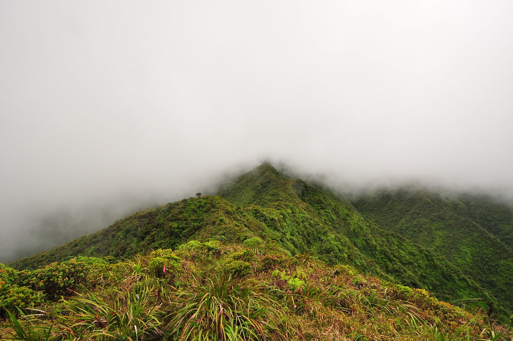 |
| Complete cloud cover |
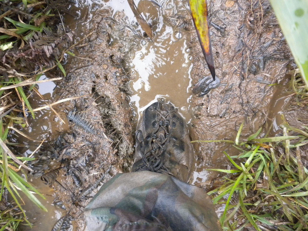
The weather conditions were far better than the last time we did Aiea back on June 21st when it had rained the entire time we were on the trail. Today it was just some mud and reduced visibility to contend with.
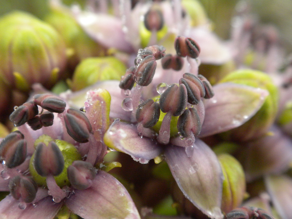
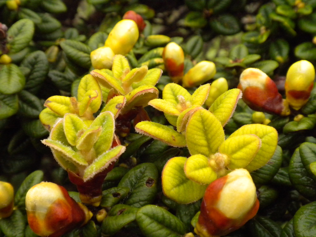
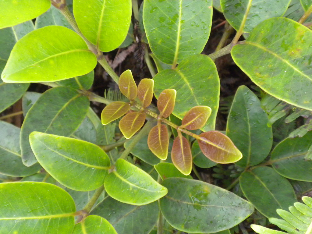
From Pu'u Kawipoo on Aiea Ridge Trail has an amazing selection of endemic and native plant life. What really stands out is the number of Ohe Mauka and Lehua Papa trail side. The lehua papa along the upper reaches of the trail grows as both a small tree about four feet high and as a prostrate shrub the looks like a ground cover.
Ohe mauka is related to Ivy and this particular form, Tetraplasandra oahuensis, is fairly common in the Ko'olaus but especially numerous in this area. The end of summer seems to be it's blooming season so it's candalabra flower spikes were tipped with it's tiny white flowers.
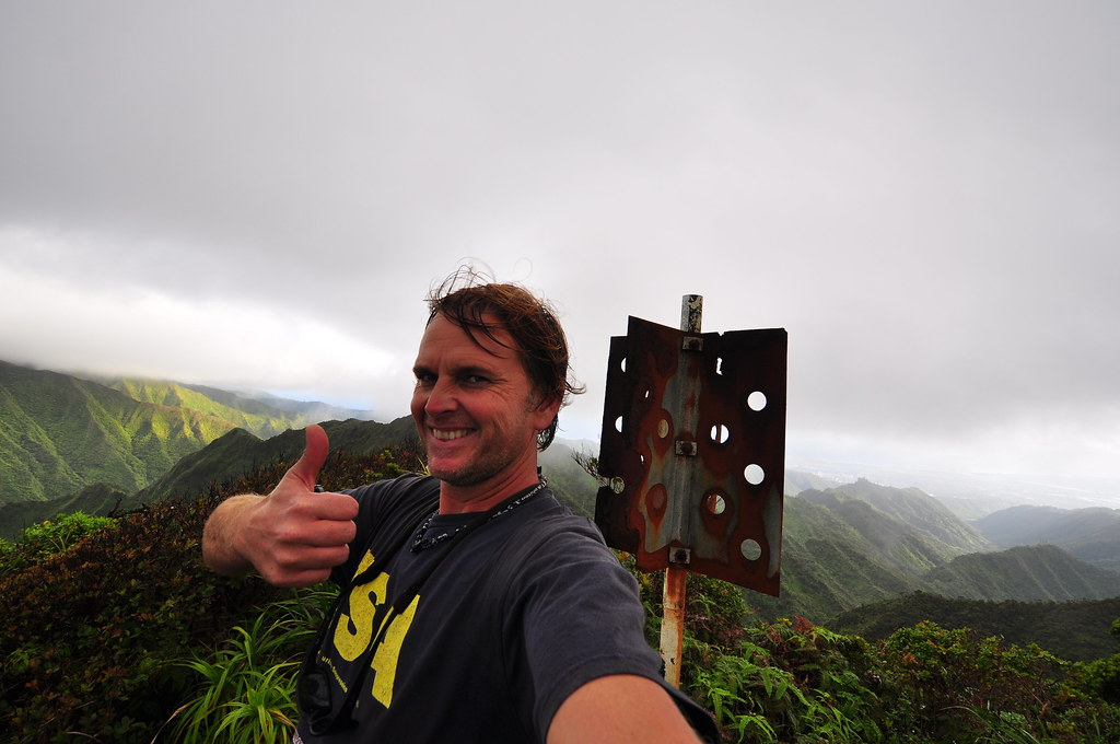
Continuing to the summit we passed the big tower and the electrical lines to finally reach the summit. For a very brief moment we were teased with a glimpse of what must be a spectacular view of Kaneohe below. I was barely able to get my camera out to catch the fleeting scenery below.
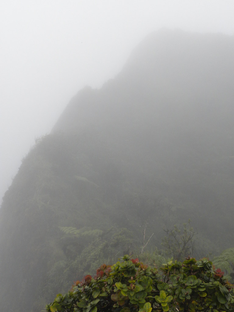
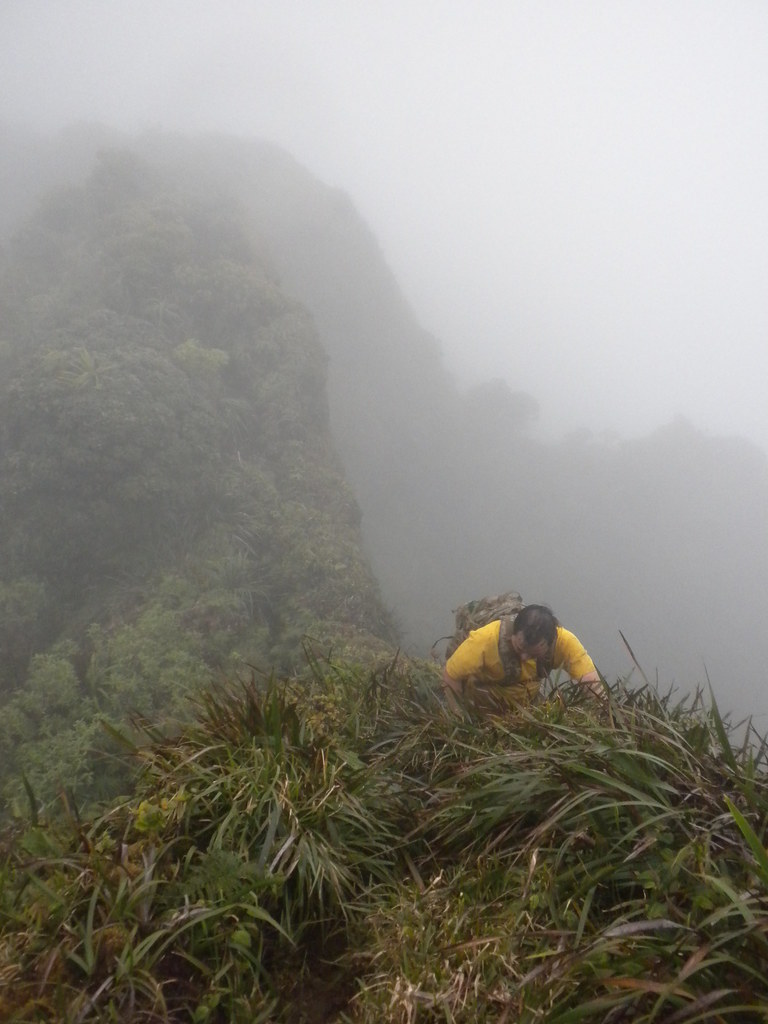
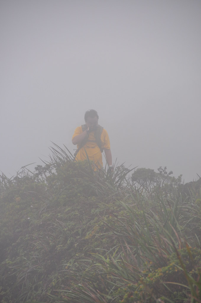
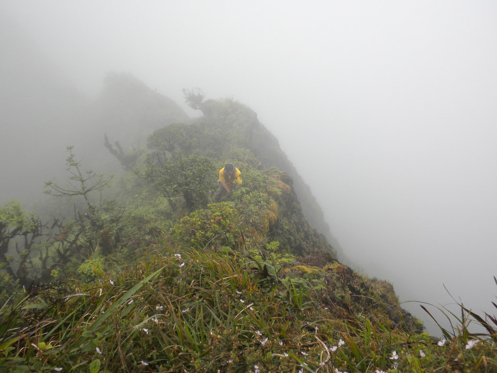
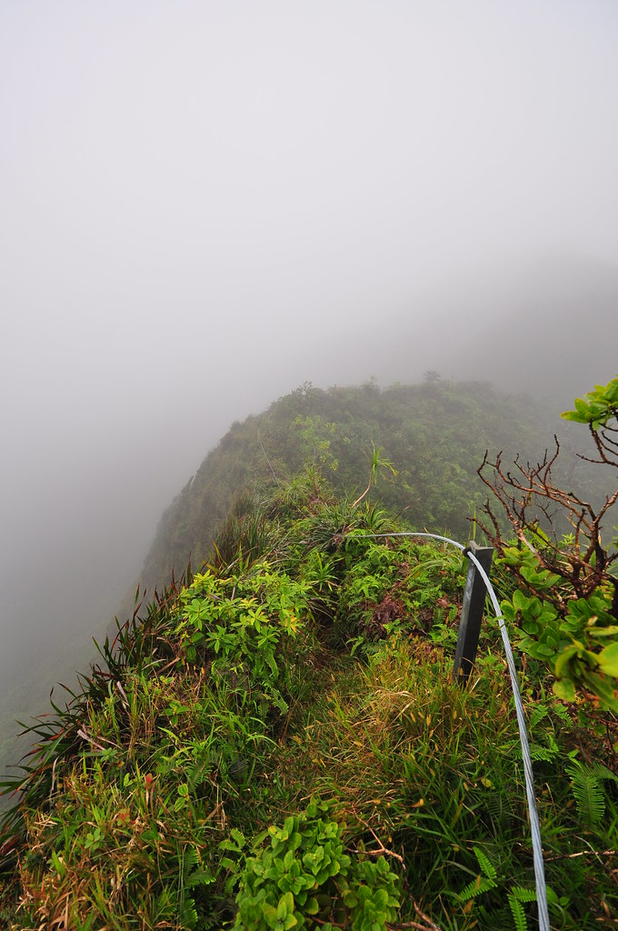
For some crazy reason, we elected to continue down the summit to Halawa. I'm really not sure what we were thinking because it was already about noon when we started and the visibility was still just a couple hundred feet meaning I'd have to rely somewhat on my Droid and Backcountry Navigator app to get us across the unmarked ridge to Halawa. We struck out onto the Ko'olau Summit the trail which almost immediately got down to business. The terrible drops on the left side of us were masked by the reduced visibility but there is a whole lot of exposure as the trail climbed and descended steeply along the edge of the ridge. To honest, I was really wondering what we'd gotten ourselves into.
 |
| II is on ridge back |
 |
| First big climb of the day |
 | |
| Descending the wrong ridge. |
Picking our way through the vegetation it was difficult to gauge our progress in the clouds but I knew we were falling behind. My hiking partner started to fade as the day wore on and I only exacerbated the situation when I made a wrong turn and we descended a ridge towards Halawa Valley instead of continuing along the summit. That little detour cost us some precious time and energy and is THE reason we should have headed back down Aiea Ridge Trail instead of continuing.
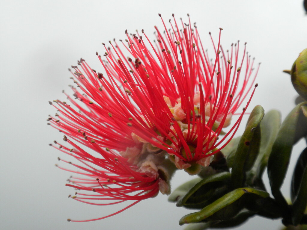
The only bright spot in the detour was that I got a couple of nice Kanawao bloom pictures.
 |
| Kanawao Bloom |
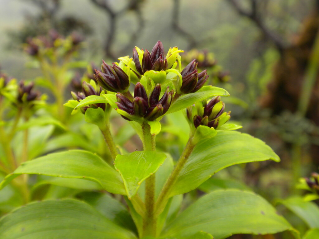
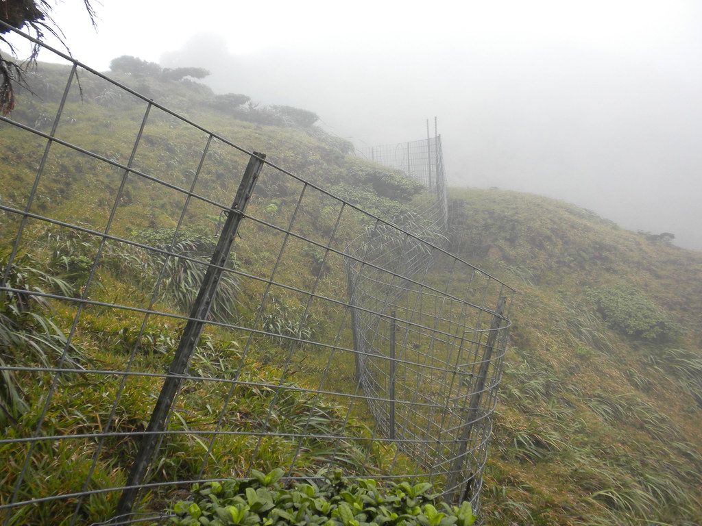
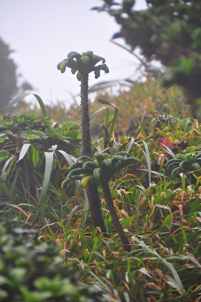
After recovering from our deviation, my spirits were lifted when we reached the Cyanea St. Johnii enclosure. This very rare plant is estimated to have less that 70 remaining individuals and is one of the key reasons I've been wanting to do this trail. While one would think that the tops of the Ko'olaus would be relatively free from the pua'a we saw a bunch of damage along the summit from their foraging. In fact, the trails we'd been following are kept open, at least from the knee down, by the pigs that seem to use it like a superhighway.
Thankfully the enclosure looks pretty pig proof so these great little plants should be safe for now as long as no two legged creatures jump the fence and crush any of the tiny new plants coming up. They remind me of cartoonish palm trees and I'd bet they'd sell millions of them if they'd grow outside their clouded summit habitat. Luckily I'd brought my 200mm lens so I was able to get one decent shot of them.
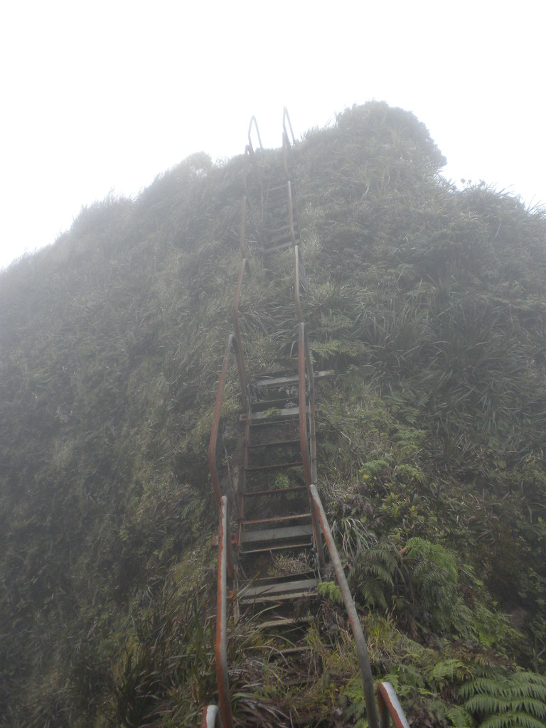
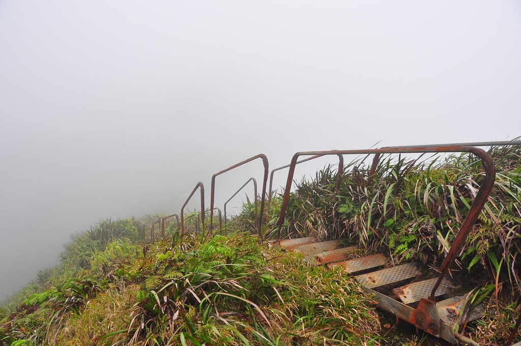
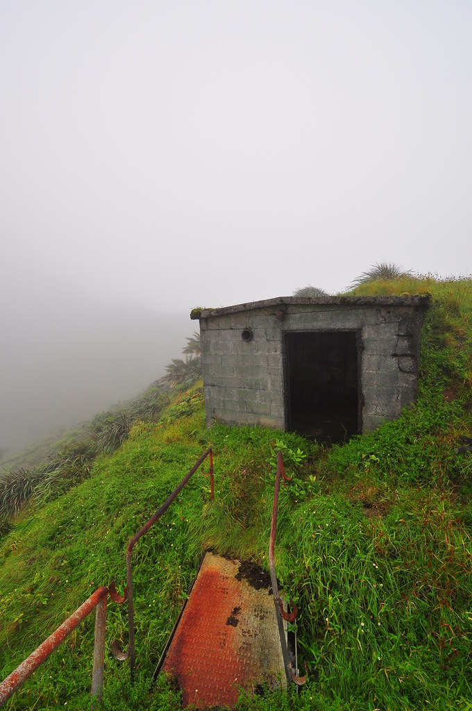
Leaving the Cyanea behind, we continued towards our next stop, the old OMEGA station stairs and storage shed.
This has been been on my list of things to visit. When I saw the outline of the old handrails in the clouds my speed probably tripled. I wandered about checking the stairs, the shed, and plant life while I waited for my partner to catch back up. His condition was deteriorating pretty quickly and his speed down to less than half normal.
We left following "Hidden" stairs and a cable towards Halawa and as we reached their end he wanted to throw in the towel and spend the night at the shed. I knew we were close to the end of the Halawa Trail and told him there was no way in hell I was spending the night up there. Even with the shelter of the shed it would be freezing cold once it got dark plus we were soaking wet from being in the clouds.
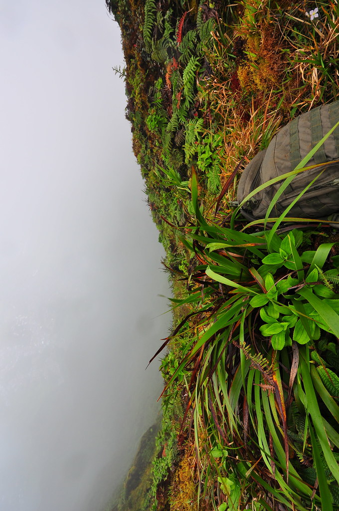
Leaving the shed behind us we continued on the various cables, ladders, and catwalks that once were used to service the cables that stretched across Haiku Valley. Unlike the stairway these have received no maintenance at all since the transmitter station was shut down. Be careful!
 |
| Hiking across the "other" stairway |
 |
| Running on empty |
We moved on and with him trailing, I reached the third thing I'd been dying to get too, an old geodetic marker. I don't know why but I like these things and ever since I'd laid eyes on it about eight months ago from the Stairway to Heaven, I'd wanted to get to it. The picture to the left was taken on that beautiful clear morning. I'm a kinda crazy like that in case you haven't figured that out yet.
My elation was not shared by my partner who was literally dying at this point. Turns out he hadn't eaten anything at all and was out of gas! We took a break and he ate a Cliff Bar.
 |
| I'm way too excited about this. |
 |
| Haiku Valley |
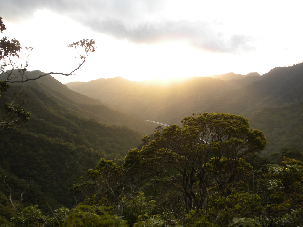
I took this shot approaching the Halawa Ridge Trail terminus to show how beautifully that trail is cut into the side of the ridge. Some serious man hours went into that!
 |
| Halawa Ridge Trail |
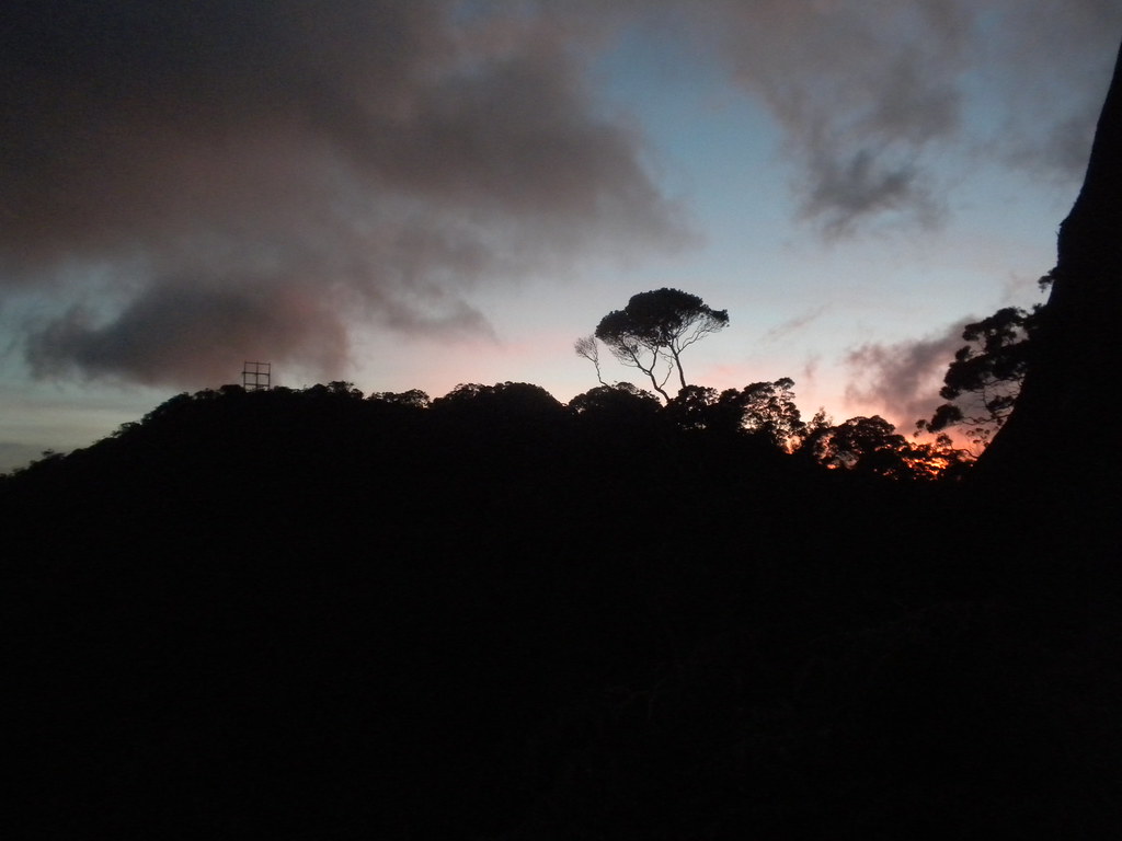
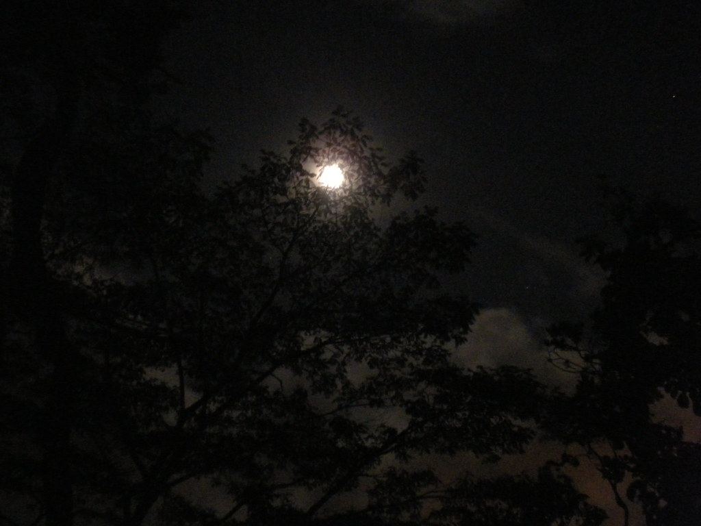
As we started down the easy grade of Halawa, the sun sank lower in the sky. Soon, it was dropping to the top of the ridge on the other side of the valley confirming what we already knew- we weren't getting out before sunset. Winding our way down I marveled at the fading light and as the sun disappeared the moonlight lit the way. I had only a tiny flashlight so II gave me one of his and he used his headlamp. It was bright enough out with the almost full moon so that I left mine off as much as I could secretly enjoying the moonlit hike. I'm sure II will be shaking his head as he reads this!
 |
| Going.... |
 |
| Going.... |
 |
| Gone! |
A
t about seven o'clock II called 911 to report himself overdue and tell them that he was okay in the unlikely event that the caretaker at Keaiwa Heiau State Park reported his car was still there after the park closed. He didn't want them to think someone was lost or hurt on the Aiea Loop or Ridge Trail and waste anyone's time looking for us. There's been enough bad press about hikers lately and he was determined not to even chance having any more.
Agonizingly we descended off Halawa Ridge Trail onto the powerline road. II needed a break so I tried a couple freehand night shots with my D90 and the point and shoot.
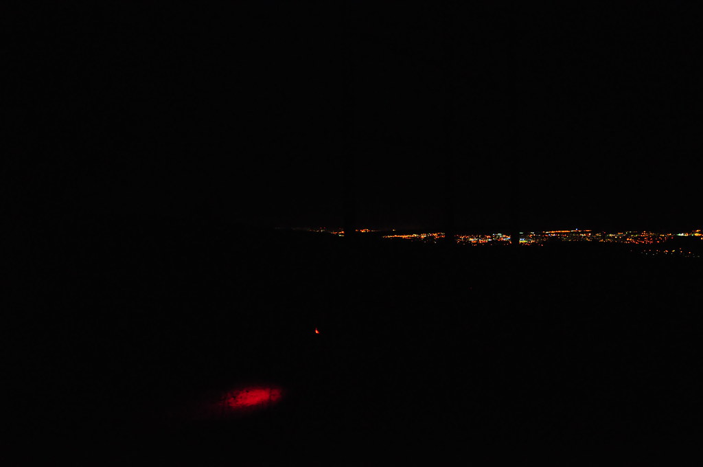 |
| II sitting near the powerlines. The red splash is the light from his headlamp. |
|
 |
| The Transition Trail- clearly marked MAHALO!!! |
 |
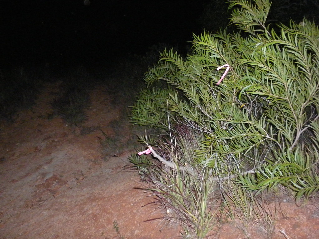
| Halawa Gauging Station- O'dark-thirty |
What I was hoping for was that the trail clearers had done a really good job with the section that takes you from the valley to the powerline road. I wasn't disappointed, they'd done a fantastic job making what had been a hellish descent through six foot cane grass into a proper trail. THANK YOU! I continued down the bottom leaving II to descend at his own pace. Even I'd reached my breaking point now and wanted nothing more than to be done with this adventure. When I broke out of the bushes at the H-3 access road I ran into a pig hunter with his son and their dogs. Apparently he thought I was some kind of guard or something because I scared the crap out of him. He confessed that hunting isn't exactly legal back there but I assured him that I didn't really care. We chatted for a while about the valley and pigs in general as I waited for II to make it down. I wished him luck as they headed up the road and a few minutes later II emerged from the bushes. Now in the home stretch, we moved as fast as we could under the freeway, through the ferns and to the stream. I did snatch a couple lilikoi and a passion fruit I saw along the way though. The water level of the stream was pretty low so I just marched across it. Passing the gauging station we hung a right down the 4x4 road towards the Board of Water Supply's Xeriscape park. We saw the side trail to bypass it but the fastest and easiest way was through the park so that's the way we went. There was a security guard at the gate sitting in his truck but it was far too late for him to do anything about us so we just walked by him and to my awaiting Jeep What a day!
So, what did we do wrong? A couple things. First, the last time we'd tried to do this we'd aborted at the top of Aiea because of visibility. While we weren't in pouring rain this time tackling a fairly long and unmarked route when you can't see anything is a bad idea. Looking back on it that was a really stupid move! Even though it worked the whole time, I have had trouble in the past with my Droid getting a good GPS signal when it's really cloudy out. Had I not had my phone with me I think would could have run into a whole lot of trouble with no guidance and not being able to see. After all, we did take a wrong turn even with the navigation available.
Second, not eating anything. II didn't eat anything despite the fact he had food with him. It took a little while but after the Cliff Bar he picked back up. Got to keep some gas in your tank!
I made a couple other bad moves. First, I bought all kinds of extra batteries for my phone and I didn't have a single extra with me. Stupid! Plus, my kids have absconded with my flashlights so all I had was a ultra small keychain sized LED with me. It would have worked but that's supposed to be a back up not a primary!
All is well that ends well though, I just got off the phone with II and his car didn't get towed out of the park. Our first taste of the western Ko'olau summit has left me hungry for more!
 More pictures from this trail and others I've done are can be viewed on Flickr. Aloha and mahalo for reading.


You need a handheld GPS. I go with a two GPS solution. Garmin Venture HC ( http://www.amazon.com/Garmin-eTrex-Venture-GPS-Receiver/dp/B000PDR230 ), long lasting battery, basic gps. DeLorme PN-40 ( http://www.amazon.com/DeLorme-Earthmate-PN-40-Waterproof-Hiking/dp/B001FVLTNA/ ) very accurate GPS and tons of memory for accurate maps.
ReplyDeleteI need a headlamp. Last time I did Aiea Ridge, I needed a headlamp.
Thanks for the links Scotty!
ReplyDelete