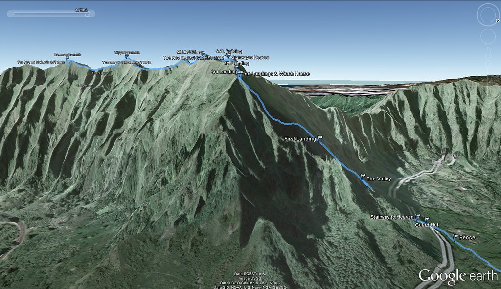
 |
It's been over a year and a half since my first trip along this very scenic section of the Ko'olau Summit and although I'd returned to do Pu'u Keahi a Kahoe Loop it was still way past time to revisit this one.
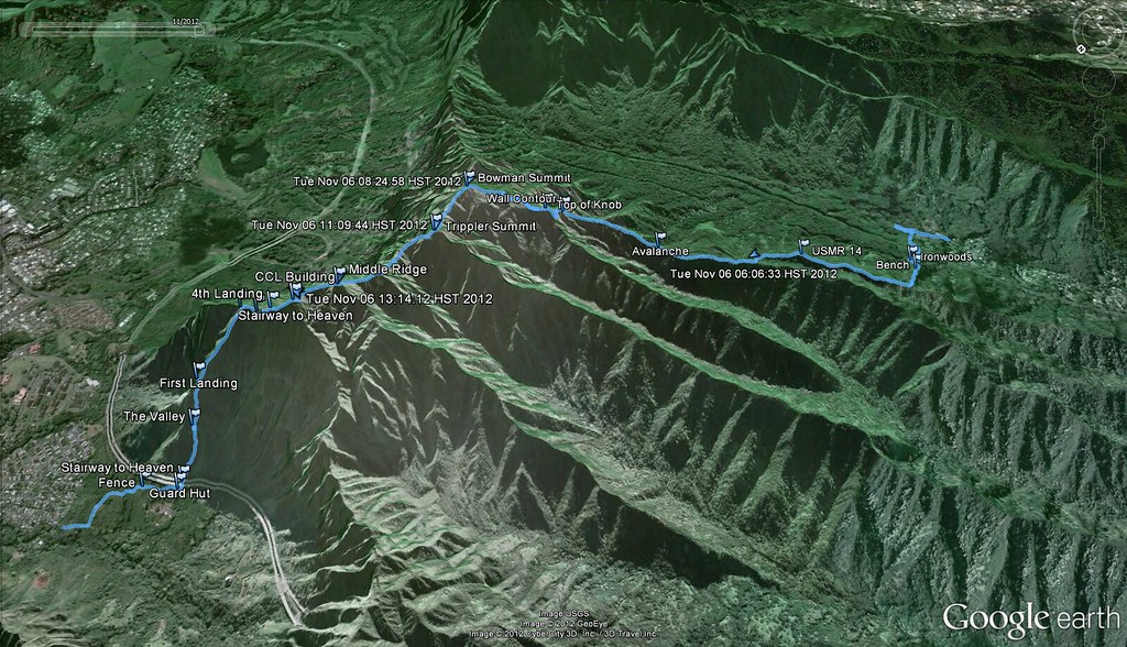
Instead of doing the full Bowman Trail, we utilized the alternate spur that comes up out of Kalihi Valley.
 |
| Banging around in the backwoods of Kalihi |
 |
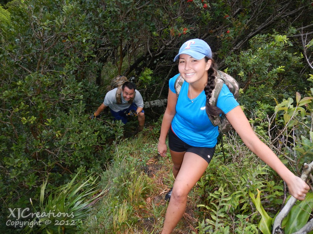
| Bushwacking to Burnmeister |
 |
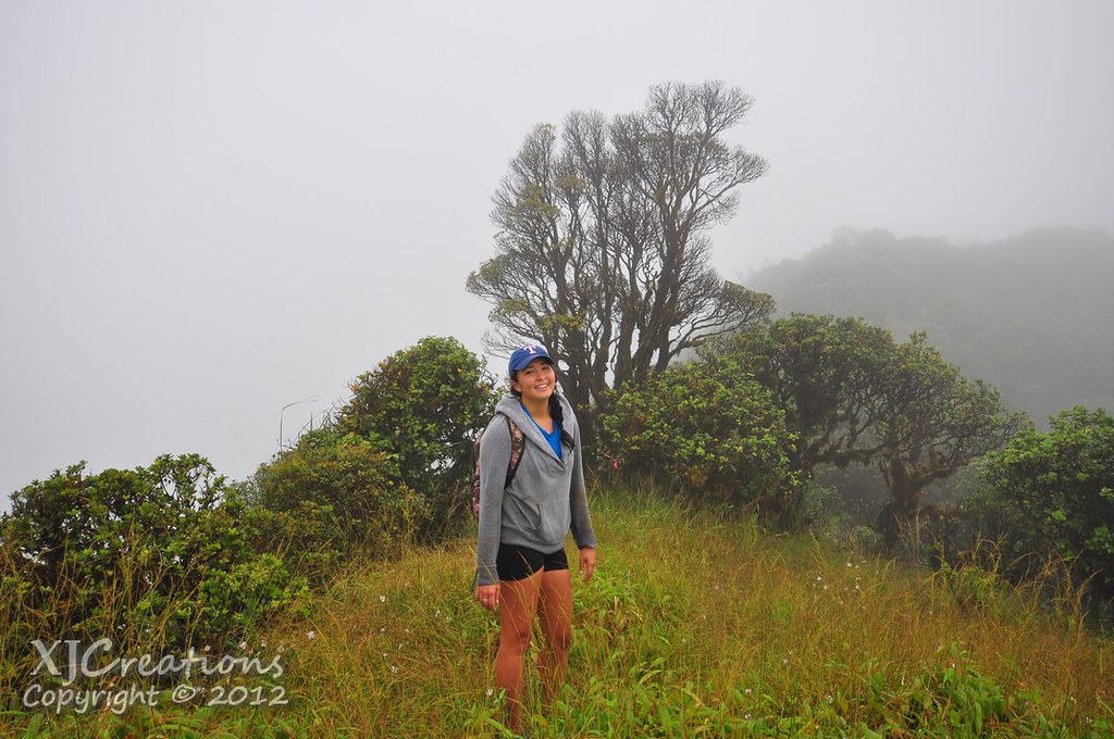
| Sam and I on the Burnmeister Overpass |
 |
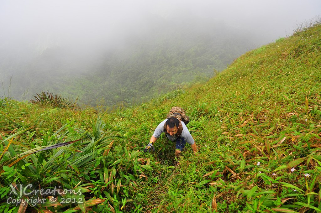
| II climbing up through the pines. |
It looked like we were in the midst of an old Forestry Division project as the ridge was graded and the pines obviously planted there.
 |
| Abandoned nursery |
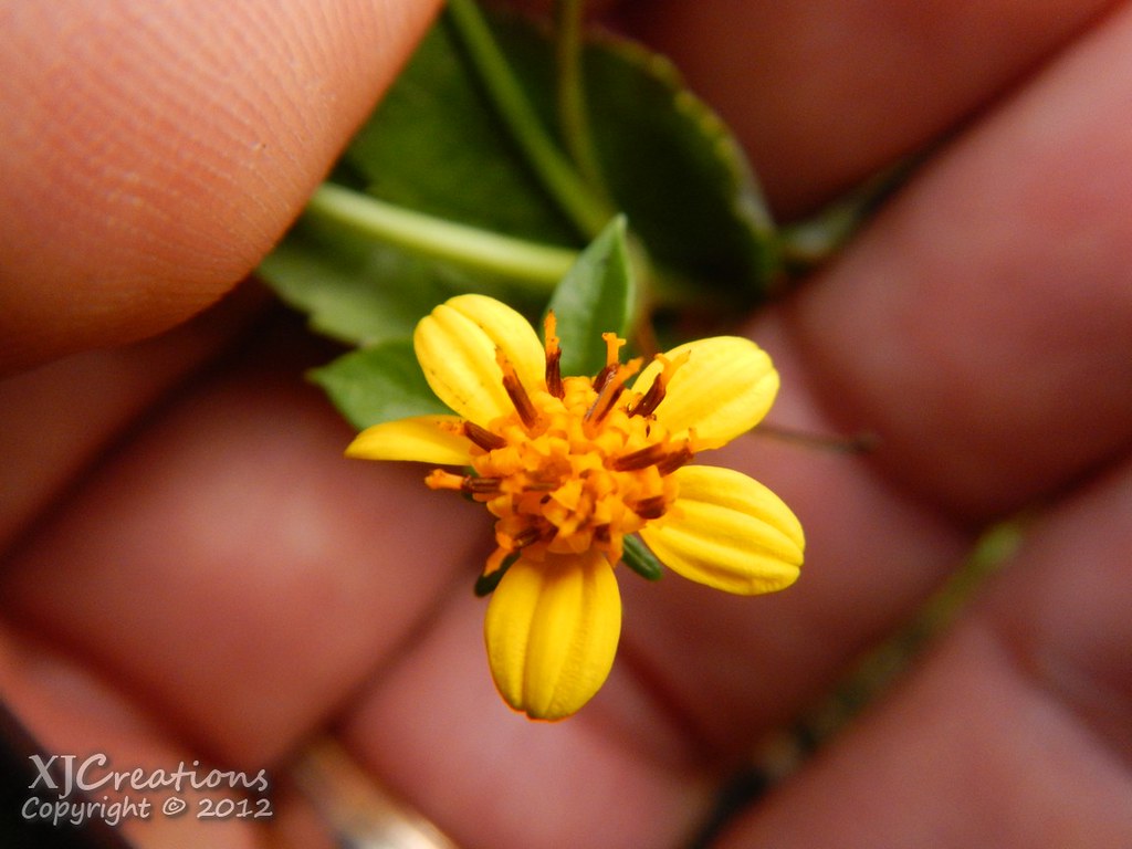
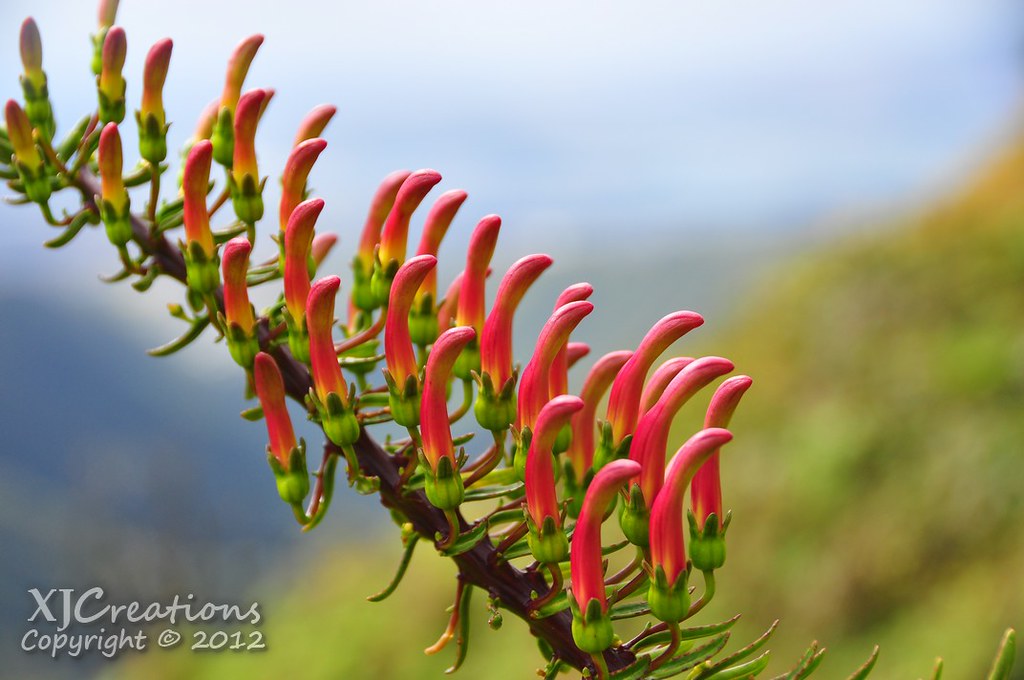
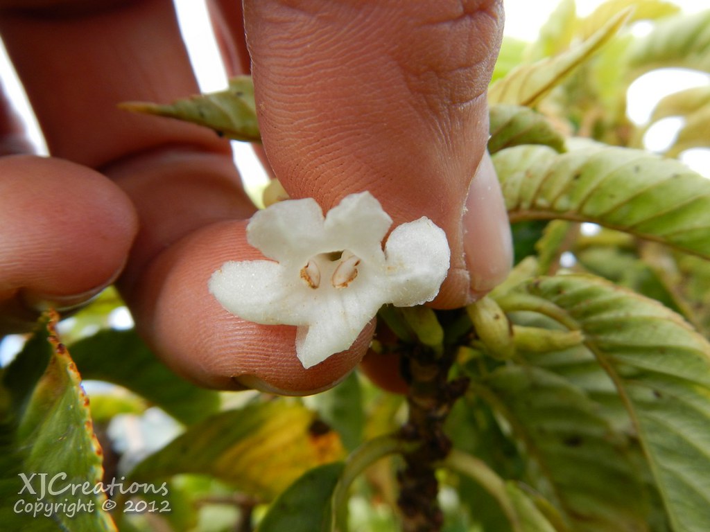
I spotted a few of these Ko'oko'olau flowers which were much smaller then the various other species I typically see.
The forecast for the day had been for scattered showers and about midway up the ridge we got our first passing shower. Luckily it seemed to blow through the eastern side of the valley leaving us mostly dry.

We reached the crest of the ridge and joined the Bowman trail roughly 1.8 miles mauka of the spot where the trail from the elementary school joins Radar Hill Road leaving us with plenty of Bowman's infamous ups and downs to enjoy.

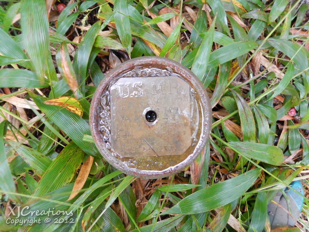
We passed only one of the markers made from old brass artillery shells that were placed here when the trail was first cleared by the military to mark the Fort Shafter Military Reservation before jumping to the ridge that would deliver us to the summit.
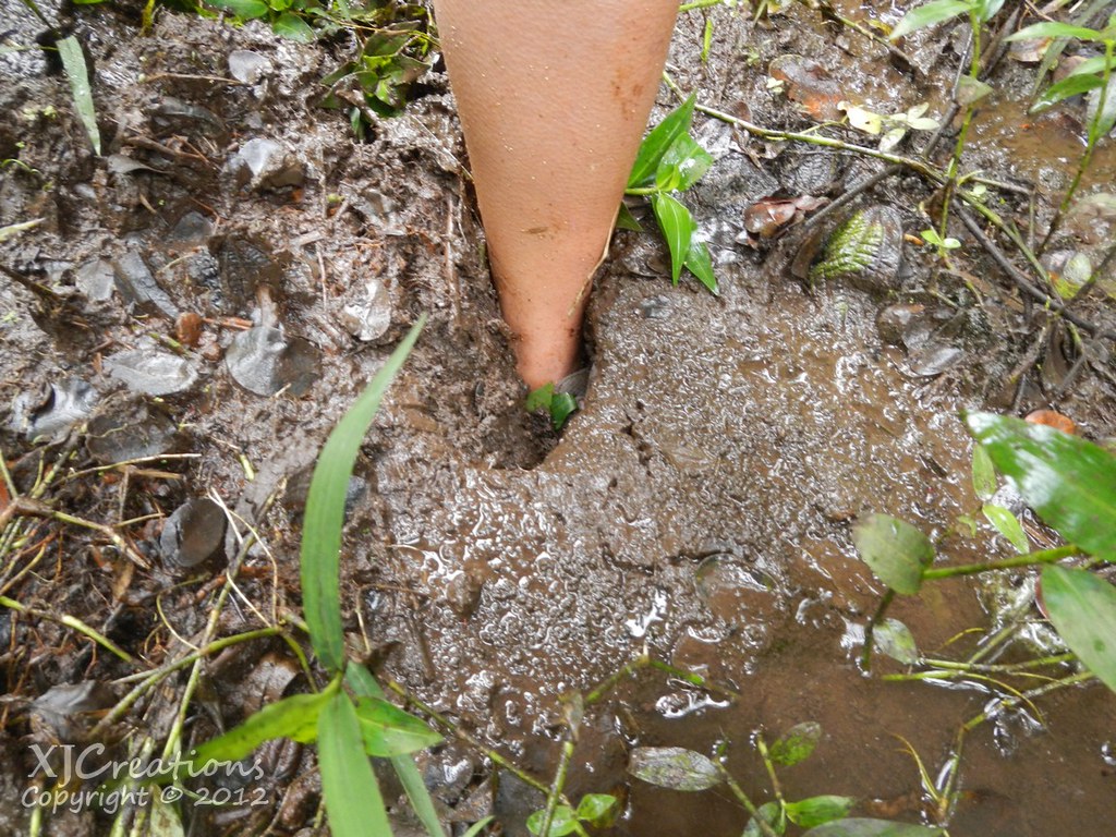
It begun to rain hard enough that I'd put on my rain gear meaning that my DSLR was put away and the waterproof AW100 would be documenting the trek until the rains let up. There were plenty of footprints in the mud from both hikers from the weekend and the pigs roaming the forest. There were a few wallows scattered about as well as in areas where they'd been digging up the trail.

A few more ups and downs later we crossed the eroded avalanche area. It always looks worse after you've crossed it!
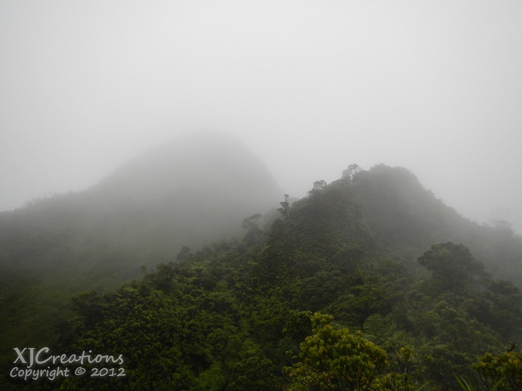
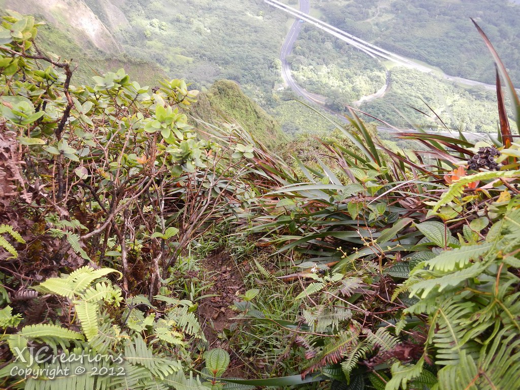
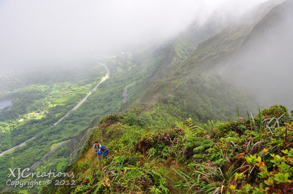
Up ahead in the mist loomed what I call "The Knob". This is the outcropping that has to be contoured to reach the summit area's cloud forest.
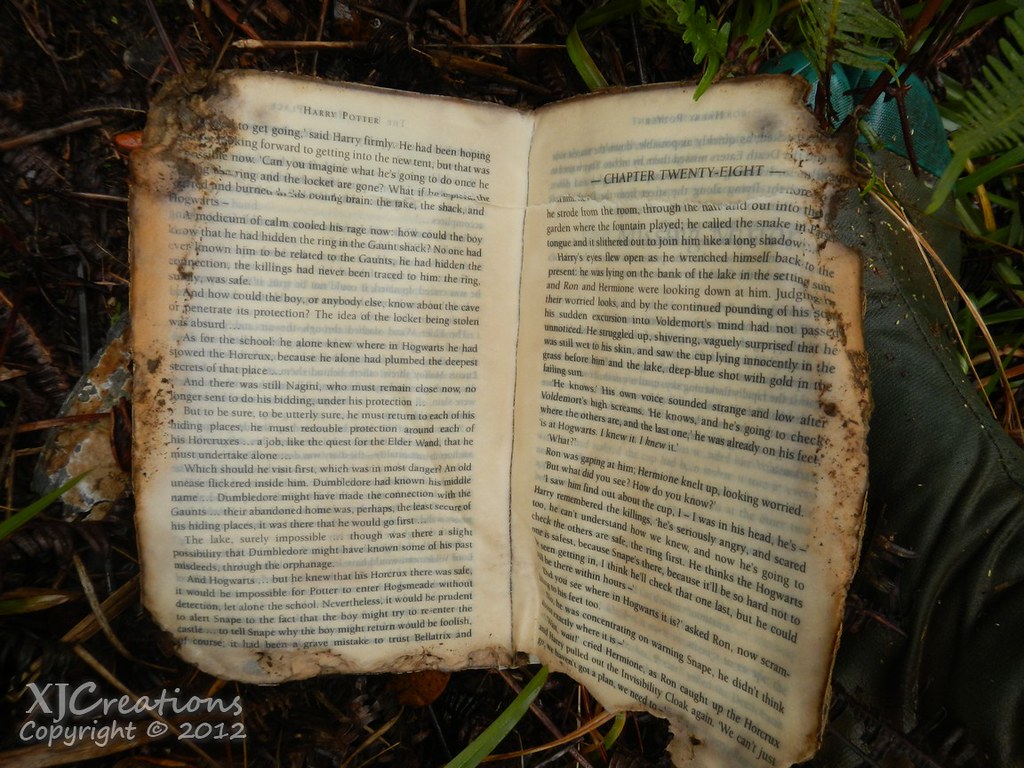
As we approached the Harry Potter book I'd seen last year still languished on the left side of the trail.
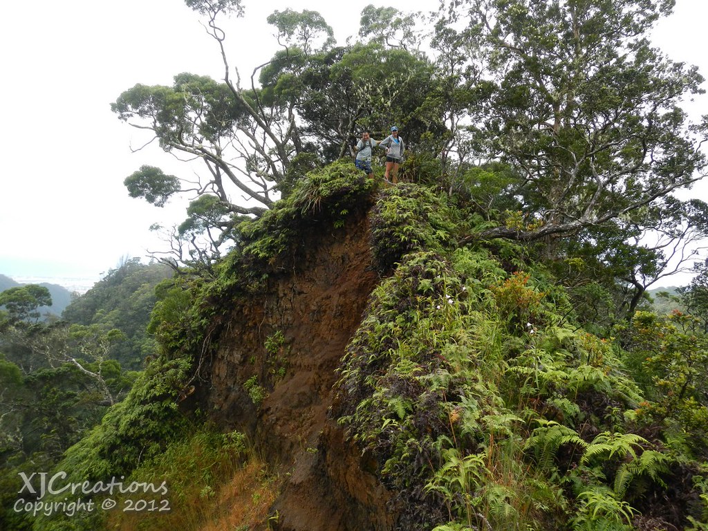
Before reaching The Knob we had to pass a large cliff which I call "The Wall".
 |
| "The Wall" |

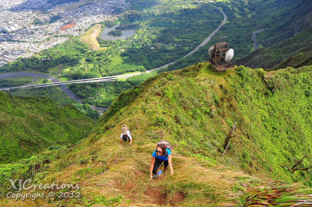
Once we'd all made the climb Sam took the lead on the grassy contour around the front of the knob. The trail here is very reasonable as far as footing goes but it's also very steep and a fall into the remote valley below would be serious.
 |
| Contouring The Knob |
 |
| Don't slip! |
On the final portion of the knob there are ropes and cables for assistance. We paused for rest after clearing this last Bowman obstacle.
 |
| Sam taking a break at the top of The Knob |
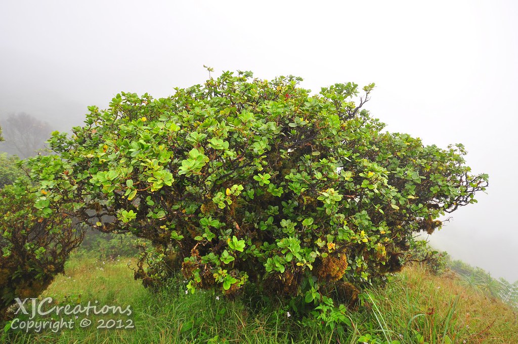

Ducking and weaving though the moss coated trees is simply amazing. These forests once dominated the Ko'olaus stabilizing the soil and collecting water from the passing clouds. The degradation of these areas has contributed to the decline of many of the endemic birds that once called this habitat home and threatens our islands water supply as nonnative plants do not perform this vital function.
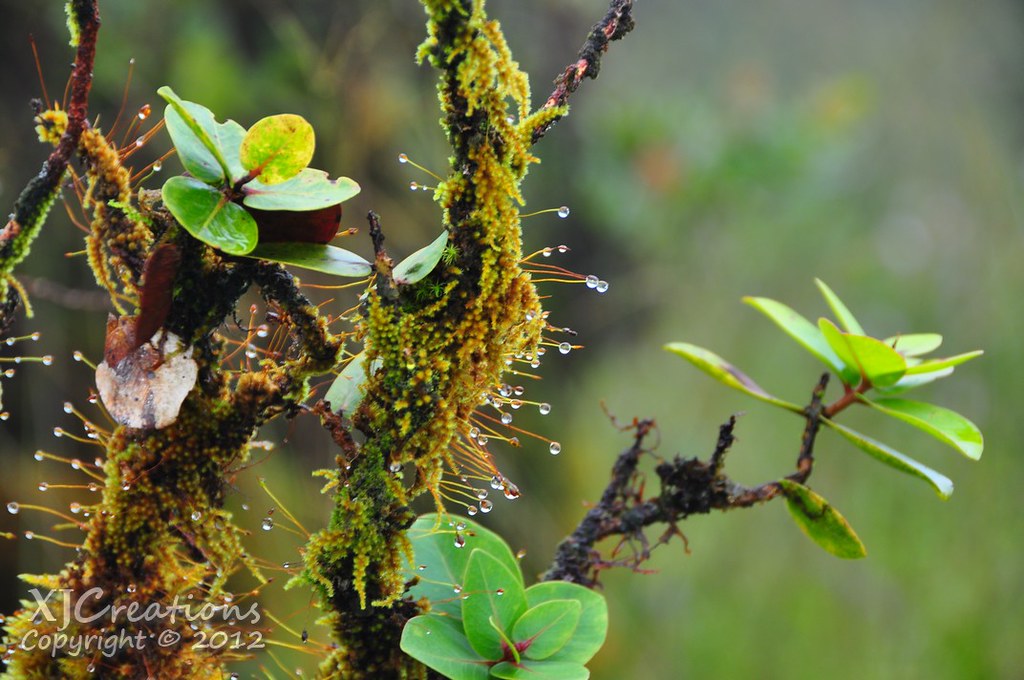
I didn't recall seeing these bromeliades growing in the Ohia last year. I don't know how aggressively they spread but their presence in the cloud forest is not a good sign.

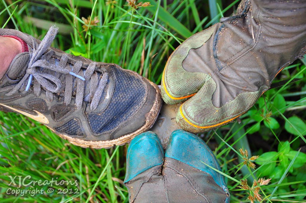
About midway though the rains began again and again I had to stow the D90 once more as we worked our way up through the deepening mud. I kidded Sam about her Ko'olau Pedicure as she sank shin deep into the trail.
At the end of the depression the trail turns west towards the summit. This is were I discovered I'd dropped my lens cap. Sam and II stayed while I retraced my steps to where it had begun to rain hoping to find it. I ended up all the way back at the top of the knob and turned back searching the trail as quickly as possible. I found my lens cap about 20 feet from where I'd discovered it was missing! Oh well, I like that section of the trail anyway... We made our way westward towards the summit where I hoped we'd get some kind of a view of Kaneohe and Kailua below.
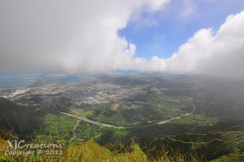
As luck would have it as we topped out at the end of the Bowman Trail at Pu'u Kahuauli there was a break in the clouds long enough for us to get some decent views and to take a few pictures.

It wasn't long though before we were enshrouded again in the mist. After a group photo we moved on for the short .3 mile journey to the summit of Tripler Ridge Trail.
 |
| Views gone as the clouds roll back in |
 |
| Don't slip! |
 |
| Safe arrival at Tripler |

Hawaiian Electric has been upgrading many of the transmission lines across the island and it appears they're preparing to replace the old towers here with new ones.
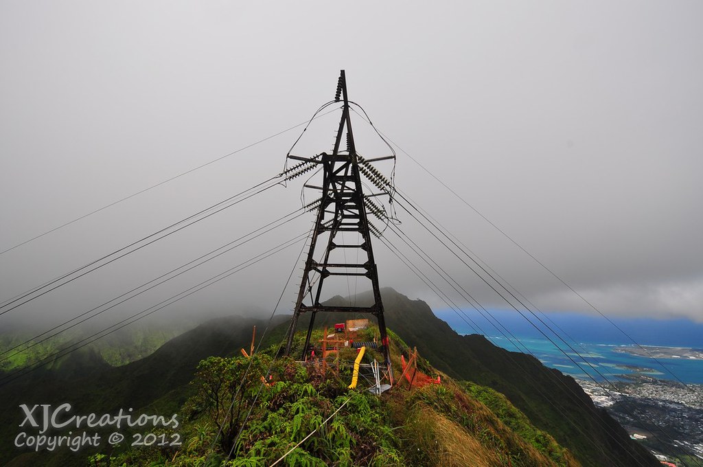
The safety lines staked into the ground descended Tripler Ridge Trail and also continued west along the summit. We took advantage of the nicely cut steps and ropes as we made our way past their work site.
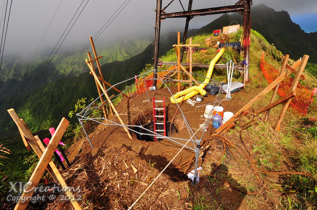
Of course we couldn't resist dropping down into the holes they were digging for the tower foundations.

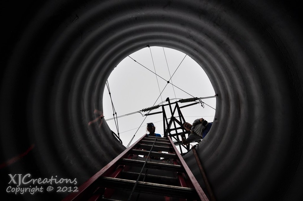
It was interesting to see that most of these ridges are nothing more than hardpacked dirt. You'd expect there to be a rocky core but at least the upper 10 feet in this section isn't!
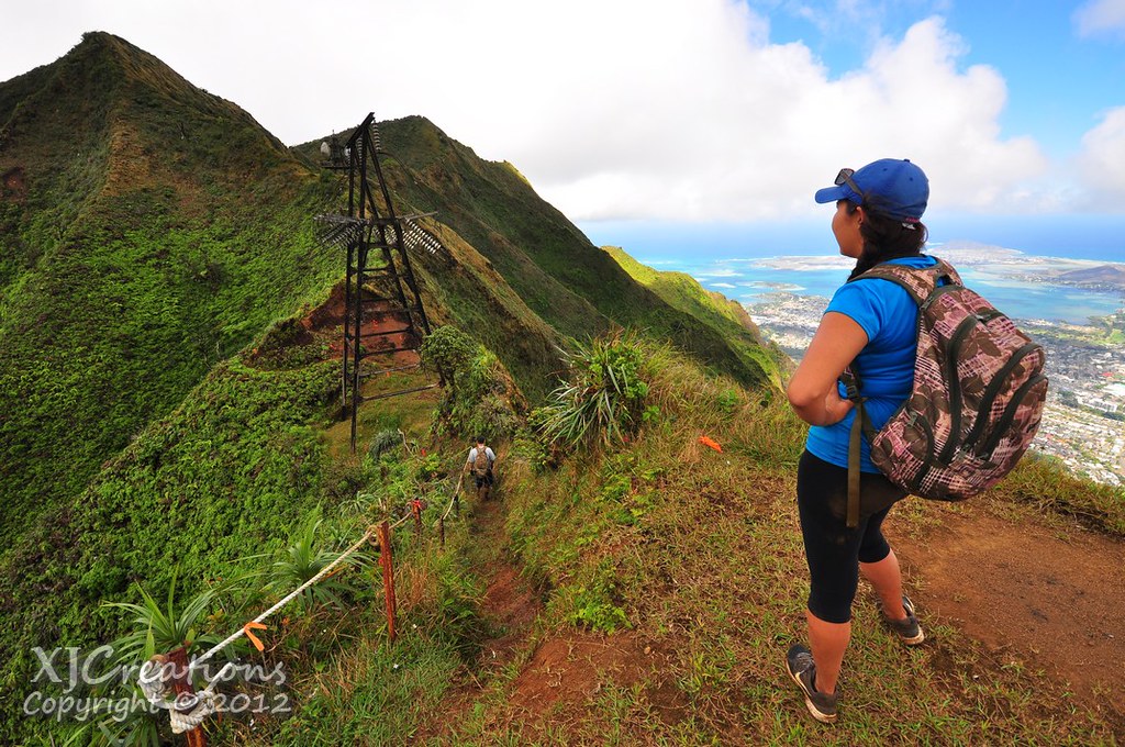
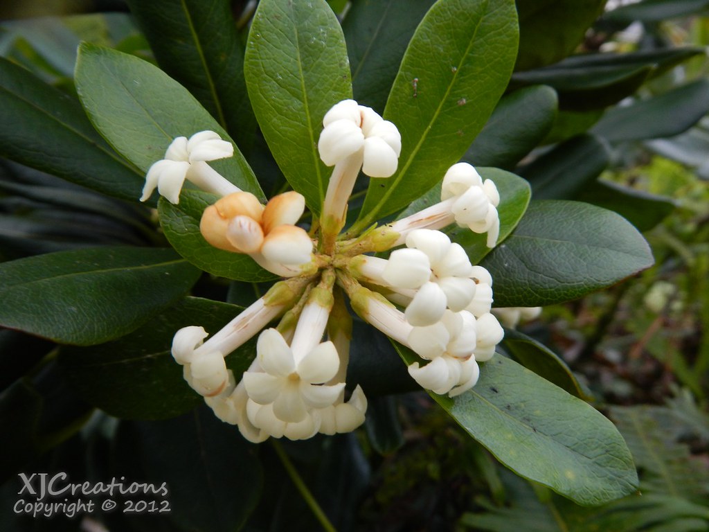
We moved on past their work site and over to the second tower. I paused to take a few shots of the Trematolobelia singularis, a federally listed endangered species only found in the Ko'olau Mountains which is just coming into bloom.

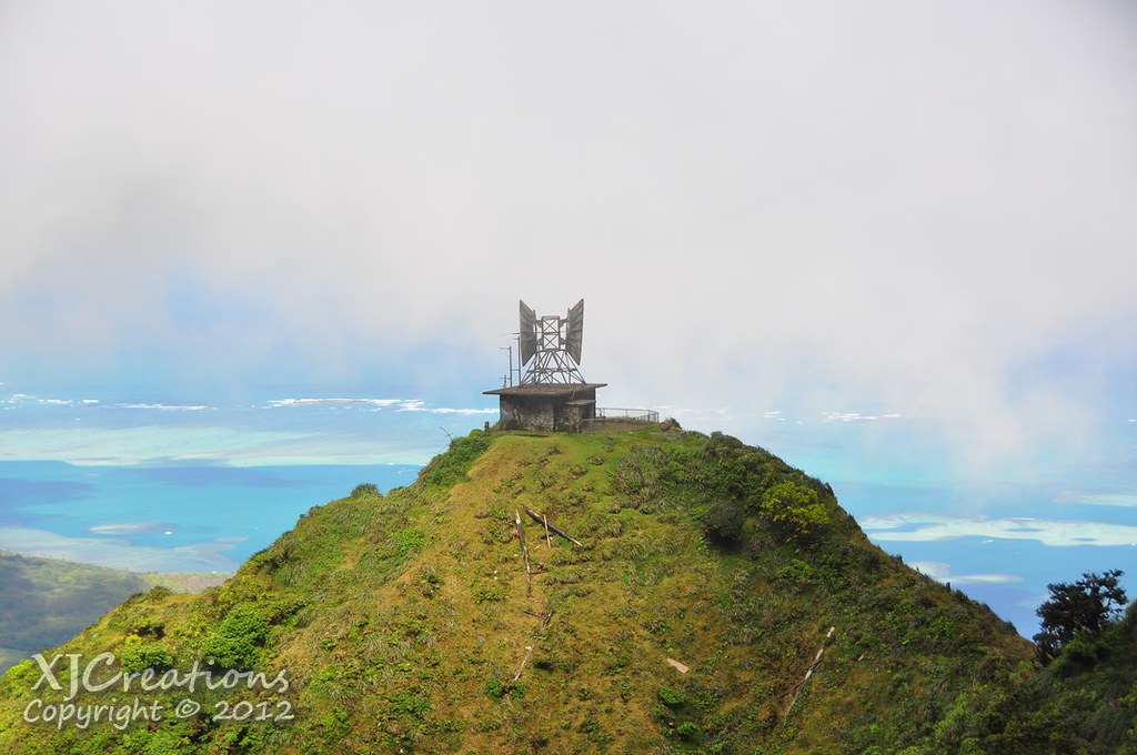
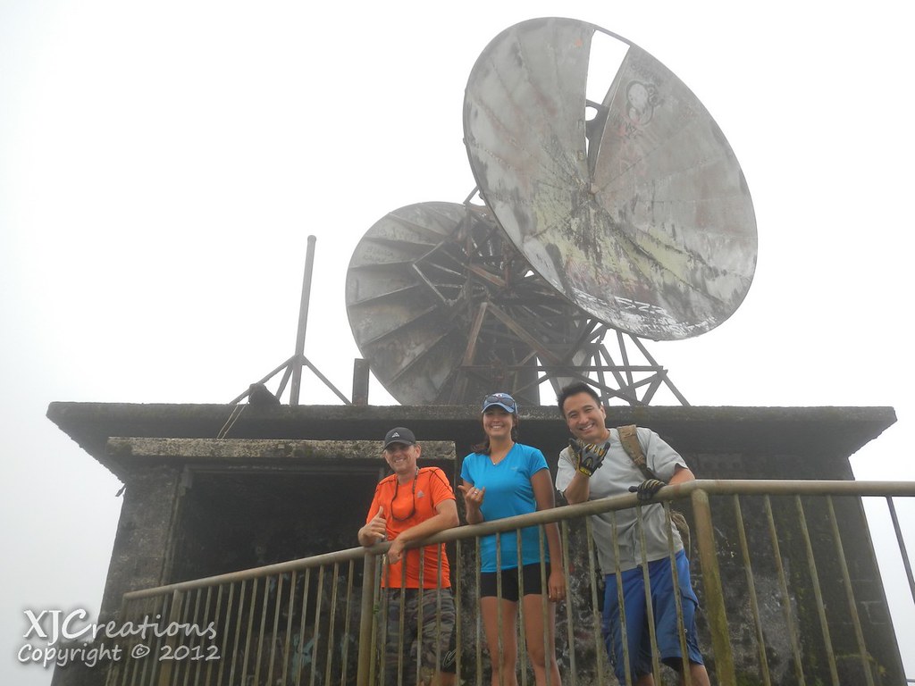
Moving on we proceeded to the old microwave relay station for more photos. Sam's hat flew off in a particularly strong gust and we watched helplessly as it flew through the air in down into the leeward valley. Luckily I was able to spot where it landed so I proceeded down into the valley to recover it. As I did I spotted another T. singularus also preparing to bloom. After recovering the hat I went back to take some pictures of it too.

The last steep climb of the the summit is from the relay to the top of Pu`u Keahi A Kahoe and the junction with the Moanalua Middle Ridge Trail. It's a short but steep climb past a large mossy boulder and I pushed myself up ahead to take advantage of the great angle of Sam and II coming up.
At the geodetic marker atop Pu`u Keahi A Kahoe I was too lazy to unpack my camera and set up a timed shot so we settled for a foot group photo. Cheesy? Absolutely.
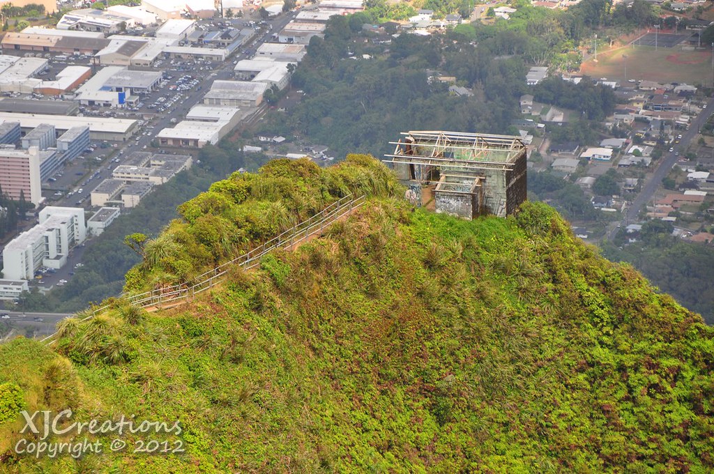
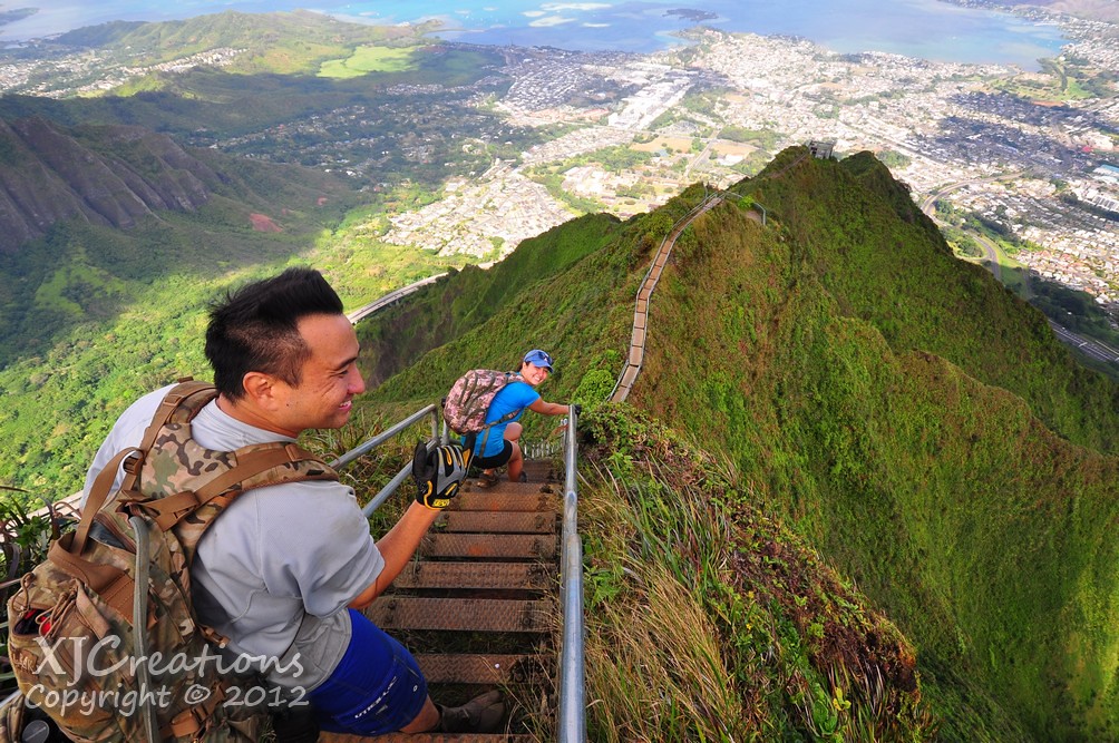
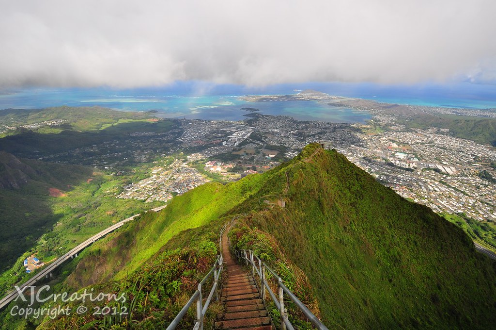
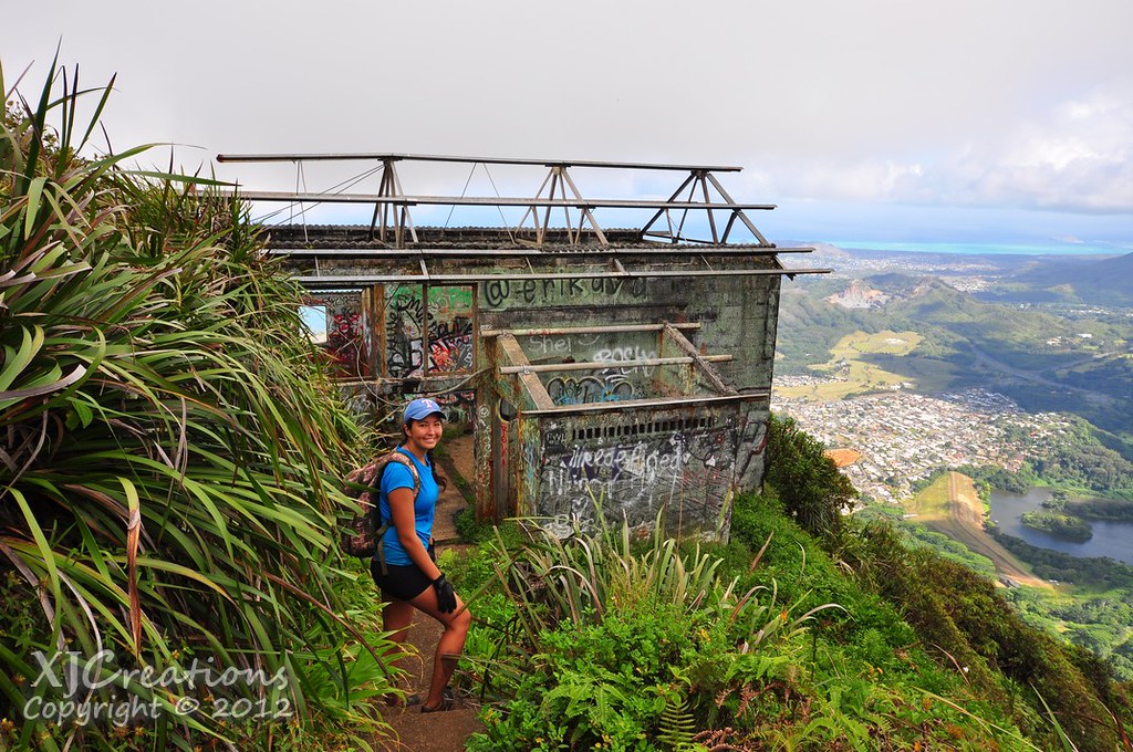
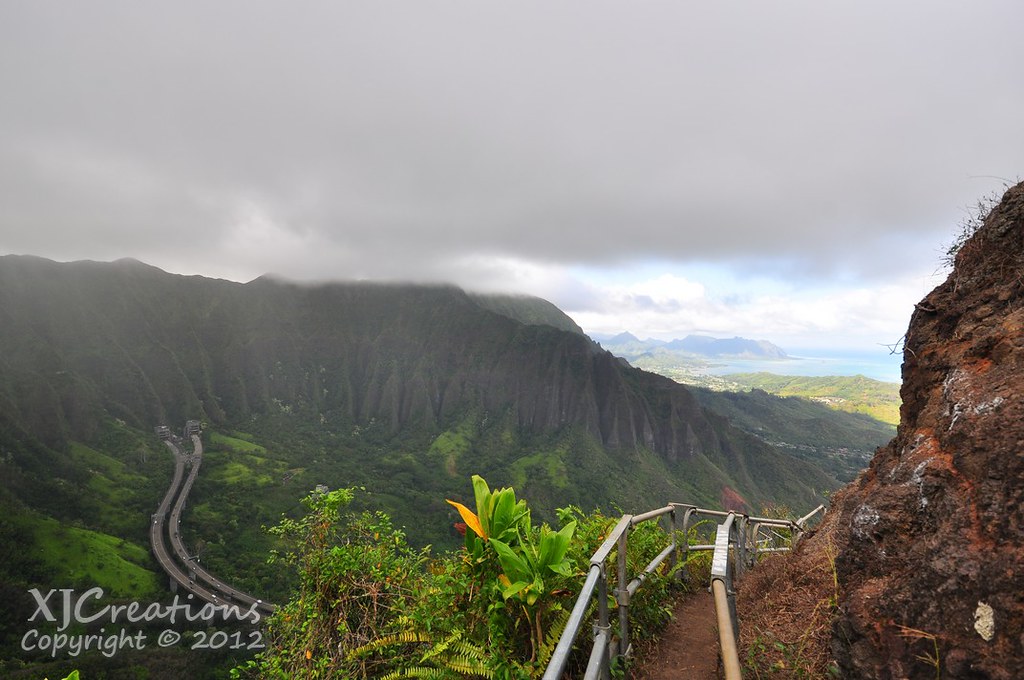
Off the the distance the CCL Building and the top of the Stairway to Heaven beckoned so we set up down the short but muddy summit.
 |
| The CCL (Continuous Communications Link) Building |
 |
| Leaving Pu`u Keahi A Kahoe |

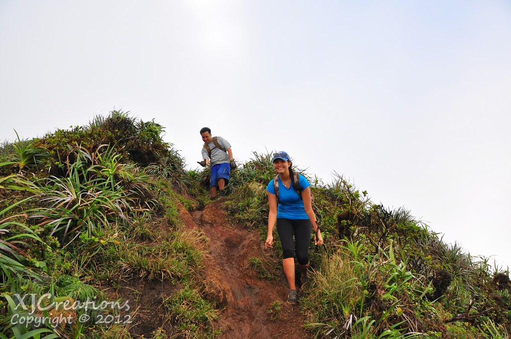
It was partly cloudy at the Stairway and we didn't stay very long. A few photos later we began our descent.
 |
| Smiles because the hard part is behind us! |
 |
| The path to earth. |
 |
| Setting off down the stairway. |

We paused again at the Winch House to take some more photos.
 |
| Sam's arrival at the winch house |
 |
| Us posing in the winch house |
 |
| Sam on the Stairway |
Later a Ho'awa was flowing right over the railing.
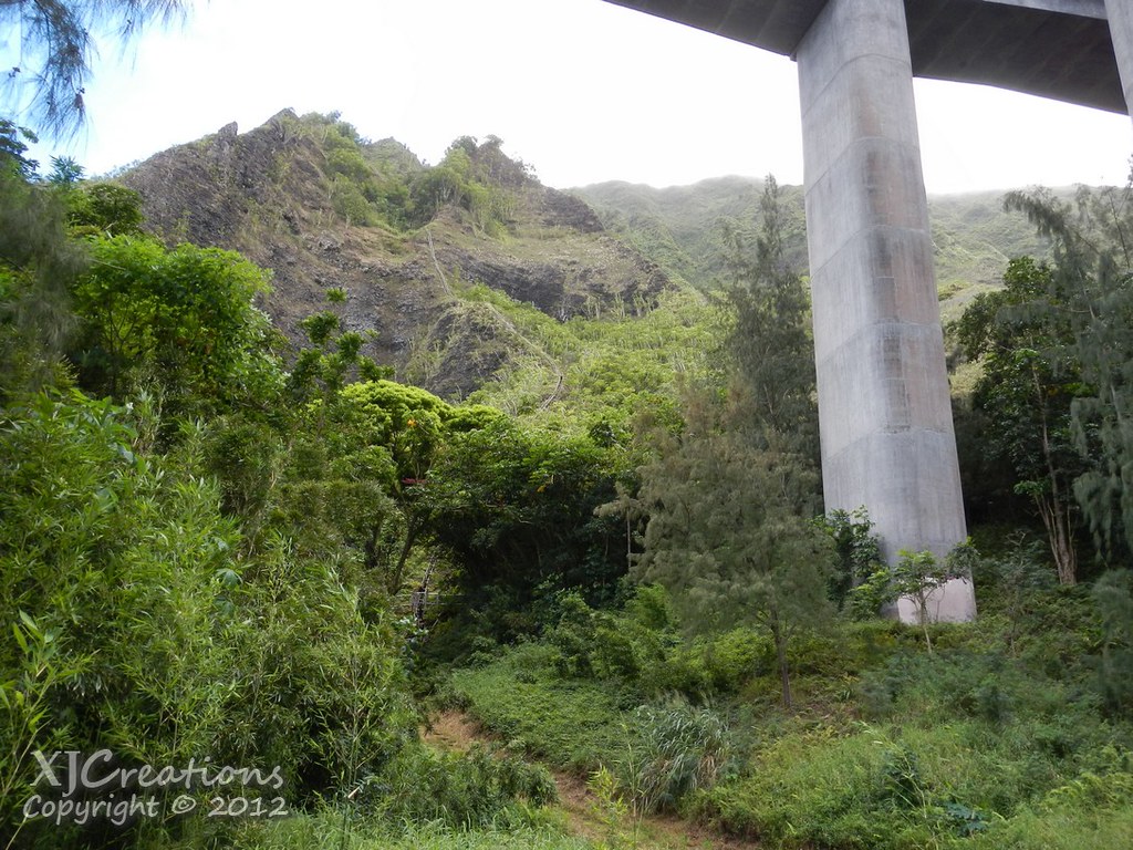
Arrival at the lowest landing meant our day in the mountains was ending. After telling Sam the Mike / Marian story which I won't share publicly, we headed down the final segment to the road in the valley below.
 |
| Kaneohe Bay |
 |
| Kaneohe and Haiku Views |
 |
| Contouring on the Stairway |
 |
| Sam on the steepest section. |
 |
| II tackles the near vertical section where The Stairway is more of a ladder. |
 |
| Massive pillars of H-3 form the gateway to the Stairway to Heaven |
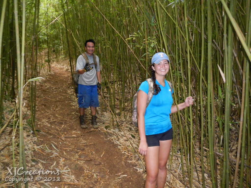 |
| Bamboo forest. |
No comments:
Post a Comment